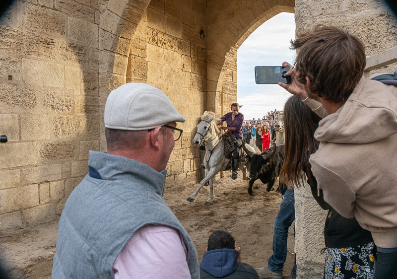
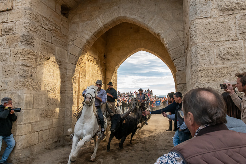
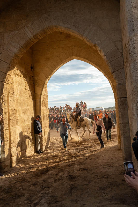
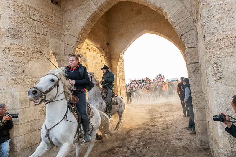
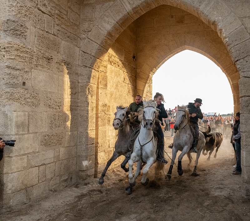
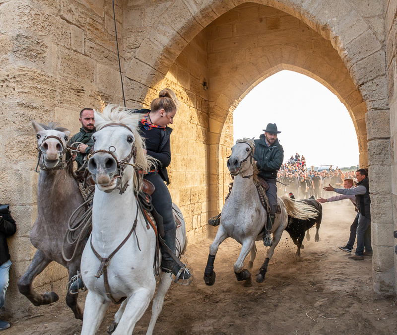
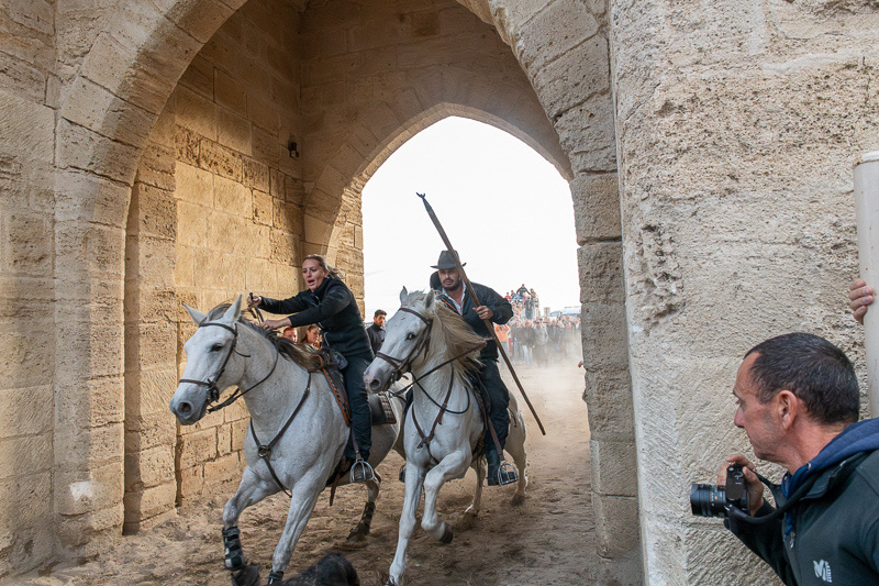
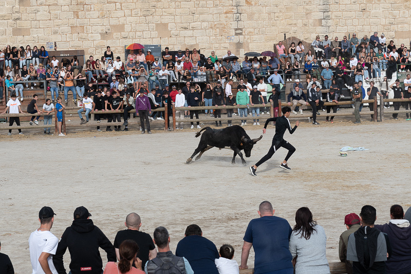
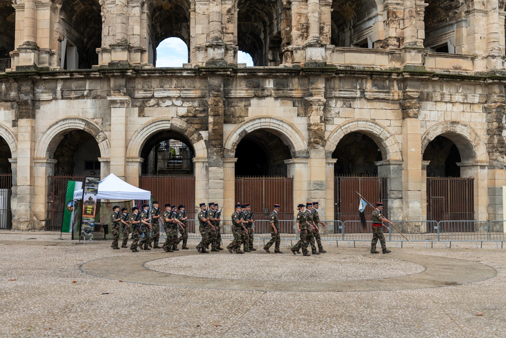
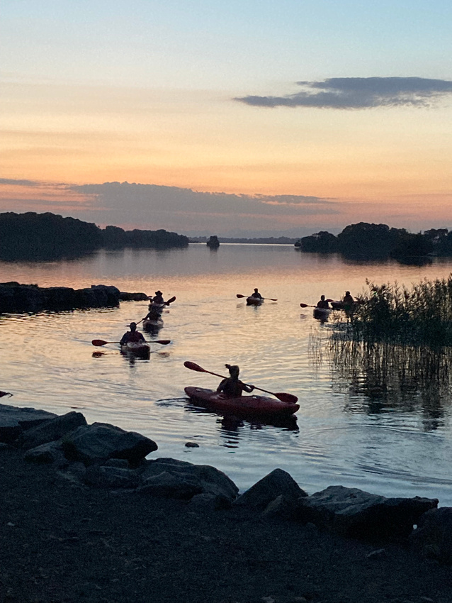
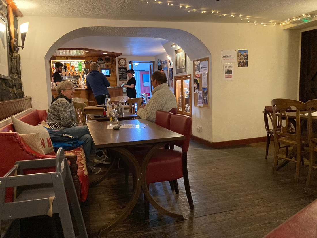
When we got to the inside of the south gate there wasn't much of a crowd yet. I had a really good spot right next to another photographer but then I made a big rookie mistake. I wandered over to the barriers where Jeanne Marie was watching and didn't realize how fast the people from the arena would cram in here and how few of them would stay behind the barriers. I lost my good spot and was now jostling around with this mob of a couple of hundred insane people, trying to get a clear shot at just a few seconds of action. I say insane because once again we underestimated the level of risk they would take just for the fun of it. Two gentlemen in particular, both well into middle age, thought it was fun to stand right in the middle of the archway until they could hear the thunder of the hooves, and then run in front of the bull and horses to the sidelines. This of course did nothing for my pictures.
Below is a video of the first run of the bulls as they flashed by.
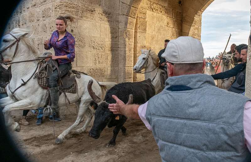
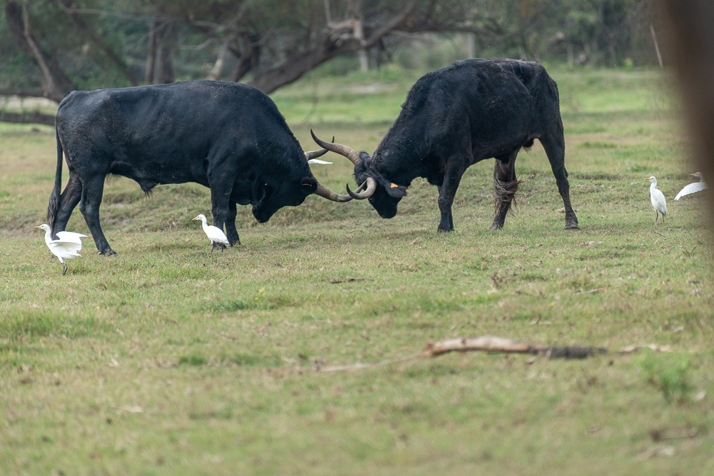
Again we were shaking our heads. We could hardly believe what we were seeing. Everyone wanted to touch the bull, especially his horns.
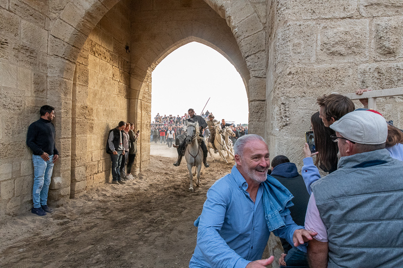
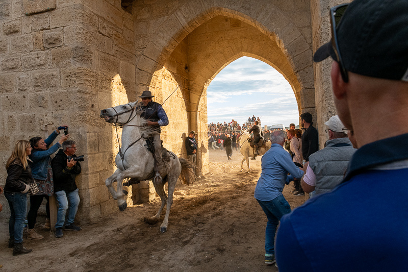
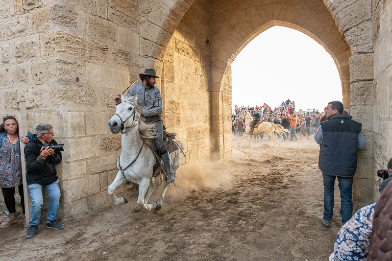
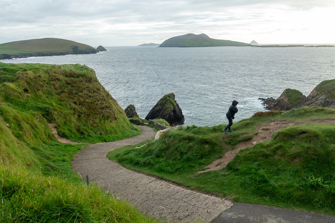
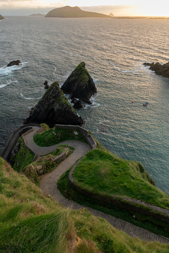
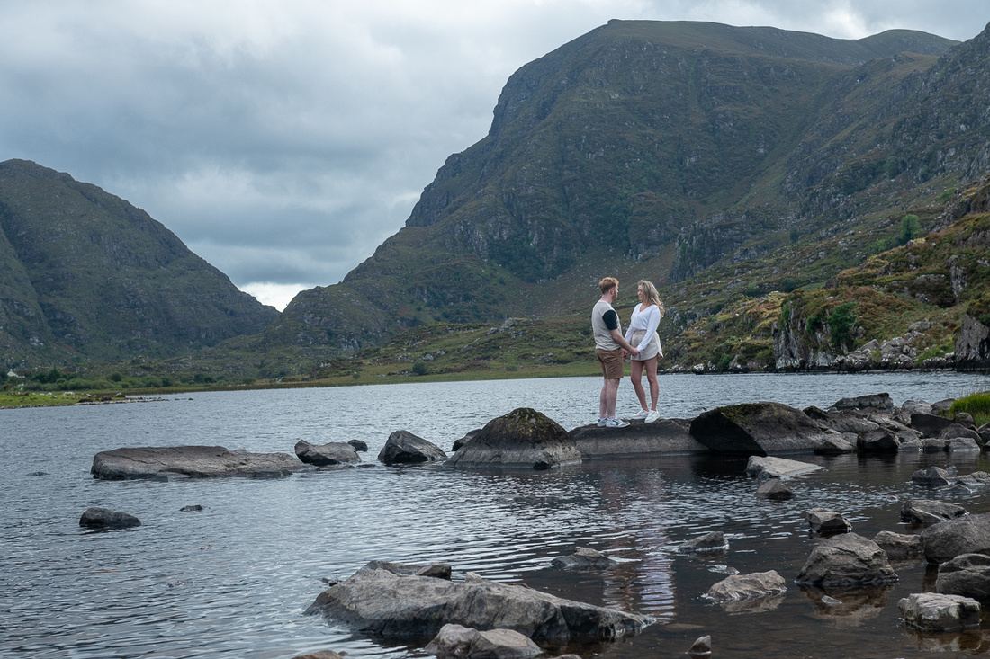
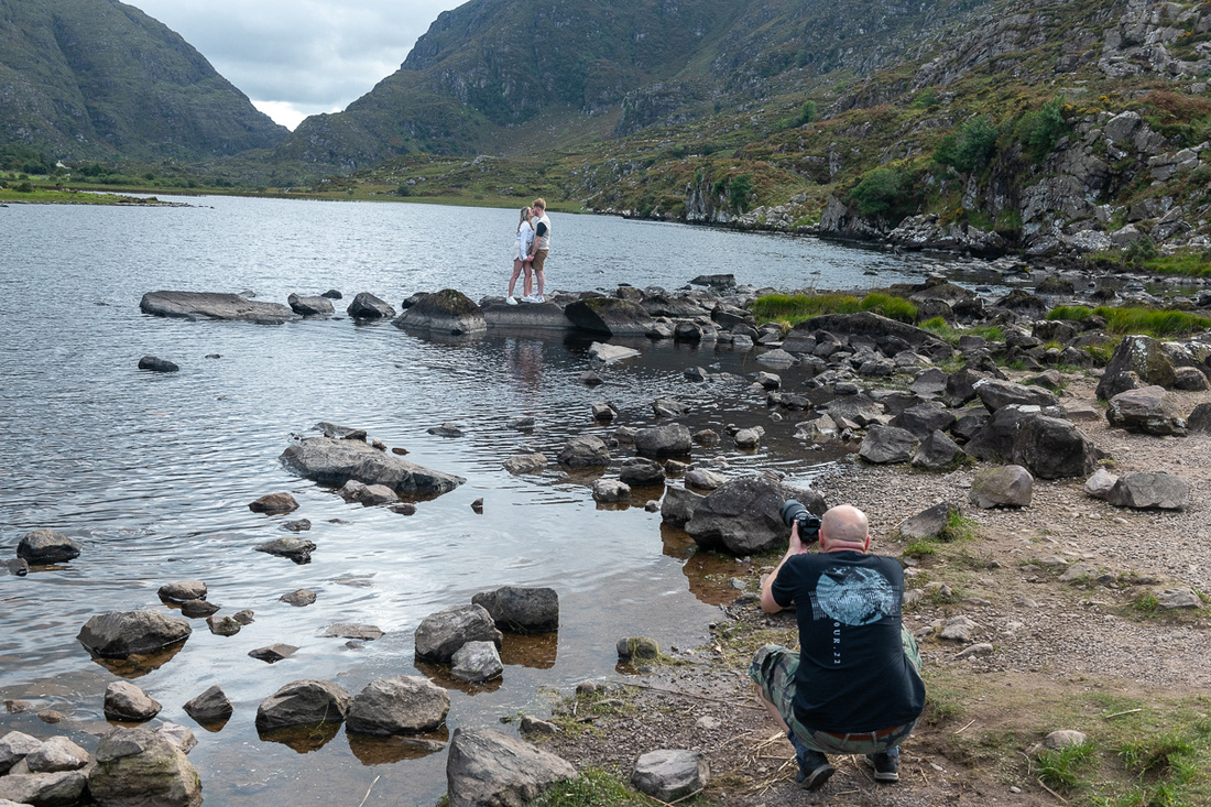
I finally got into position to get some clear shots.
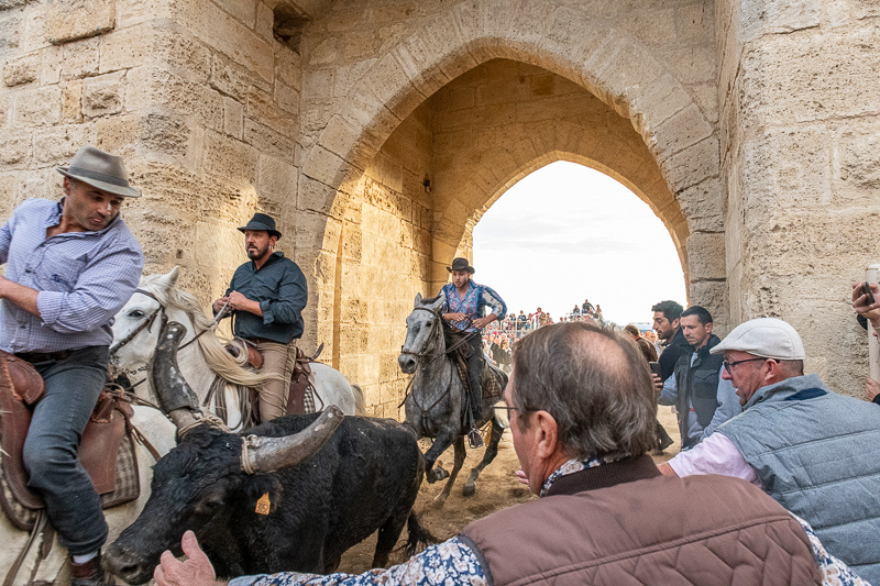
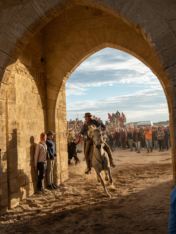
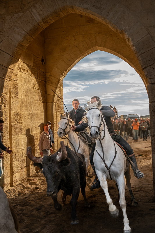
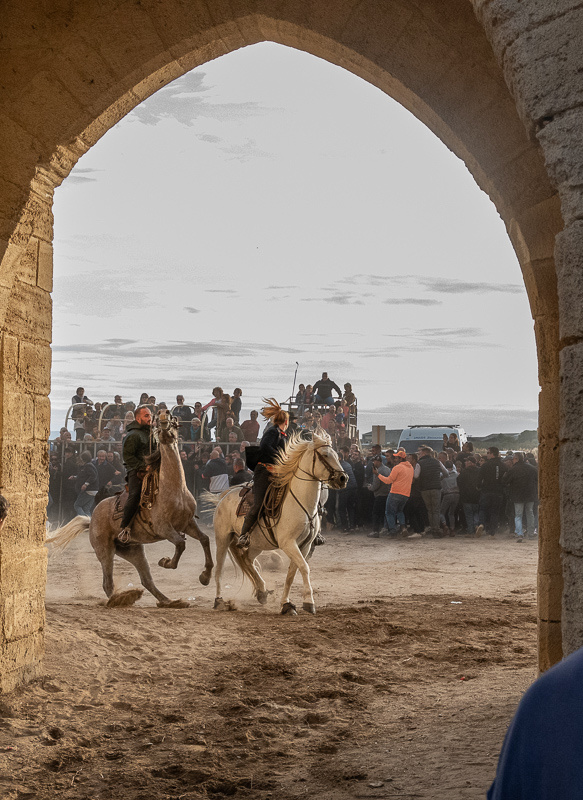
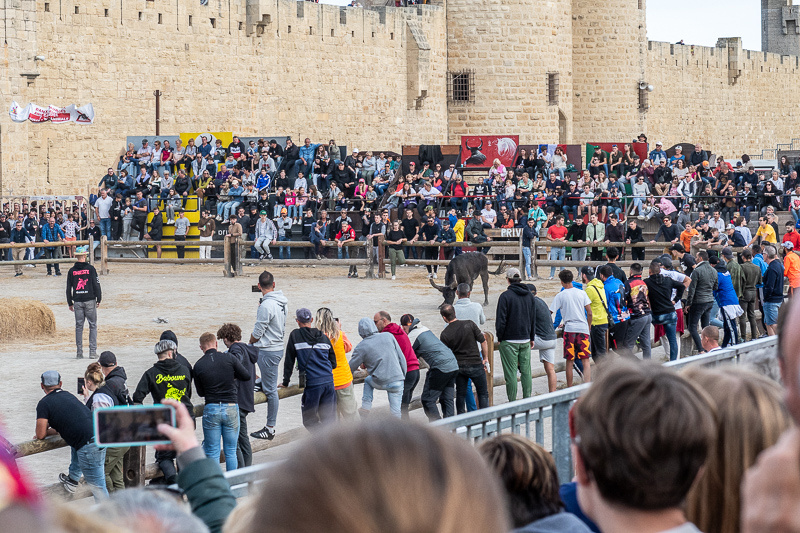
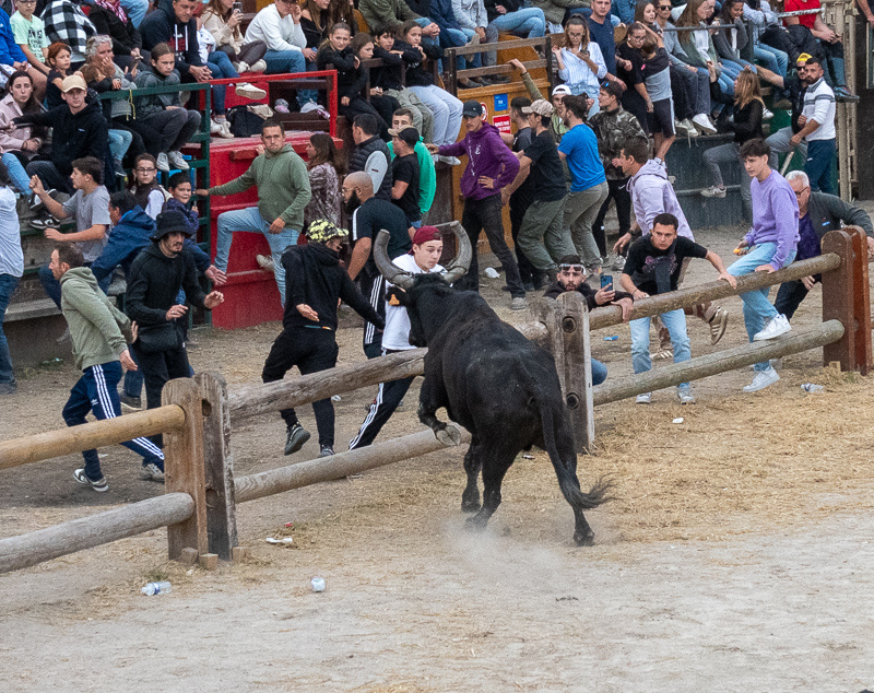
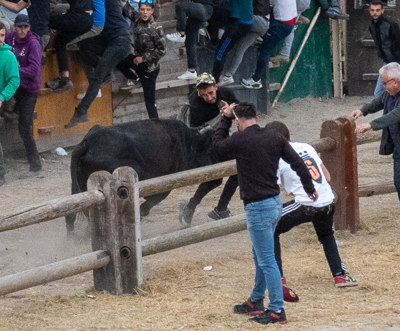
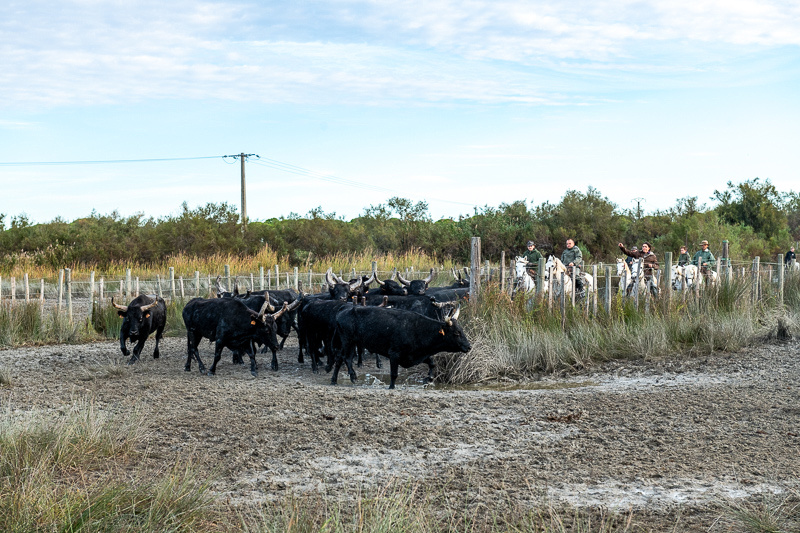
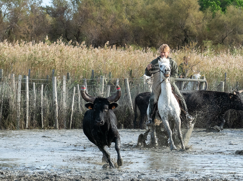
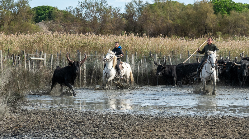
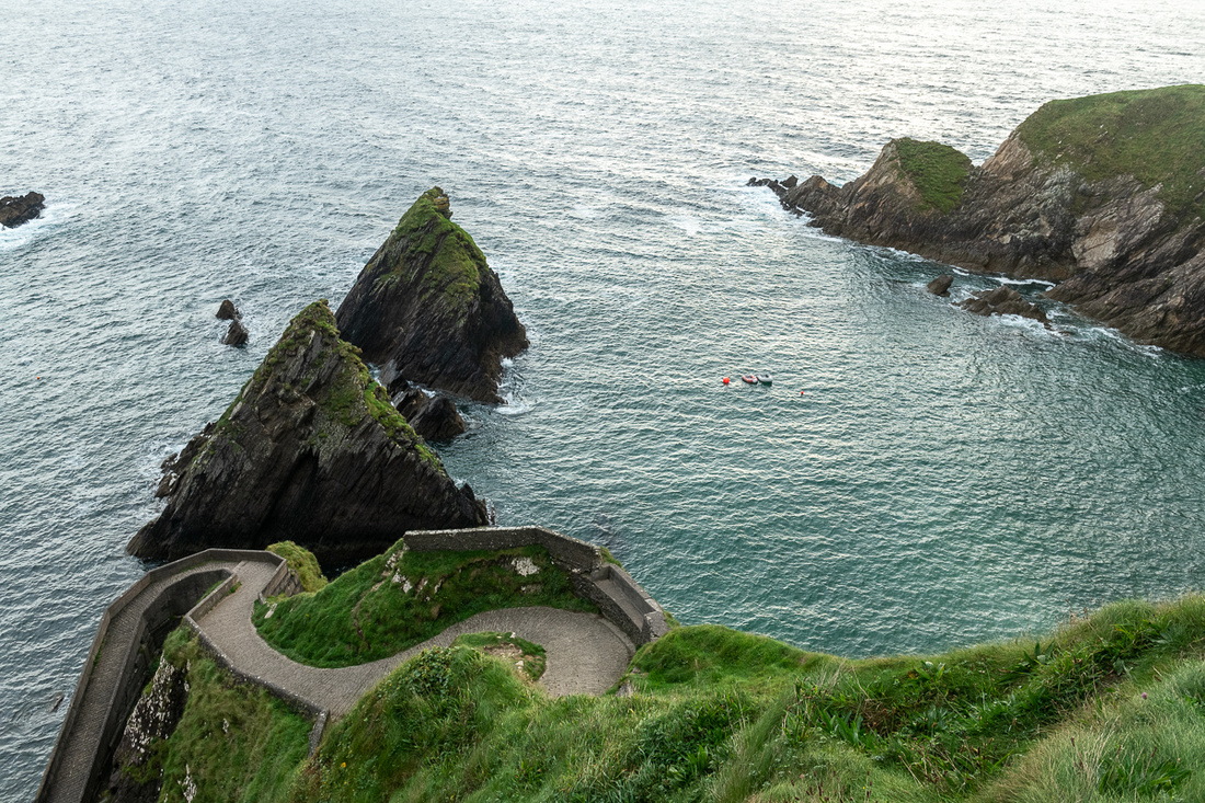
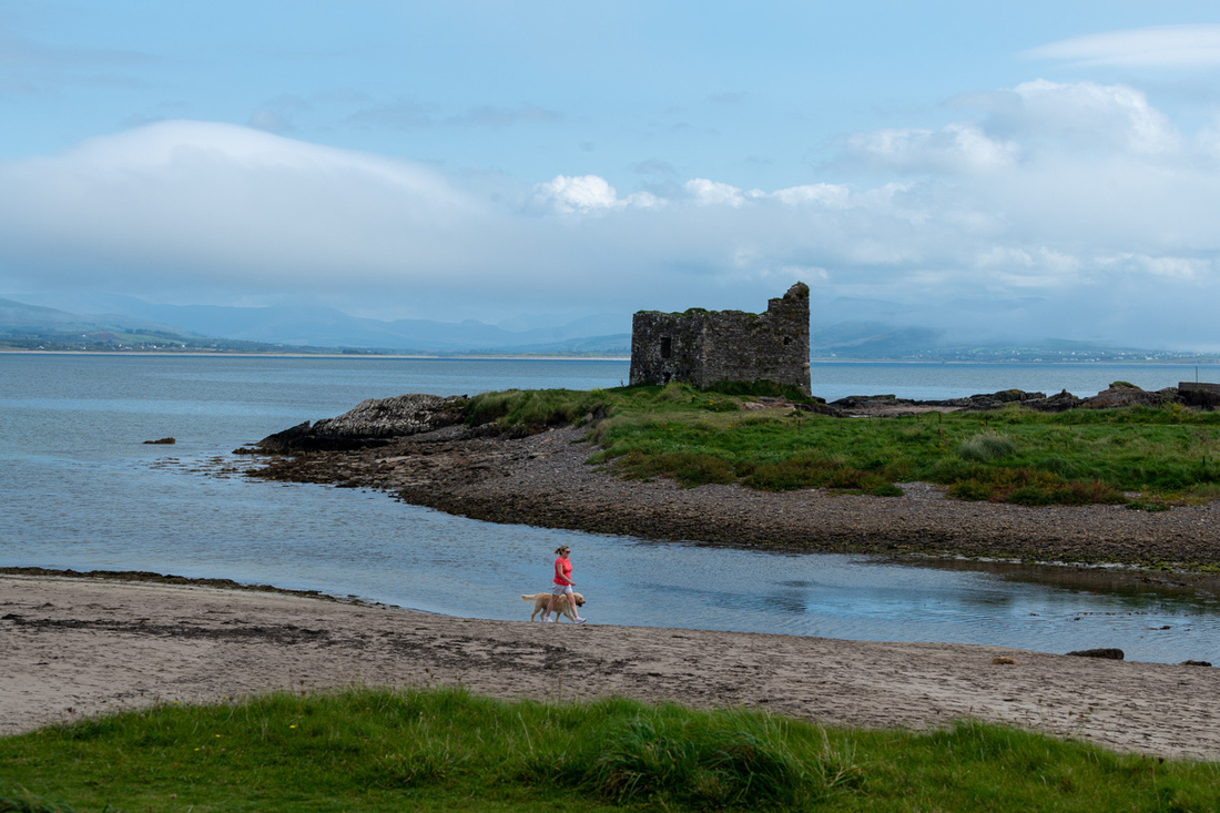
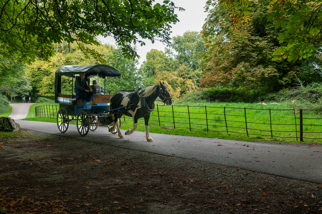
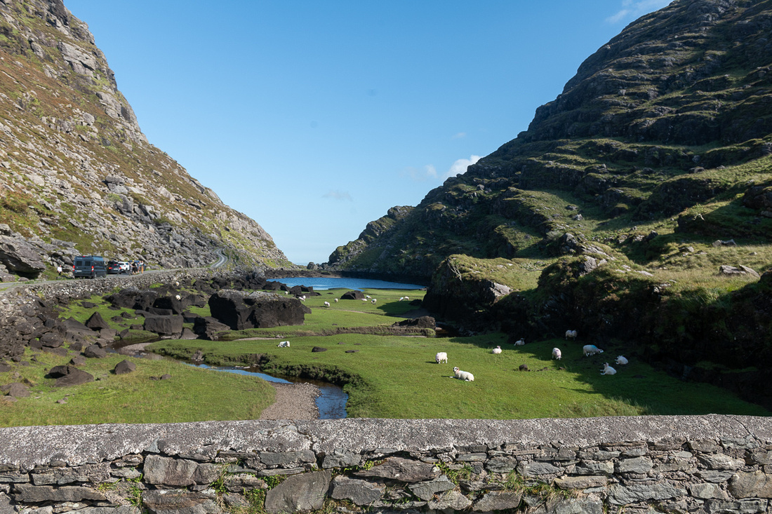
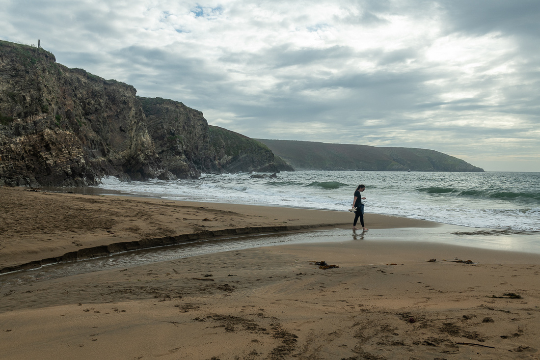
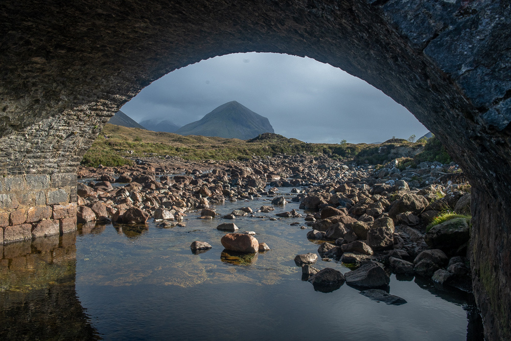
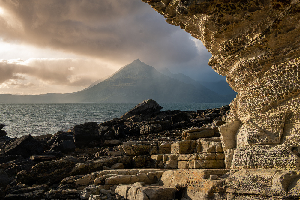
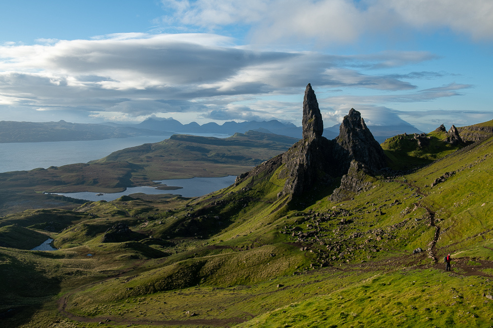
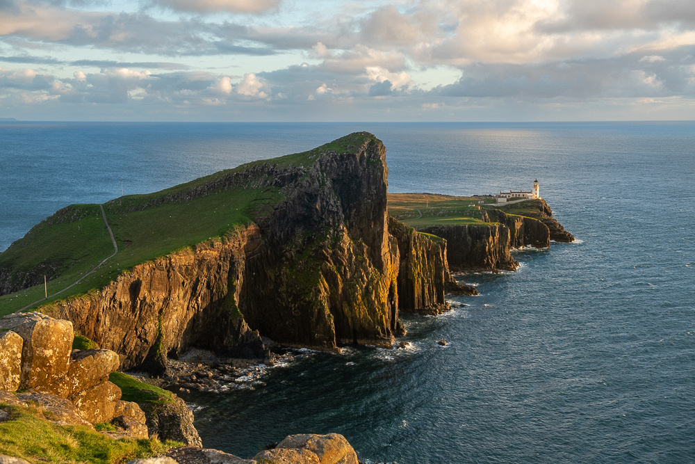
Notice all the people in the background in the picture above. They are all inside the steel barriers which is about to lead to some interesting encounters. You see, the gardians have to guide the bull around this left turn through the archway. It didn't always go as planned.
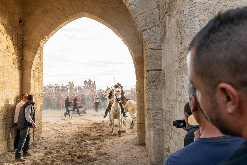
"Ooops! What happened to my bull?" Mr. Bull didn't make the turn. Now he's out there with those three hundred people inside the barrier.
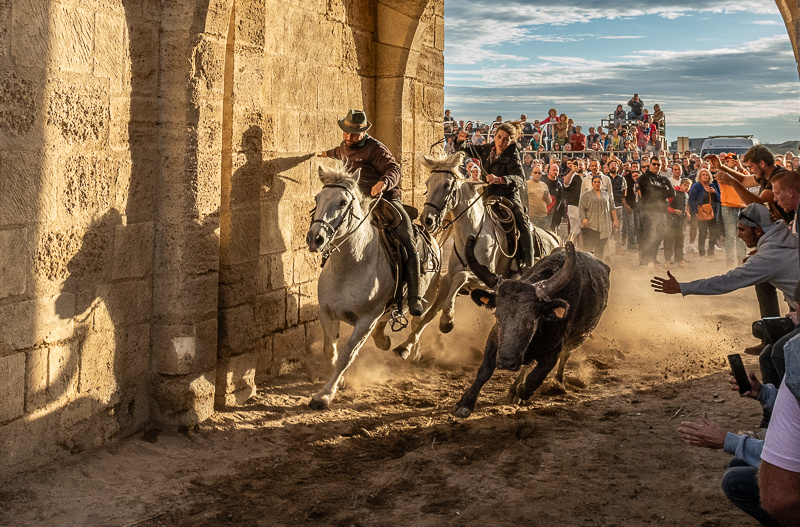
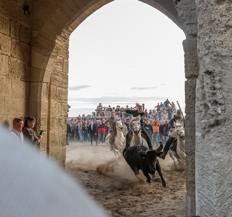
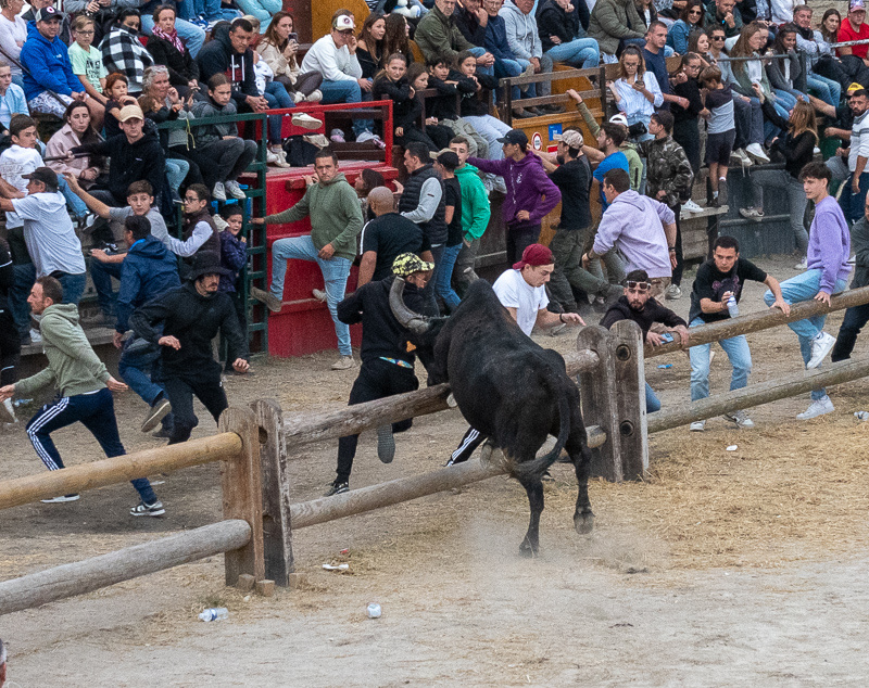
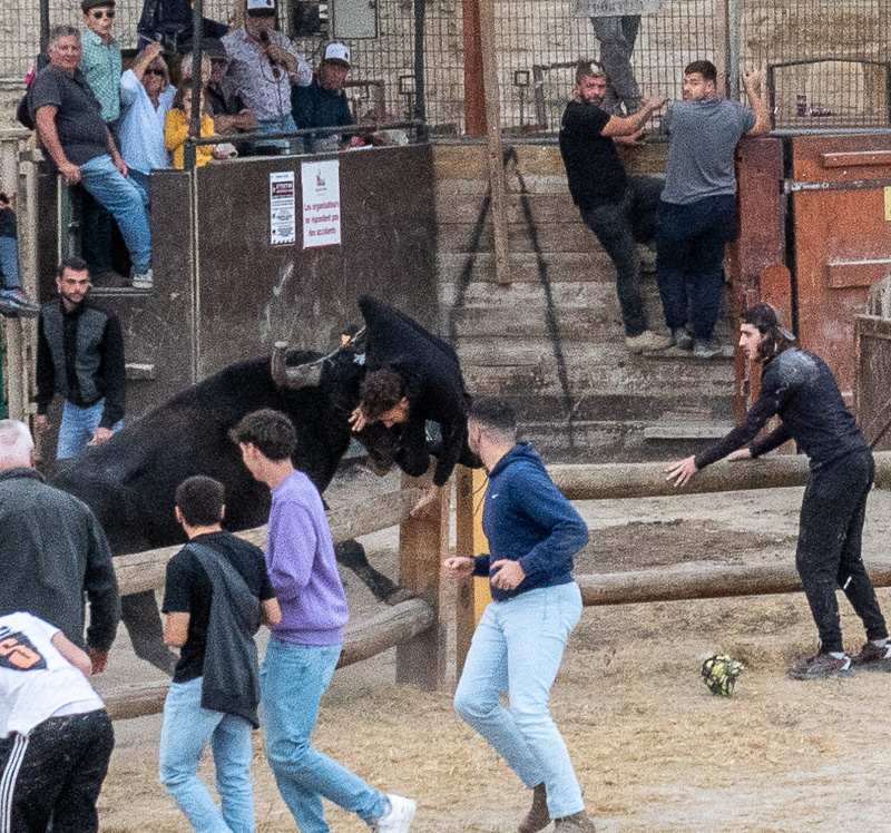
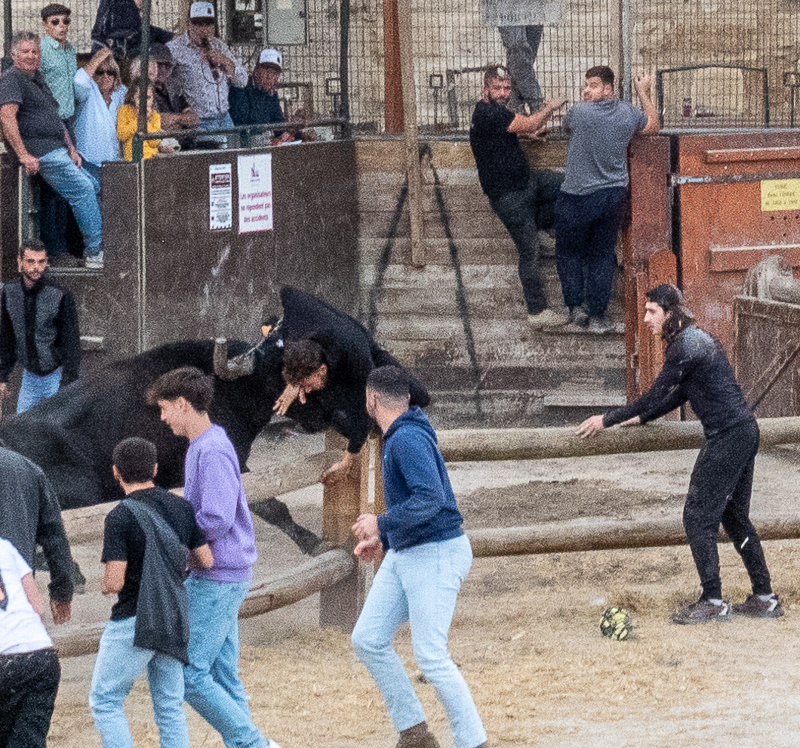
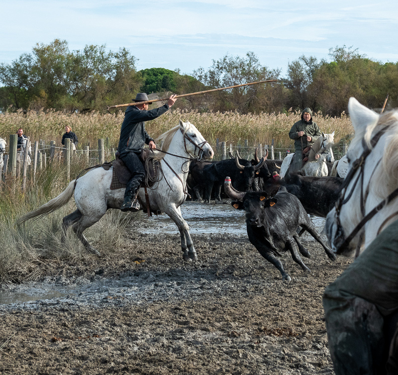
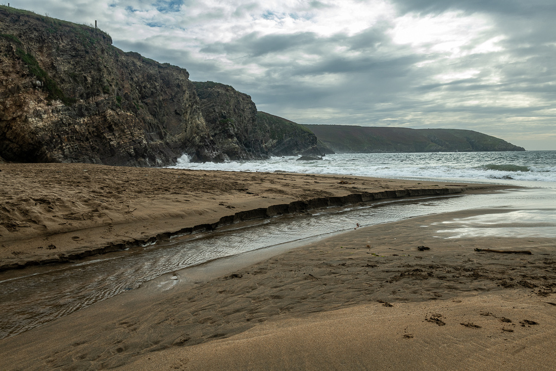
Below we get another bull that didn't make the turn. You can just see his tail disappearing past the arch. This time the consequences were not so benign.
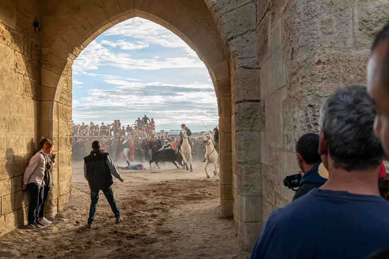
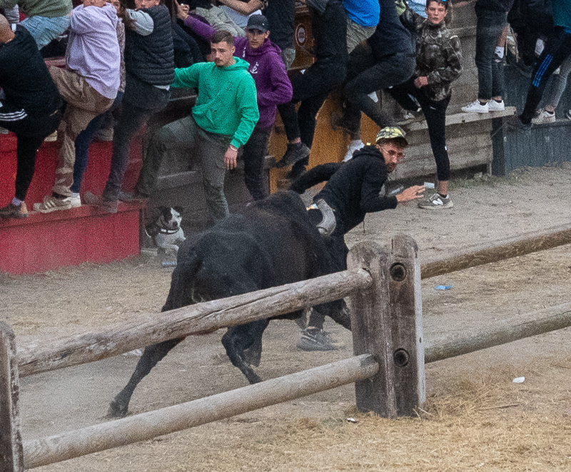
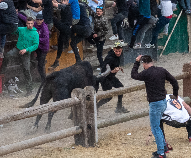
The victim did get up and hobble off on his own steam. Three of the nine bulls got loose in the crowd. Below are pictures of the third. None of this seemed to persuade anyone to get behind the barriers.
So that was our excellent adventure in Aigues-Mortes. If you want to see more of the festival I've attached below some youtube videos. The first one has footage from the entire 11 days including the opening ceremony. The second one starts off slow but it picks up around the 5:50 mark. Then shortly after that point you will be seeing footage from the day we were there. The third one is from 2022. I think you will have to copy & paste the web address into your browser and they may open in the middle of the video. You can just scroll it back to the beginning. Check them out. They're fun. But we warn you, they are also quite addictive. And there are plenty more to be found online.
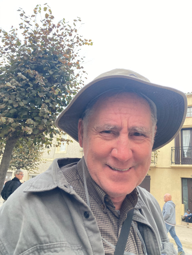
Jeanne Marie made me include the picture below. That way I couldn't whine later that I didn't have any fun.
Only one more day for us in Provence.
https://www.youtube.com/watch?v=iv2mF-BWzqg&list=PLpfTmBFH19HjSJOEdqKSw00DJWKcT8Cgm&index=3
https://www.youtube.com/watch?v=z8mAI-a2piw&list=PLpfTmBFH19HjSJOEdqKSw00DJWKcT8Cgm&index=1
https://www.youtube.com/watch?v=5SfmGiyWoms&t=12s
]]>
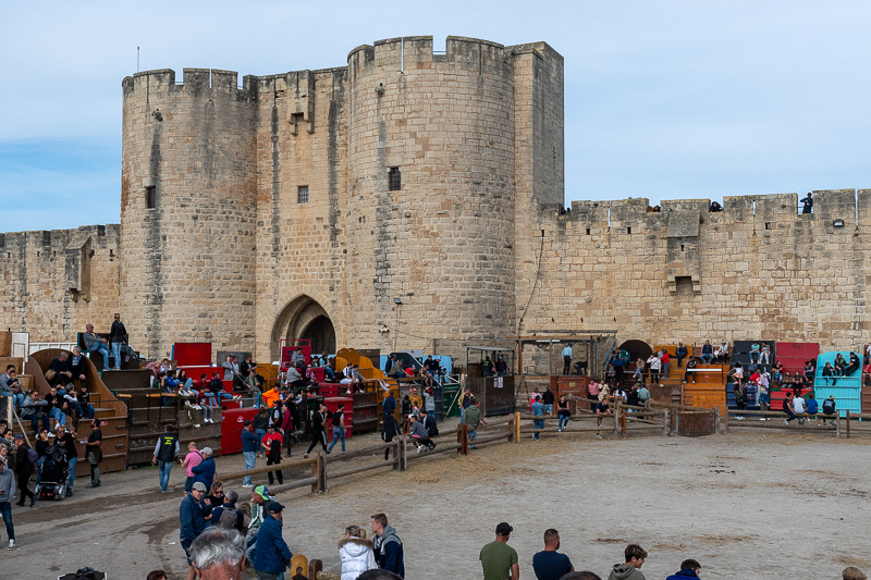
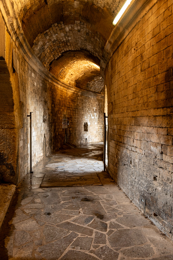
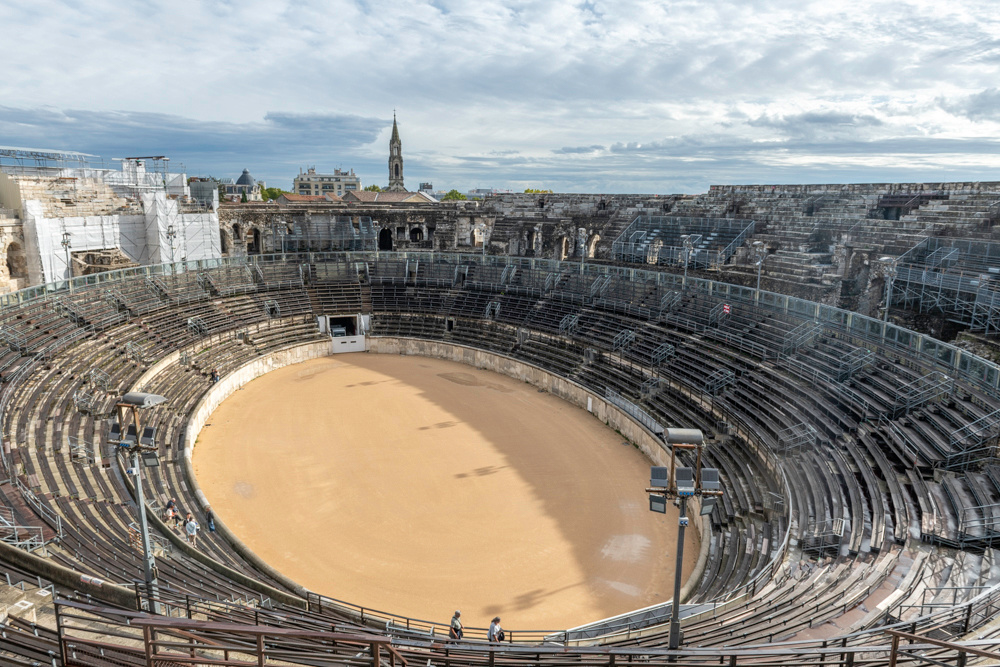
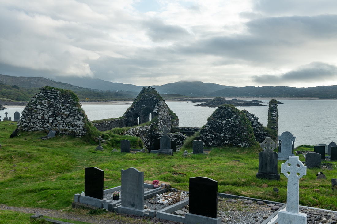
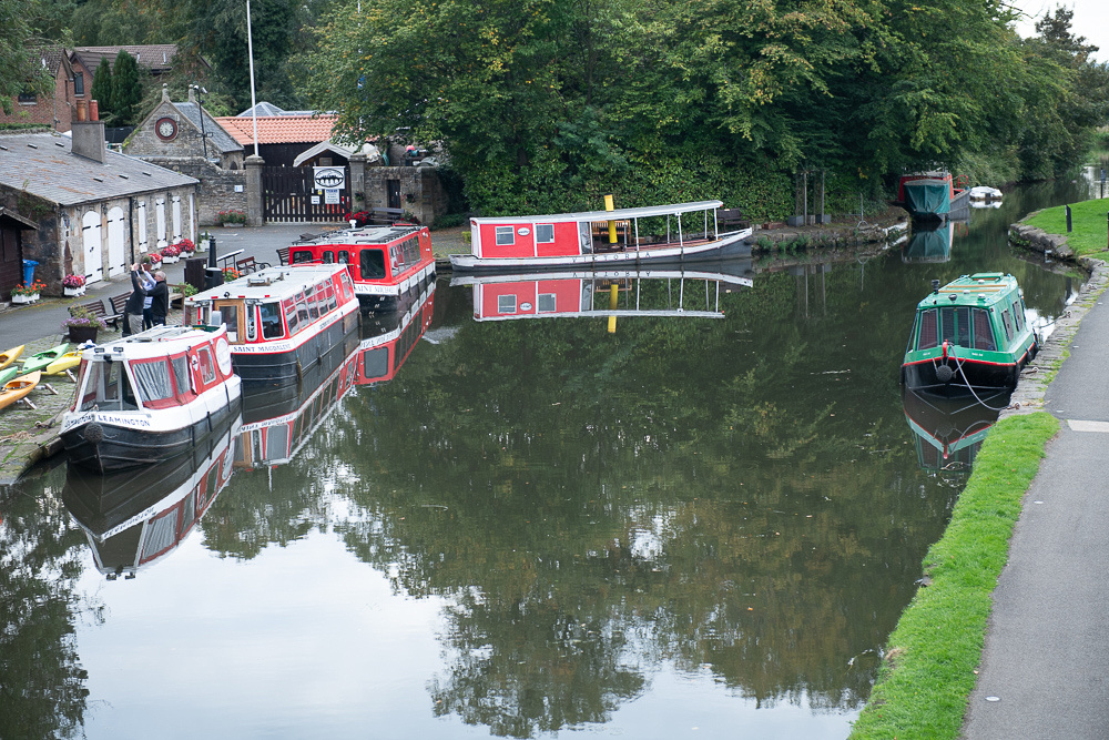
The arena itself is a temporary assemblage of large metal grandstands and private homemade boxes, some of which have been in families for generations. That's what you see pictured below.
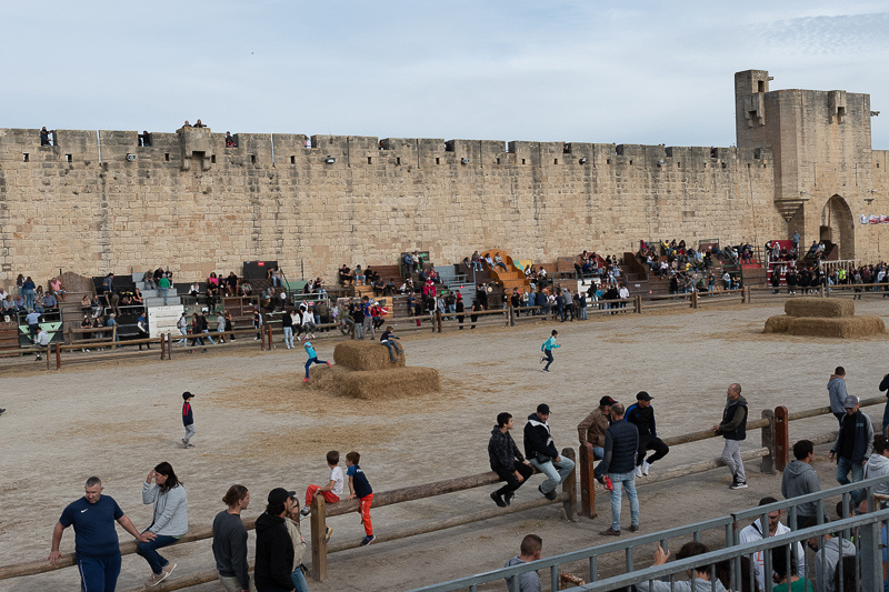
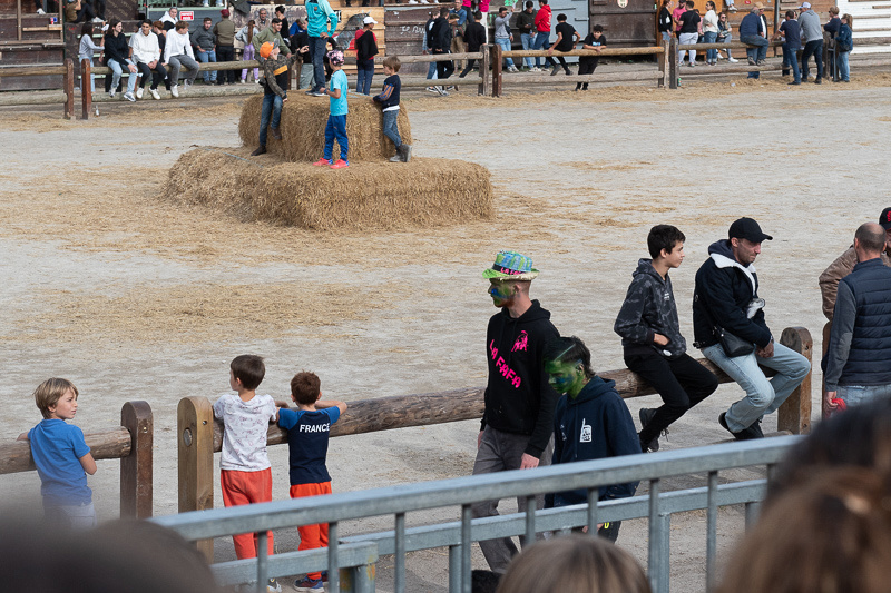
The little kids are running around because we are between bullfight sets. There are three sets of three bullfights each. These children are practicing for the day when they, too, can run for their lives with a 1500 pound raging bull snorting down their necks.
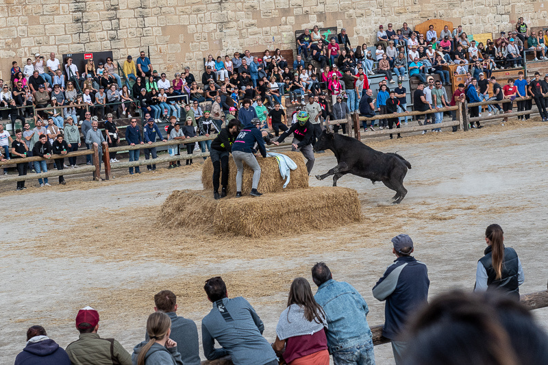
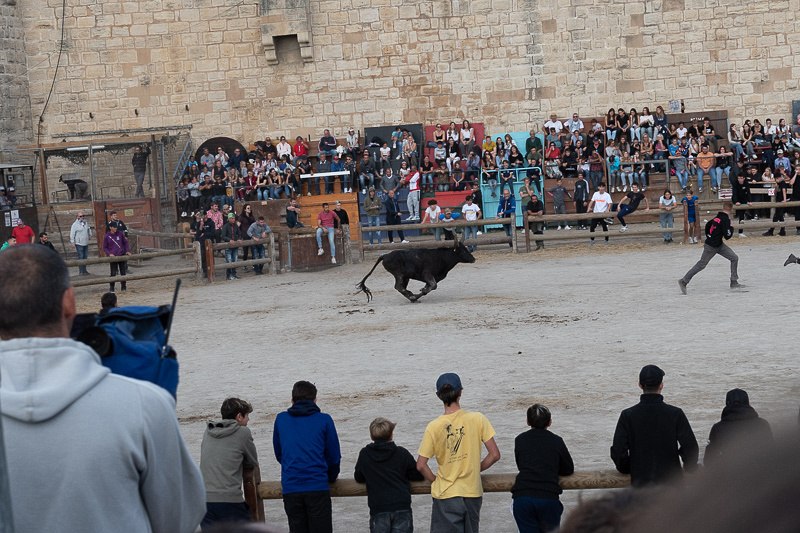
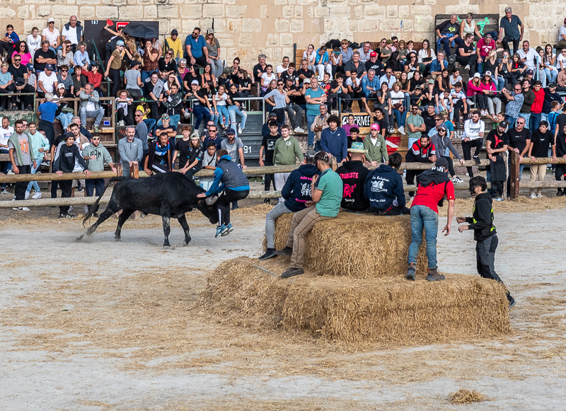
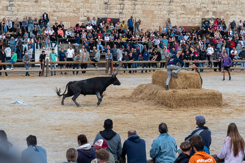
Below is a typical encounter. The razuteur has to get as close as he can but still make it back to the haystack.
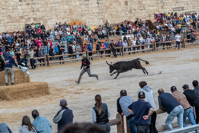
Did I mention that in this contest the bull's horns are sheathed? So he can't gore you. That leaves only nine other ways to get killed doing this.
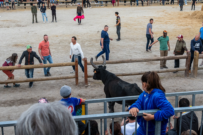
Throughout this whole spectacle Jeanne Marie and I were constantly looking at each other asking, "Can you believe this? Are we seeing what we're seeing?" And it wasn't really the antics of the young men that had us slack jawed. In all cultures the young males need some way to burn off their excess testosterone. What amazed us was the casual way young and old, men and women, would hang around on that rail fence, casually talking, sipping a drink, sometimes not even watching the action, as if they were not involved. But they were. Many times the bull jumped over that fence and went after anyone who happened to be standing there. The young man below had not been taunting the bull at all but he got the full treatment. The bull hooked his horn on the kid's shirt and threw him over the fence. But then the lad got up, dusted himself off, and walked away triumphant. He had faced the bull.
Needless to say I took lots of pictures. My camera can do ten frames per second so it makes a little movie. Below are several slide shows each with a good stretch of action. The most aggressive bulls are saved for last and you can see this as the slide shows progress. The best ones are at the last three.
In our next post we will be herding the bulls back out of town.

]]>
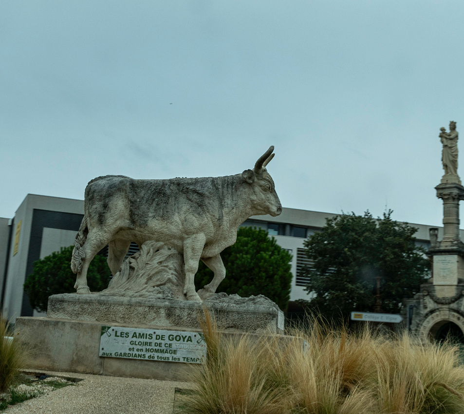
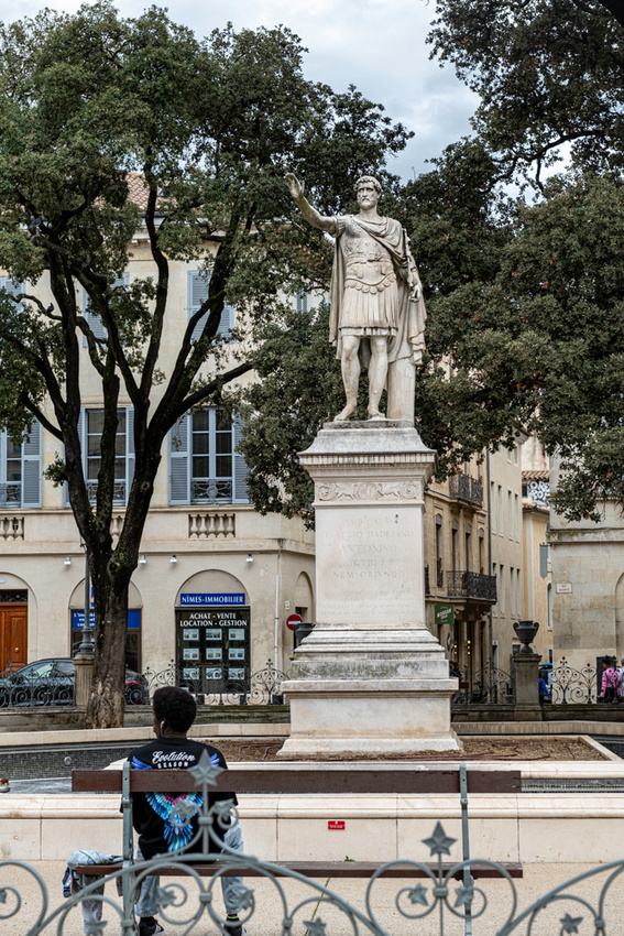
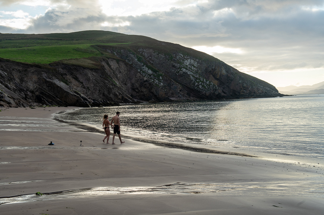
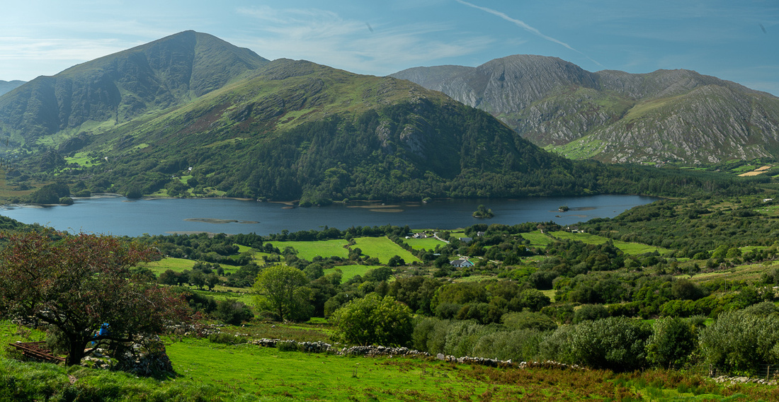
The cult of the bull across the Mediterranean region has very ancient, and very pagan, origins. Southern France is right in stride with this. Many towns have a statue of a revered champion displayed in a place of honor. The Camargue bulls are raised for bullfighting all over France, and the horses are for managing the bulls.
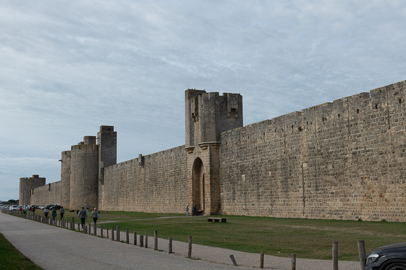
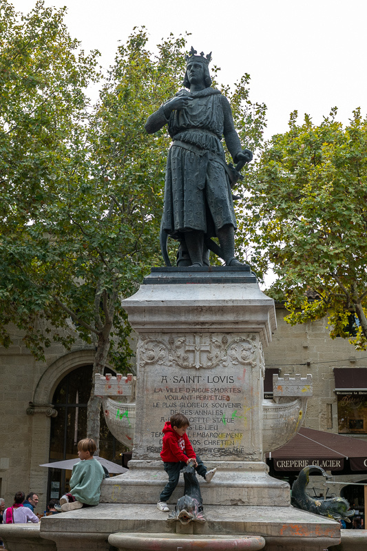
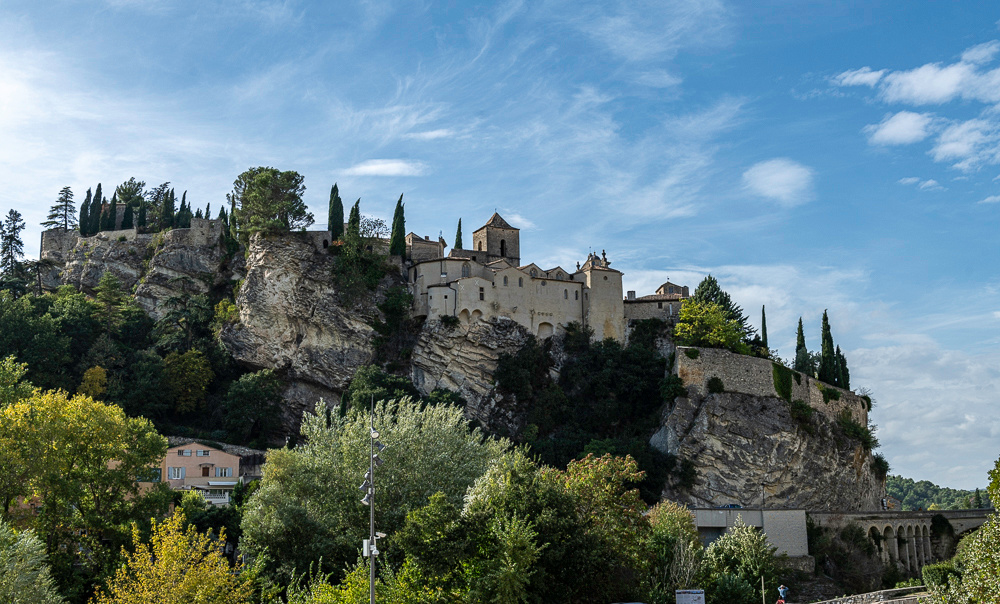
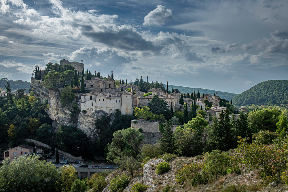
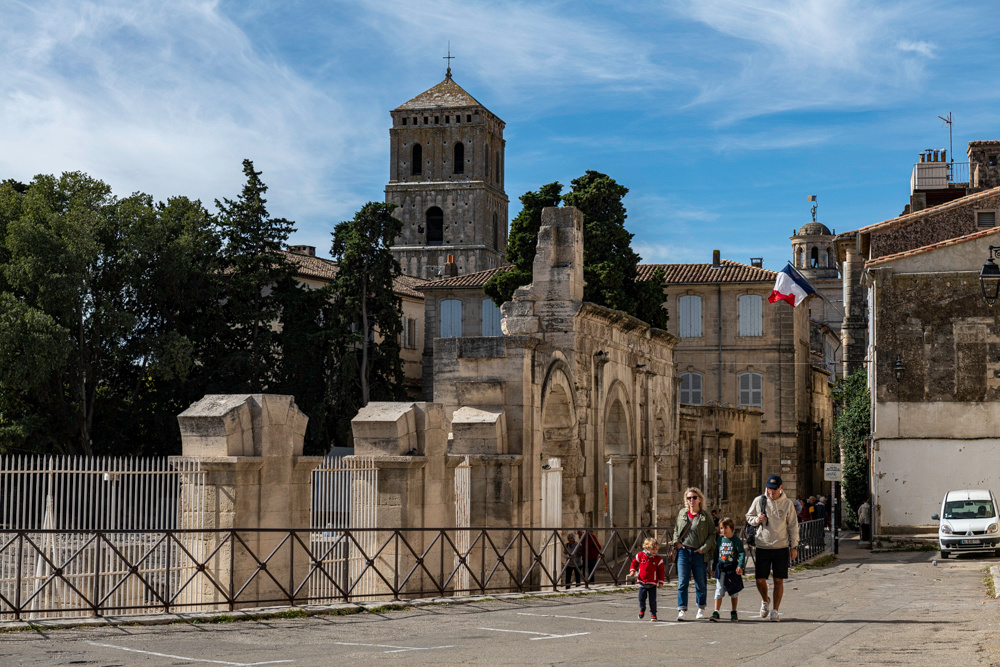
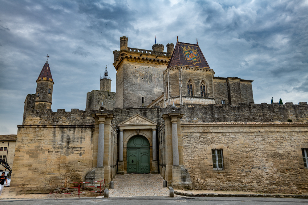
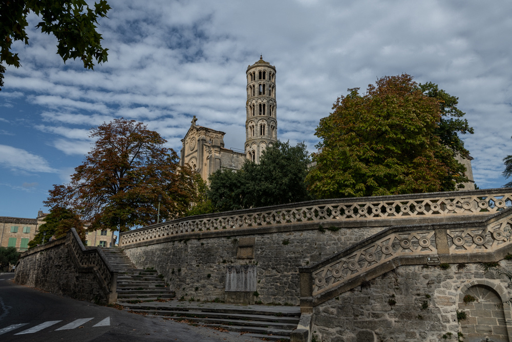
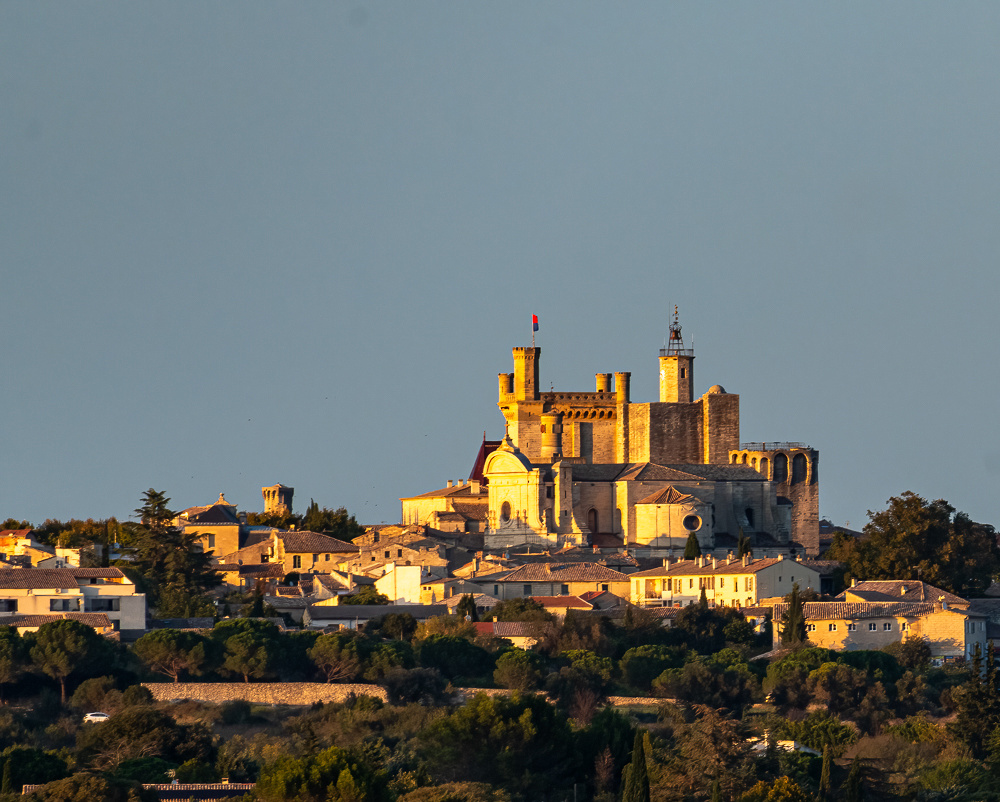
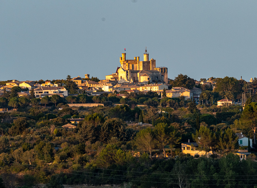
 We will be seeing this spectacle in the town of Aigues-Mortes on the western edge of the Camargue. It was founded and built by King Louis IX, Saint Louis, because he needed a Mediterranean port. He embarked from this very spot on his crusade, from which he would not return alive.
The event we witnessed is actually an eleven day festival put on by the breeders of the bulls. It had a very "small town, county fair" feel. There were not a lot of tourists and those few were from other places in Europe. We know this because it was all free, even to park our car. It was the Camargue celebrating itself.
The main event is the Camargue style bullfighting where the bull is taunted, not killed. But there is much more to the day than that. So the remainder of this post will report on the preliminary activities. They alone were worth the trip.
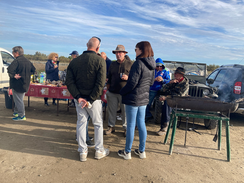
The day starts with breakfast. We were told to go to a field on the edge of town where we would see the gardians separate the bulls that would fight that day. When we arrived about 9 AM we found ourselves in the middle of a big tailgate party. Tables of cheese, champagne, French bread and pastries, people grilling, this is what they call breakfast!
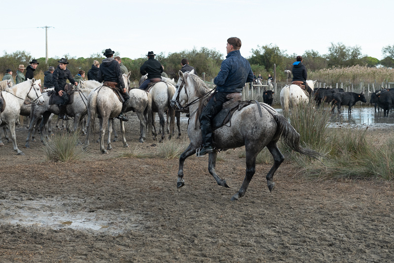
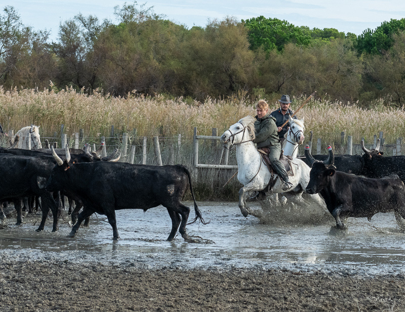
We waited around for maybe 30 minutes wondering when something would actually happen. Finally they brought in a herd of bulls, moving them into a shallow pond. The gardians then rode up and faced the herd of bulls, just standing there for several minutes. What was this about? Were they saying a prayer? Saluting the adversary? It had a ritualistic feel to it. They then rode over to the fence where we were watching, dismounted, and went back to the party.
Not having brought provisions of our own (we'll know better next time) we could only wait and watch them eat. Finally they got to it, separating the bulls they wanted for the bullfight.
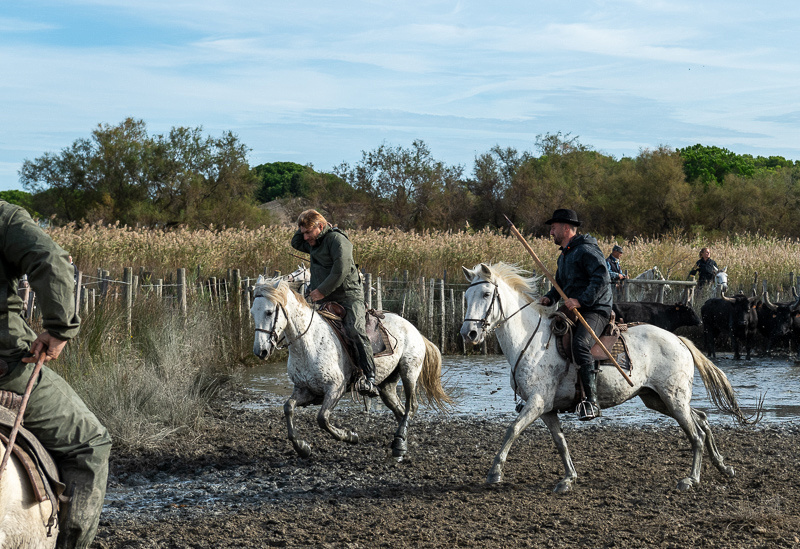
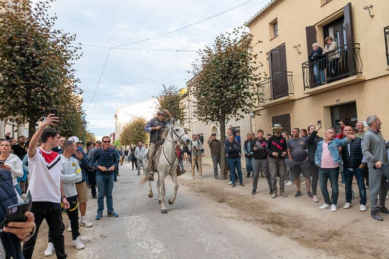
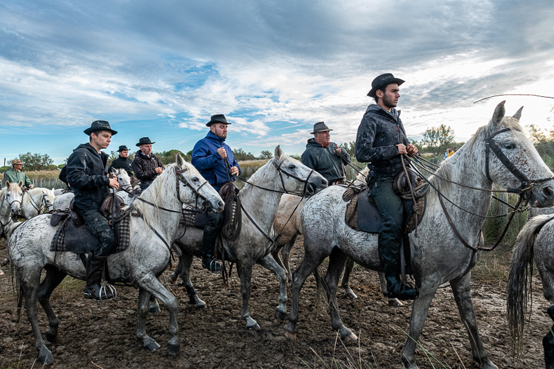
As the bulls were picked out they were herded down a country lane, through the north gate of Aigues-Mortes, down the city streets to the south gate, and into the arena. This all happened before we could get in position to get pictures. We did get these gardians bringing up the rear.
Next, the bullfights!!
]]>

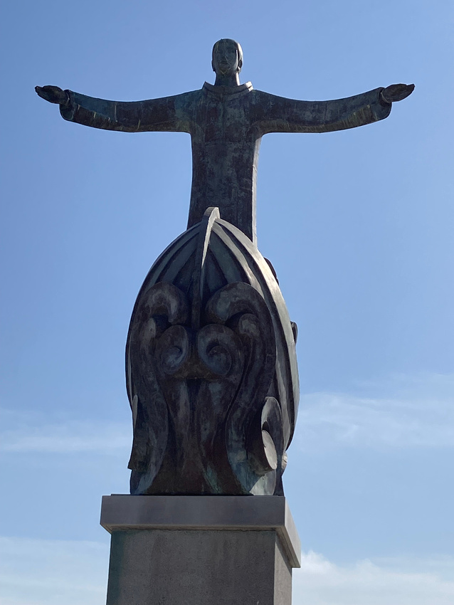
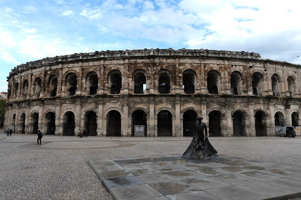 Yes that's a statue of a matador. The French do some of the corridas bullfighting (Spanish style), but mostly it is Camargue style where the bull, not the matador, is the star of the show and is not killed. More on this in a future post.
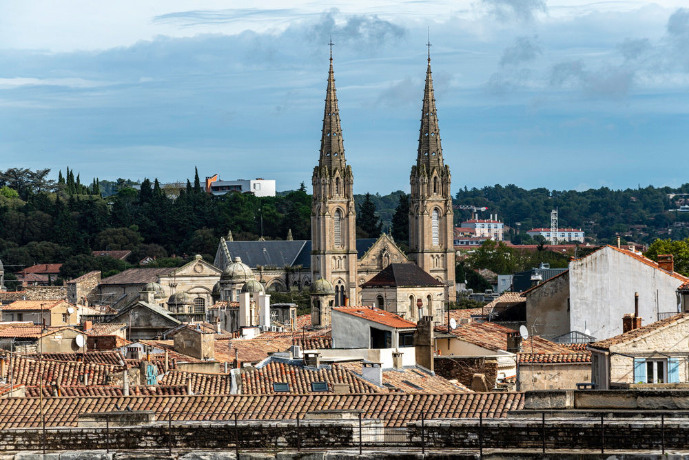
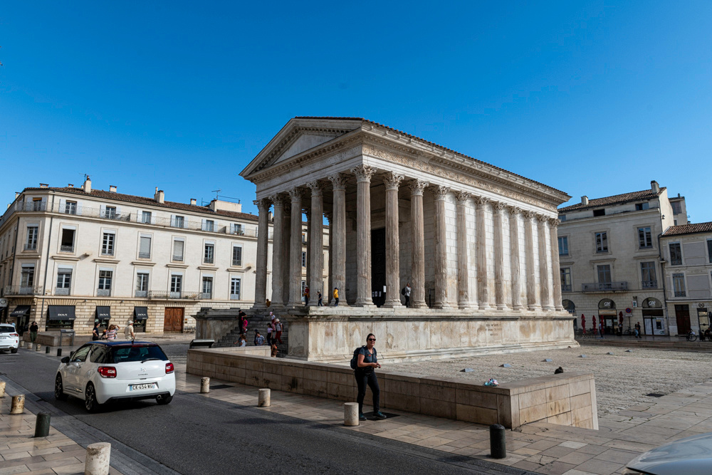
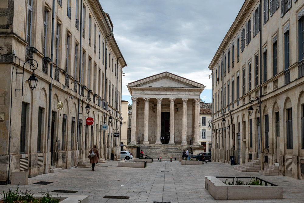
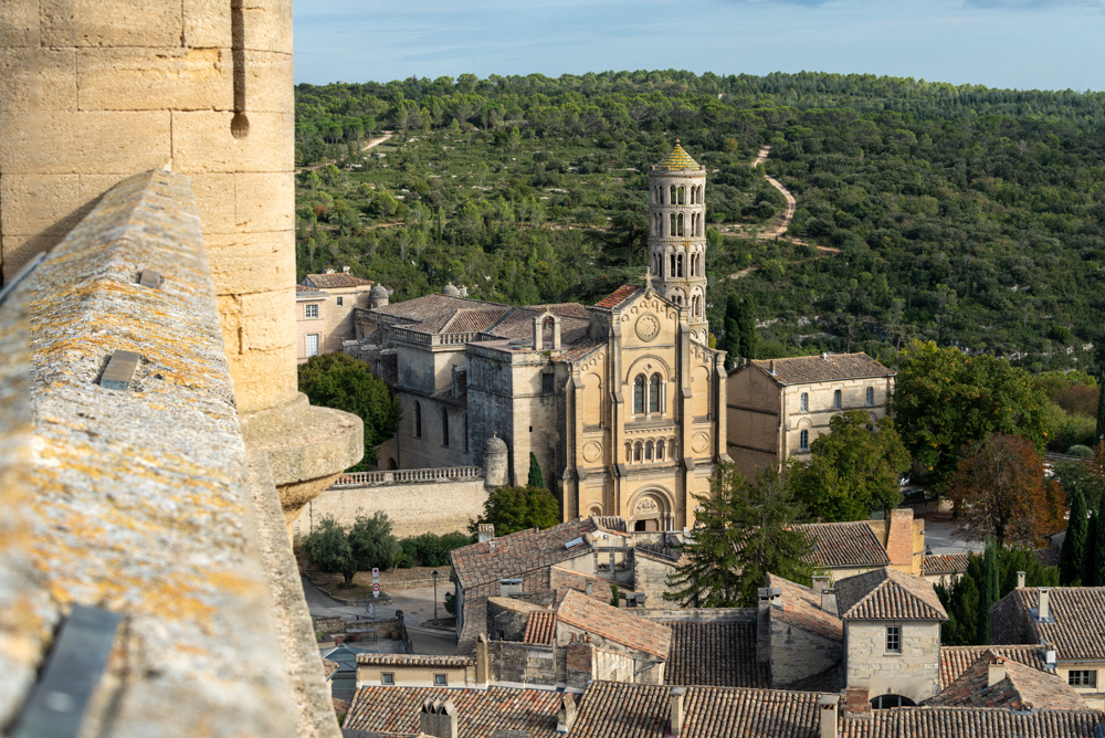
But wait, there's more! Nimes also has a first century temple built by Caesar Augustus. It is the best preserved Roman temple in existence.
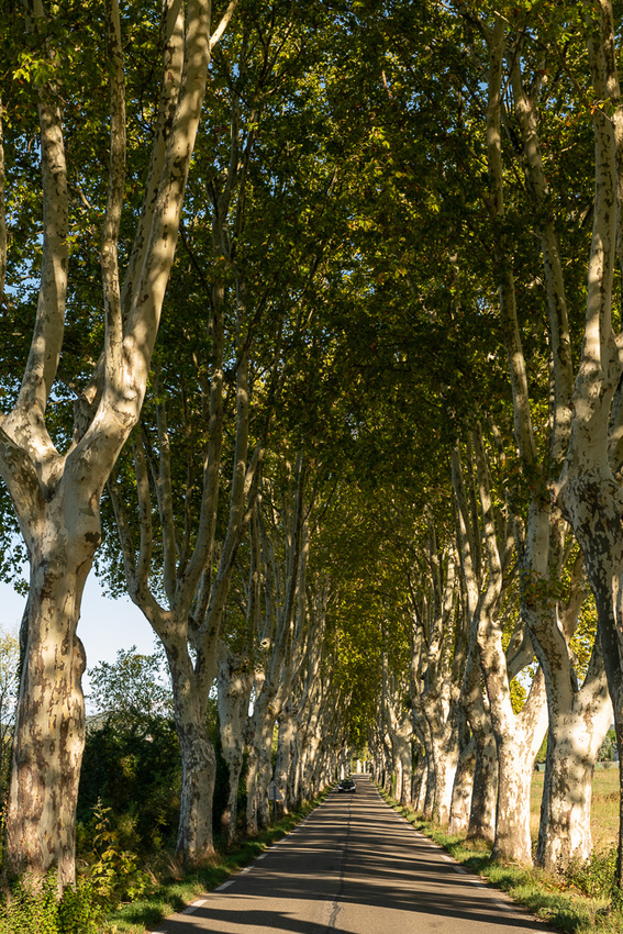
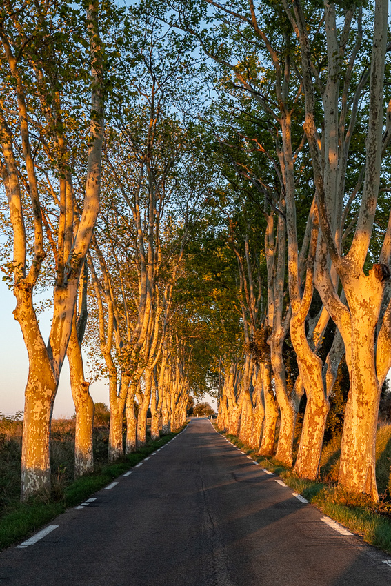
Below is a stand of the famous Provence sycamores. They line the streets and roads everywhere. The drive back to Uzes had several fine examples.
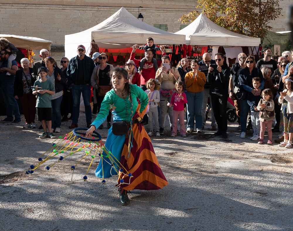
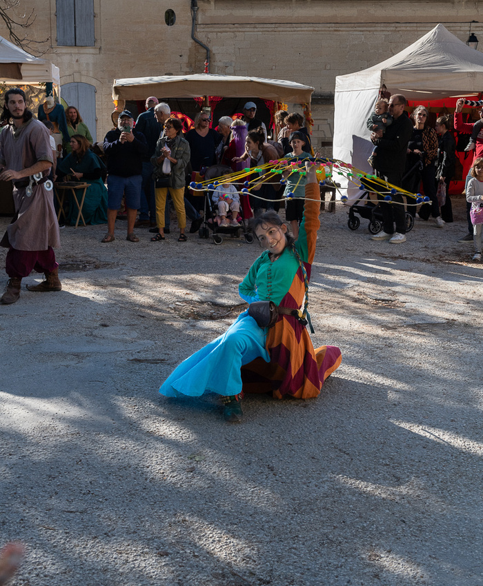
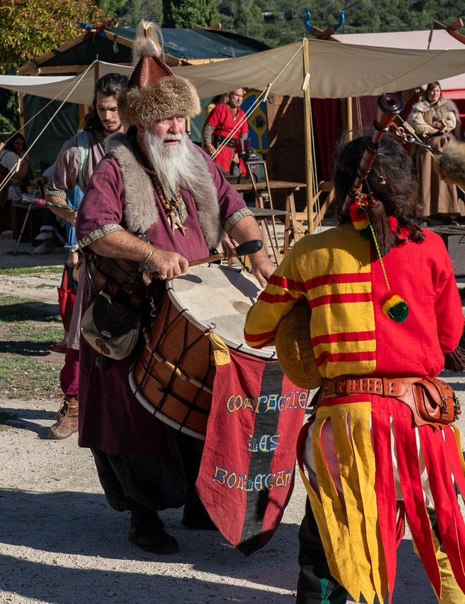
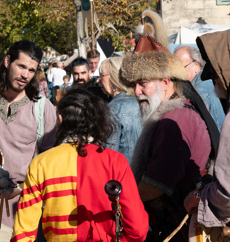
On Saturday Oct 21 we took a down day, staying in Uzes and checking out their Medieval Festival.
Tomorrow, Sunday, we will head back down to the Carmague, where the serendipity photo gods have kept the best for last.
]]>
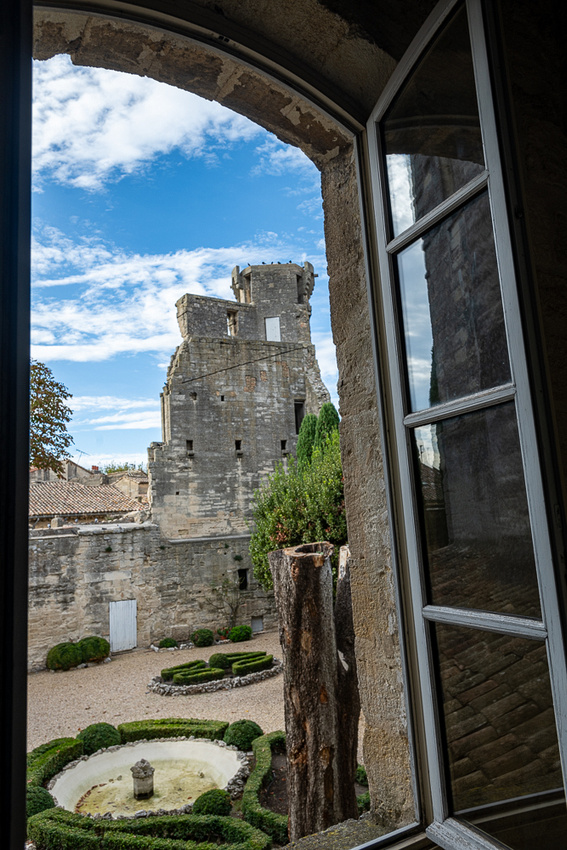
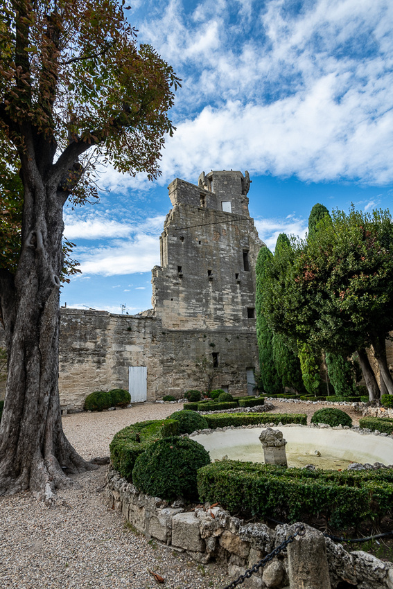
First stop were the gardens.
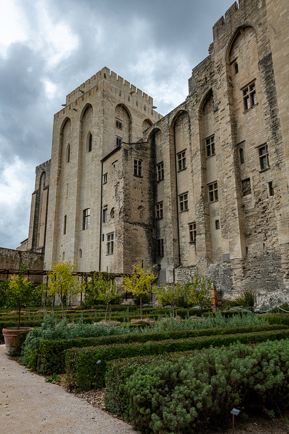
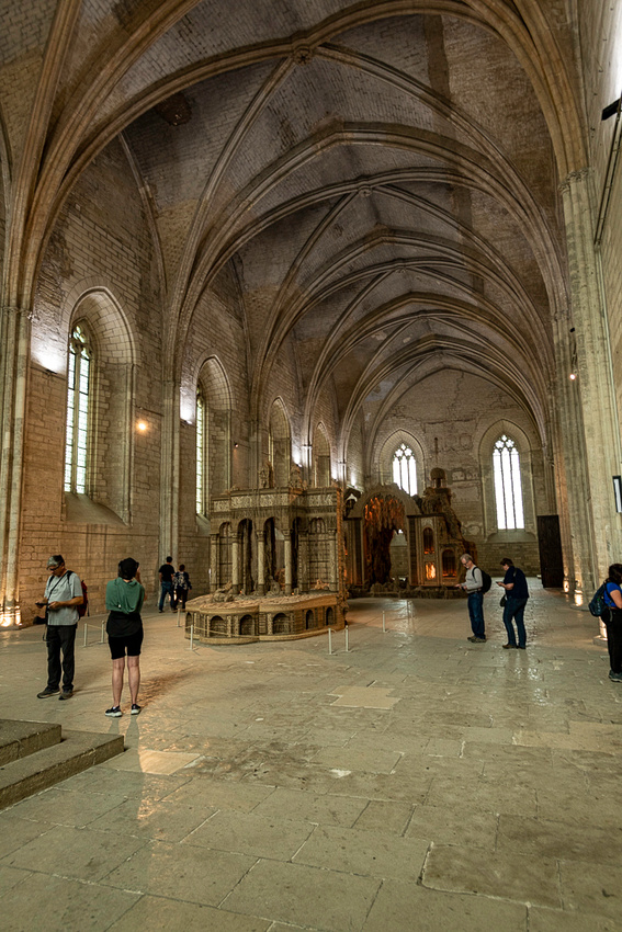
Then in typical palace tour fashion we went from one room to the next and tried to picture business going on as usual.
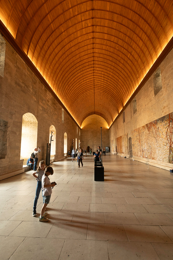
 Below is the grand hall where formal ceremonies such as receiving ambassadors, installing cardinals etc, were held.
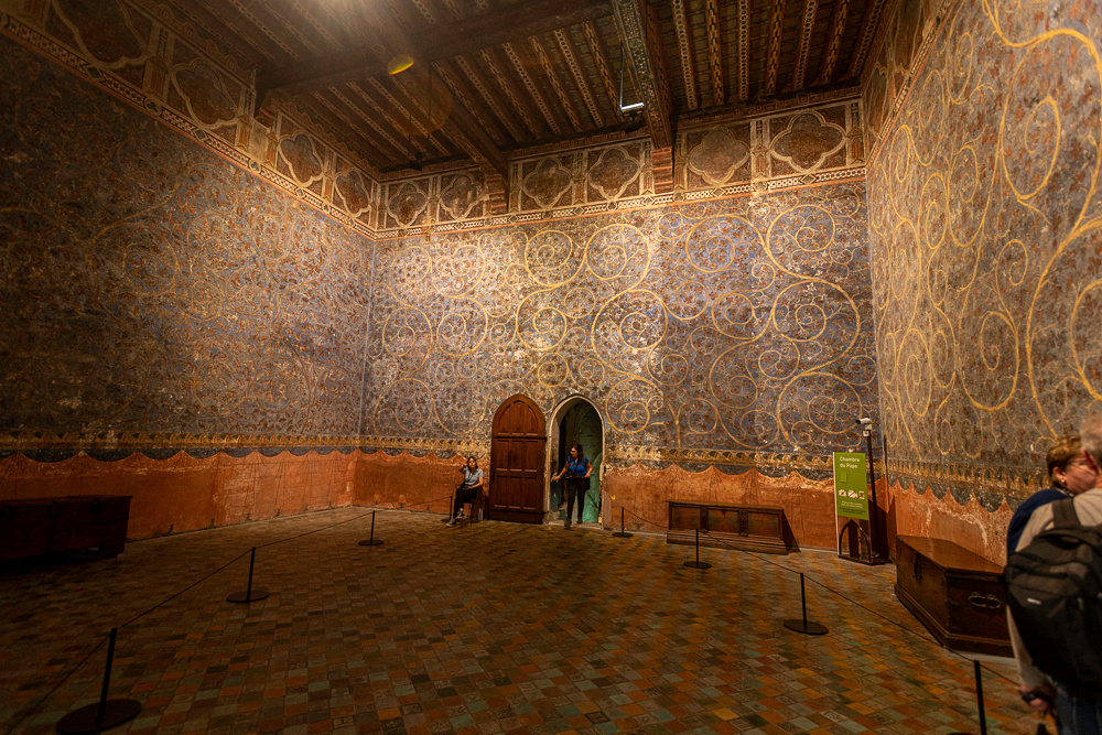
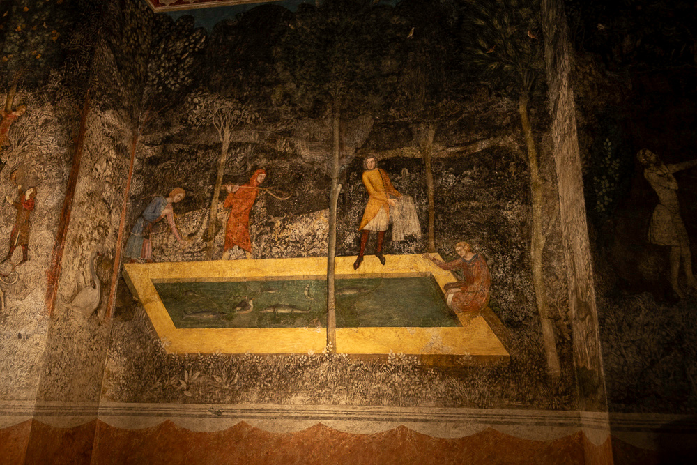
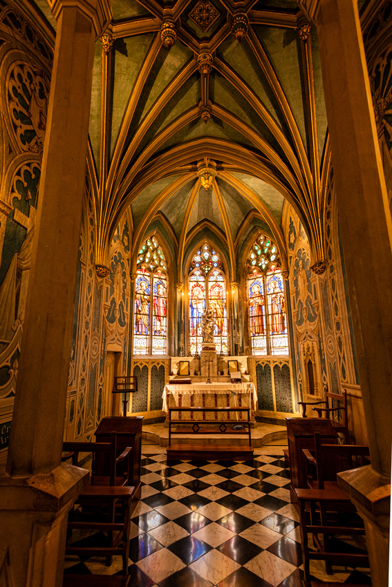
Below are two rooms that got their finishing touches. They are frescoes and some of the most vibrant we've ever seen.
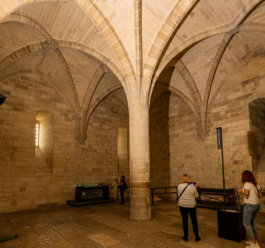
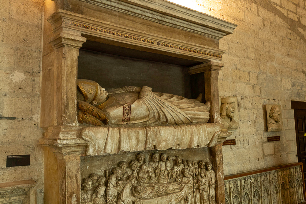
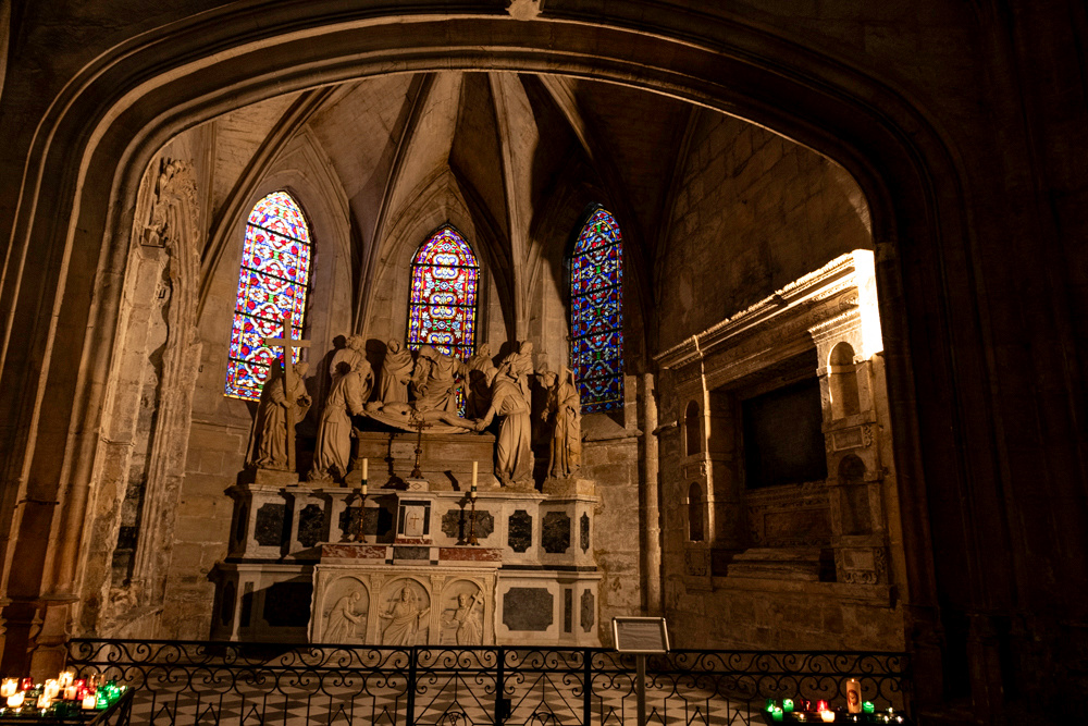
Then there was the crypt. All seven Avignon popes were buried in or near the city but not all in this crypt.

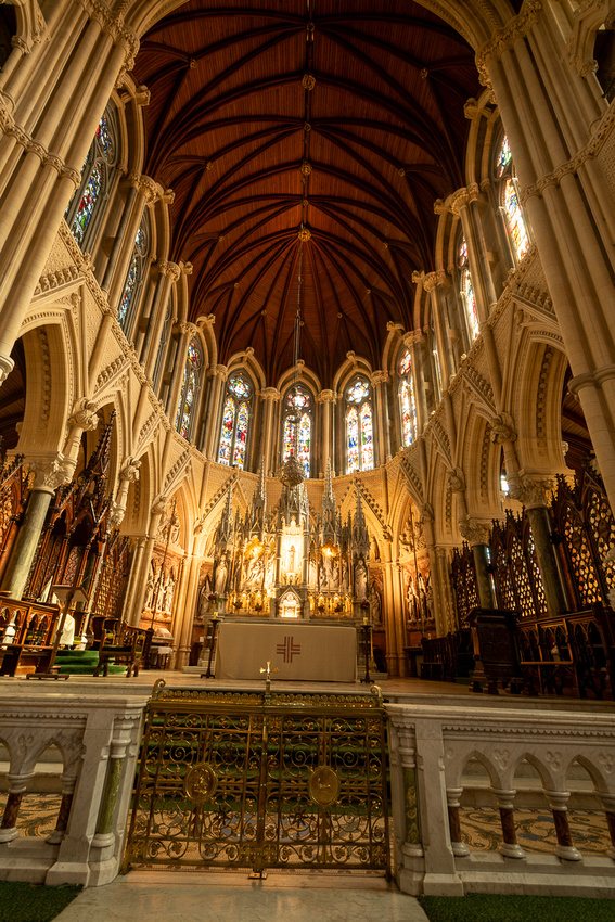
 Below is the main cathedral. Not as impressive as St. Peters, which had not yet been started, but it was built in about one tenth the time. (and even less money)
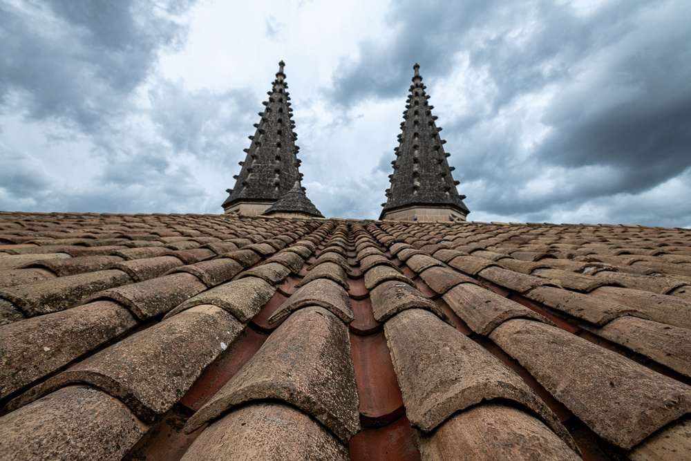
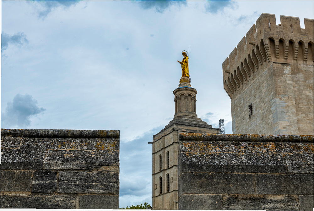
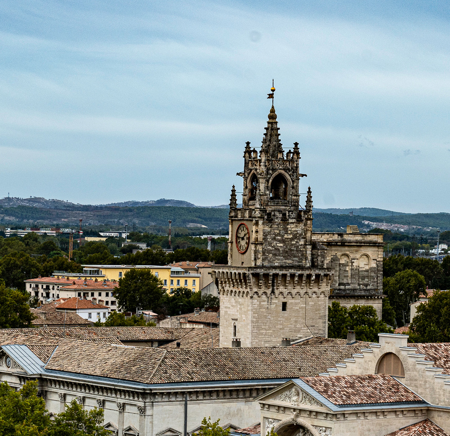
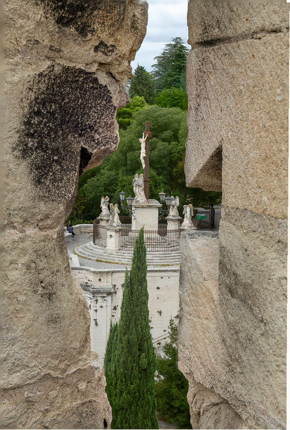
So now for the view from the roof.
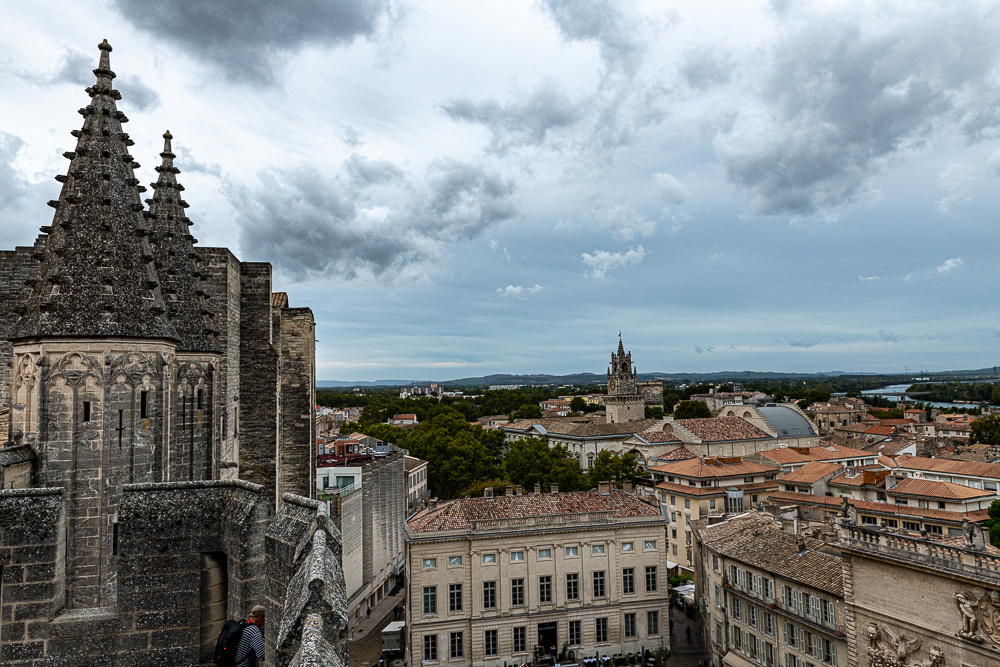
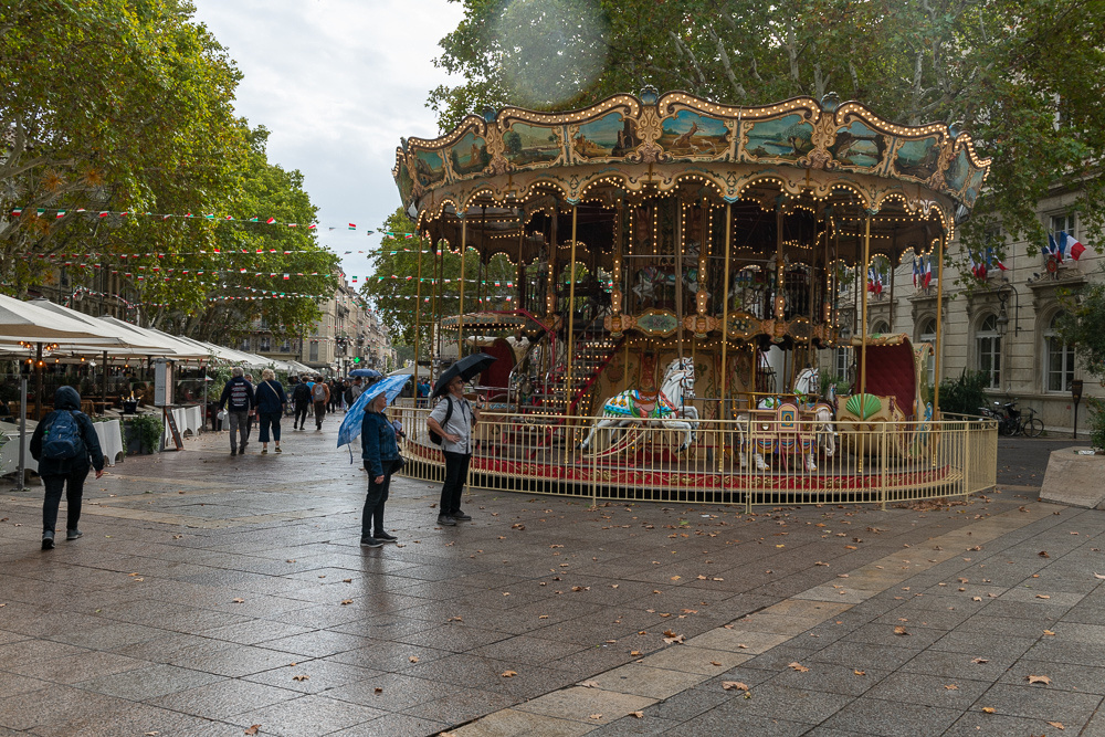 Above is the requisite carousel in each French town square.
On the way out of town we stopped at an island in the Rhone that gave us a nice view of the town. Wish the light had been better.
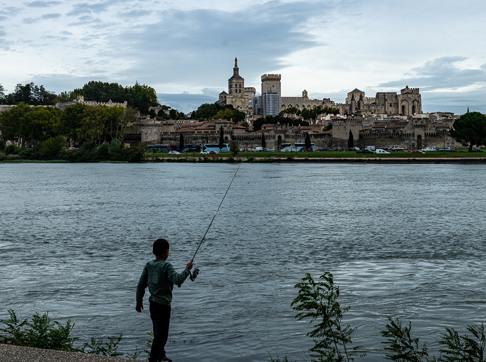
 Above in the background is the famous bridge at Avignon. Okay now try not to hum the song. "Sous le pont d'Avignon, L'on y danse l'on y danse!" I guess after repeated flooding of the Rhone in the 1600s took out most of the bridge it was only used for dancing, as it was no longer a bridge but a pier. Who but the French would think of making lemonade out of those lemons? Well, besides the Italians?
]]>
 Just down the road is the village of Gigondas. It doesn't have Roman ruins but it does have something else, its own wine appellation. Gigondas is a red blend of the lower Rhone wines, very similar to its more famous neighbor, Chateauneuf du Pape.
 Again though, we learned that this time of year these villages are best visited on a weekend. Not much was open. Even so exploring these little towns is a joy in itself. And one never knows when the serendipity gods might appear.
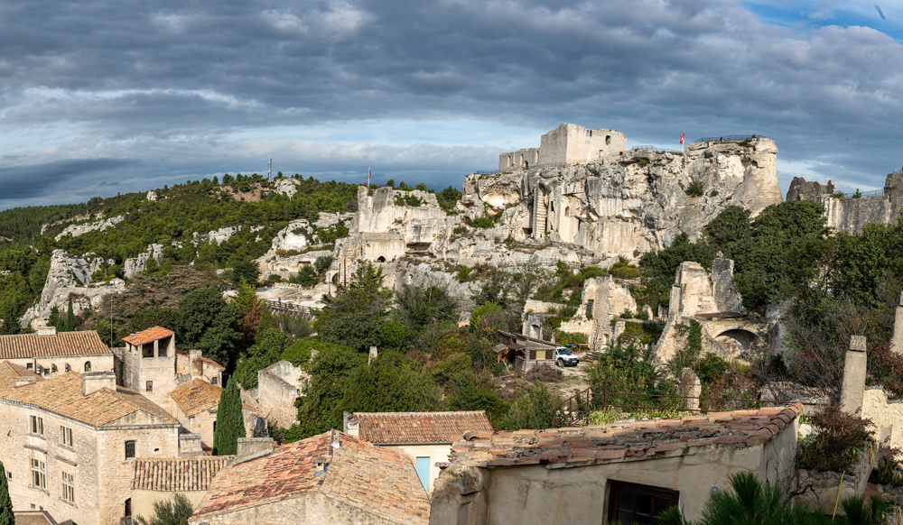
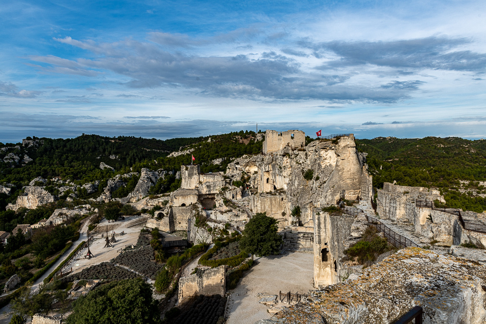
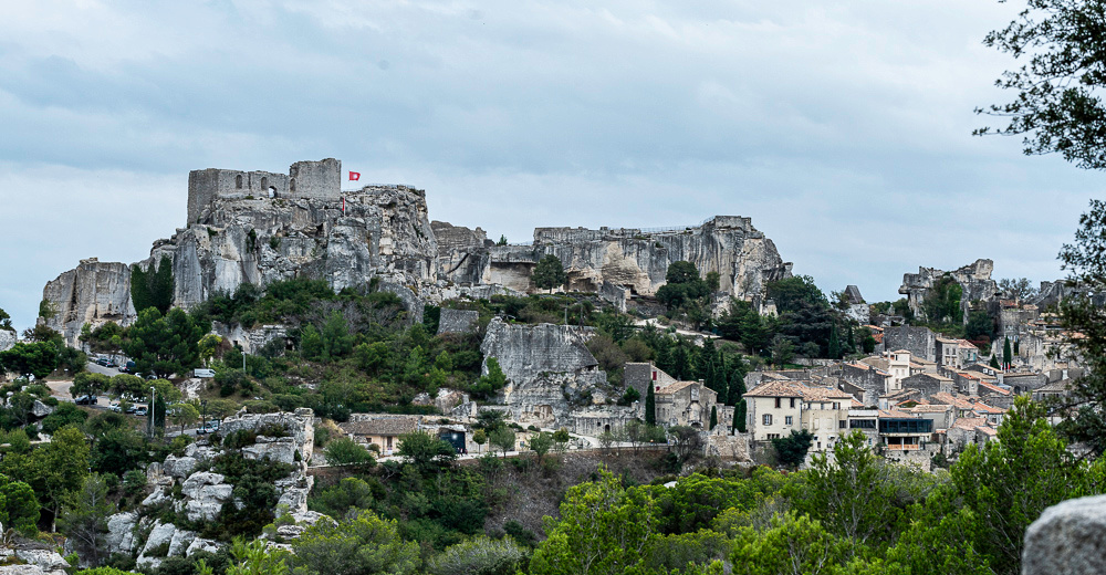
Time to forgo the Roman sites now and get back to the Middle Ages. This day we would explore the medieval castle and town of Les Baux. Whereas the Romans built their cities with trade in mind, feudal society was more concerned with defense. So this mountain redoubt northeast of Arles would dominate the lower Rhone valley for most of the Middle Ages. The village is a "frozen in time" kind of place with all the buildings many hundreds of years old. The castle was as much dug out of the mountain as built on it. There is enough of it left to get the feel for life in a medieval stronghold. During the religious wars of the 17th century Protestant rebels took over the then vacant fortress, against the wishes of the villagers, and had to be extracted by force. The villagers then petitioned the king to have the castle walls demolished. They were blown down from the inside with gunpower. Had they no idea they were on a gold mine of a tourist attraction!!?
First though, the drive over. We crossed the Rhone at the town of Beaucaire. They too, have a castle. We just grabbed a few shots as we passed through.
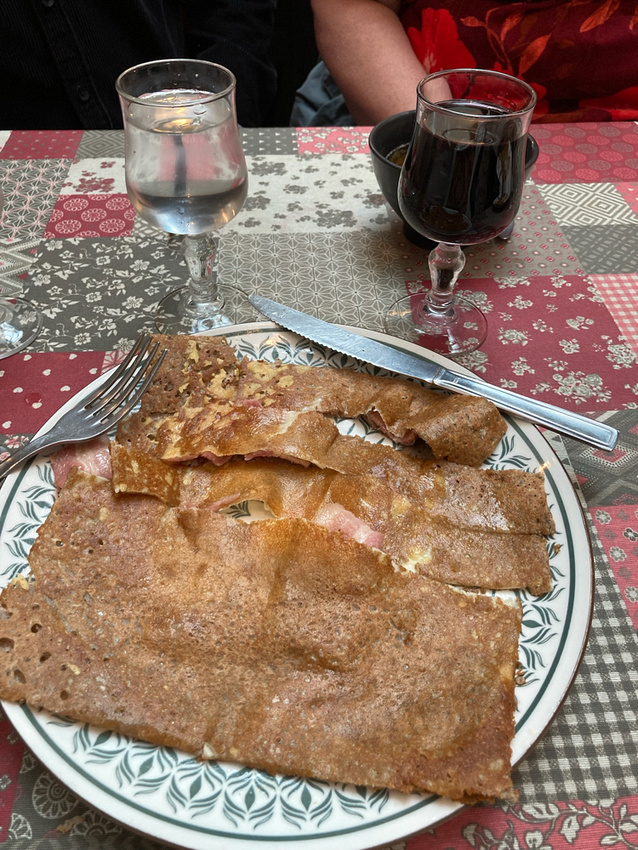
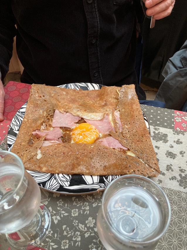
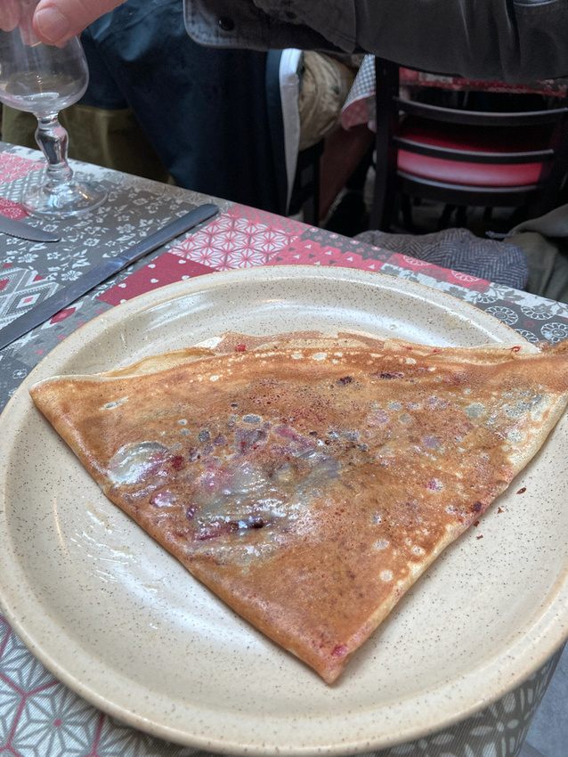
As we arrived at Les Baux it began to rain so we decided to retreat to Saint-Remy and find some lunch. A creperie promptly presented itself. Just what we wanted. These creperies are one of the French versions of fast food. They are very quick and soooo much better.
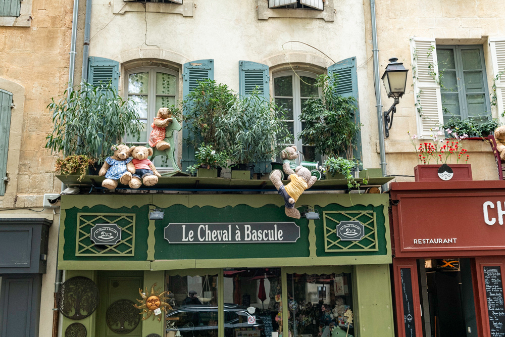
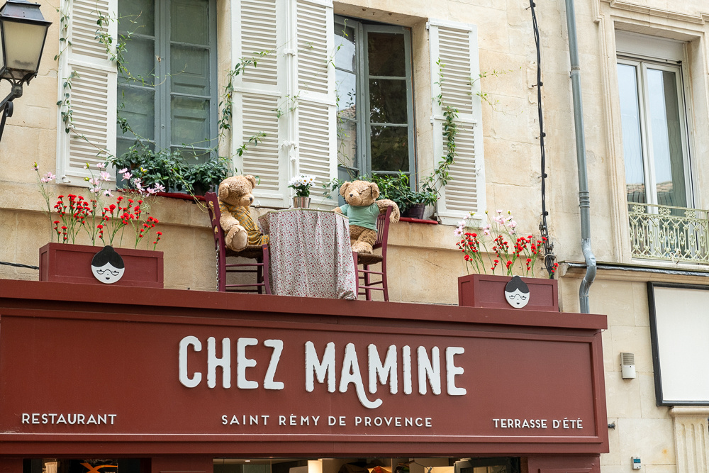
We then walked around the town a little just to check it out. This store was pushing some kind of bear theme. We like bears.
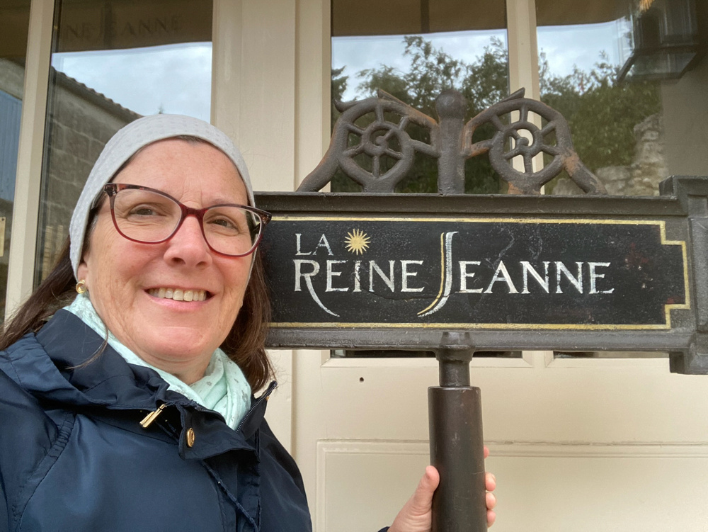
 Then we had to get a selfie:
 So very French:
Jeanne Marie is widely revered here, as she is everywhere.
Finally the rain started lifting so we headed back to Les Baux.
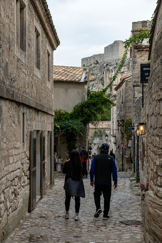
Walking around these quaint little places can really pull one back in time.
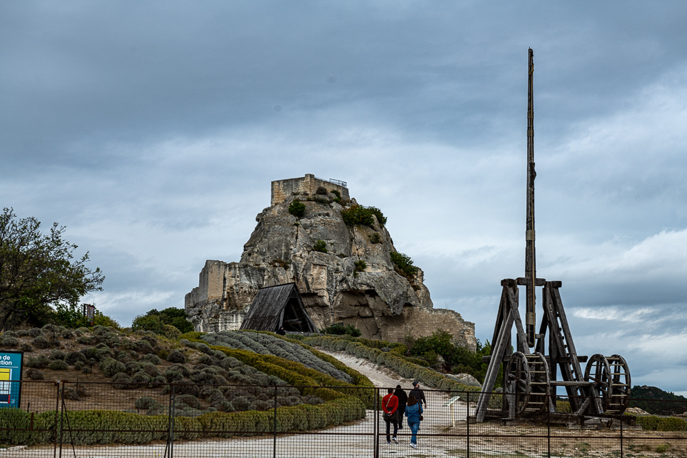 Above is a trebuchet, a siege machine for slinging large boulders.
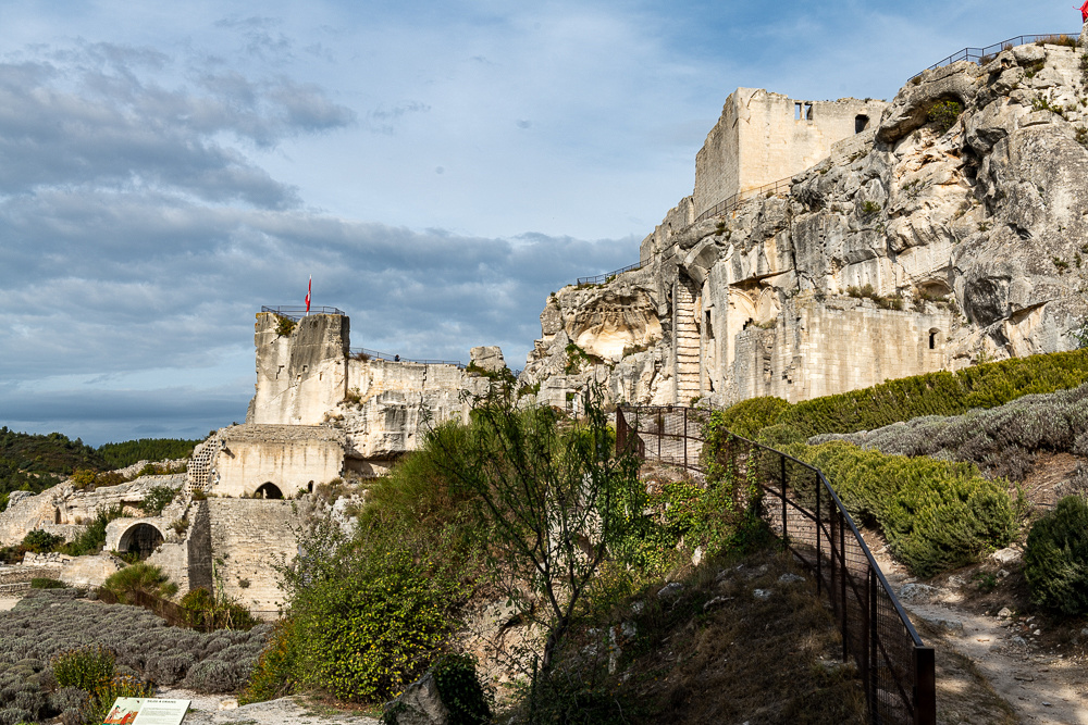
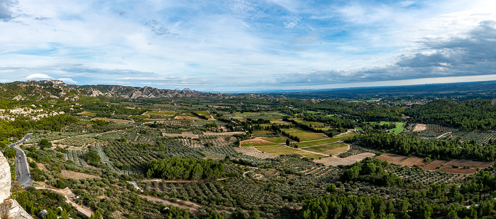
The view from the top. Above, of the fortress, below, of the valley beyond the walls.
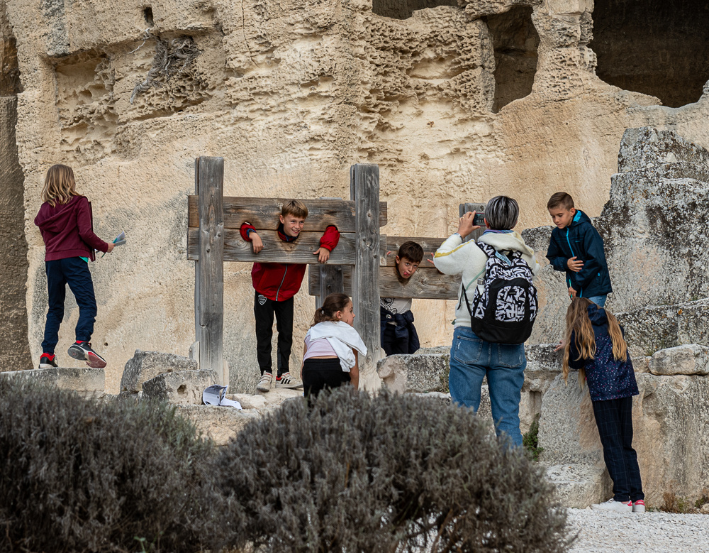
You think our schools are tough? These French kids didn't do their homework!
We were wise to retreat from the rain earlier. It turned into a gorgeous day.
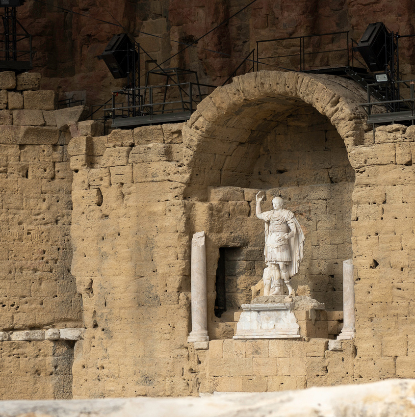
]]>Another day another Roman ruin. Are you sure we're in France? We did make an effort on this trip to track down every place the Romans had a significant presence. As I mentioned earlier the very density of all this stuff really helps to get a picture of what life in those days was like. Orange was founded right after Julius Caesar's full conquest of Gaul, by veterans of the Roman Army. So when Caesar Augustus established the Pax Romana it was ready to blossom into a center of civilization, as the founders were keen to emulate anything Roman. The two surviving Roman structures are the theater and a grand triumphal arch. The theater is first.
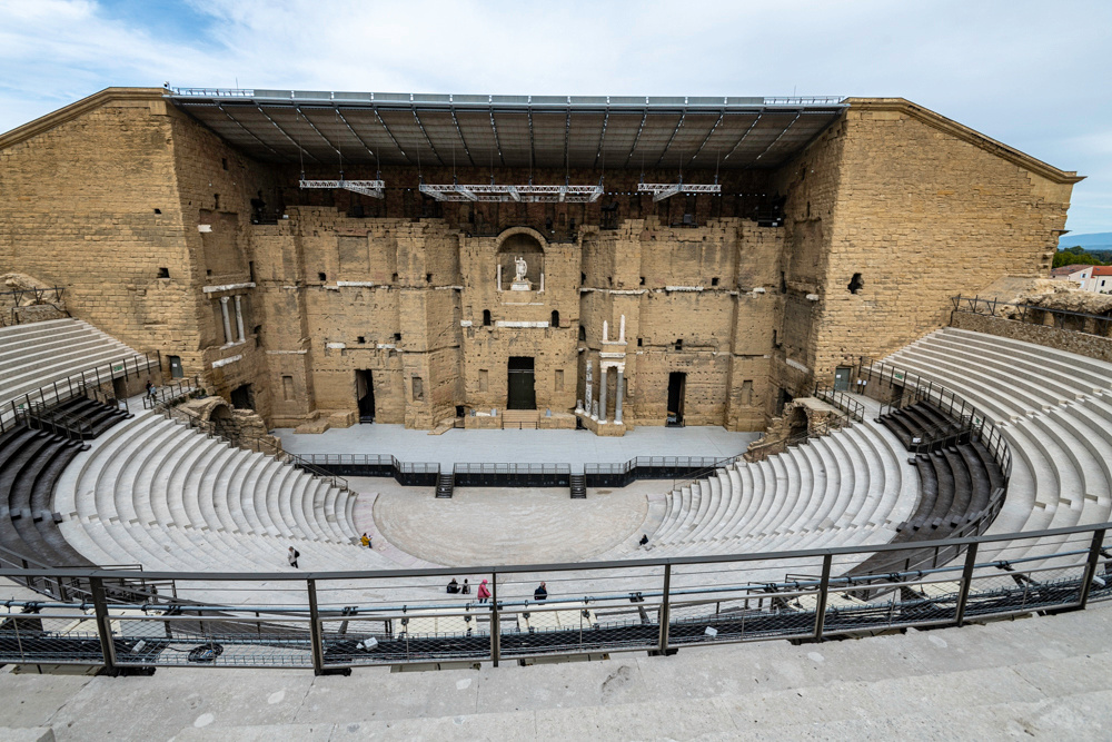
As grand as this place looks it was originally much more grand. The columns embedded in the wall are all that remain of 44 original ones. That massive stone back wall provided great acoustics too. A steady bill of plays and concerts are held here in the warmer months.
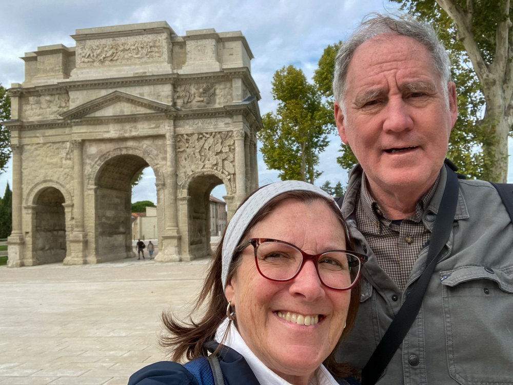
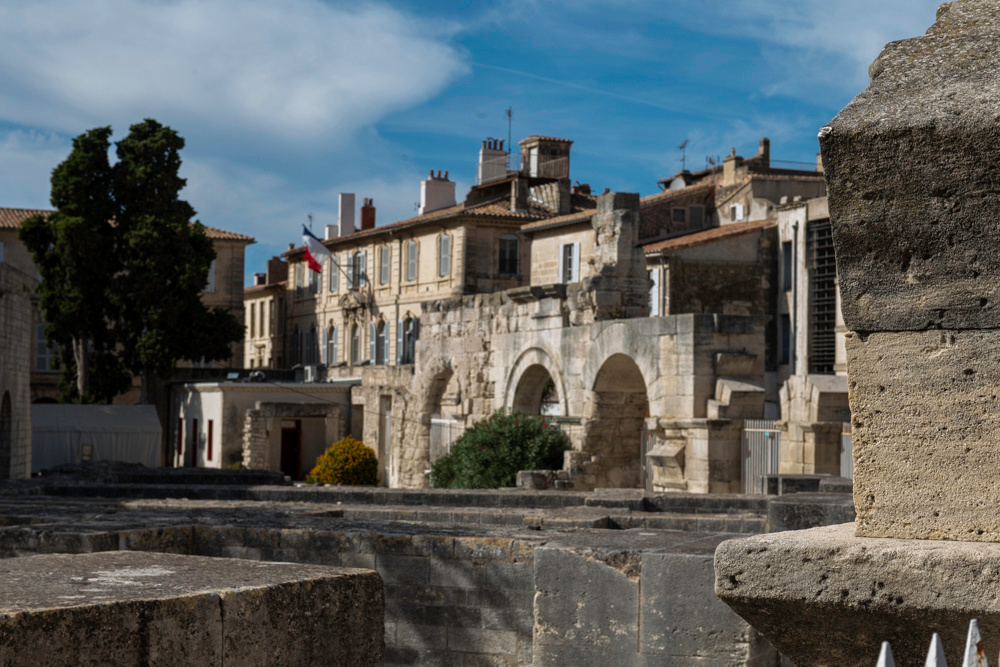
The other Roman antiquity to check out is the triumphal arch that stands at the original north gate to the town.

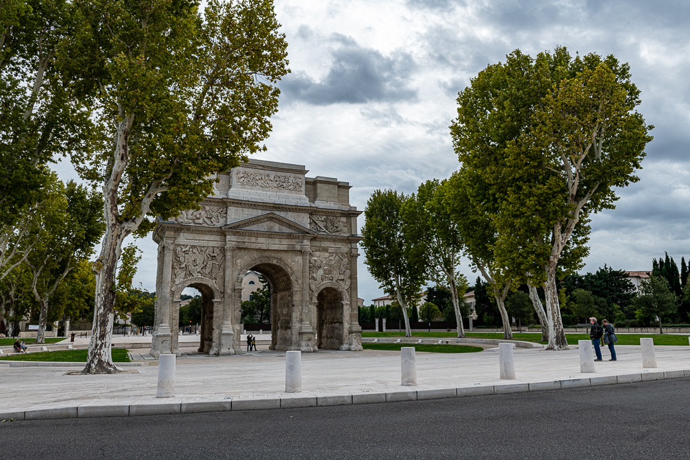 Looking at these two grand examples of Roman architecture, one does get the picture of a provincial town trying very hard to emulate the mother country and create a miniRome.
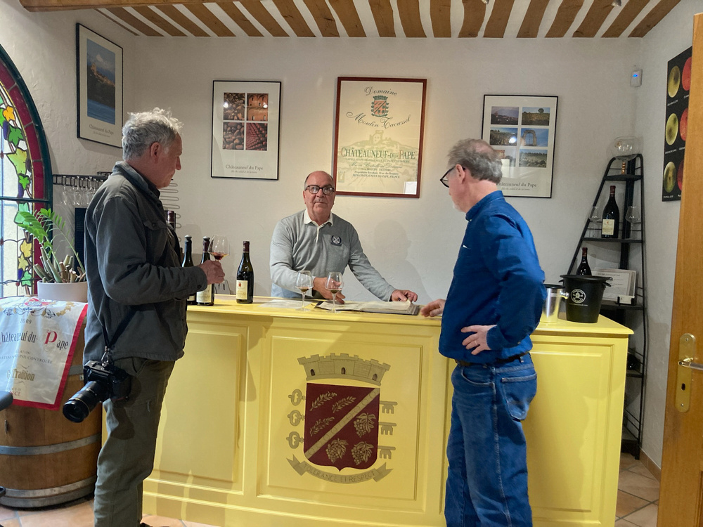
On the way home we stopped in at Chateauneuf du Pape. This village just north of Avignon that is the center of the Chateauneuf du Pape wine growing region, one of the more renowned in the world. It is a must stop for wine lovers, hence, we stopped! What we were finding, and would see again, was that this time of year not a lot was open during the week. We still tasted some wine and bought a few bottles.
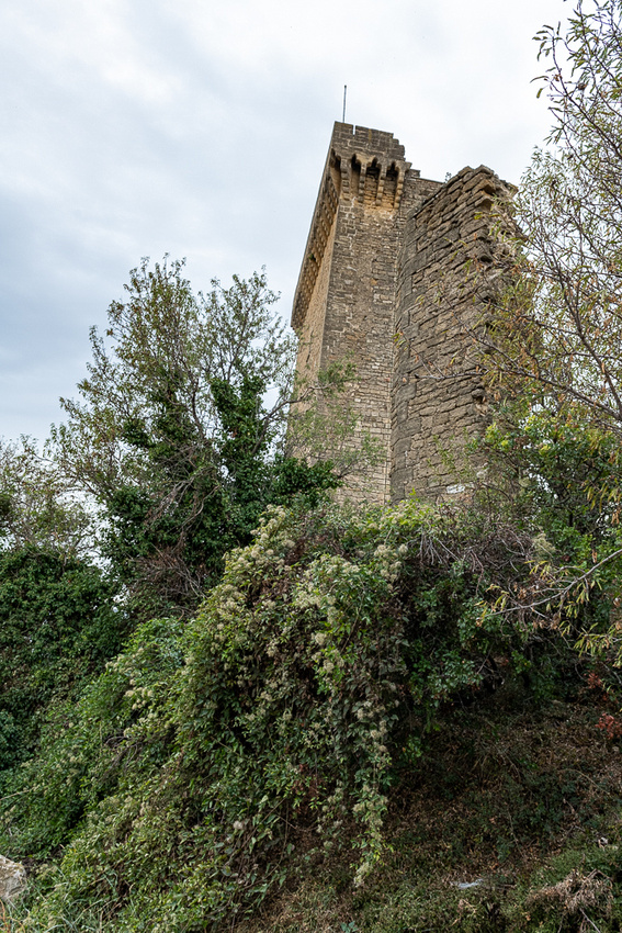
The castle that guards the town was damaged during the religious wars of the 17th century so less than half of the original complex is still standing. The Avignon Popes had built it and used it as a summer residence.
 Tomorrow back to the Middle Ages.
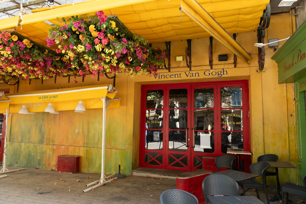
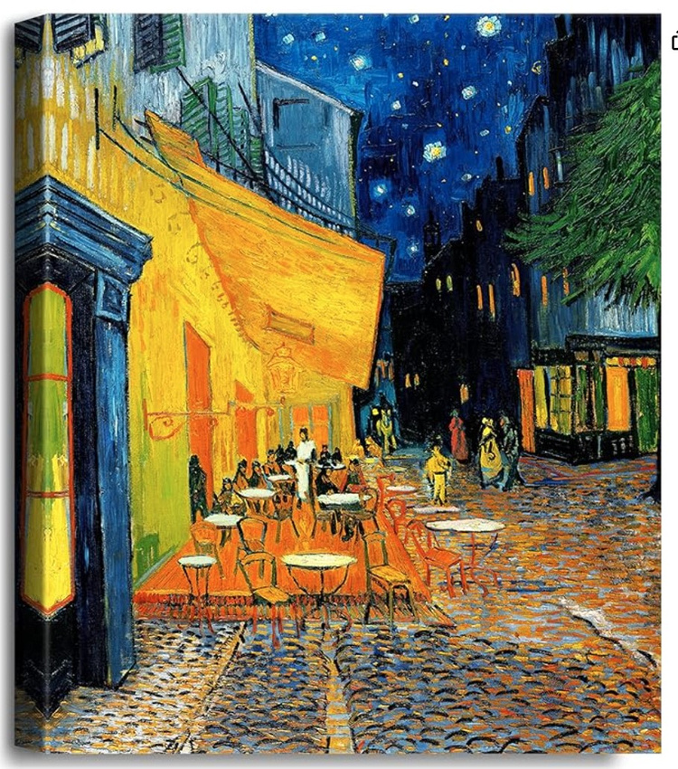
The cafe above was the scene for one of Van Gogh's more well known paintings.
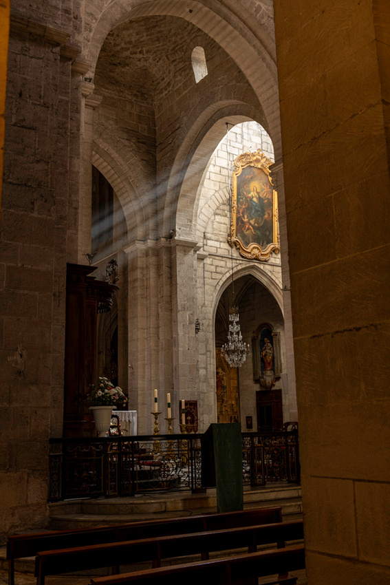
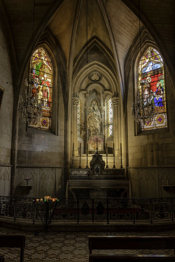
The cathedral was open so we slipped in for a visit. It was Sunday after all.
Then it was on to the Roman stuff. They left us a large amphitheater for the big events and a smaller one for plays. Both are in use today.
The obelisk above from the fourth century is part of the Roman legacy
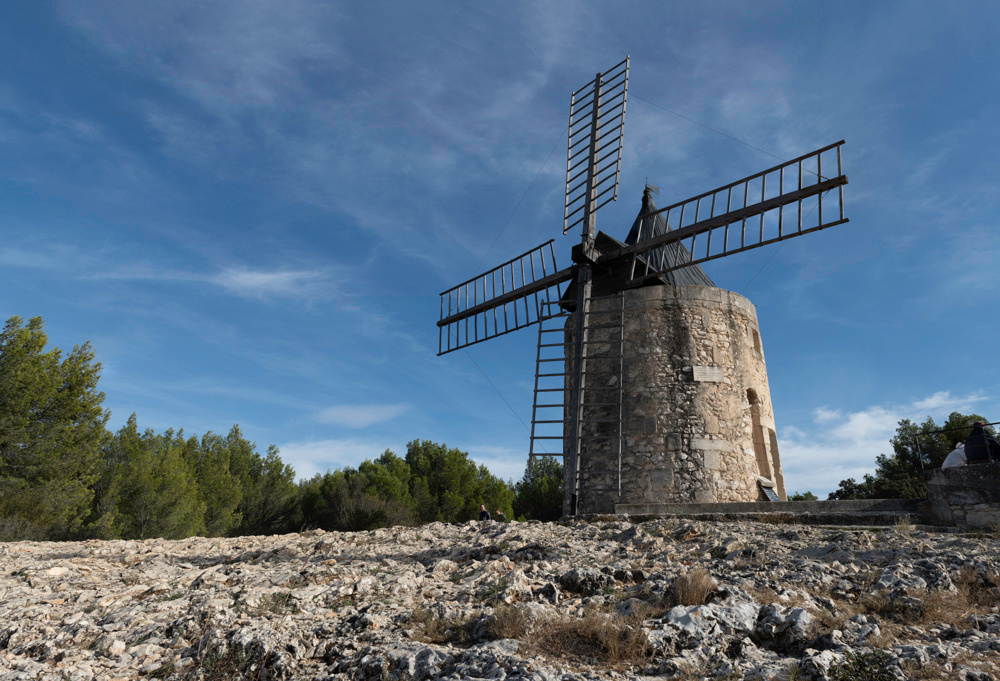
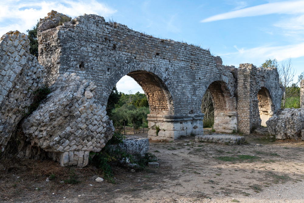
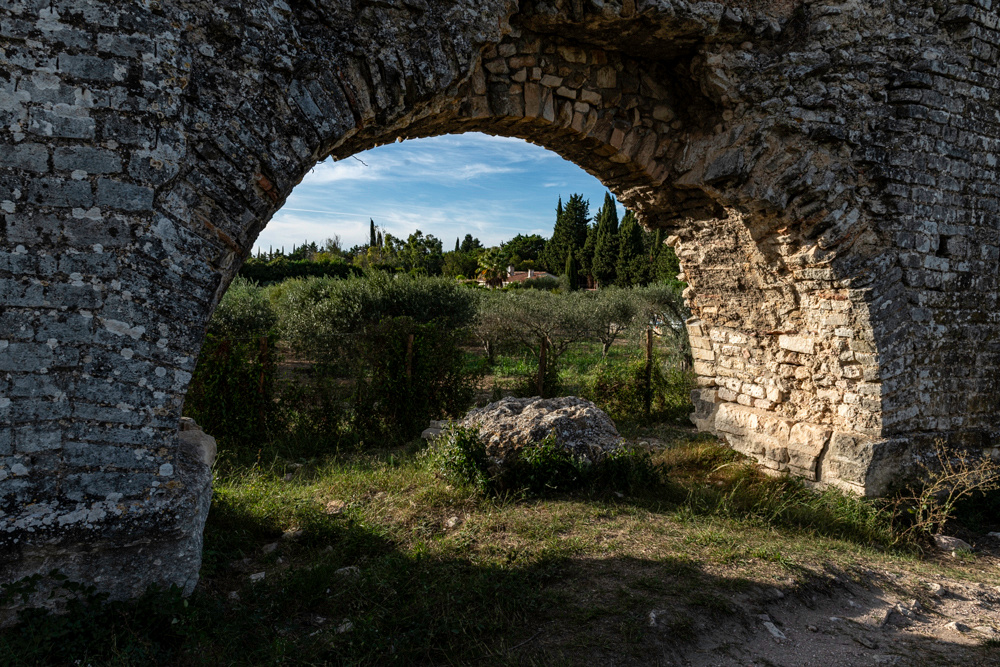
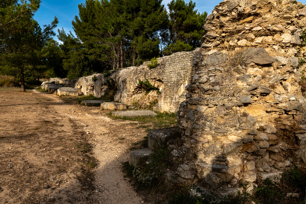
On the way home we stopped at a couple points of interest. First a windmill. The environment provides enough steady wind to make building windmills in medieval times worthwhile. Quite a few dotted the landscape until the steam age. We also found the ruins of another Roman aqueduct. This one was not quite as majestic, nor was it in as good a condition, as Pont de Gard. It provided a different kind of picture too.
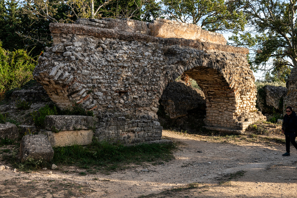
Back to Uzes for wine. More Roman ruins tomorrow.
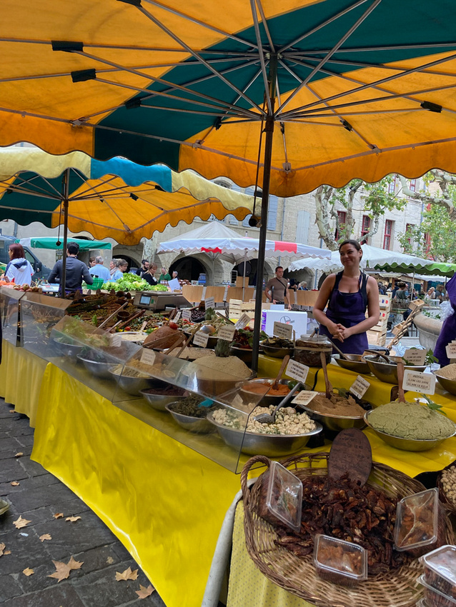
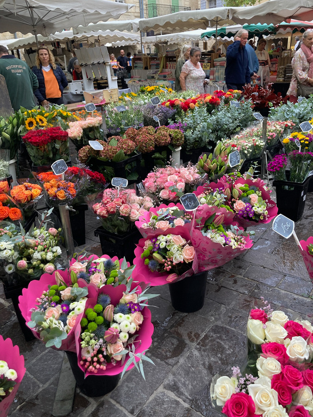
]]>Saturday is market day in Uzes. A large open air market popped up overnight, filling the town square and spilling into the side streets. By 9 o'clock it was thronging with customers. This is where the French do their shopping and great fun to see. A few pictures are posted below.
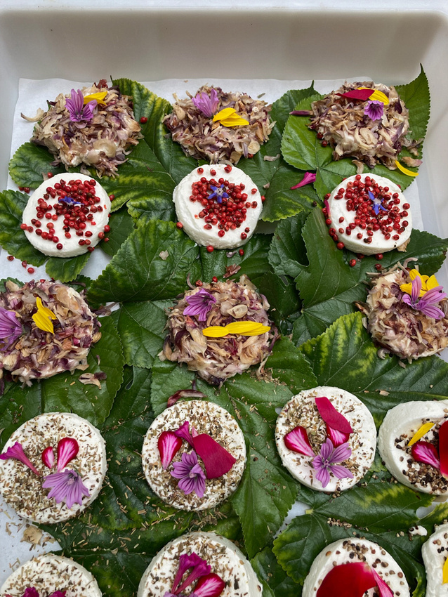
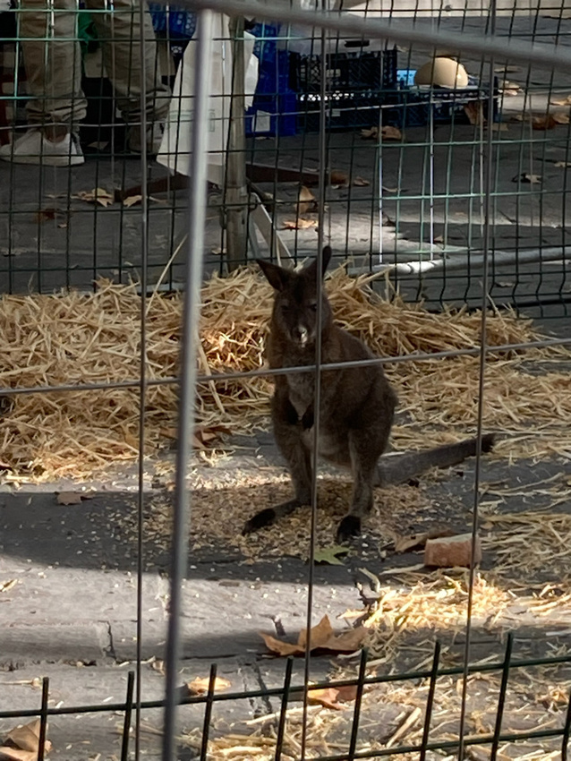
Above are a selection of cheeses. Below is a baby kangaroo if you find you find yourself in need of one of those.
After checking out the market we embarked on an expedition to check out the rest of the town. And Uzes, for a town none of us had ever heard of, has quite a rich history. For instance the Duchy of Uzes, by a series of historical events, has risen to the first peerage of France, ranking just below the royal family. The Duke and Duchess take up residence here regularly.
Here are more pictures.
Below is the Duke's private chapel.
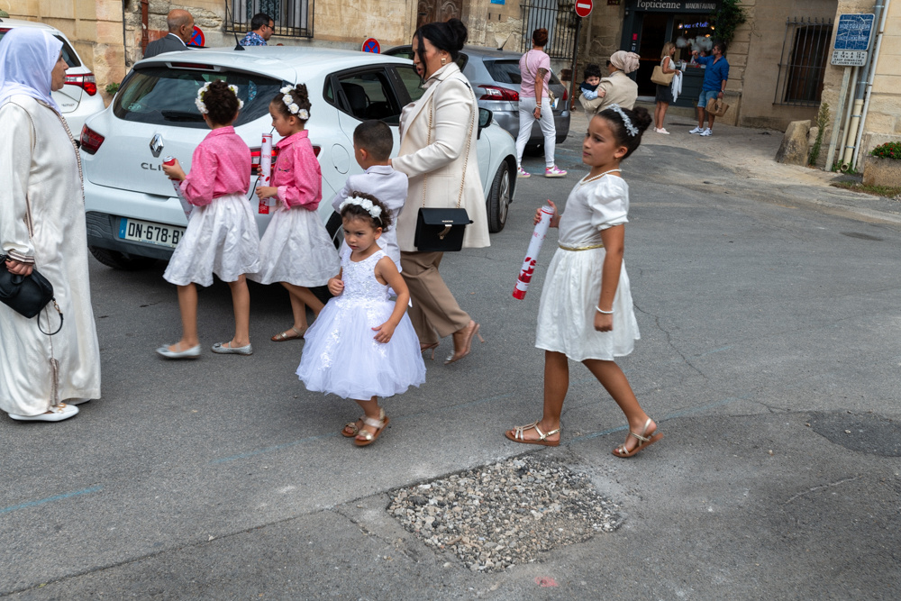
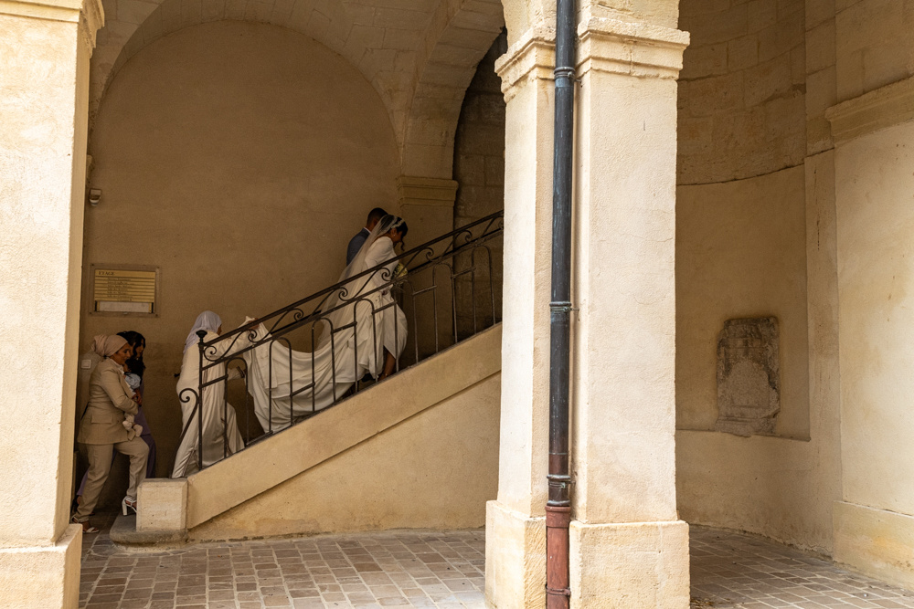
We didn't get to see a wedding but we got to see a bride arriving for her reception.
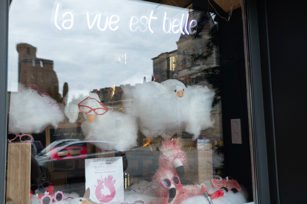
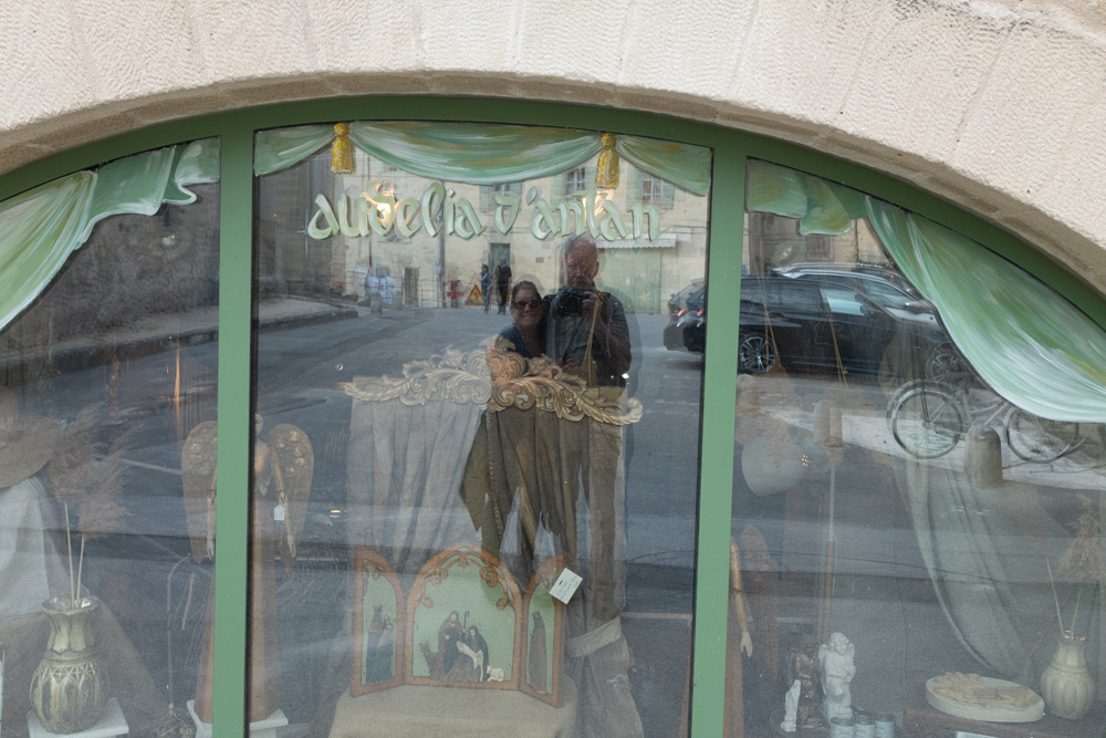
One of the little things we Americans have lost, now that we buy everything online, is shop windows. Walking through these old streets with their little shops is one of the little pleasures.
Below is my technique for getting a selfie.
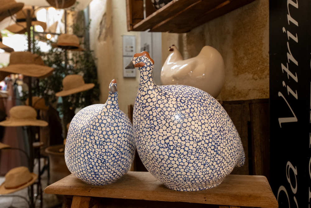
These porcelain chickens pictured below are very popular. We saw them in a number of shops.
 The sun was setting so it was time for wine.
]]>
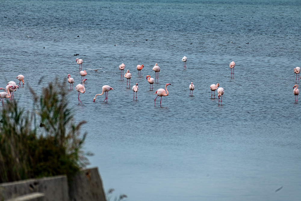
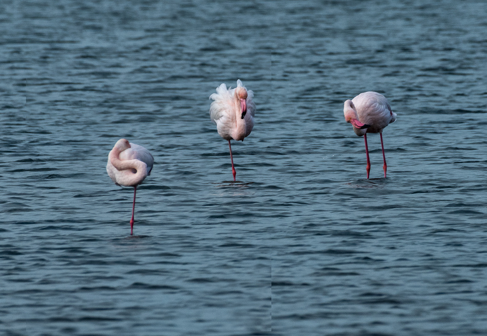
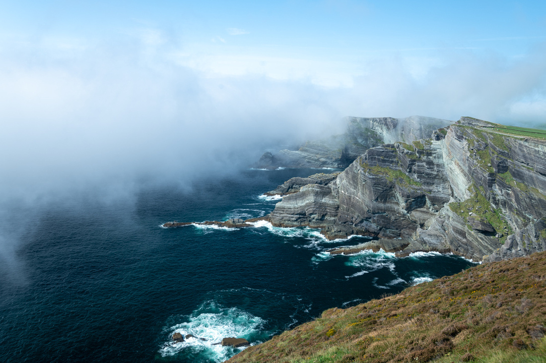
This was the off season for the flamingos. Most of them winter over in North Africa and come to the Rhone delta in spring to mate and raise their young. After the chicks fledge in Aug/Sept most of them go back south. 10-15,000 birds is typical. But about 5,000 stay all winter so finding some to photograph is easy. But getting them doing something interesting is hard. The best time to photograph most birds is when they are courting, nesting, feeding, or fighting. That mostly happens in the spring. But you can see below that we did find some flamingos.
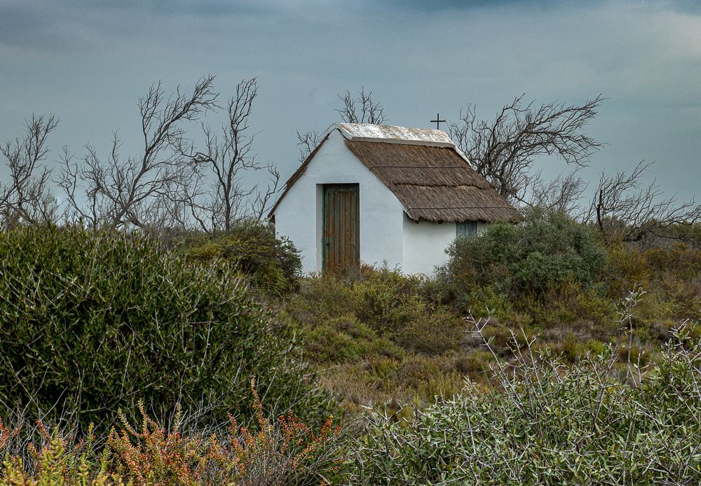
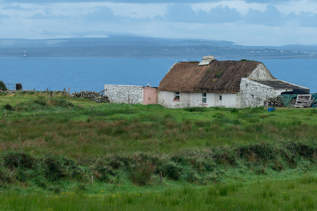
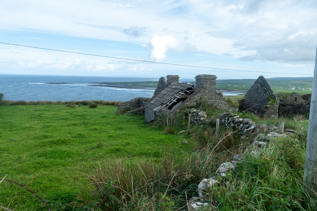
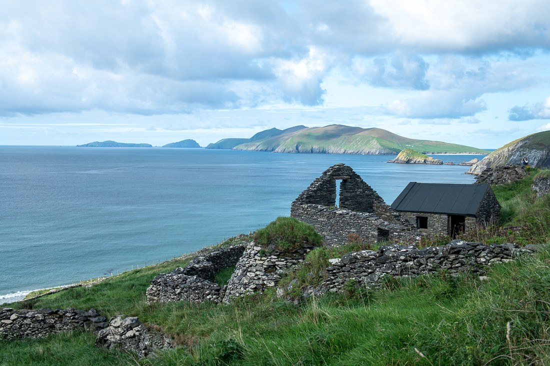
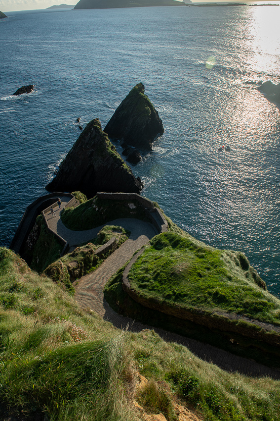
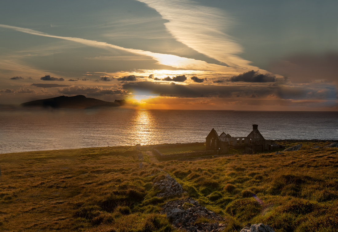
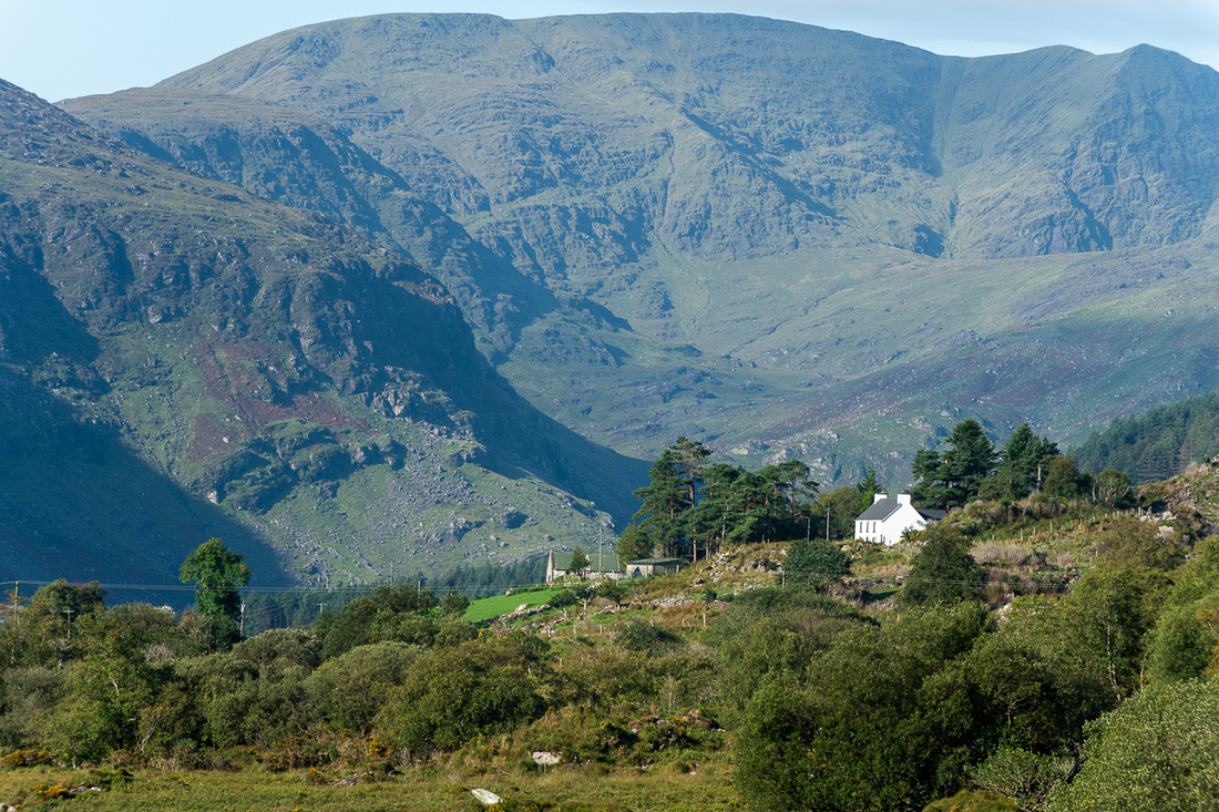
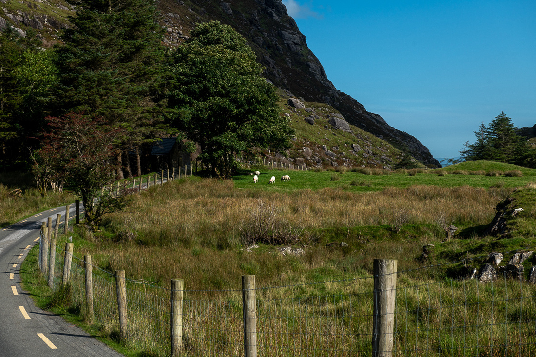
 This little house/shack is one of many scattered around the Camargue. The French cowboys would bunk in them when they were out overnight.
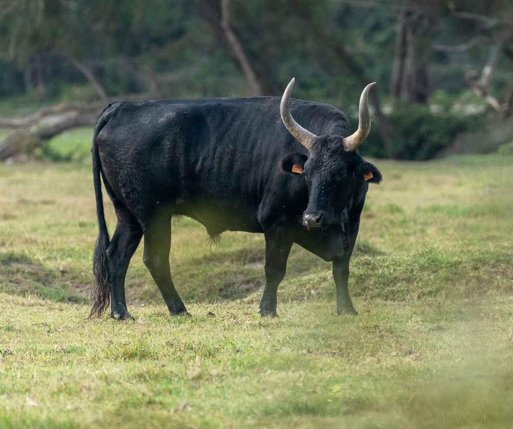
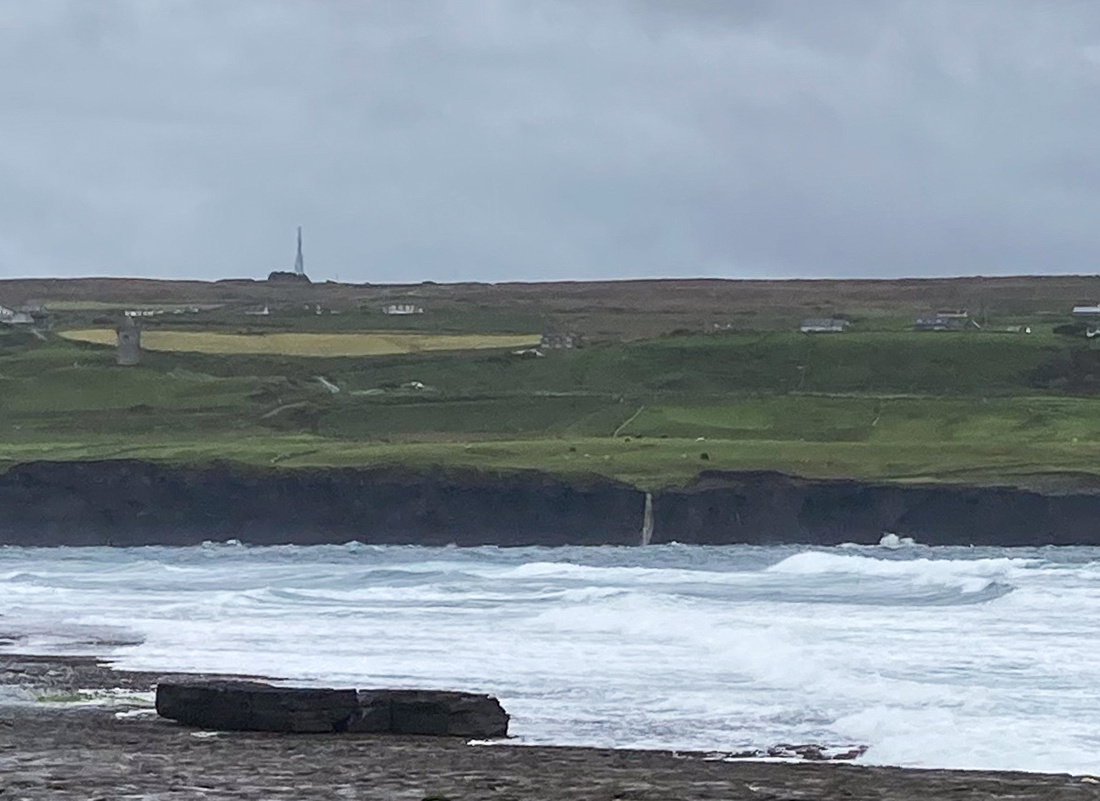
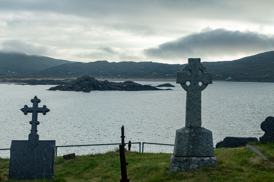
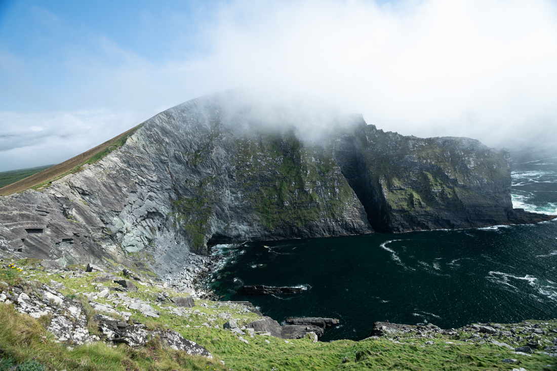
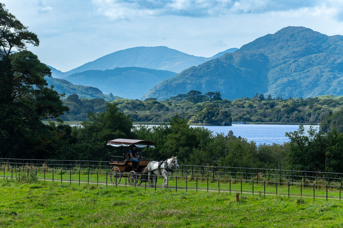
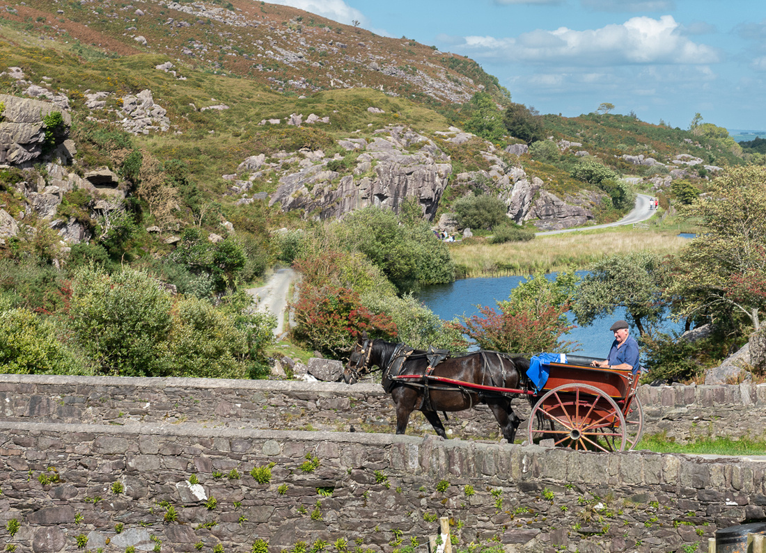
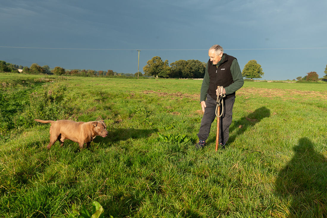
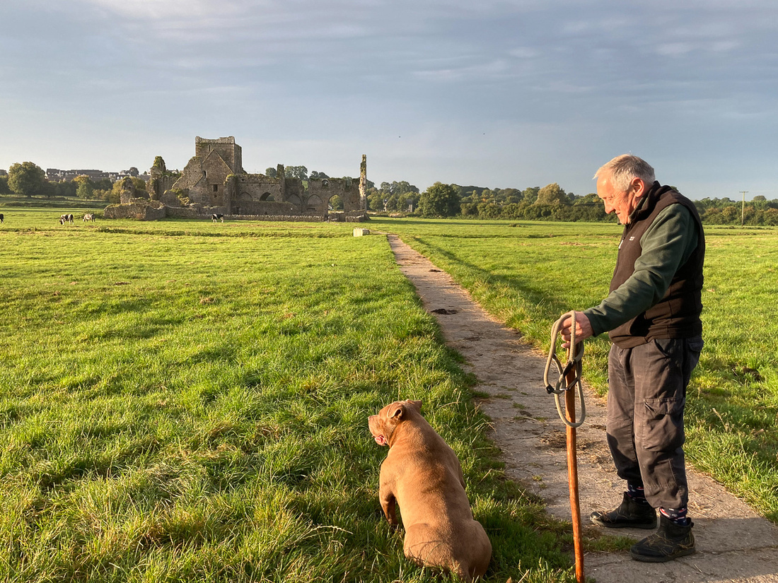
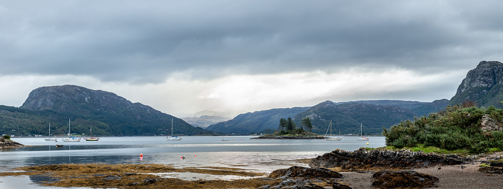
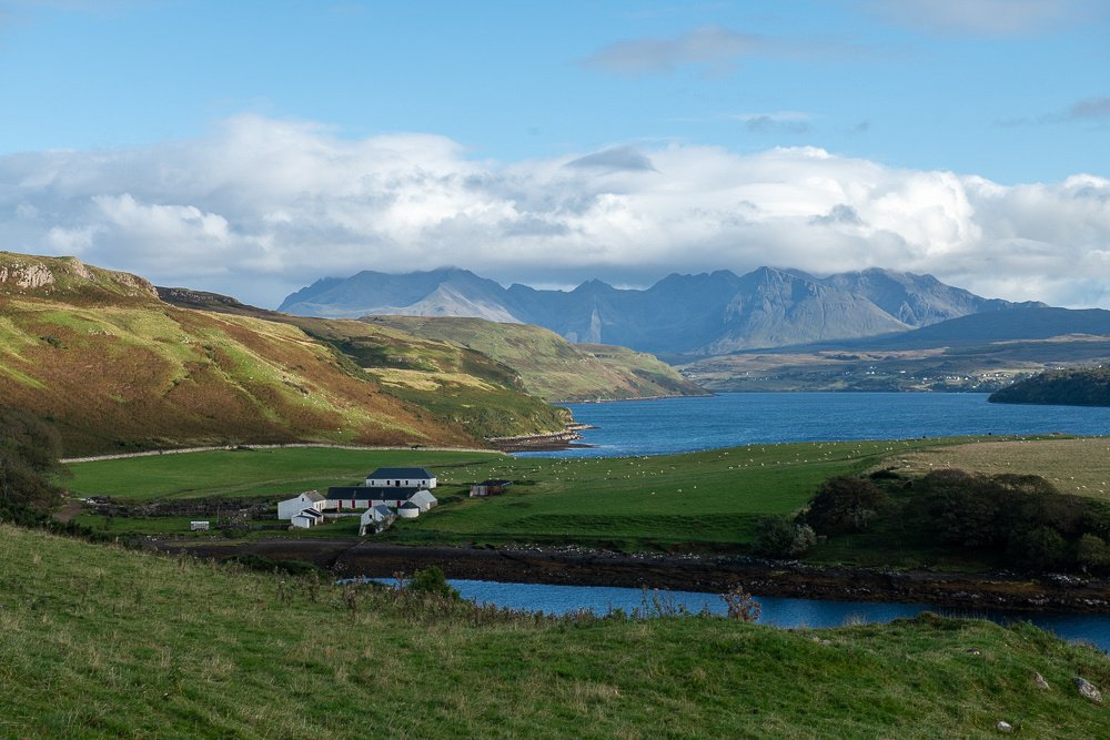
 Shortly after leaving the flamingos we came upon this herd of bulls. These bulls are bred for fighting, just like their Spanish cousins, but they are not killed in the ring. In fact, whereas in Spain the matador is the main celebrity, in France it is the bulls themselves. The more aggressive they are the higher the demand for their services. The best ones have careers in the ring lasting ten years or more, and the champions, when they die, are buried standing up, facing the sea, and get their own tombstone.
 And just around the corner from this farm we found a lovely country farmhouse cafe for lunch. Was it ever good!
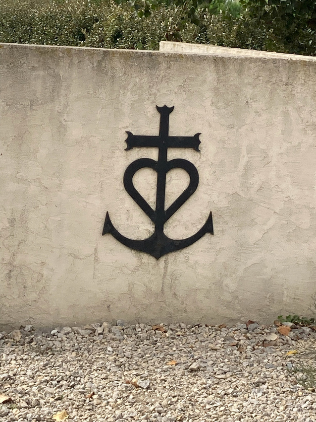
The symbol below is the Camargue trademark. We saw it displayed everywhere. It stands for the three cardinal virtues: the cross for faith, the anchor for hope, the heart for love.
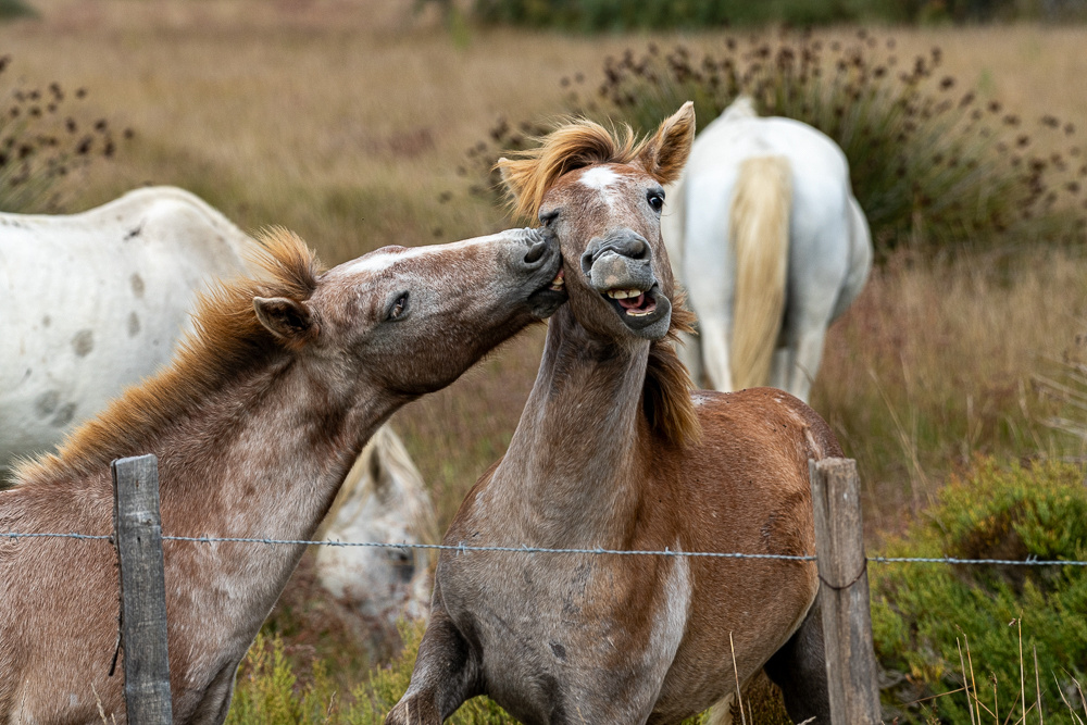
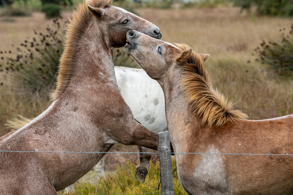
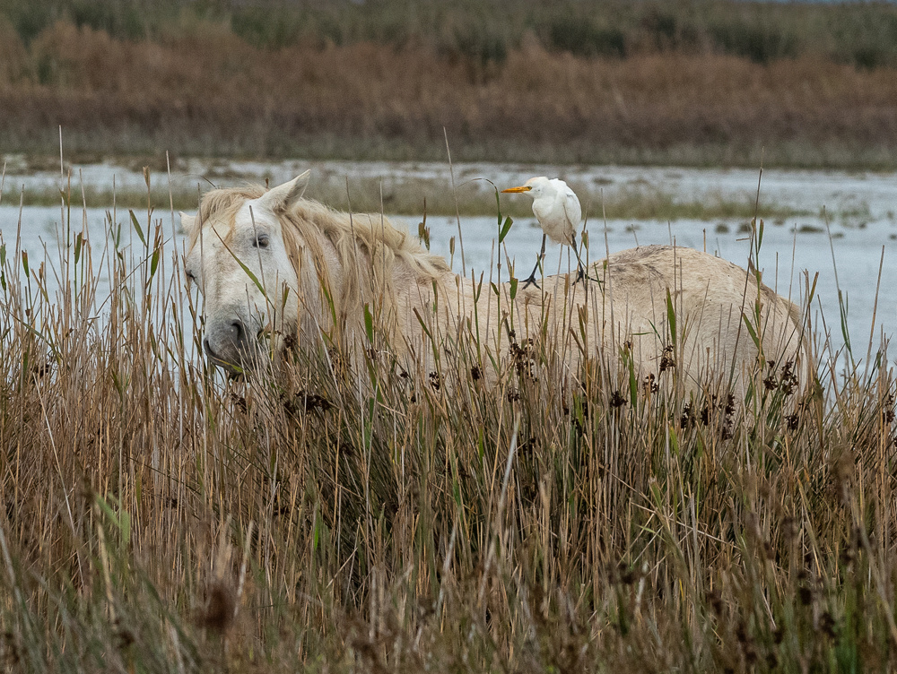
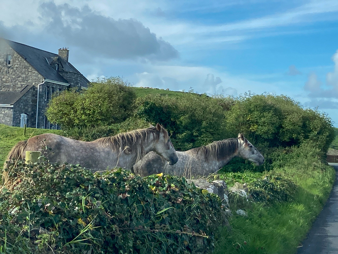
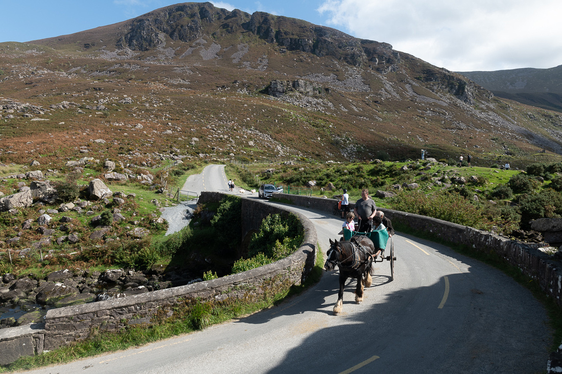
After lunch we still needed to find some horses. The white horses of the Camargue are one of the oldest distinct breeds in existence. They were living there wild before they were ever domesticated by man and they are sometimes described as wild but that is an overstatement. They do live in the marshes year round, many of them are unbroken and unshod, but they actually do belong to somebody. We soon happened upon a couple of mares with their foals. Those are always good for a picture.
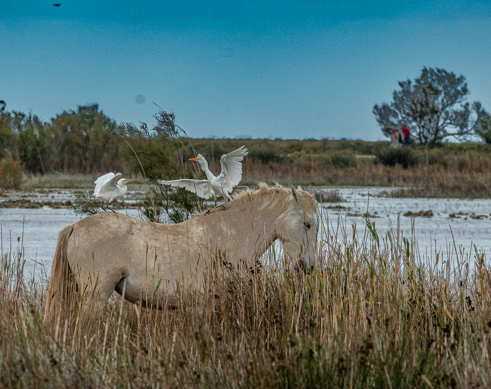
 And then we hit a little paydirt with some horses grazing near the road with the cattle egrets hanging out on their backs.

We will have a more interesting encounter with the Camargue bulls and horses at the end of the trip so stay tuned. But this wrapped up Friday the 13th. Pretty lucky day!
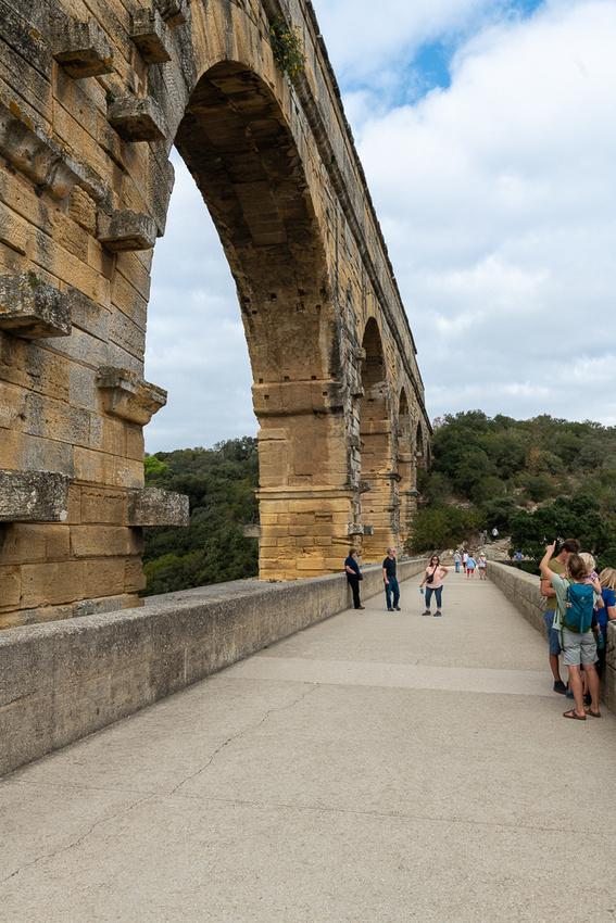
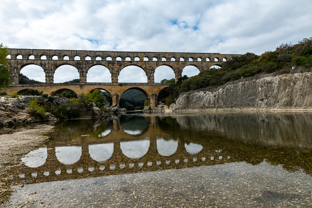
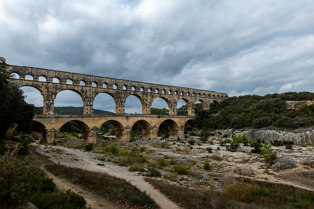
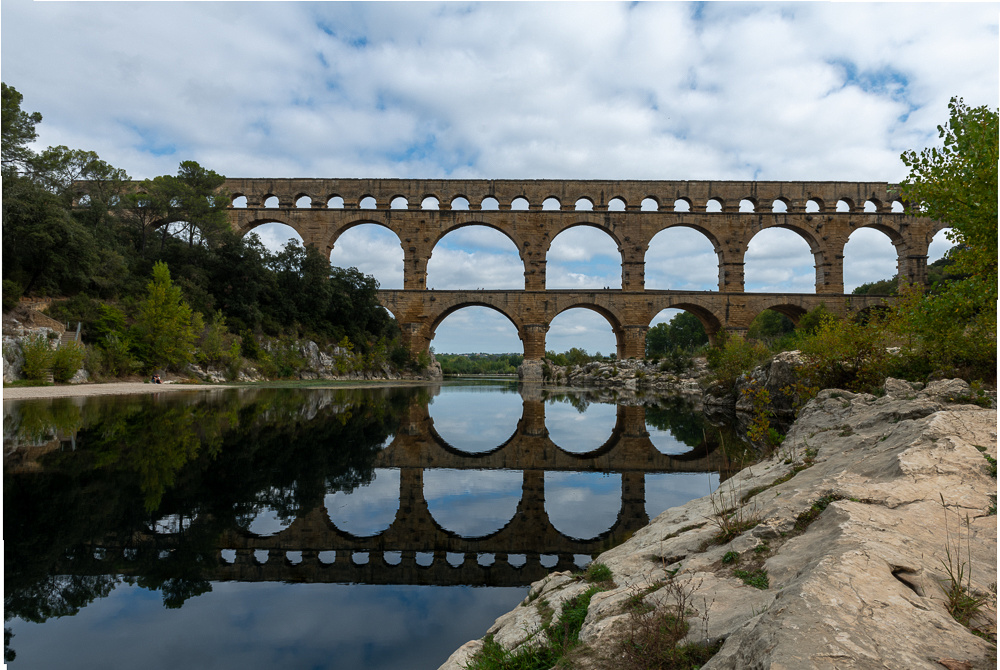
The jarring thing about all of this is the density of it. Everything we saw, and everything you will see in this entire blog, is within 60 miles of Uzes. Nothing more than 90 minutes away and that's taking the backroads. Several days we took in two sites. Like today. We will first see the Pont du Gard, the highest aqueduct the Romans built anywhere, and then drive over to Avignon for the rest of the day. Shall we begin?
As I mentioned, the Pont du Gard is the highest aqueduct the Romans ever built. It was completed in mid first century and took 1000 men five years. The aqueduct system was bringing water from Uzes to Nimes, the provincial headquarters. Quite an impressive piece of engineering but the really impressive little factoid is that the spring at Uzes is only 56 ft above the collection basin at Nimes 31 miles away This slight gradient had to be maintained along the entire route to keep the water flowing. So the three tier structure you see below, with the massive limestone blocks, had to be accurate to a fraction of an inch.
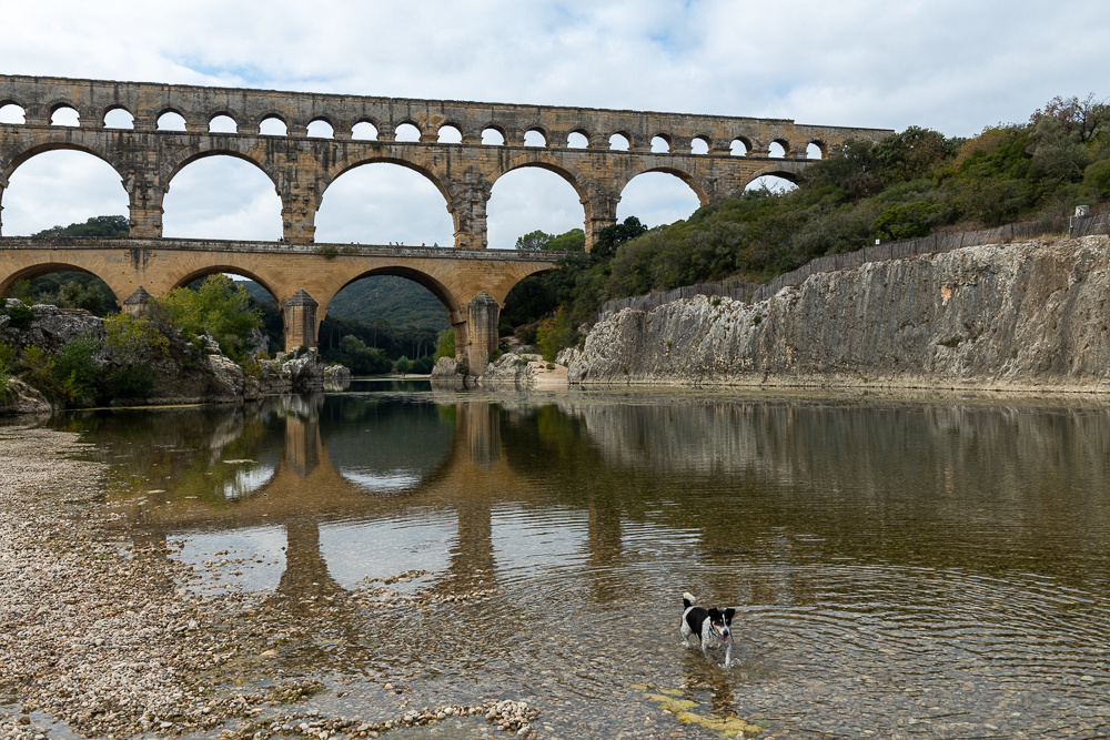 Does anyone out there know what to do with a little dog like this? He's messing up my reflections.
 There. That's better.

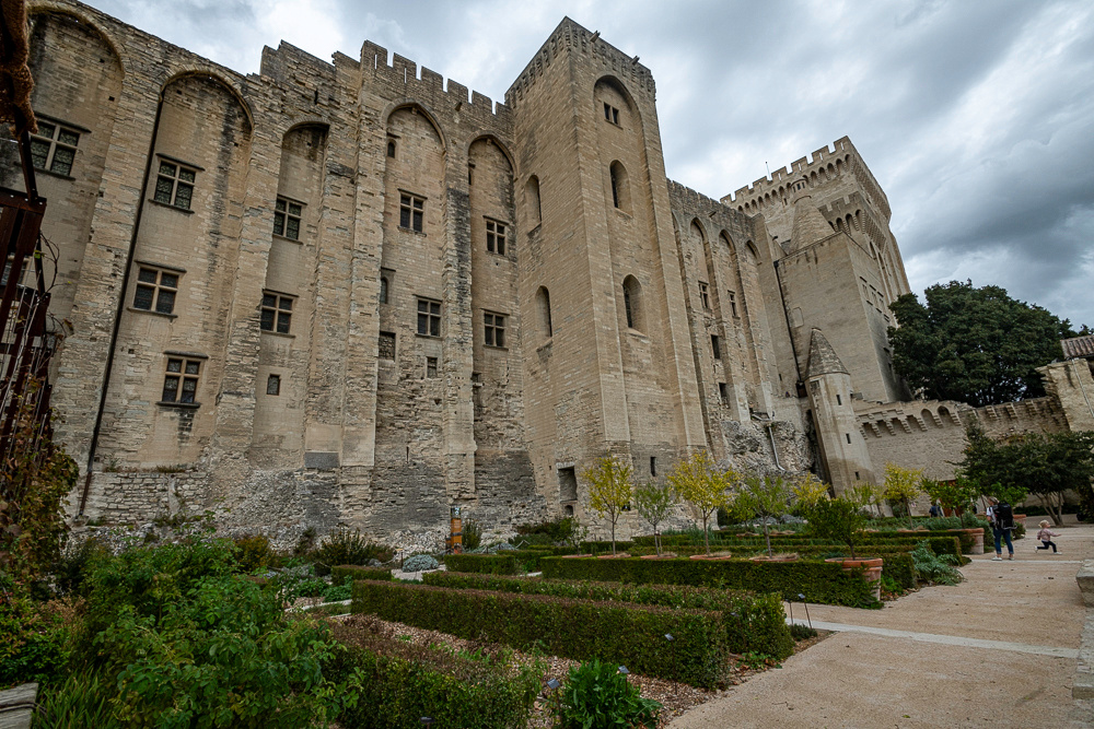
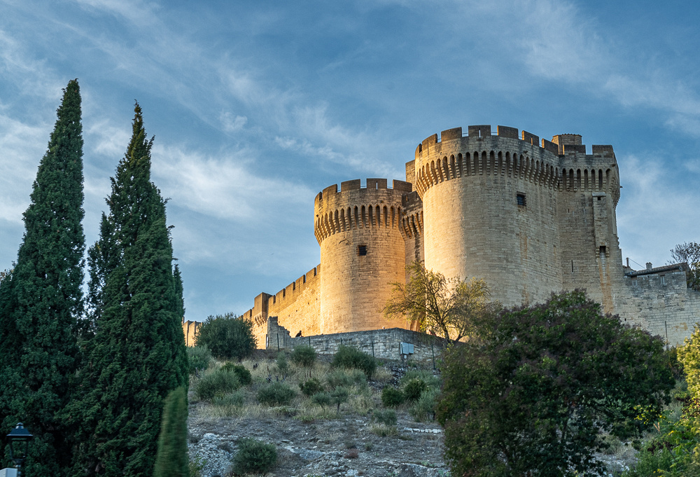
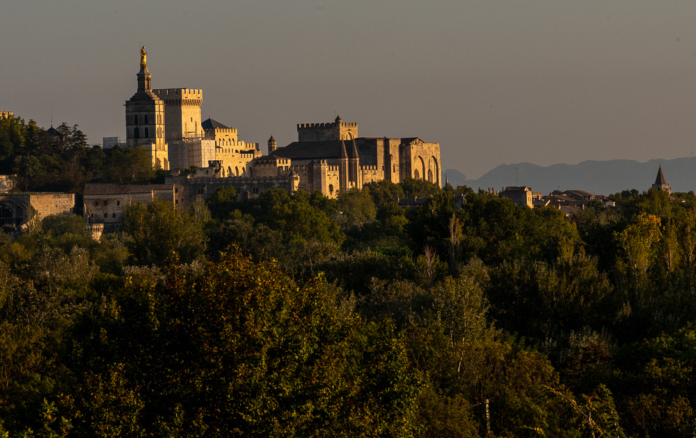
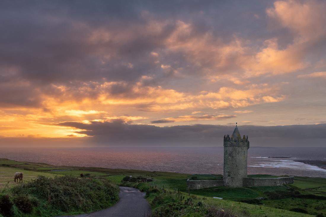
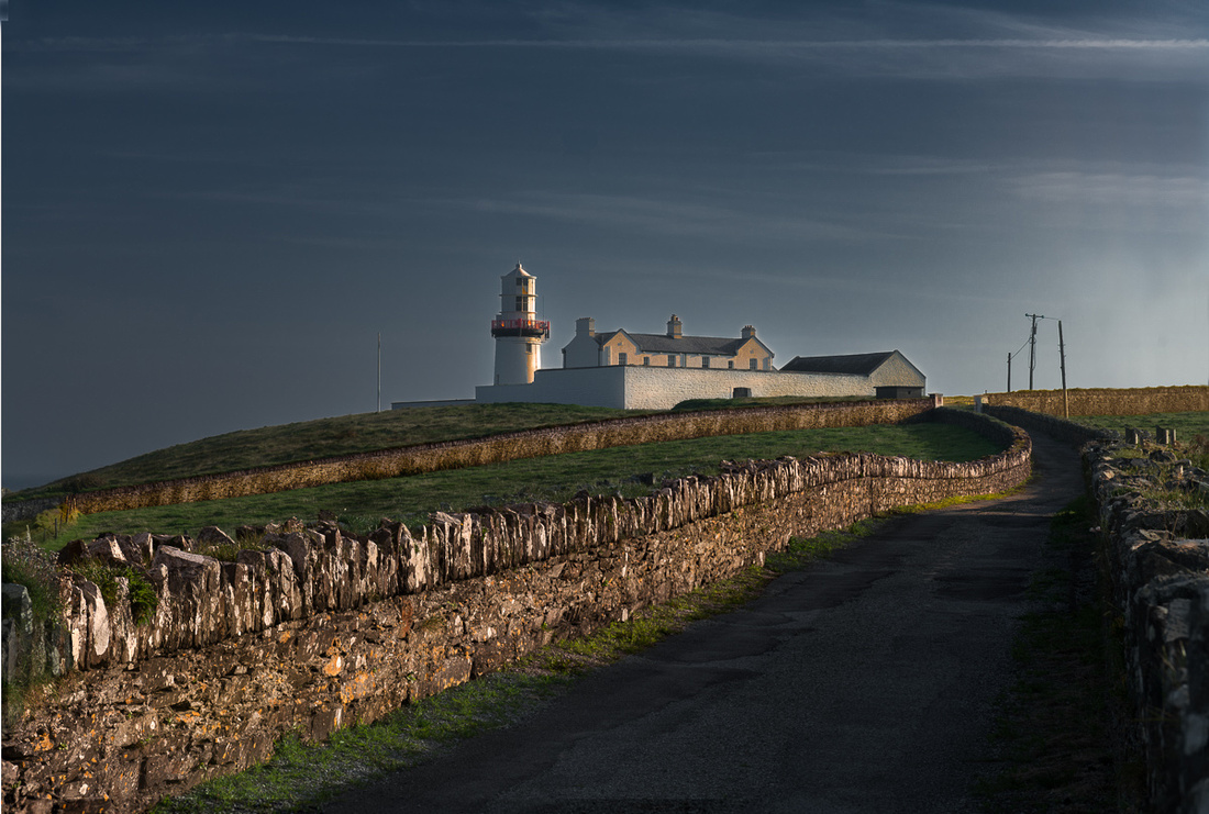
Just a short jaunt down the road is the medieval town of Avignon. Its location on the Rhone river made it a strategic spot during feudal times. The main interest now is the Papal Palace but it was such a gorgeous day, and it was getting late, that we decided to forgo that tour and just walk around the town. We would come back on a rainy day to check out the Pope's digs.
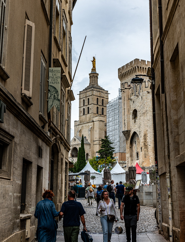
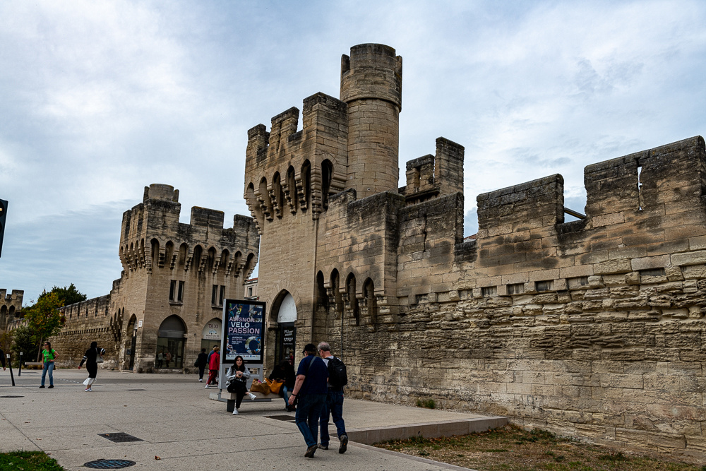 Above is the south gate to the medieval town.
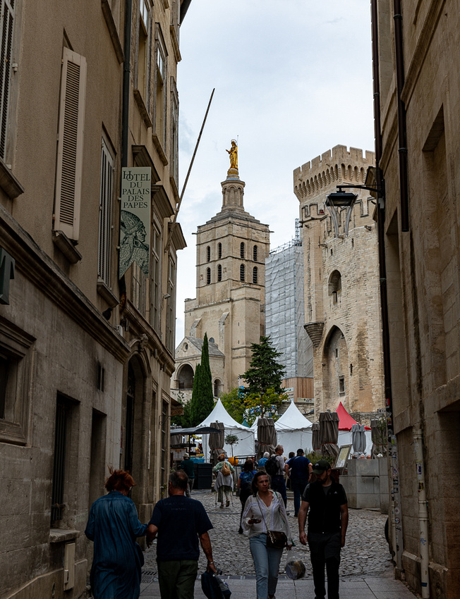
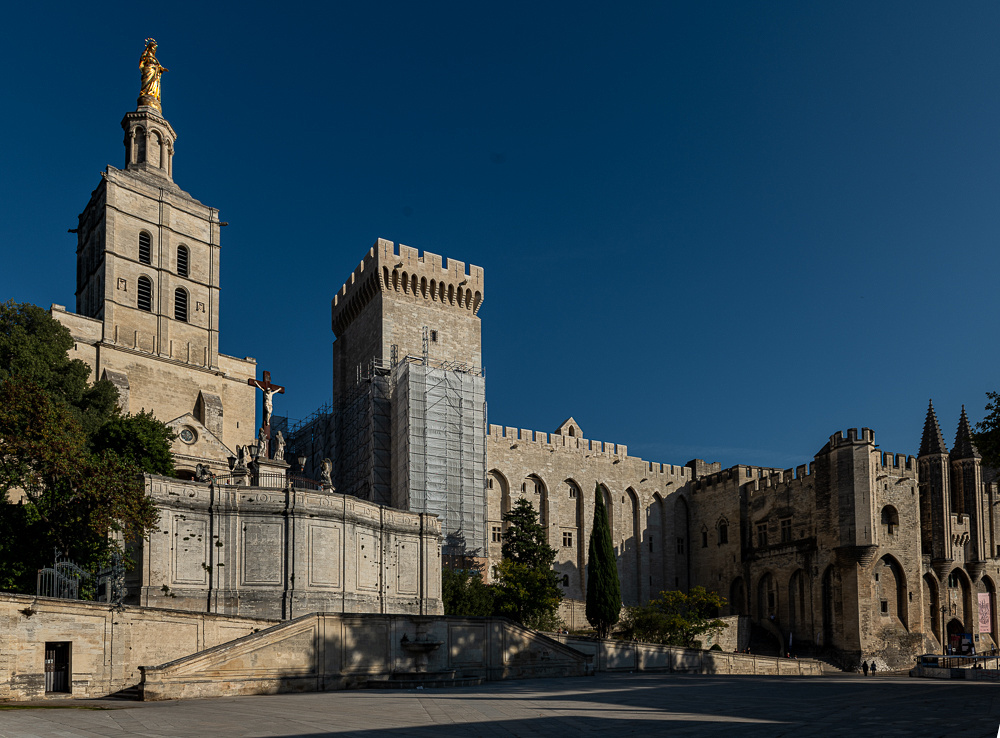 Above is the Papal Palace.

 With that we headed home for some good red wine. Pretty good first day.
]]>
We flew across on Oct 9th, landing in London on the 10th and connected to Marseille. We stayed the night there, planning to meet our friends the next day. Jeanne Marie found us a nice little hotel just a very short walk from the village of Saint-Victoret. There's a lovely little waterfall right where you enter the village, a nice little church and all of the casual street food goodies of French cuisine. Crepes, croissants, omelettes, ham on buttered baguette, pain au chocolat... We did not hesitate. The gorging commensed immediately!
Now I’ve been reading for years that the South of France has way more in common with the rest of the Mediterranean than with the part of the country, say across from England. This was a well known fact to me. But is still quite jarring to see Italy or Spain everywhere I looked. This was obvious even coming in on the plane. Tile roofs, pinnacle pines, olive trees, architecture, umbrella pines, even the color of the dirt, all made me think “Italy”. Not only that but as we shall see in future posts, there are Roman ruins everywhere.
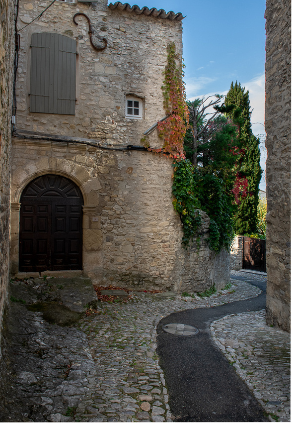
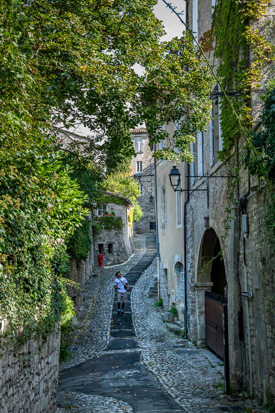
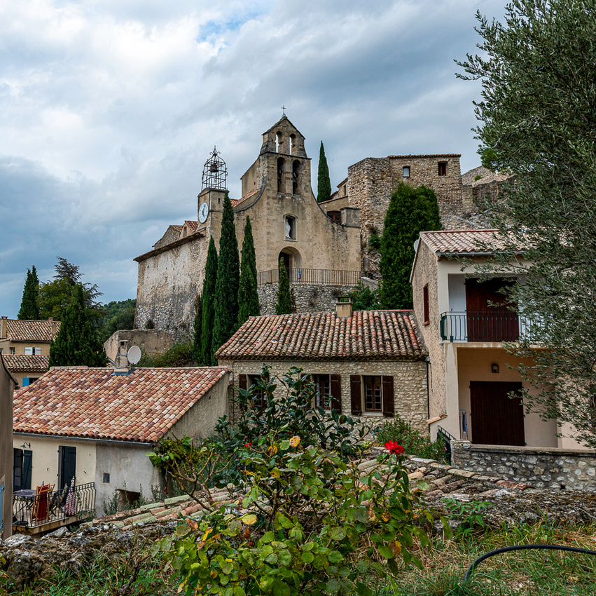
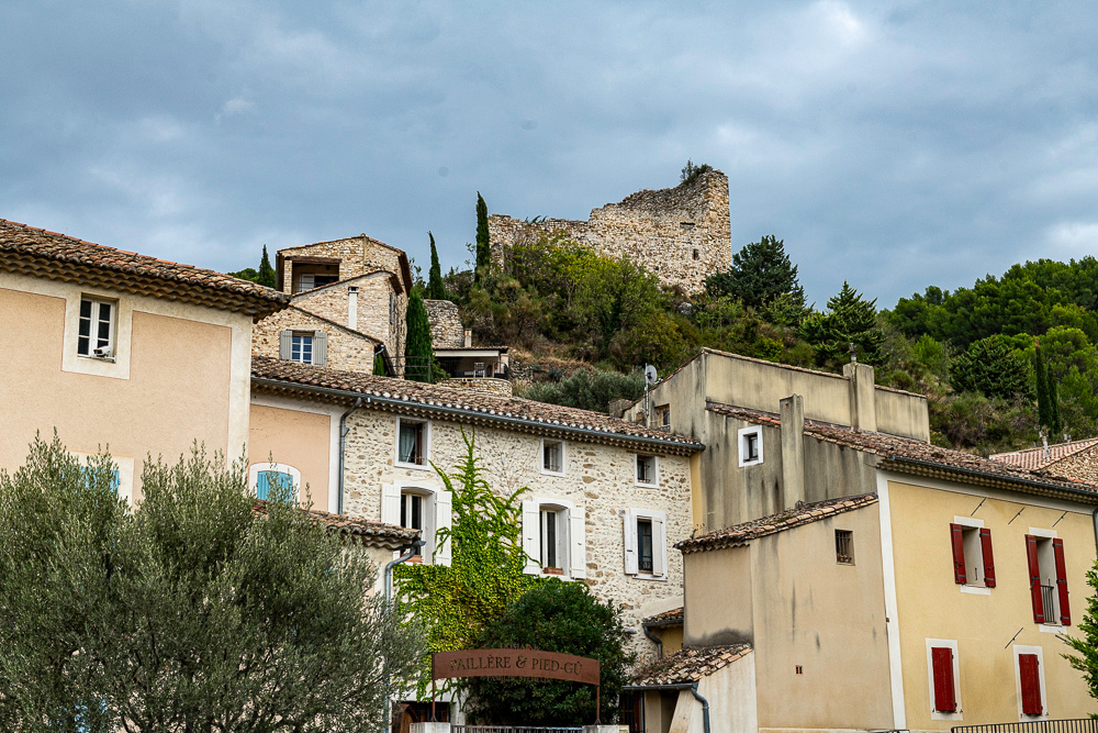
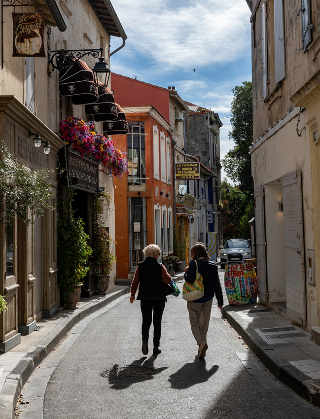
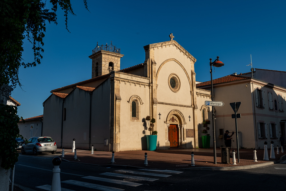
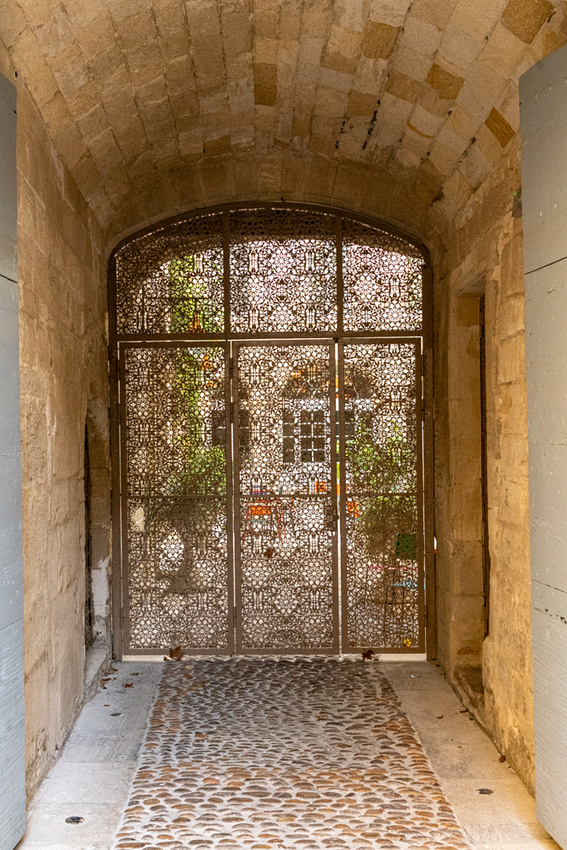
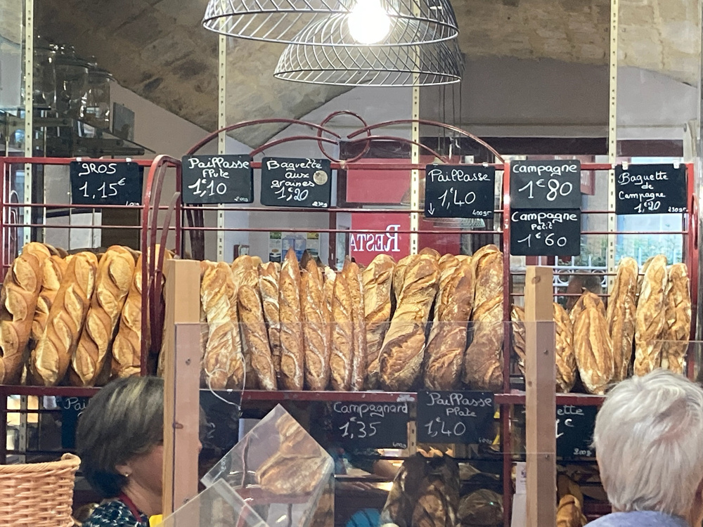
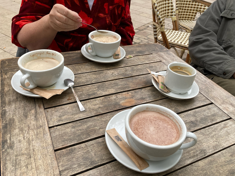
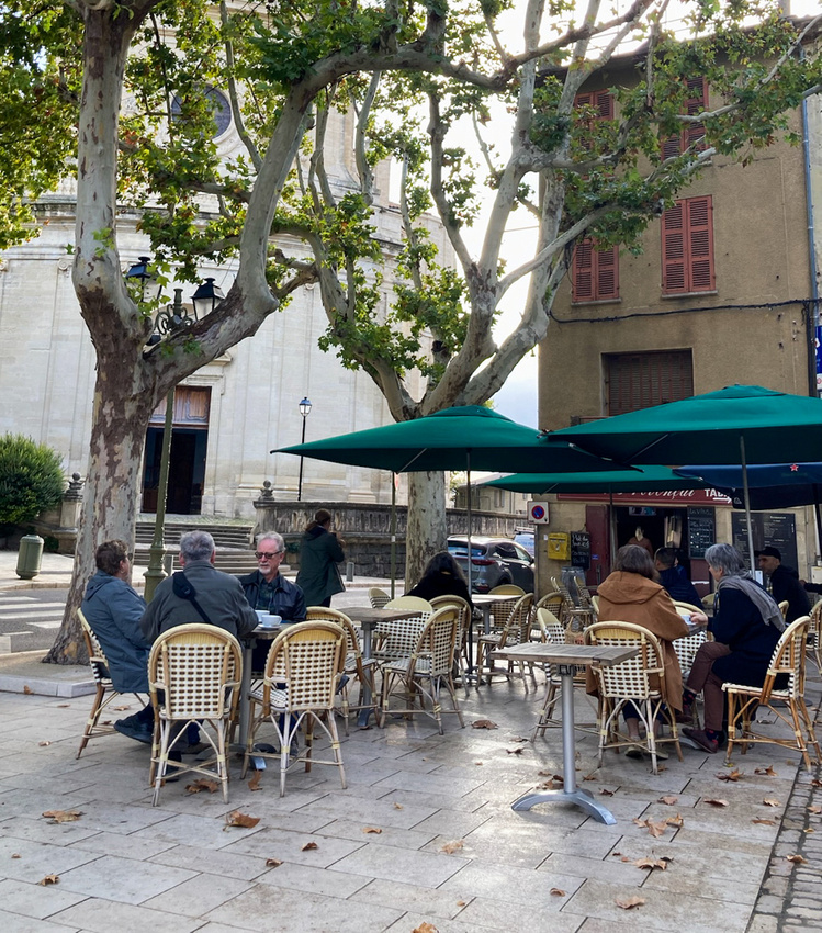
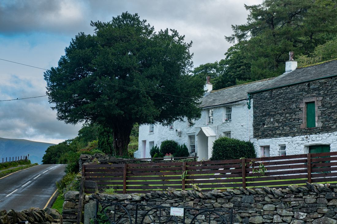
The Conners arrived on schedule the next day, the rental car was retrieved, and we were on our way to the medieval town of Uzes, about an hour and thirty minutes northwest, where we would be based for the next two weeks. Uzes is a town of about 8,000 which made it the perfect size for our needs. It had the groceries, bakeries, restaurants, churches etc but we could easily walk the entire town. We soon established the routine of walking up to the cafe for fresh pastries and coffee in the morning. Here's a quick glimpse of the town.
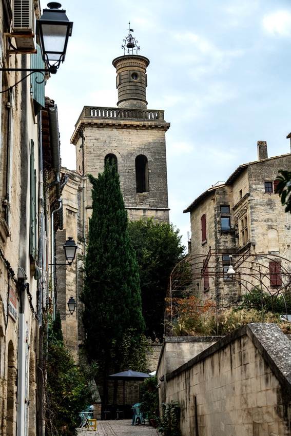
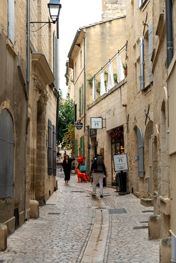
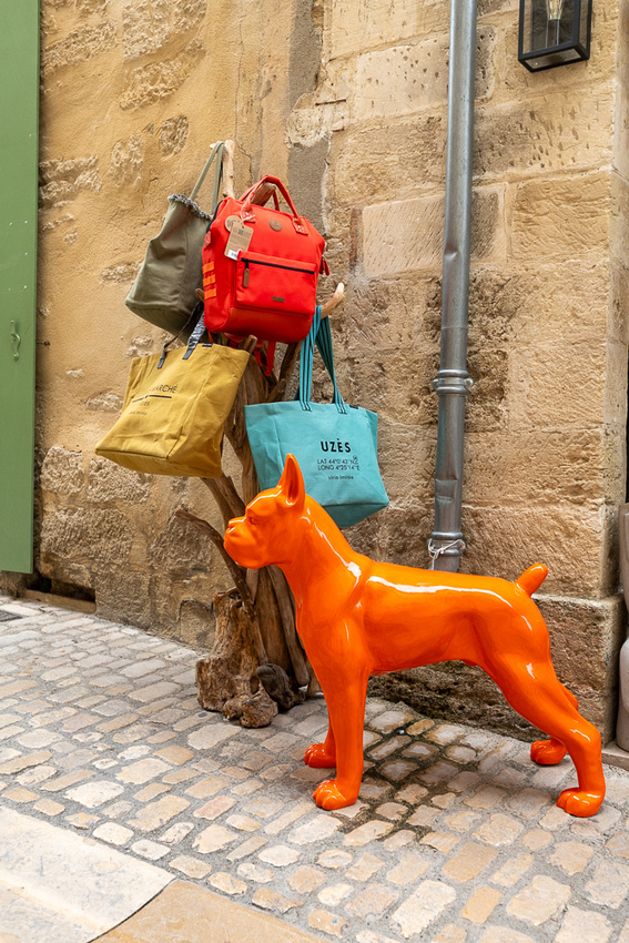
More about Uzes in future posts.
]]>
True to form after the rainy day we had clear skies for our trip back to Dublin. We couldn't drive through Ireland for three hours without stopping somewhere though. First was the village of Shannonbridge, where we have fond memories from the 2009 and 2013 trips. The old stone fort guarding the bridge is now a restaurant so we pulled in there just as the motorcycle club was leaving.
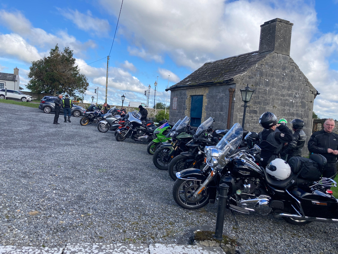
The road through the village was the main Galway to Dublin road for centuries before the new motorway bypassed it. It has now become "road trip alley". As soon as the motorcycles roared off a Triumph sports car club paraded in. So we got our own little car show.
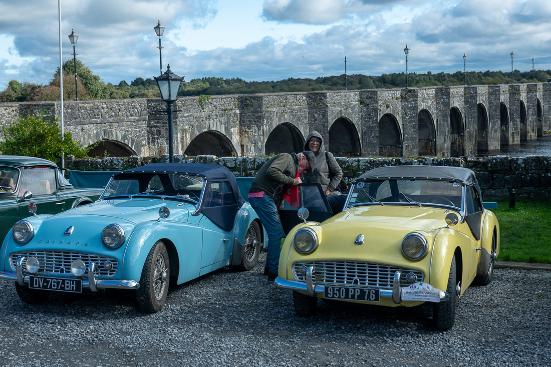
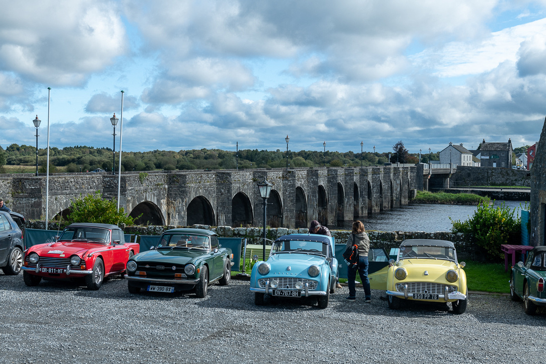
Now here's a question I've often pondered. How many Irishmen does it take to fix an English sports car?
 But actually our main motive for taking the scenic route to Dublin was to stop in at one more monastery. Just upstream on the Shannon is Clonmacnoise, founded by St. Ciaran in 544. If you find it on the map you will see that it is smack in the middle of the island, right where the main east west trade route crossed the Shannon River. This location, along with the piety of the monks of course, led it to become one of the preeminent monastic settlements in Ireland, on a par with Glendalough. And it would provide us with the best serendipity of the trip. For unbeknownst to us, there were four columns of pilgrims, one from each of the four provinces of Ireland, converging on the monastery at that very time. They were doing a three day walk to observe the Feast of the Exultation of the Cross. The walk would conclude with Holy Mass so we would be able to celebrate with them on this very holy ground.
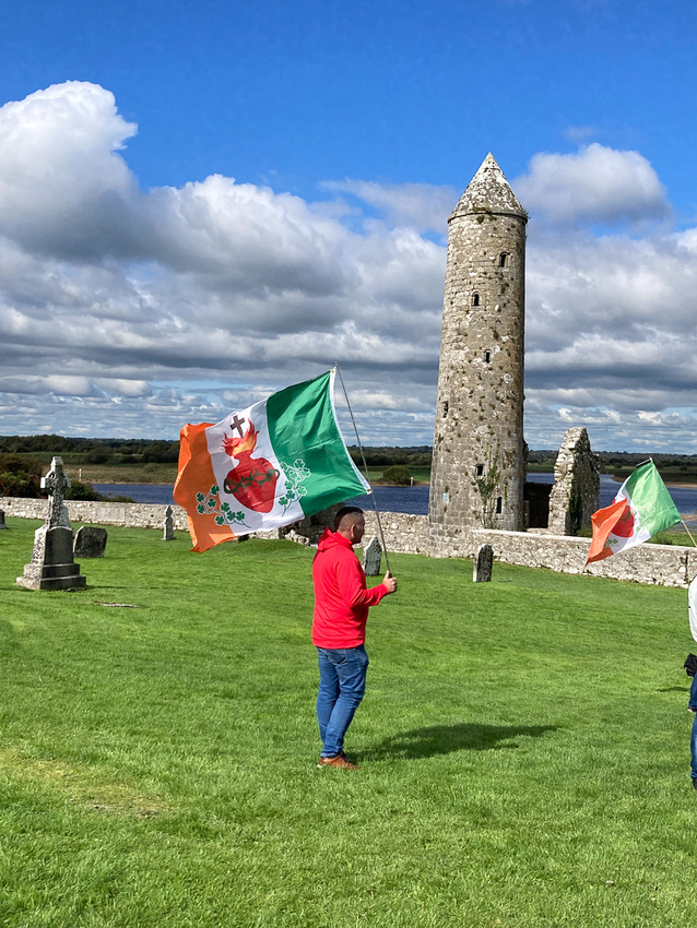
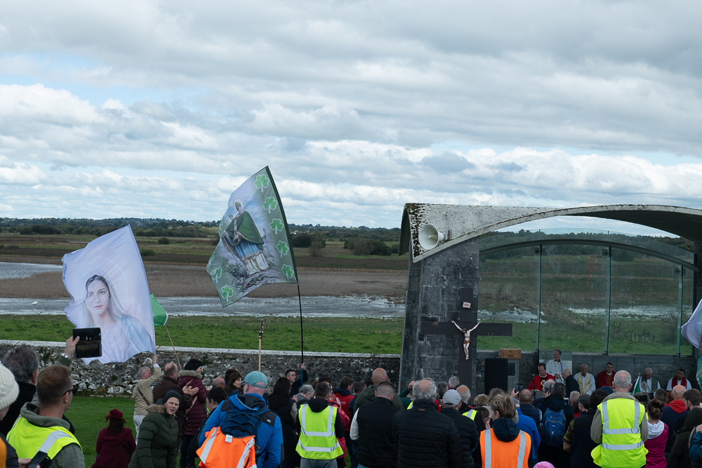
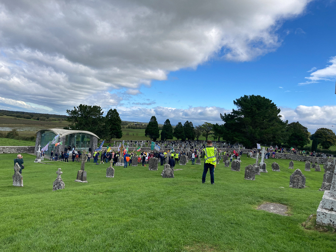 After that invigorating experience we grabbed a few more pictures and headed on to Dublin.
 We arrived in rush hour (not that bad) and checked in at the San Juan B&B where Cathy McConnell has hosted us every trip since '09.

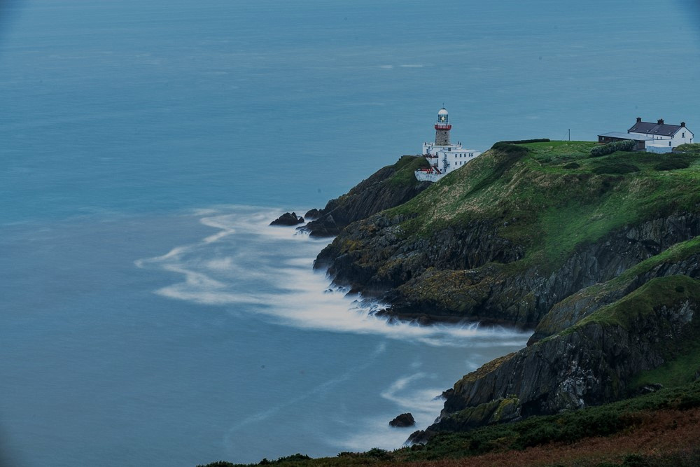
We had time for one more outing and I've always wanted to check out the village of Howth, which is right on the northern tip of the entrance to Dublin Bay. It is a charming little town with lovely cliff walks and the Baily Lighthouse. Unfortunately the overcast rolled back in which meant the light would fade fast. So we made for the lighthouse and used what light we had left there. I did long exposures to smooth out the water.
So that was our very excellent trip to Ireland, 2023. You have only to endure the black and white pictures and we are done with this blog. Except that I'm writing this from France. I'll be getting started on that one soon.
]]>
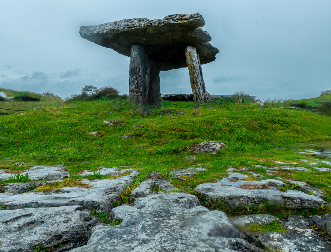
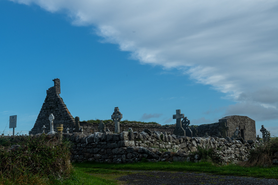
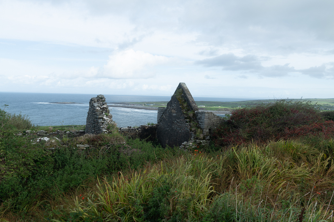
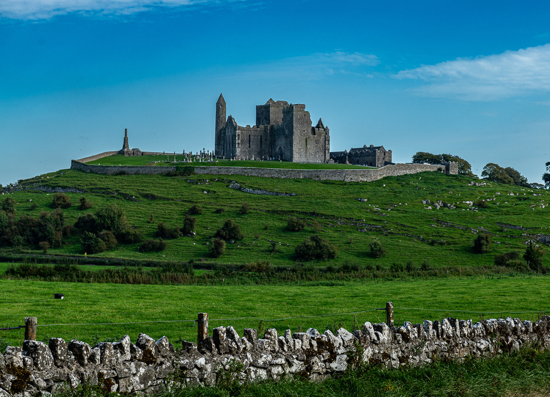
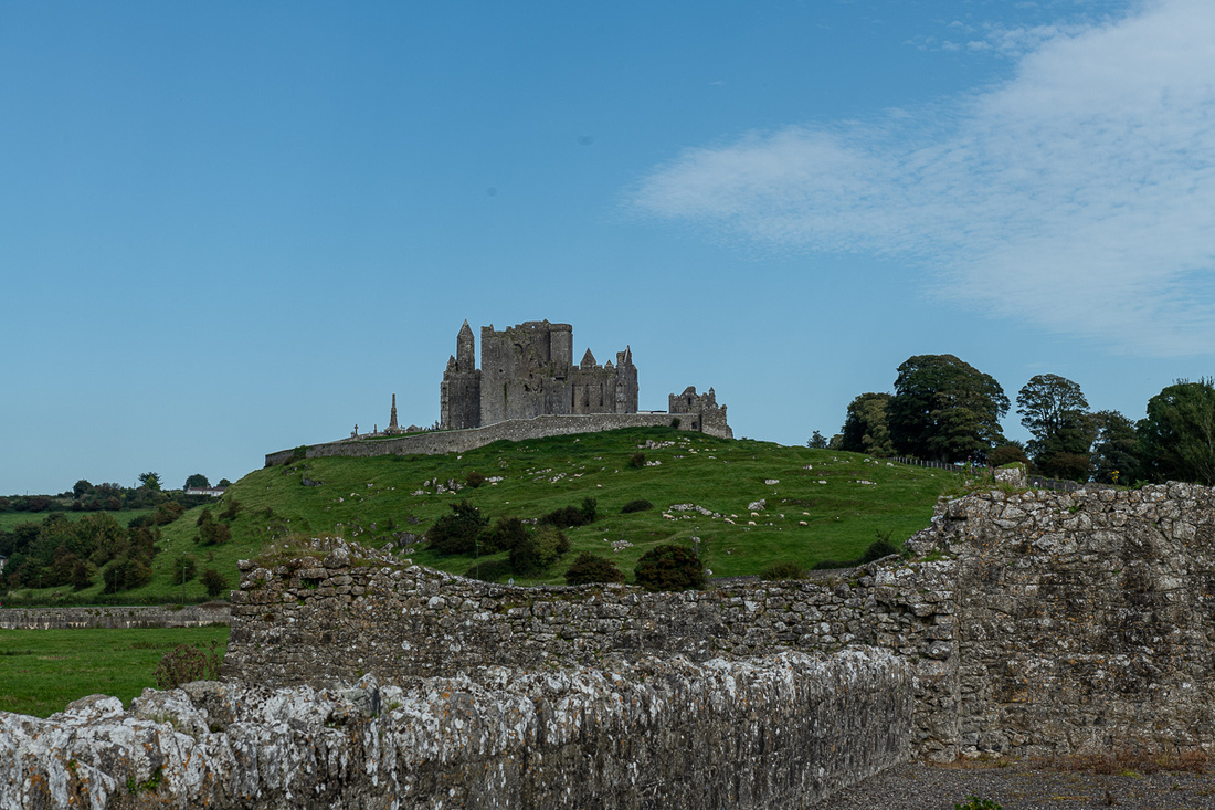
The Burren is about 200 sq. miles of northern County Clare where the glaciers of the last ice age scraped off all the soil leaving the bare limestone. It is a unique area in Ireland and despite its moonscape appearance it has had human habitation as long as anywhere else on the island. The Poulnabrone Dolmen, pictured below, is a 5000 year old tomb.
Here's something you don't see in every village in Ireland, or anywhere else, but you'll see it in Lisdoonvarna, County Clare.
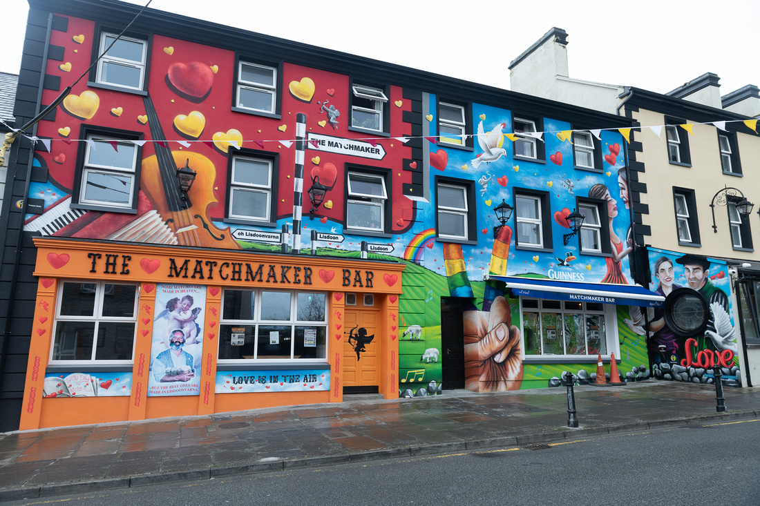 This is not a gag. The owner of the bar, Willie Daly, is from a long line of matchmakers and claims to have arranged 3000 marriages. Going back not that many years it was common for many Irish, farmers in particular, to consult a matchmaker to find a mate. Things have changed but as the Irish like to do they have morphed this practice into a party. The Matchmaking Festival runs the month of September (so we were in the middle of it) and people do actually come here hoping to find a special someone.
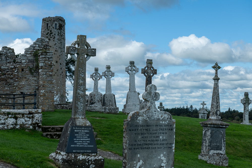
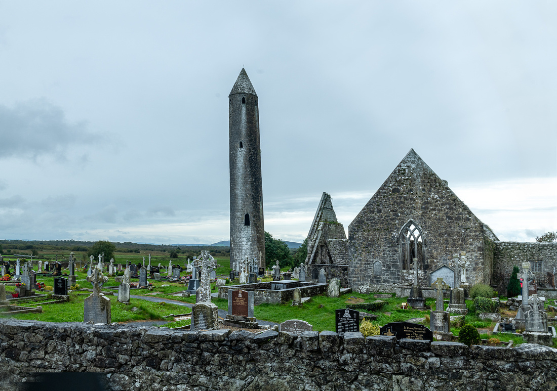
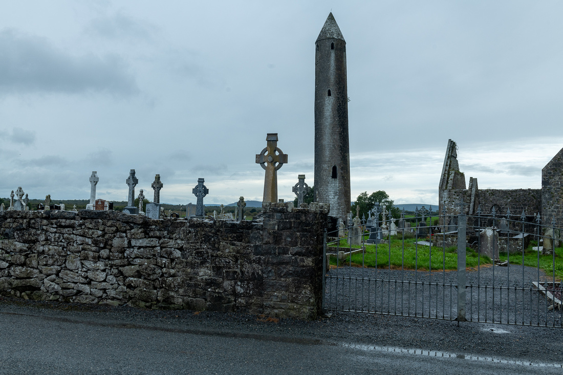
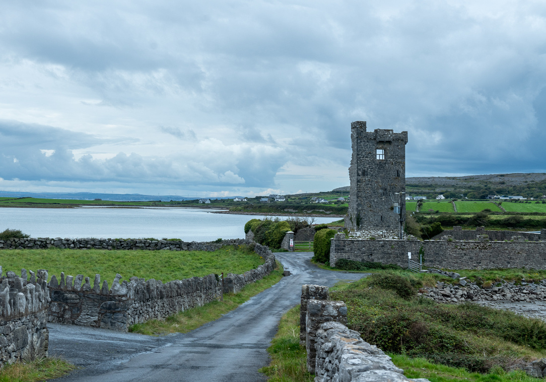
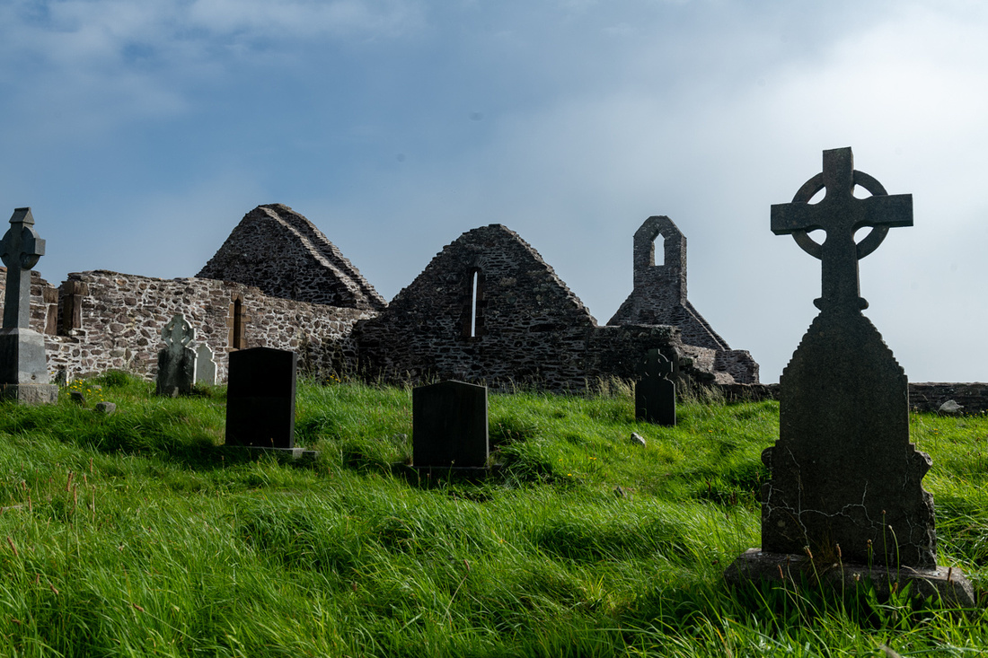
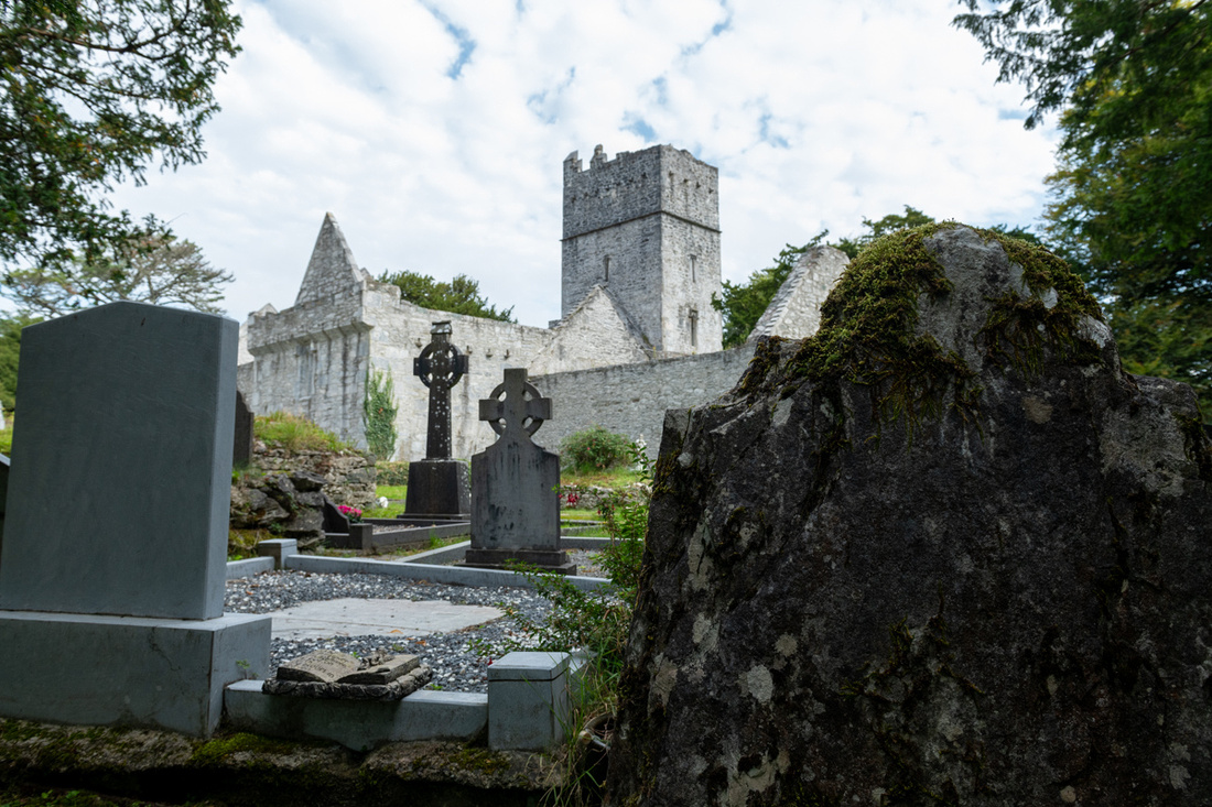
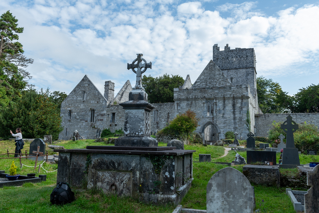
Keeping moving we worked up to Kilmacduagh Abbey near Gort. And yes, the round tower is indeed leaning.
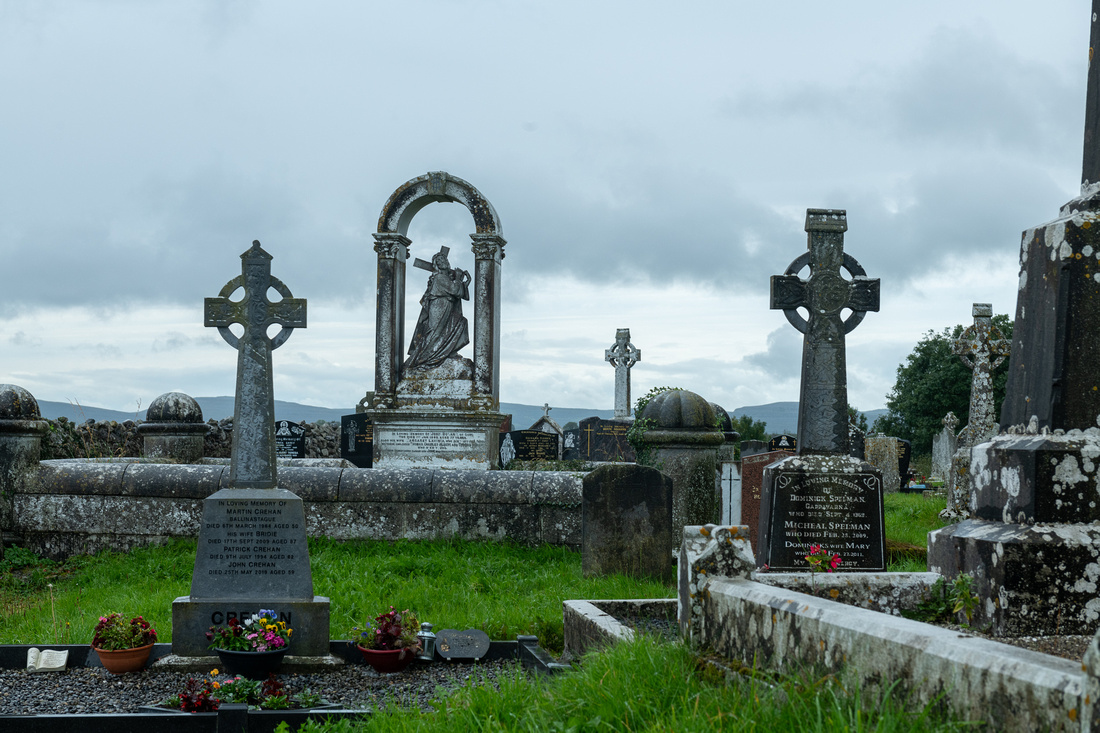
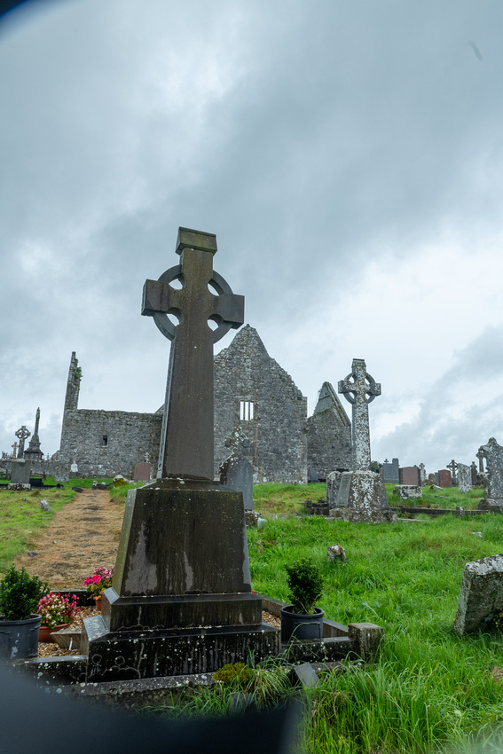
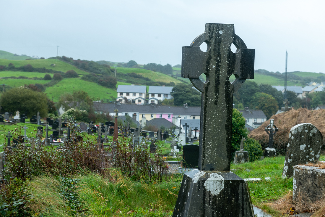
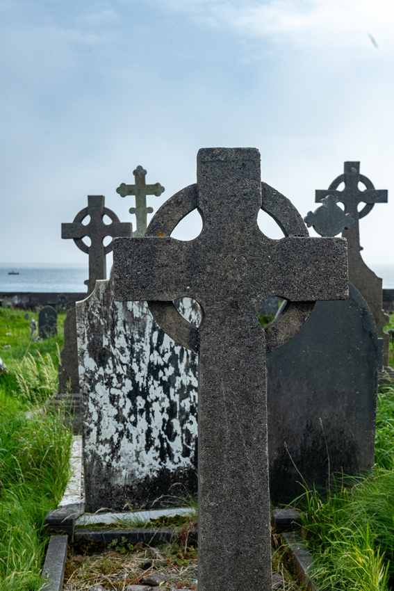
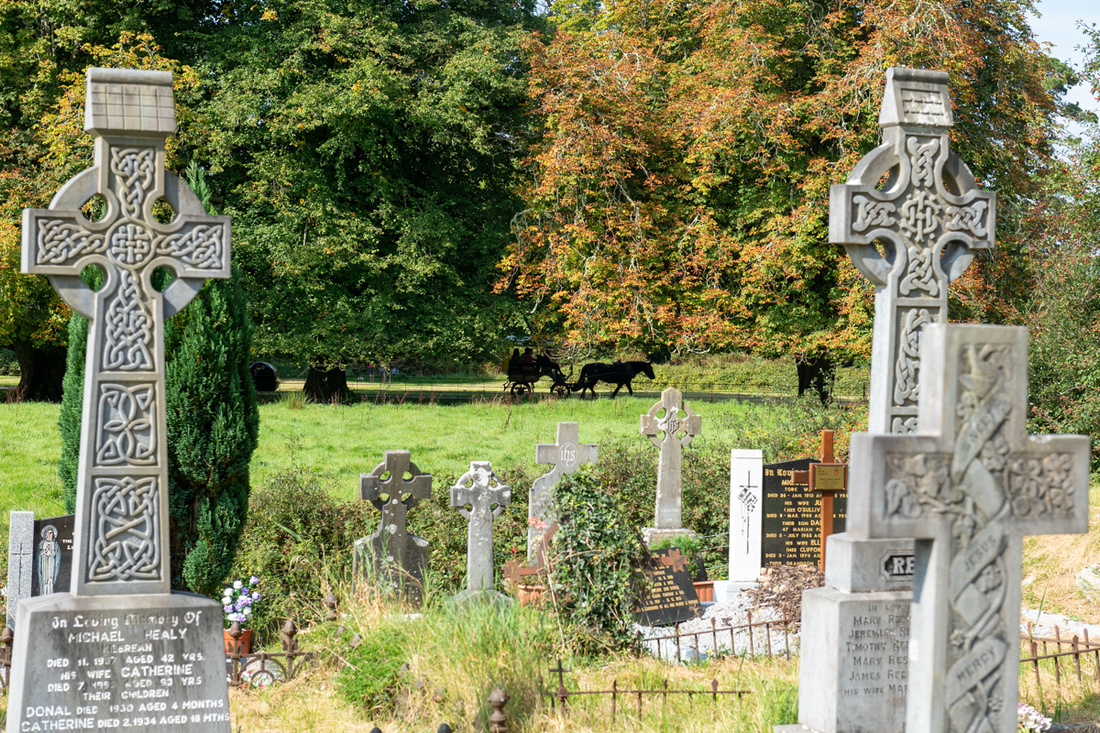
It might look to some like I spend too much time in old abbeys and graveyards. Well maybe. But they are so much part of the history of Ireland and her people that I feel most deeply connected to them when I'm in those places. And they hold their delights as well. Here's a marker Jeanne Marie spotted in one of them, probably in Co Kerry, being an O'Sullivan.
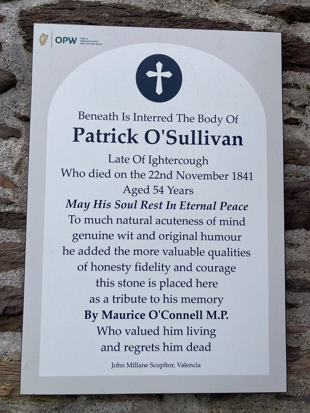
We are planning to plagiarize from it for our own.
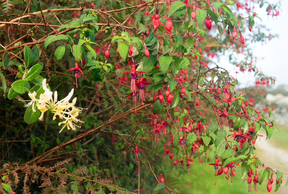
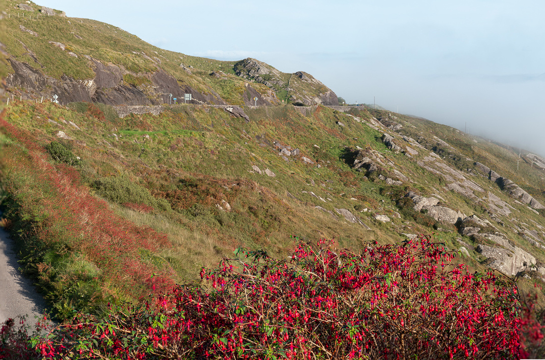
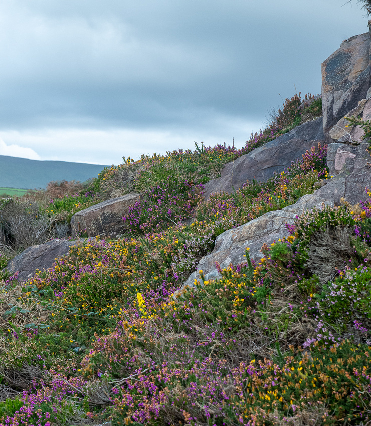
It's time now to mention some of the flora Ireland displayed for us. It was late summer so a lot of the most extravagant stuff was over. No big riotous displays of gorse or rhododendron for instance, although it looked like the gorse was going to try a second blooming. The first interesting plant that caught our eye was something with red berries in the hedges. We didn't get that close for a few days but then walking back from the stone circle in County Cork we saw what they were - fuchsia. The berries were actually buds about to burst open which they proceeded to do the remainder of the trip. Big thick hedges of fuchsia along the roads.
 We were also seeing the heather turning purple but we might have been a little early for that. Where we could find the heather and the gorse together it made for a great display but none of them were all that massive.
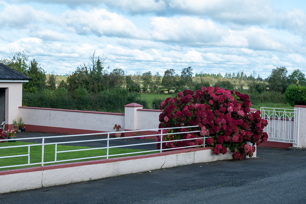
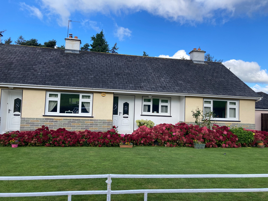
Something else we saw a lot of, not growing wild but in abundance, were these raspberry color hydrangeas. These are spring/early summer bloomers for us but with the even temps of Ireland I guess they bloom whenever they want. They were everywhere and I don't remember seeing pink or blue. I wonder why these couldn't grow in Missouri?
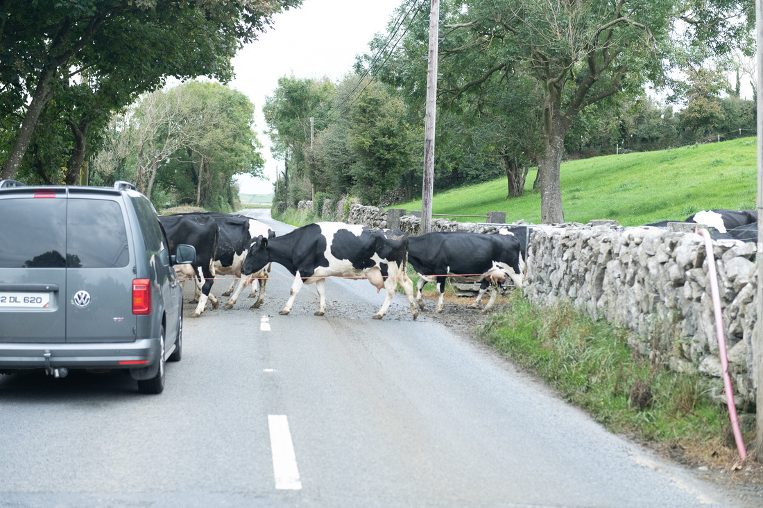
Then we have the obligatory "stopping traffic while the cows cross the road" shot. Or sheep. Doesn't matter. You need one of those.
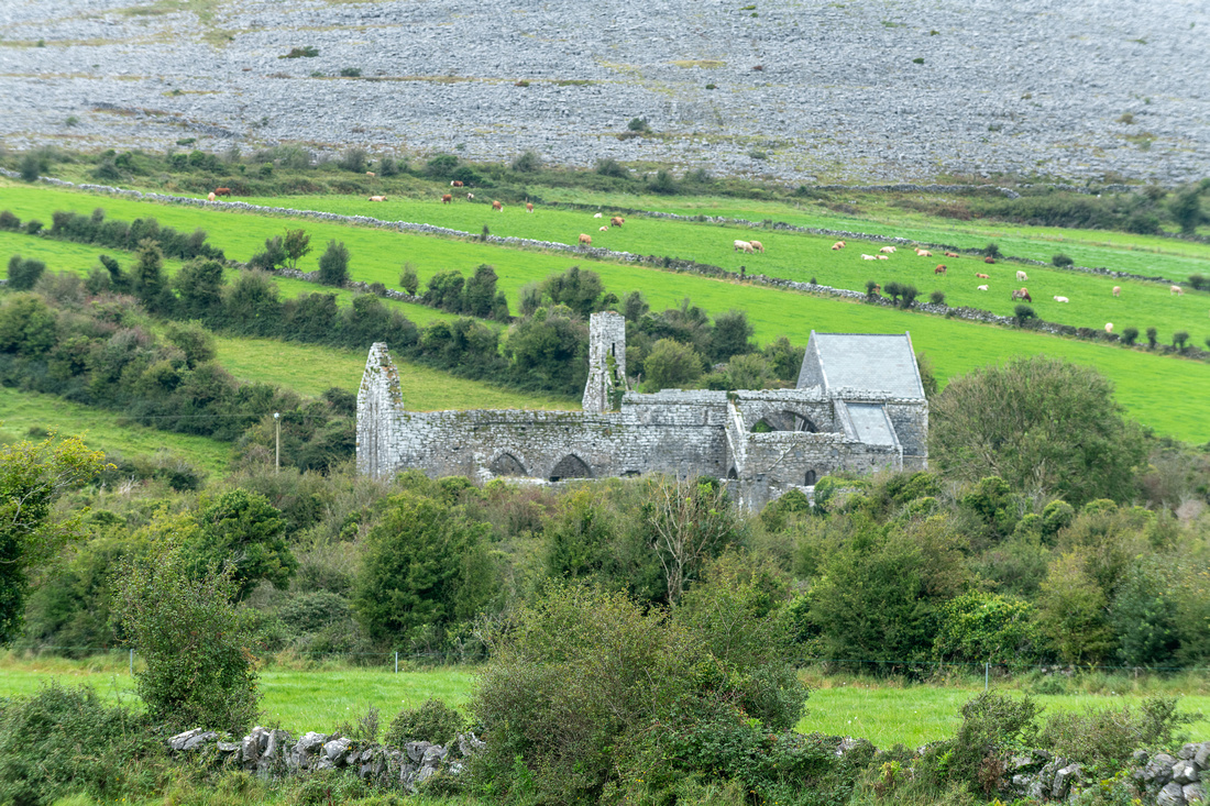
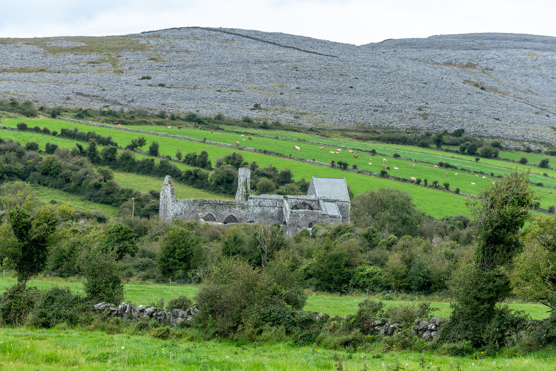
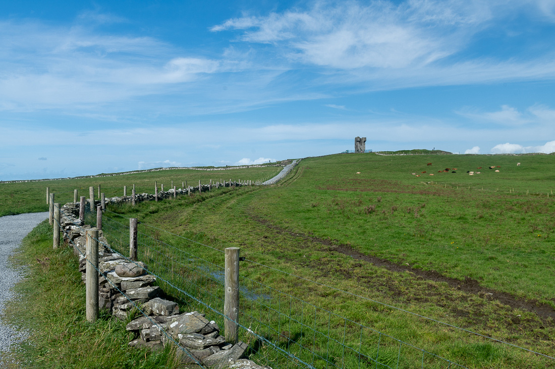
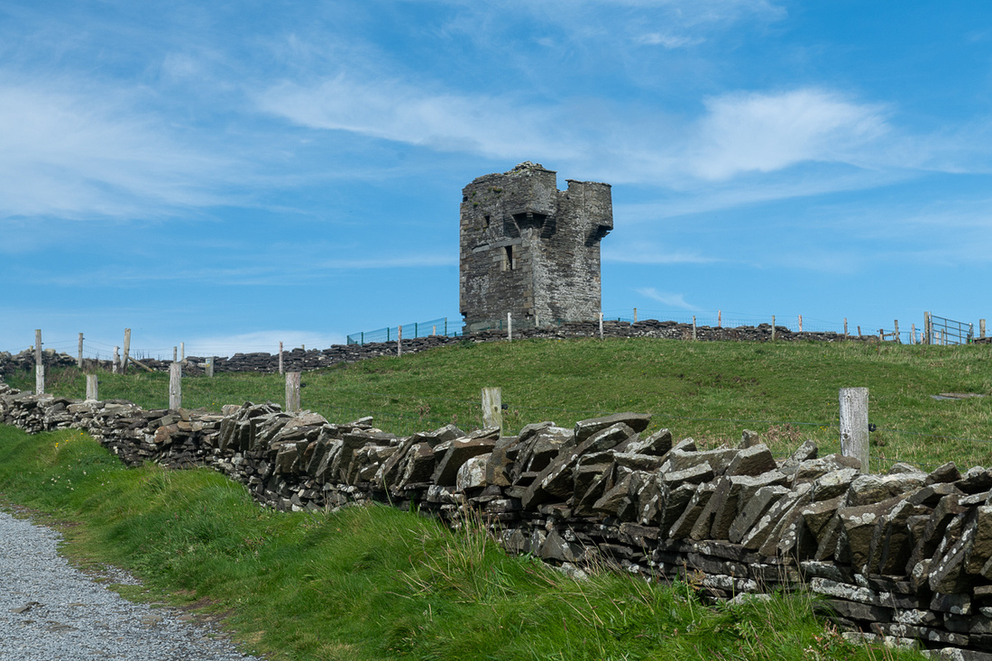
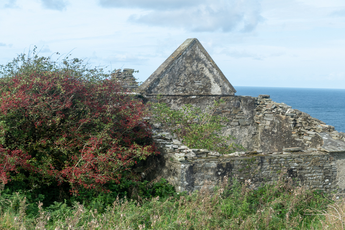
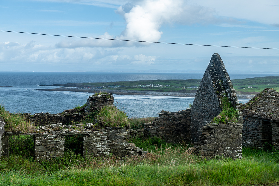
Above is Muckinish West Tower House, easily photographed from the road. And below is Corcomroe Abbey which we drove past. Yes, I showed great will power. I'm including it because it is the best rendition I got of the Burren's landscape. The bare hilltops and the farmable valleys is a common sight.
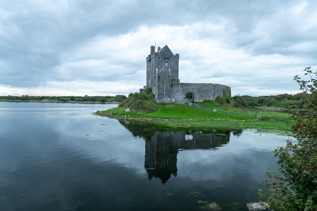
Our destination for the night was the village of Kinvarra, just into County Galway. There we had Dunguaire Castle, ancient seat of the King of Connaught, which I've photographed on previous trips. But I'd always been there at midday and low tide. This time I checked the tide tables and high tide was just an hour before sunset. Close enough. But I was not thrilled with the sky.
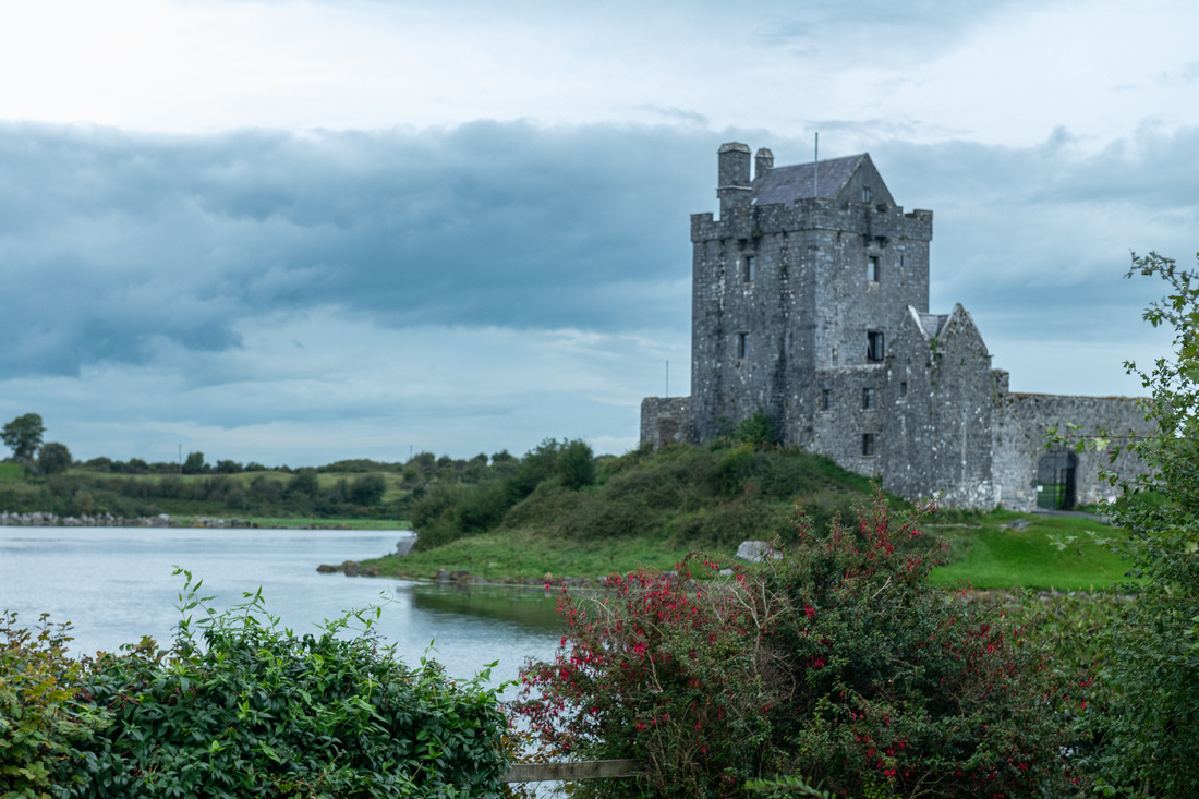
Oh well. The best laid plans of mice and men...This was at 6:15, just before high tide. We waited around until 6:30 and the sky gods did give me this.
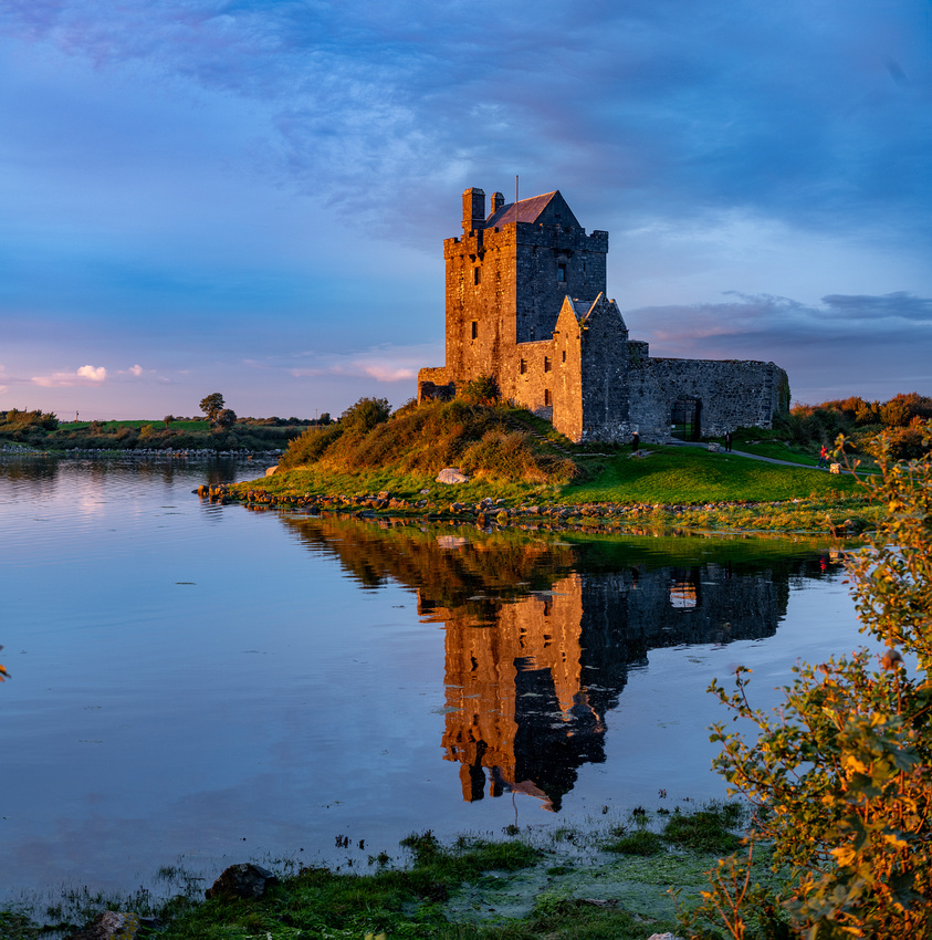
 I shouldn't complain, right? I noticed though, the horizon in the west was lighter. I could see there was a chance the setting sun might get up under that overcast. We still had an hour before sunset, we were starving, and our B&B was three minutes away so we dashed up there and scarfed down some cheese and crackers. I had a good view of the western horizon from our window. At 7:25 it was evident that something might happen so we jumped back in the car in time to get this:

At 7:39 we got this:
This is what the sunset itself looked like:
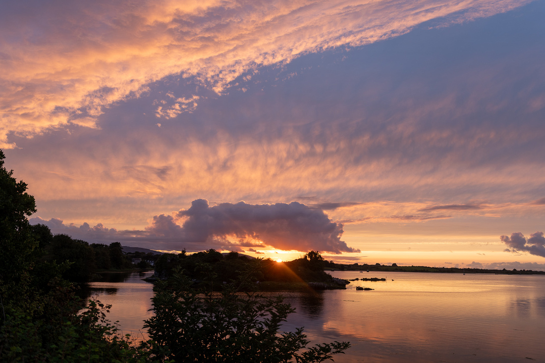 And at 7:46 we got this:
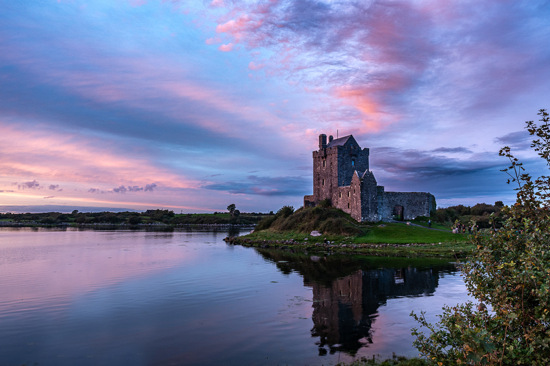
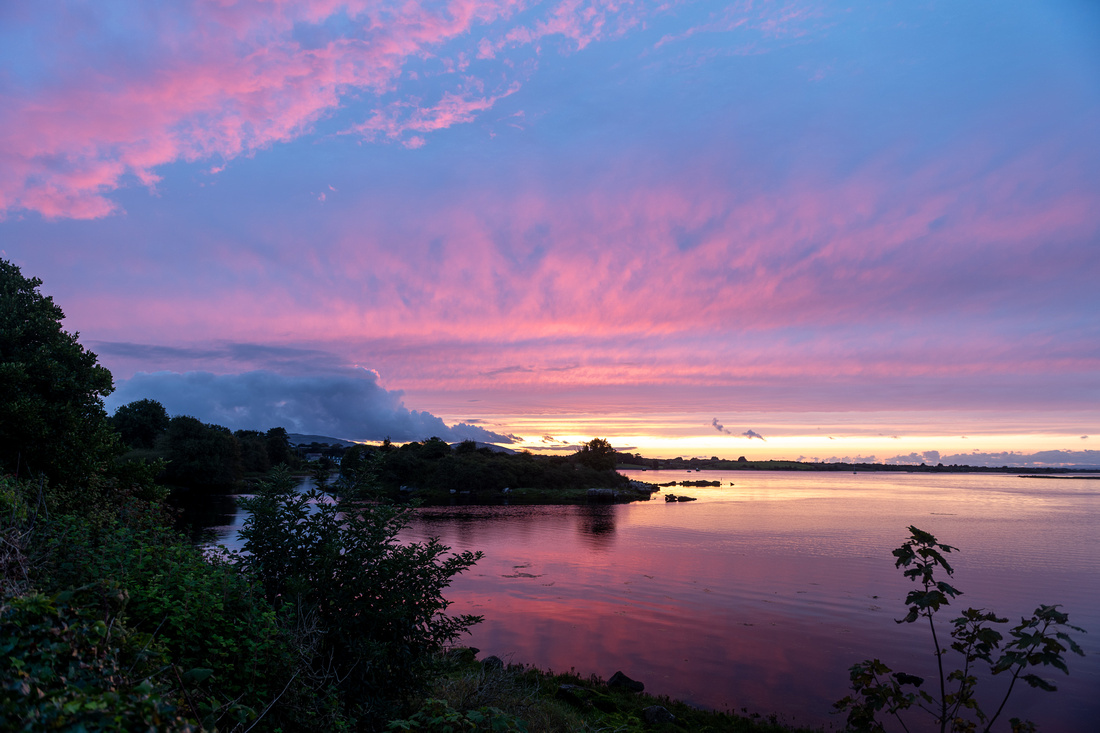
It ain't over till it's over.
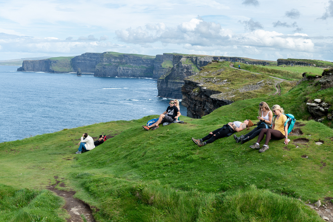
]]>Doing this didn't get us out of any walking. It was more than just a stretch of the legs from the nearest car park.
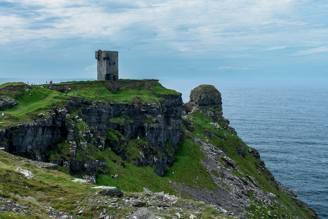
 Above is Hag's Head Tower, which like O'Brian's Tower was built by the English to watch the coast for Napoleon's invasion.
Definitely some nice views.
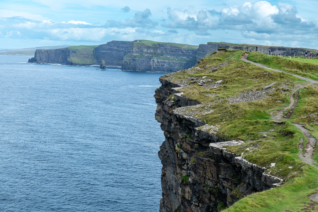
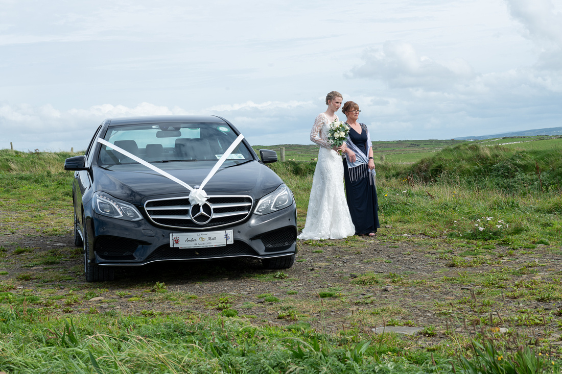
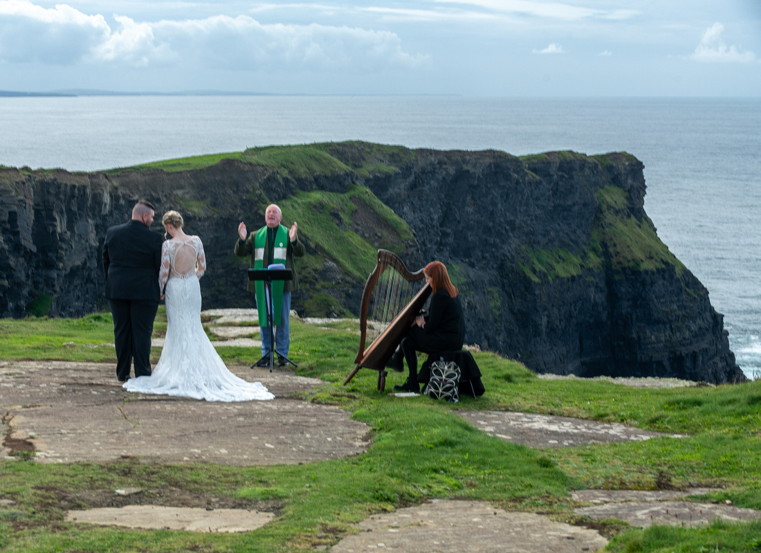
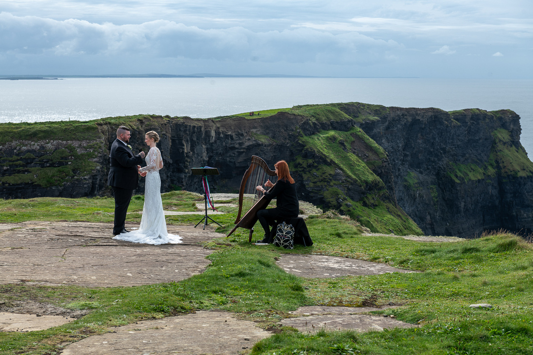
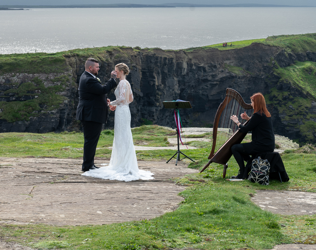
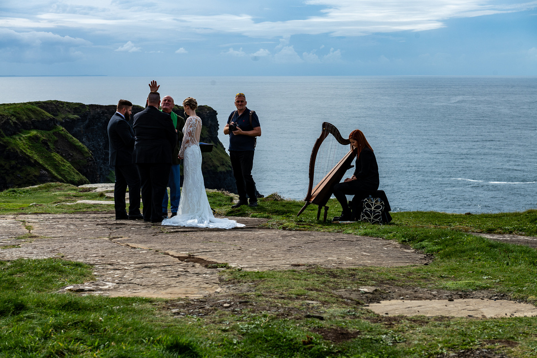
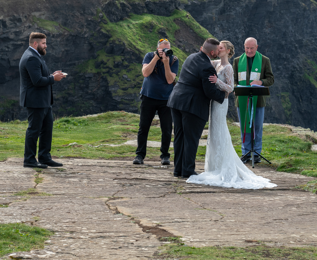
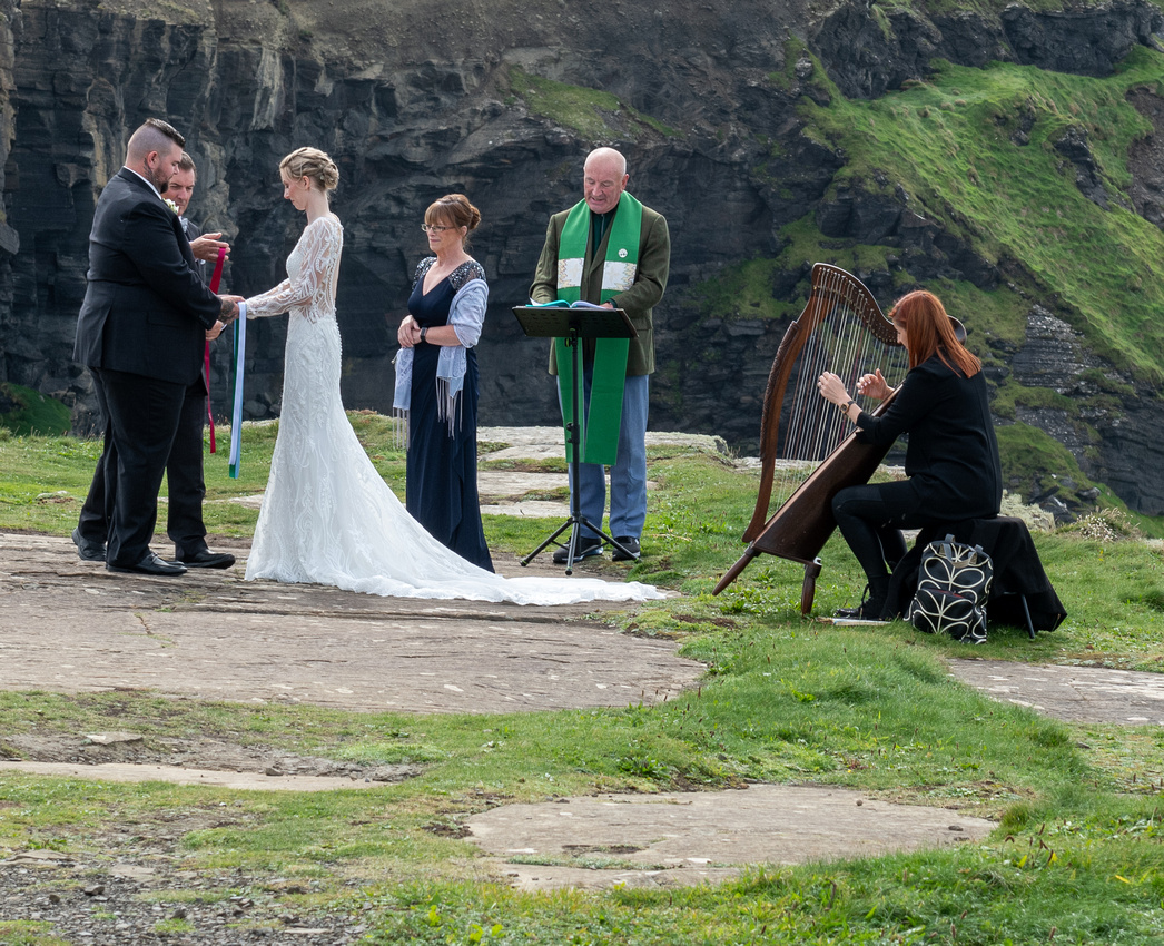
 We were starting back when right at the southernmost point we saw a group of people dressed up in their finest. It could mean only one thing.
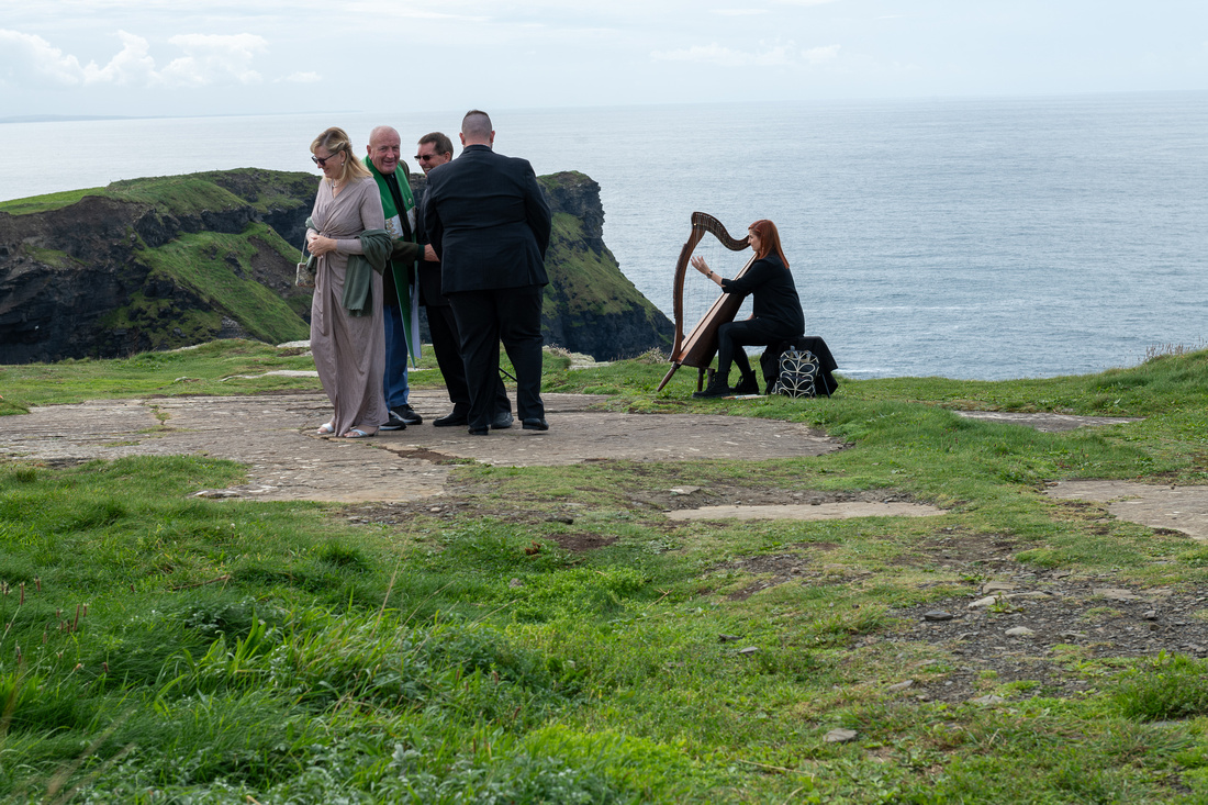 Yep! We get to see a wedding!!
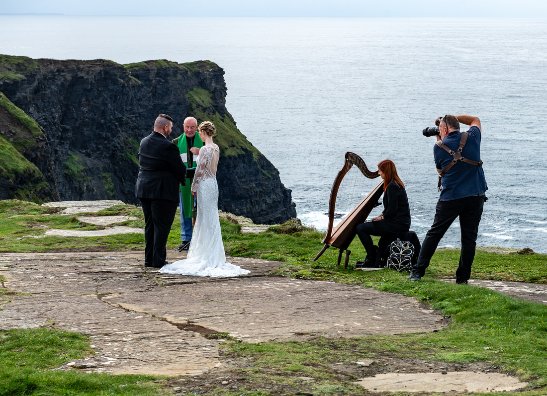
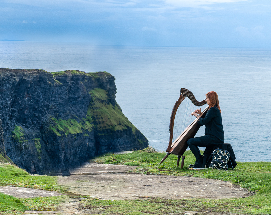
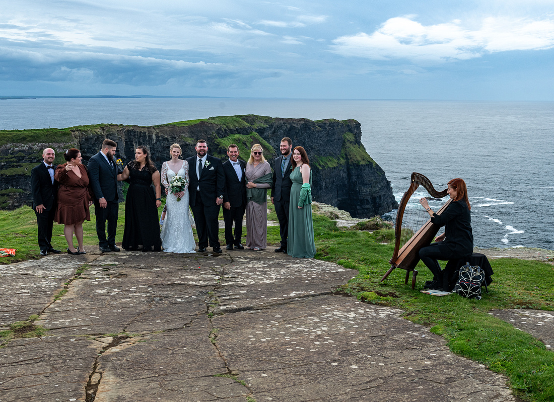
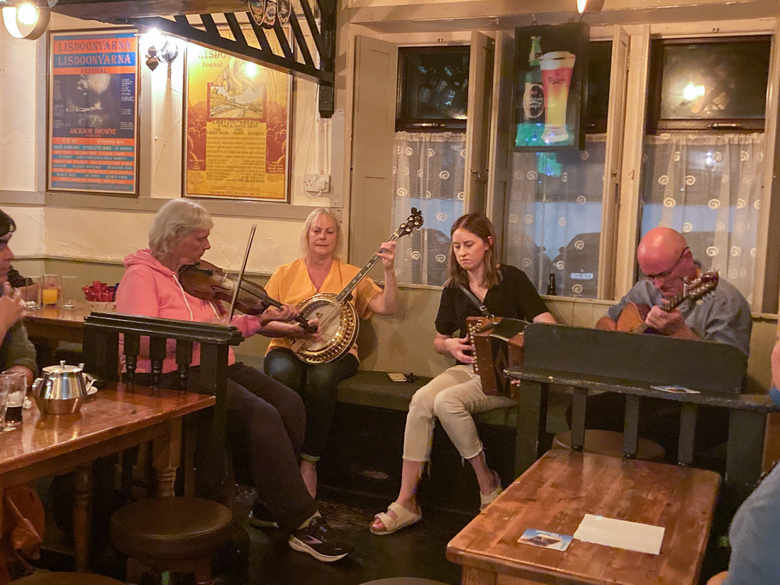
After the long march back to the car we were ready for the pub and some good Irish music.
]]>
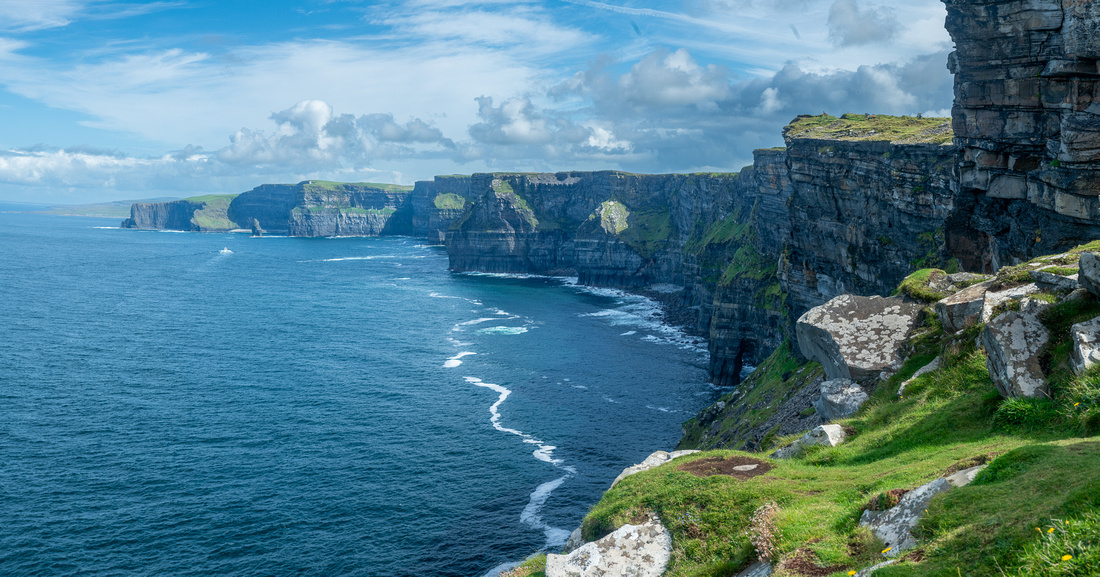
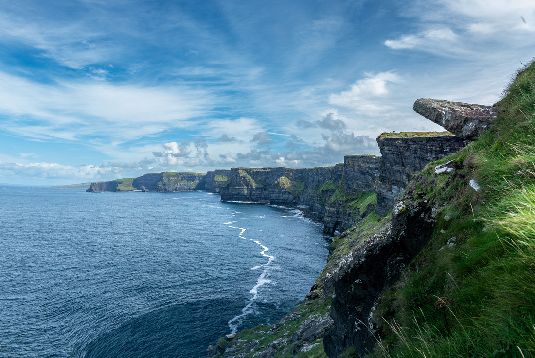
County Clare has three main points of interest, in my opinion, those being the Cliffs of Moher, the Burren, and the village of Doolin, the great mecca of Irish music. We were staying in Doolin, which is just a stretch of the legs from the Cliffs, and we would visit the Burren as well.
The next day the seesaw with the weather continued. After the drippy day we had before, we woke up to blue sky. The plan for the day was to walk the northern half of the Cliffs of Moher and take a taxi from the visitor center back to Doolin. This would be in the afternoon, as the cliffs face due west which means afternoon or evening light, so we had the morning to look for something interesting.
 I've photographed both of these cottages before so I like to check on them. The top one we call Maggie's Cottage after my cousin Maggie Lewis who died shortly after our 2016 trip, which is when I first saw it. She loved Irish cottages.
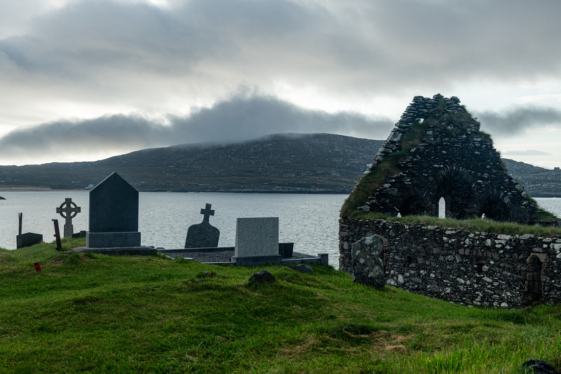
We then found an old church ruin with a very old graveyard. I guess you've figured out by now, Dear Reader, that it's hard for me to drive past these places. They do say "Ireland!" though don't they?
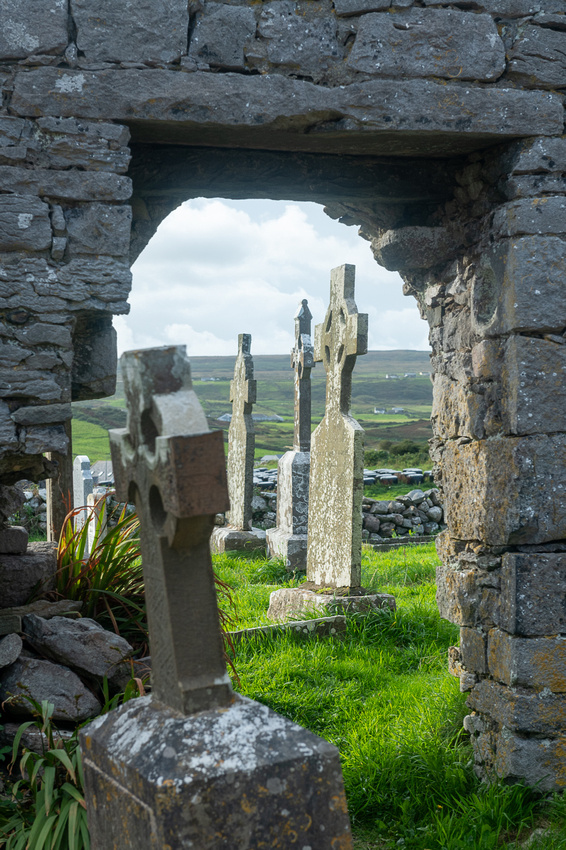
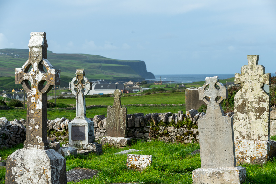
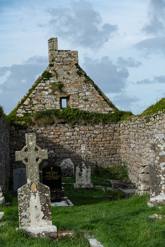
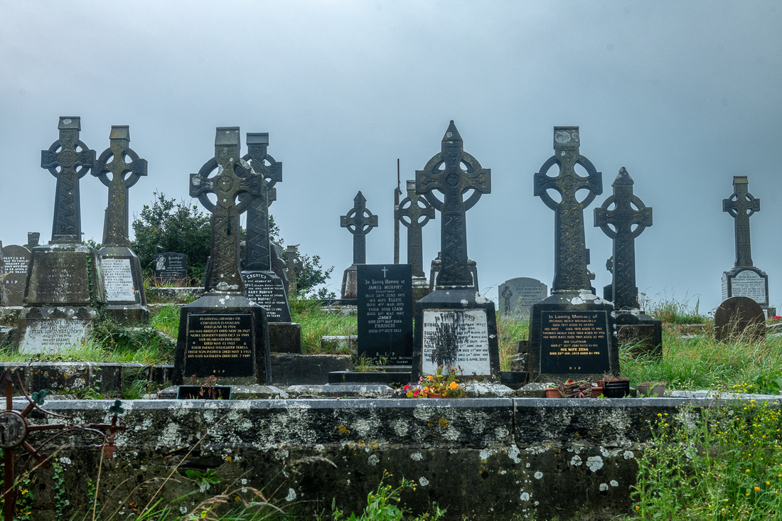
And if you think I've overdone the graveyard pictures wait until we get to the black & whites!
 Jeanne Marie grabbed these horses out the car window.
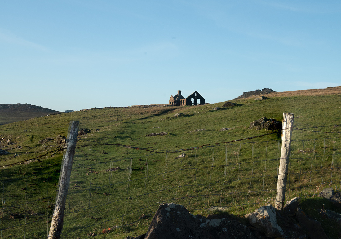
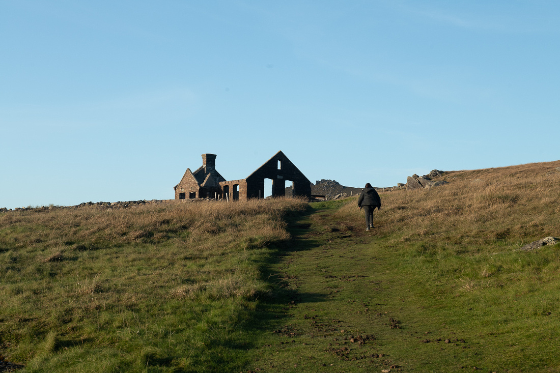
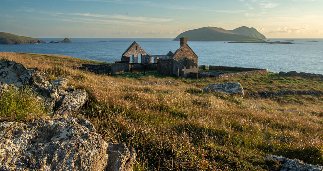
We then drove back over to near Doonagore Castle where we had discovered the ruins of a village. These are commonly called "famine houses", referring to the Great Famine of 1845-1849. But many of them were abandoned later than that as the Irish continued to emigrate long after the Famine.

I've included the picture above because five years ago the cottage to the left of the castle was a candidate for a fate similar to those above. I photographed it on our last two trips and it was falling apart fast. We went back to see how much of it was left and to our delight it has been restored, thatch roof and all! So maybe there's hope for all of these houses. Anybody looking for a fixer upper? Great view? Needs some work?
Time now to head for the Cliffs of Moher but they will get their own post.
]]>
Given the gorgeous weather of the previous day I thought we would be back to clear, high pressure weather patterns but nope. Rain and drizzle again. So we lingered over tea and got packed. We visited with Beatrice and discussed the changes in the B&B business. Prior to covid there were seven B&Bs in Ventry Bay and now its just her. Getting help is the main issue. So we packed the car and waved goodbye, hoping she would still be doing it next time we come.
We needed one more photo shoot before we headed north so we went up to Kinard Beach. It was still drizzling as we arrived so I made it quick.
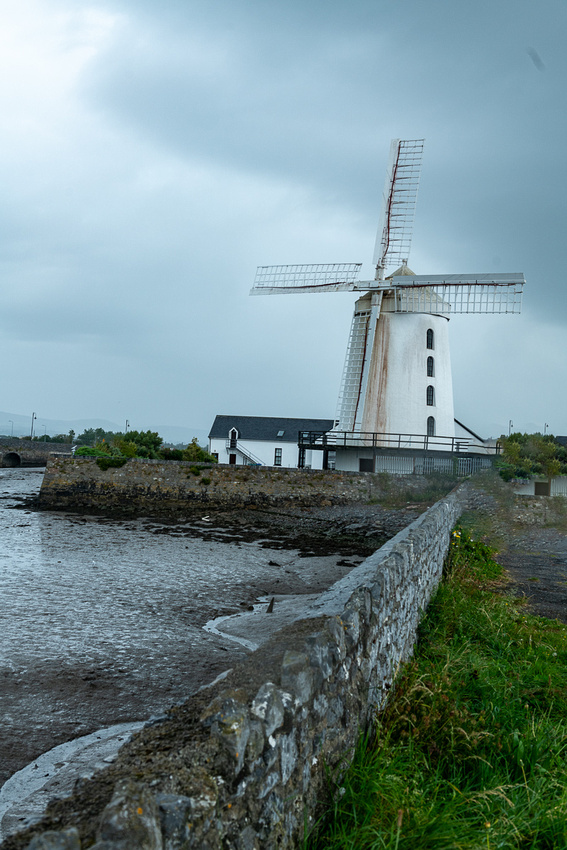
 Then over the Conor Pass and up to Tralee. There is a great windmill there waiting for its photo op but it was still raining and the tide was out. This was the only shot I thought was worthwhile.
Now on to the Tarbert ferry across the Shannon.
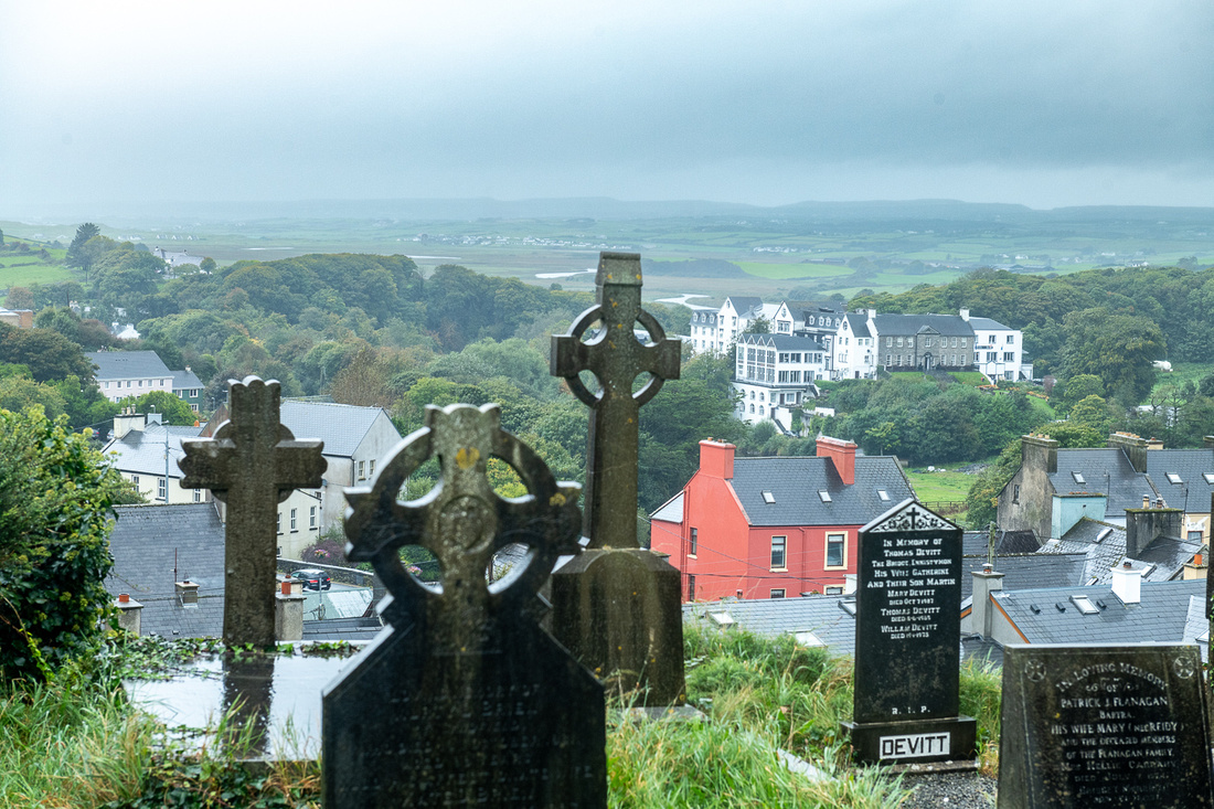
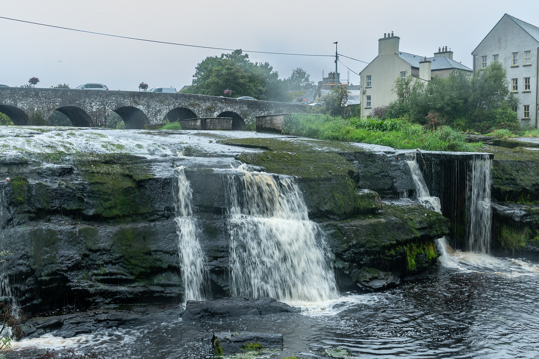
 Our first destination was the town of Ennistymon, which has a river and waterfall running through the town, as well as a cemetery on a hilltop overlooking it. The rain started up again and even though it was raining, the river flow was rather skimpy. Maybe I let the conditions defeat me. I didn't think it was a very good session. We'll see if they look better in black and white.
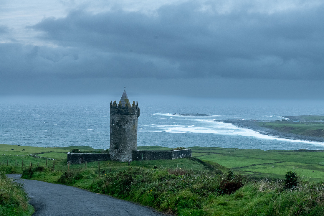
So we proceeded over to Doolin where we would be staying. The soft weather followed us but we stopped at Doonagore Castle, which I've photographed a number of times, just to see it again.
We really had no hopes for the sunset so we were just scouting for possible shots the next day. But rule number one in Ireland is, "Don't give up on the light." or as Yogi Berra put it, "It ain't over till its over." We drove down to Doolin Pier and watched the wind and waves crash on the shore. There's a small waterfall there which you can see in the picture below. Doonagore Castle is at the far left. The picture was taken at 7:24 and sunset would be about 8. The light is as dead as a doornail.
Then we noticed a little color in the sky so we thought we should get back up to the castle. At 7:44 we got this.
 And at 8:02 we got this:
 Yogi was right.
Another grey sky greeted us in the morning so there was no rush to get out. Besides, we wanted to talk to Beatrice, our B&B hostess. This was the only traditional B&B, with the full Irish breakfast, that we would do on the trip and we had stayed with her before. So we lingered awhile. Plus we met an interesting couple from South Wales, just across the Bristol Channel from our friends the Humphries in Bath, England. This is part of the fun of a traditional B&B but many of them have converted to “guest houses” or something like that. This is one of the consequences of covid.
As we were finishing breakfast I could see the clouds thinning out to the east so we headed back through Dingle Town to find something on that side of the peninsula. Minard Castle wasn’t too far so we decided to try it again. This time the light would be completely different.
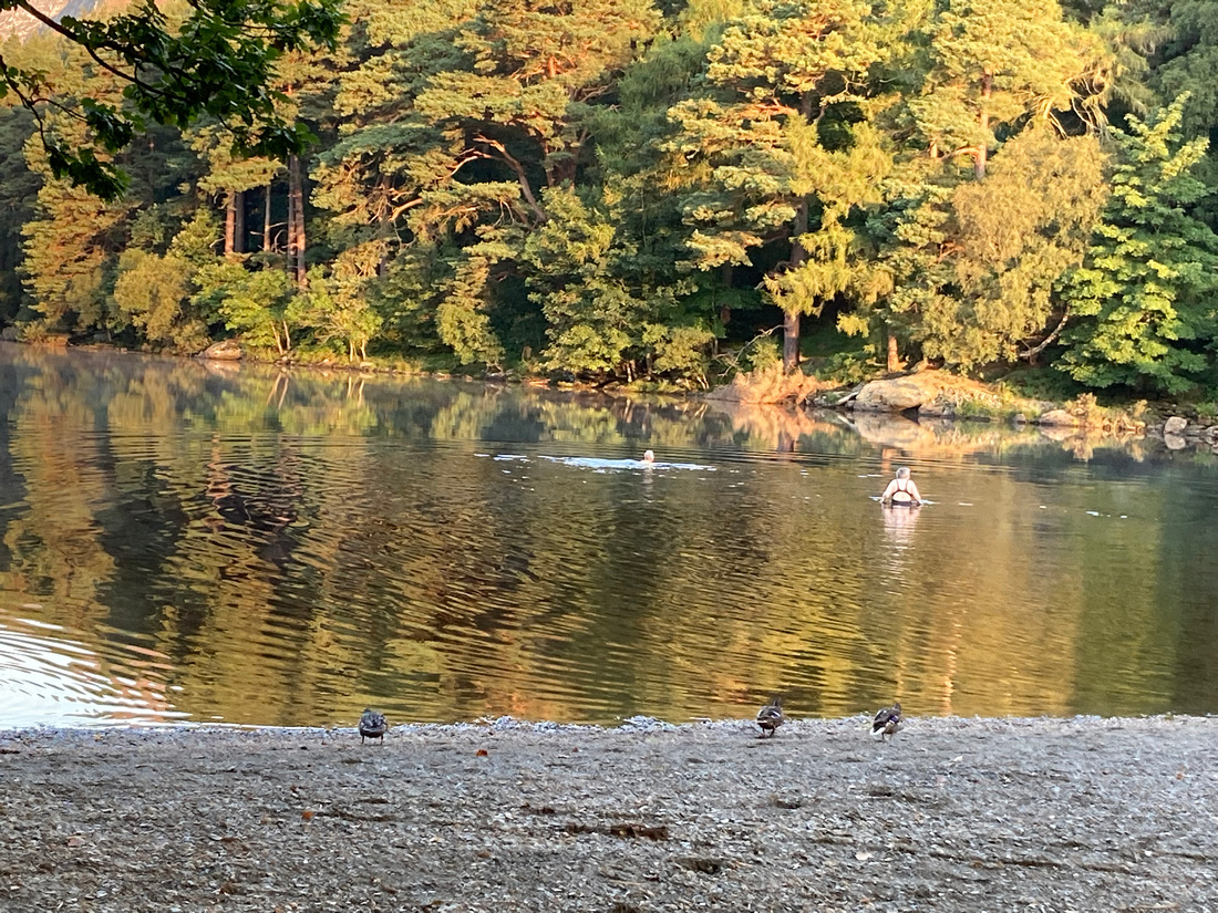
Above we have more Irish who can't wait to dive into the freezing sea.
A cold swim every morning hasn't seemed to hurt this guy.
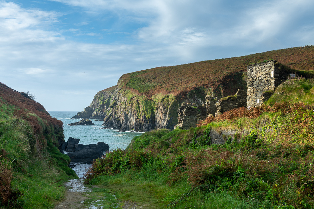
After that little shoot we headed back around Slea Head to the Blasket Island Center. I had to stop for just one picture of my little friend, pictured below. And that is Great Blasket Island in the background. If you zoom in you may be able to see the remnants of the village. It was inhabited until 1953 and the Blasket Center is basically telling these people’s story. We found it a very interesting place to learn some Irish heritage.
Just a short stretch of the legs up the seashore is a ruin of a cottage that I wanted to scout for a possible sunset shot.

Okay, full disclosure: This is not an authentic Irish cottage. It was built in 1970 by director David Lean for the film Ryan’s Daughter. This was the home/schoolhouse of the Robert Mitchum and Sarah Miles characters. In fact most of the filming was right on this stretch of Dingle. But it’s close enough to a real one. He didn’t cut any corners on building it. Everything was authentic including the stone wall around it. And its easy to see why he wanted it here. No other building is in sight and the feeling of being at the end of the world haunts the place.
It looked suitable for sunset so we planned to come back.
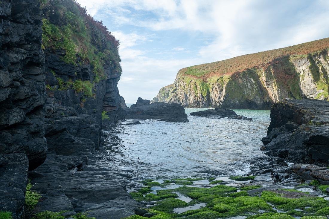
We've been to Dingle on every one of our trips and she has always given us one of her grand and glorious days. This would be another one. Clear and calm. I've stood very close to this same spot on six different trips and looking out at this panorama I always wonder if the people living in these ringforts and beehive huts 3000 years ago appreciated the beauty around them. Or did they just get up and trudge off to work worrying about the price of wool?
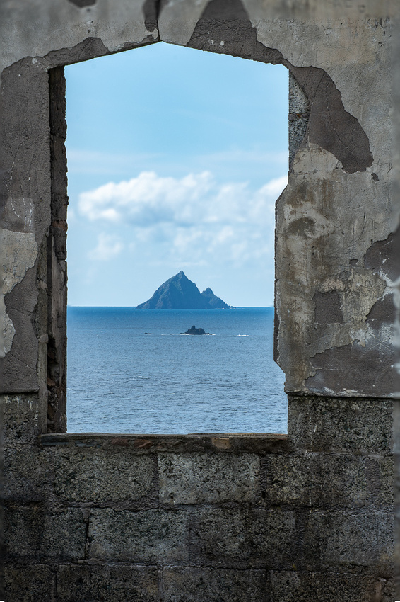
 Slea Head has lots of these antiquities which I can't resist. The one above must have been pretty nice because it apparently had electricity. Might it be the Flintstone residence? On the horizon are the Skelig Islands.
The shadows are getting longer so time to get back around Slea Head for sunset, with a few stops on the way.
And a grand day that it was indeed!
]]>
We awoke to a drizzly “soft” Irish morning. The plan called for us to relocate over to Dingle so with that kind of weather we just got started, not looking for any more photo ops around Kilarney. We've been to Dingle on every one of our trips to Ireland and there's just something magical about the place. The pull is very strong. We always look forward to finding (and photographing) our old favorites, and finding something new as well.
Driving along the coast road to Dingle Town I’ve always wanted to go down to Minard Castle, right on the coast so why not now?
We stopped in Dingle Town for some lunch and a little walking around, grabbed a souvenir, visited the church, and soon Beatrice, our B&B hostess out on Ventry Bay, let us know our room was ready so we could get settled there. As we pulled up the weather really got nasty with rain and gusty winds. It looked like a down day. We put on some water and made ourselves a cuppa tea and thought maybe we could get this blog started. But about 6 the wind let up and the clouds were lifting. We might eke out a picture after all. Out on Slea Head drive we went.
One of my favorite old houses just before you turn the corner at the tip of the peninsula. You can’t live any further west than this and still be in Europe.
Then another of my familiar subjects.
Dunquin Pier was a new one for me. I don’t know how it got past me on all of these trips.
We decided since we were so close to the new Blasket Island Center we would drive over and scout it for the next day. It was already closed but they had an observation platform which offered a view we had never enjoyed. The clouds started breaking up as we walked out.
After getting this quick shot, with the sunset gods ready to deliver something good ,we hightailed it back to the pier.
Not too bad, from solid overcast to this in about 40 minutes. We remained on the best of terms with the sunset gods for the remainder of the trip.
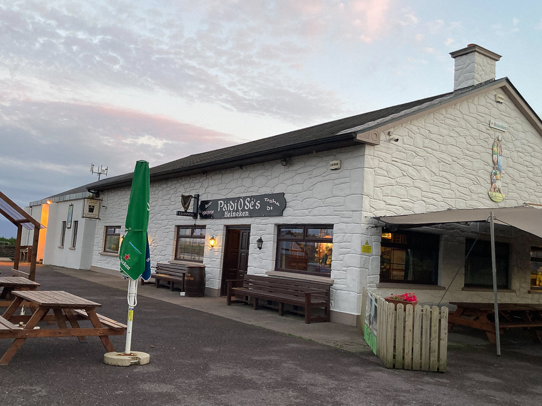
Now to Paidi O'Se's before they close the kitchen.
]]>
The great weather appeared to be holding we so decided to make this our Ring of Kerry day. We had not done the Ring since our trip in 2009 and I had several places to photograph at the western tip of the Iveragh Peninsula. Staying in Kenmare allowed us to head straight down the peninsula along Kenmare Bay. Doing the Ring this way (clockwise) allows us to avoid the big tour busses, who usually do it the other way. Our first objective was Derrynane Abbey It could be a great sunrise shot but since I’ve despaired of getting great sunrises we departed at a civilized hour. I thought the monastery was worthwhile. It sits on what was at one time a high tide island but it now appears that you can walk to it most of the time.
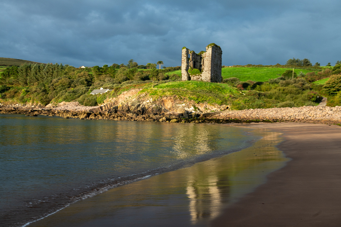
We then headed across the tip of the peninsula looking for Ballinskelligs which has an abbey and a castle. This one was founded by the monks who had scratched out a living on Skellig Michael for about 600 years and finally gave it up and came back to the mainland.
 Above is Hannah, building her own castle.
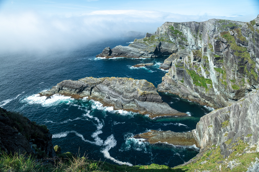
Working our way further across the tip of the peninsula we had a bowl of chowder in Portmagee and then went over to the Kerry Cliffs. This was to be my sunset shot so we just wanted to look over the set up. But as we pulled into the parking lot we could see fog climbing up the cliffs. We asked some of the people coming down about the view and they said it was still pretty impressive so we decided to go for it. They were right. It was indeed impressive.
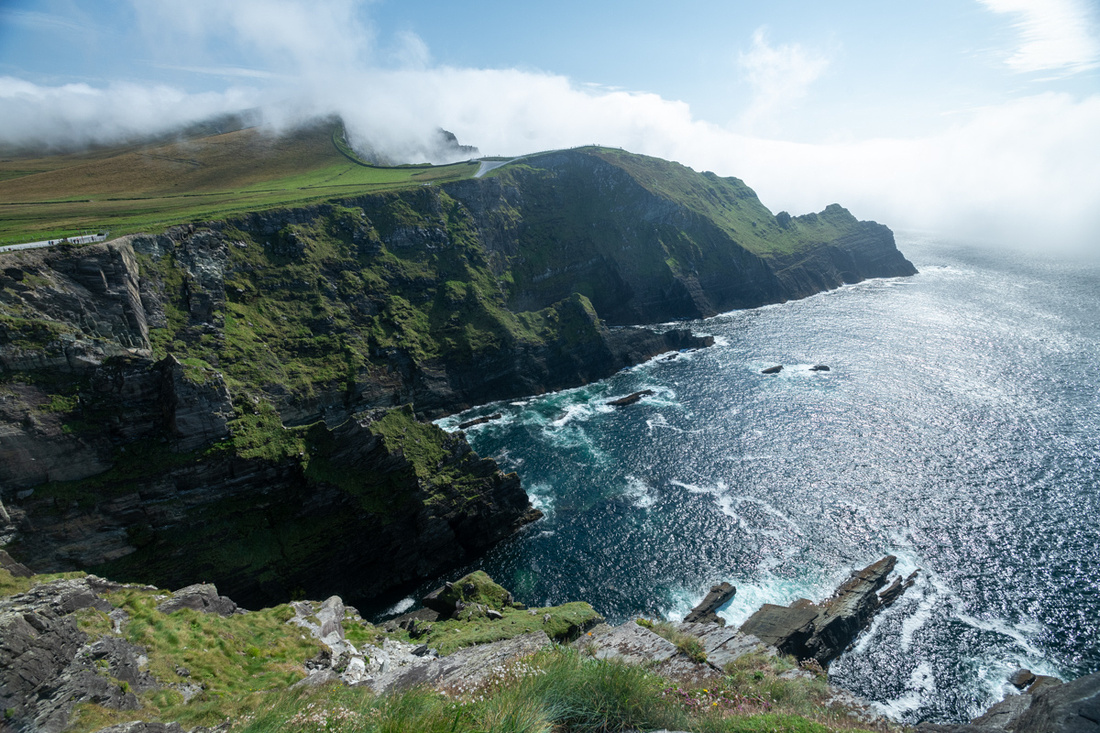
We were seeing in the hour or so we were there that the fog was thickening. This would be a problem for my sunset. What to do?
There was another castle to check out so we went off to look for it, keeping an eye on the coast. But we found the castle closed and inaccessible to the public. We were stymied again.
 Above is Ballycarberry Castle, the best one we'd seen all day but we couldn't get near it. I got this picture with my 500mm lens.
I decided at this point to drive back to Derrynane Abbey and maybe get a decent sunset shot there. But as we crossed the tip of the peninsula we could see the fog engulfing the entire coast and the Bay of Kenmare. The weather gods had turned against us.
We wound up back in Kenmare early enough to go to Mass at Holy Cross in Kenmare.
Day Four in Kerry Sun Sep 10
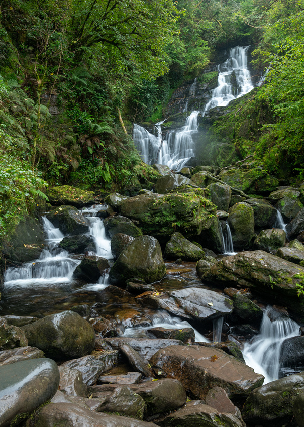
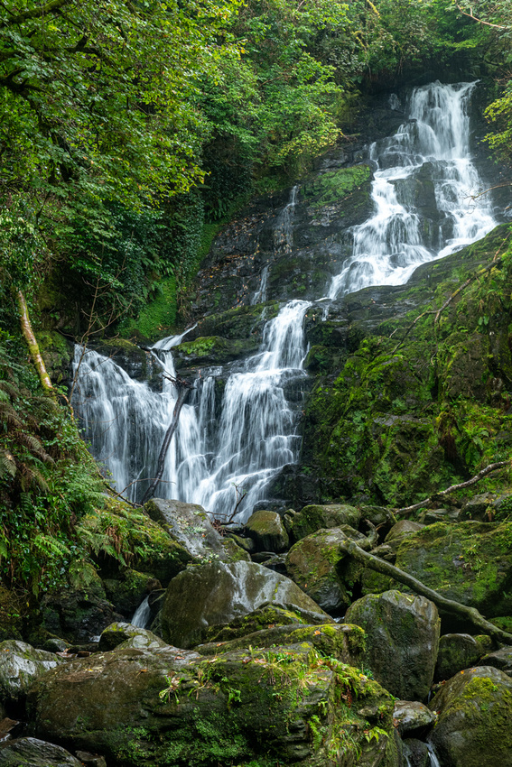
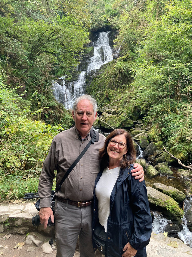
The day started pretty grey and with the fog chasing us home the day before we thought it best to check out some spots in Killarney National Park - a little closer to home. First stop was Torc waterfall. The flow was a little light but still pretty good.
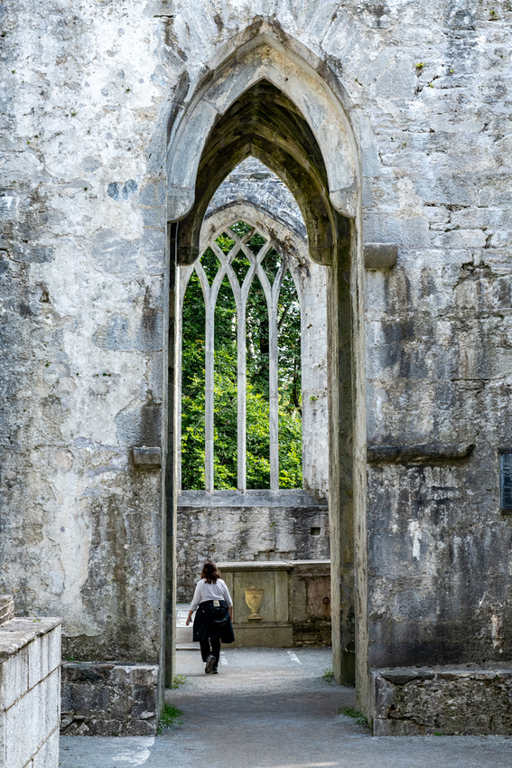
Muckross Abbey was next . Yes another abbey. This one has been kept in much better repair than any of the others we had visited. In fact, this might be the only one we’ve visited that you could actually enter and climb to the top floor. And like Glendalough the area around it has been preserved as a national park. If you want to see what a medieval monastery really looked like this is about as good as you will find.
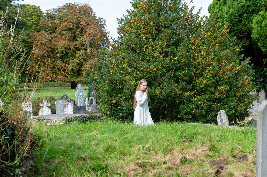
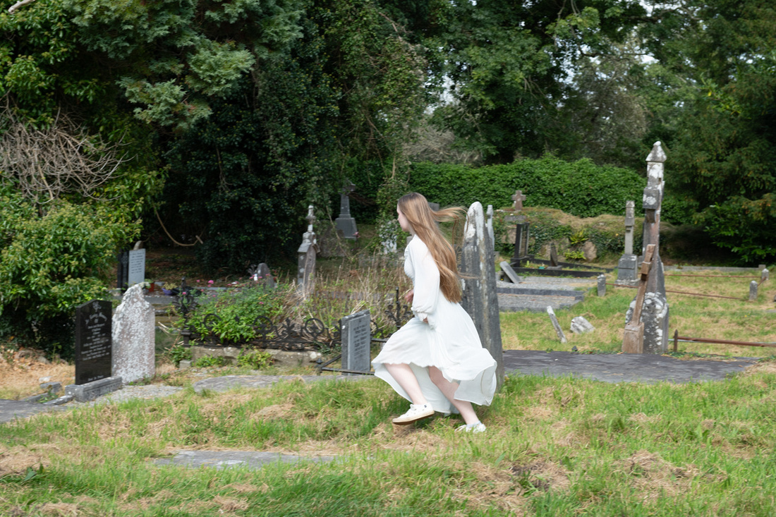
The young lady below was there making a video with her friend. Running through the graveyard in a white dress appeared to be the theme.
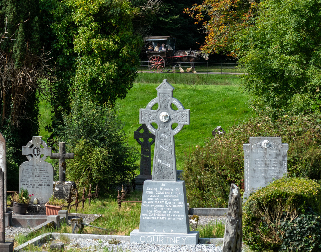
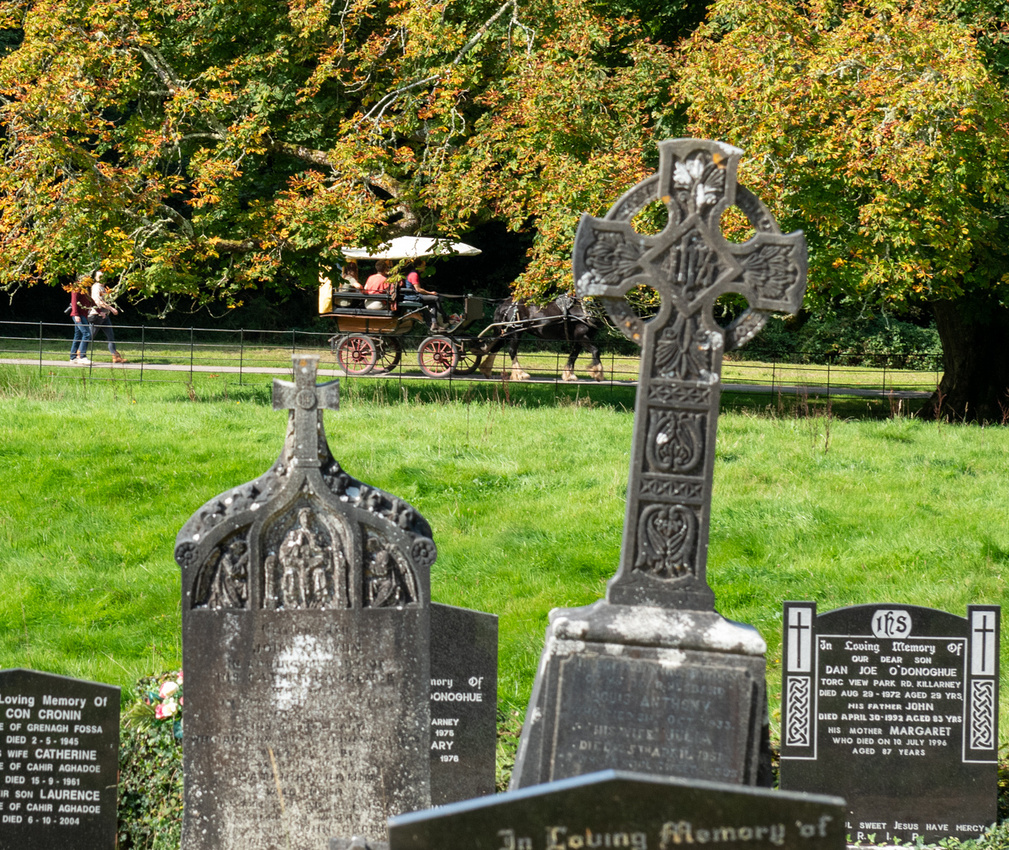
We also had jaunting cars running all over so they made good pictures.
By late afternoon the weather had started moving in again, dampening any hopes for an epic sunset so we went back to Ross Castle to try for a moody cloudy picture. And more jaunting cars.
Heading back to Kenmare the clouds were just about to close up over Moll’s Gap.
Our first four days were spent on the Iveragh Peninsula, the larger of the two that point out into the Atlantic, the other being Dingle. Iveragh has attracted tourists since the 19th Century, the most famous of whom was Queen Victoria who visited in 1861. She stayed at Muckross House near Killarney and when she and her entourage returned to England extolling the striking beauty they had seen, Killarney would forever be a tourist town. In 1932 the Muckross Estate was donated to the government and was made a National Park which has preserved the pristine beauty.
 Above:Upper Lake Killarney
Below is Lady's View. So named because Queen Victoria's ladies in waiting were brought here to see the view of the valley.
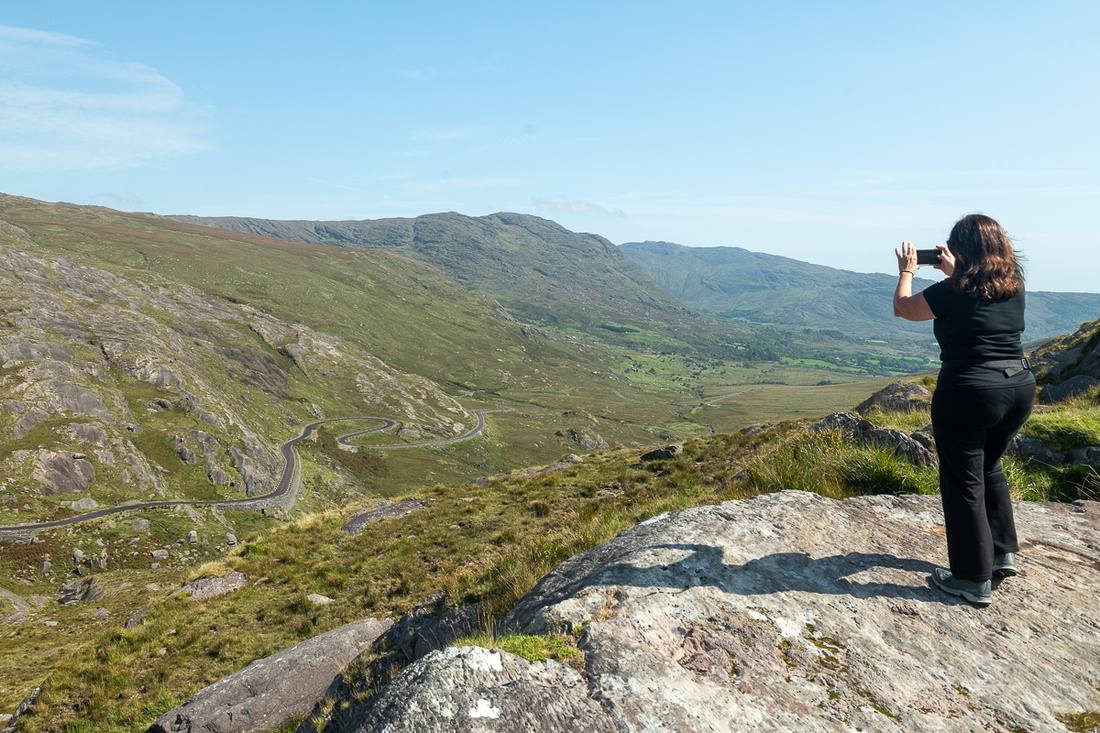
We had enjoyed stellar weather from the time we arrived and this promised to continue for at least a few days so we decided to check out the areas that needed clear skies. The Black Valley and the Gap of Dunloe were high on that list so that’s where we decided to start.. Going through the Black Valley is the shortest route from Kenmare to the Gap of Dunloe. But of course, in Ireland shortest is not the same as quickest. The Valley runs through the heart of the wild & wooly part of the peninsula and bumps right into the highest mountain in Ireland, Carrauntoohil, which is just over 3900 ft.
There was a lonely little ruined cottage that wanted its picture taken.
Going this way brought us to the top of the Gap of Dunloe at the south end. This is one of the primo photography spots in Ireland as the River Loe cuts through the mountains but then pauses on the way down to widen into pristine lakes. We traversed the one lane road that runs through the Gap several times. It was a fun day.
And then there are the jaunting cars. They are really fun to photograph.

The bridge above is the Wishing Bridge. I don't know where that name came from, it is not the only arched stone bridge in the Gap, but it gets the romantic name. The jaunting cars were back and forth across it all day.
And now its time for our first visit from the serendipitous photography gods. As you who have read the blogs of earlier trips might recall, the serendipity gods sometimes give me a chance at a little something extra, something I cannot set up for myself. Or maybe its just that if you spend enough time at jaw droppingly beautiful places, eventually someone will show up to use it for engagement pictures, wedding pictures, or even the wedding itself. This young couple was probably the former.
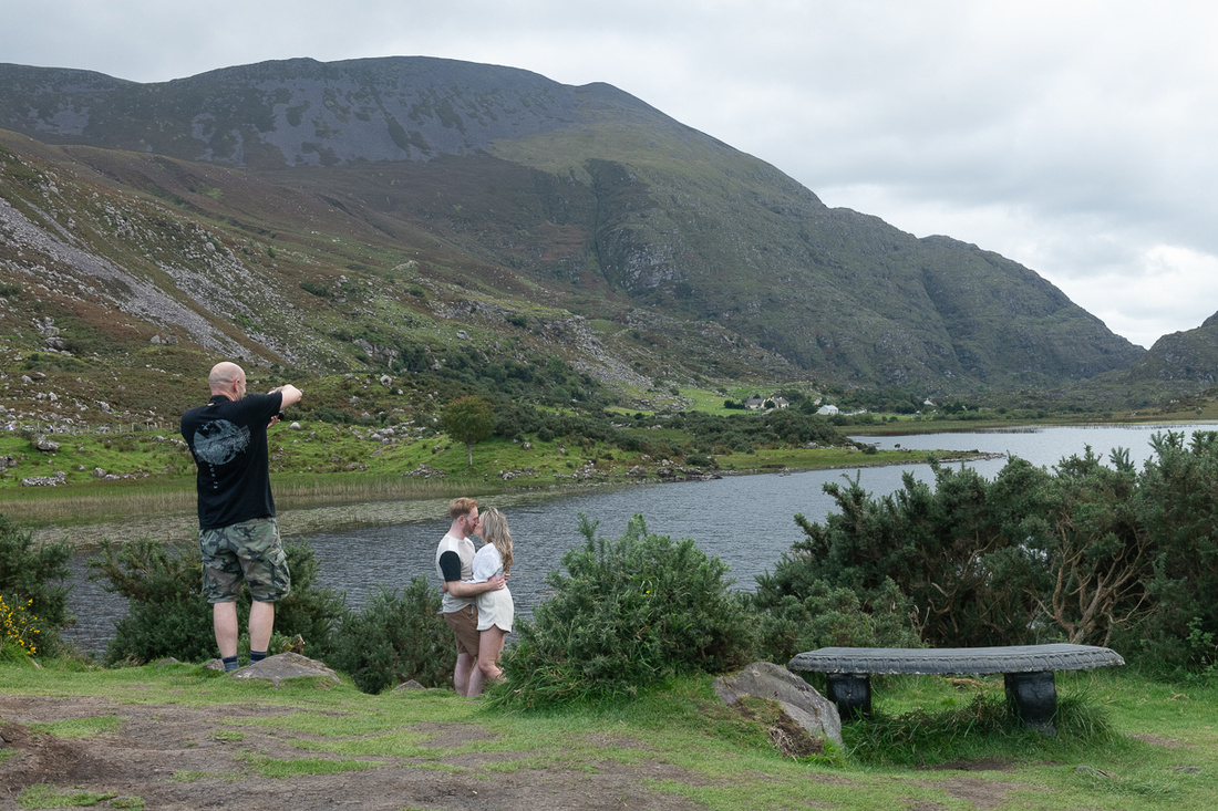

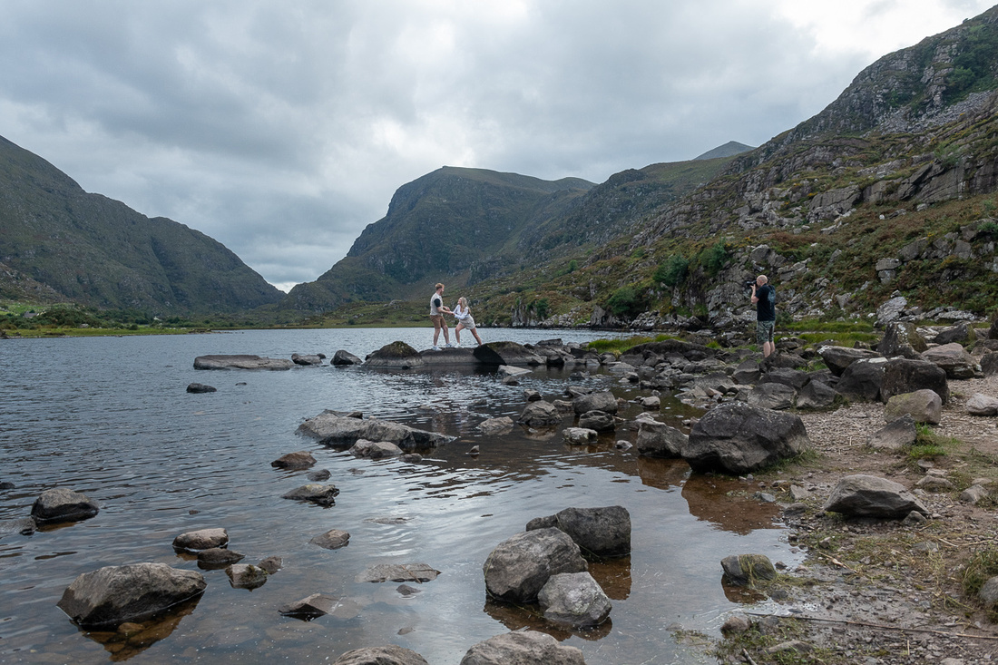
 Of course, all this time I was trying to do some serious landscape photography.
Below is a slide show with more pictures of the Gap of Dunloe and the jaunting cars. And by now you're probably asking, "Can't this guy spell cart? They are carts, not cars." Yes I know. But the Irish call them cars.
The slide show includes a video of a jaunting car.

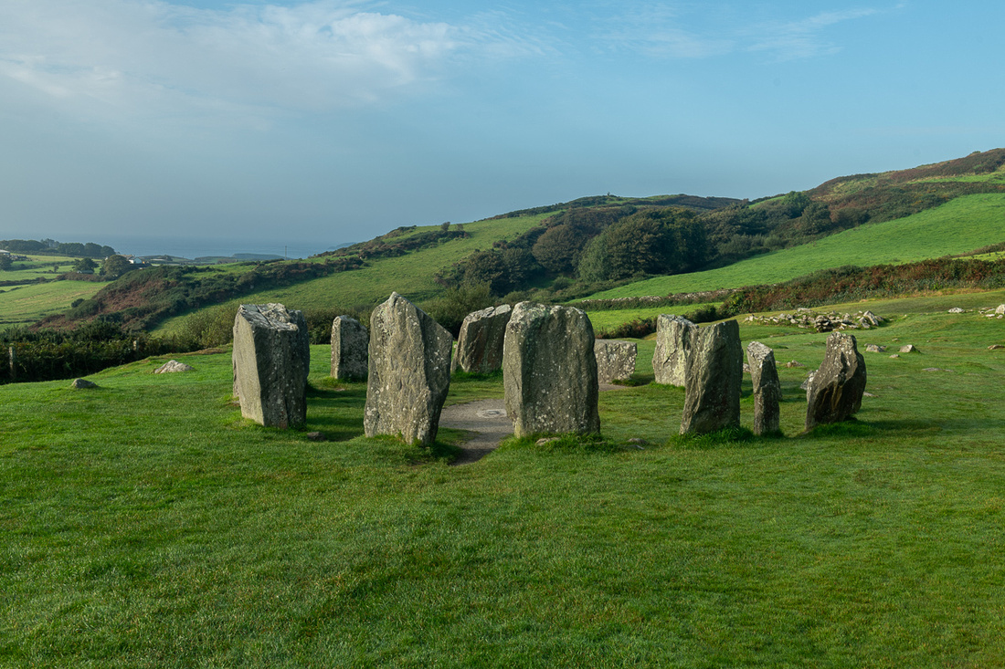
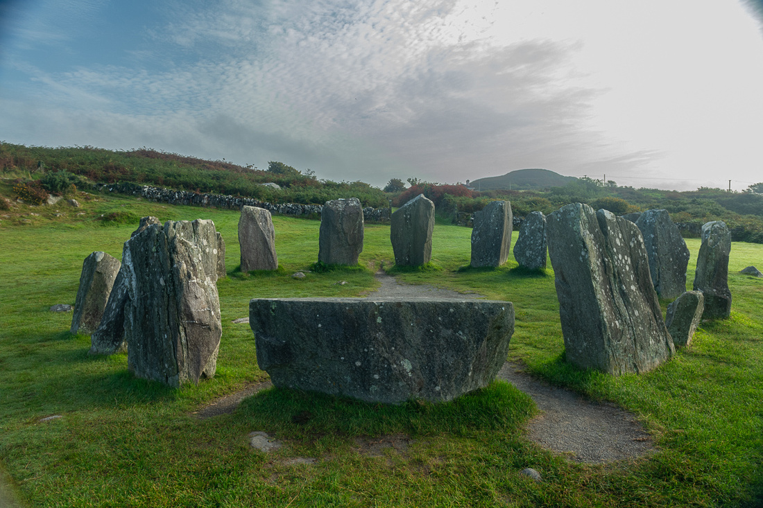
The other benefit of the route we chose was the Drombeg stone circle. There are at least ten of these that I know of along this southwest Irish coast. This one is fully intact and beautifully sited on a flat spot overlooking a valley.
We then worked our way up to Bantry and stopped for tea. Bantry is one of the spots that claim to be the departure point of St. Brendan on his transatlantic voyage.
Then around the end of Bantry Bay and onto the Beara Peninsula. Going onto Beara one sees immediately that he has entered the wild and wooly part of Ireland. Wild because the terrain is largely untouched by the hand of man. The rocks are just too big to move and if you do you simply uncover more rocks. And wooly because the only thing the land is good for is grazing sheep and goats. This extends west through large swaths of counties Kerry and Clare.
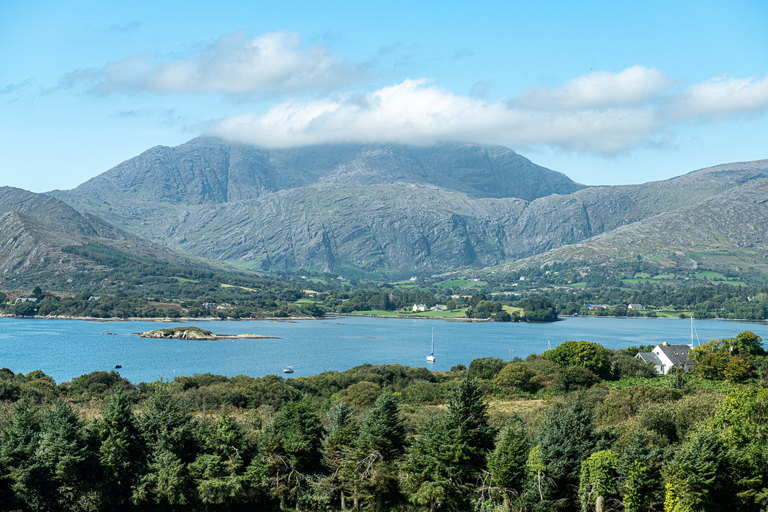
The mountain below is Hungry Hill which has had that name since before the Famine but I don't know why. We are looking across Bantry Bay.
We had a lovely lunch at a little craft and sandwich shop and had to make a decision about the rest of our day. I had a couple of places I really wanted to photograph near the tip of Beara but they would be sunset shots and it was still early afternoon. So we decided to go over the Healy Pass to our accommodations in Kenmare and try to get back down Beara on one of our four nights in that spot. At the top of the Pass we entered Co Kerry and would be there seven days, between Kenmare and Dingle.
Jeanne Marie chronicles our crossing of Healey Pass
Above is Glanmore Lake, just below Healy Pass. Very typical of County Kerry.
By the time we got settled into our quarters, just a three minute walk from Kenmare’s main street, it was late enough that we would have to pick a subject for sunset that was close by. So we headed over to Ross Castle in Killarney National Park.
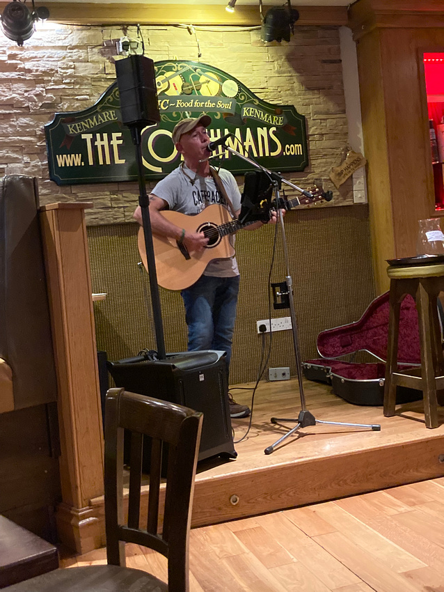
We got back in time for some music, banoffee pie, and a pint. The musician is Frank O'Sullivan and he was good.
Ireland, as one would expect, has lots of lighthouses but the really good candidates for photography are rather few. They require a fairly serious expedition, as they are stuck out on these long peninsulas, or actually on islands, with a mix of public and private land, so extensive scouting is needed to get the best angle. And some have not reopened to the public since the covid lockdowns.
We drove the coast road which took us along the undulating coastline of West Cork, as it is called. The tide was out so the vast tidal flats were on show.
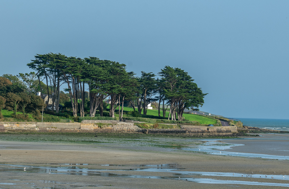 Here's an interesting stand of trees at low tide.
We arrived in plenty of time to find the best locations and while we waited for the golden hour I got a few shots from the cliffs.
As the sun was going down a thin overcast formed on the western horizon which diffused the light and color quite a bit but we did eke out a little bit of warm light. I guess the final result was worthwhile.
Next day the main plan was to go into Cobh and photograph St. Colman Cathedral but I knew I wanted afternoon light for that so we scouted up a little beach that had some interesting structure on it. We headed out at a civilized hour and let Gladys navigate. That's Gladys P. Smith, AKA GPS. She took us to this little cove which had no beach but was kind of interesting anyway.
We gave her another chance to find Rocky Bay beach and this time she succeeded. It was a nice beach but it was high tide so no unusual structure. I was finally figuring out how close you have to watch the tides on these coastal shots. One more thing to juggle along with the light and the weather. The pictures came out okay. Might make good black & whites.
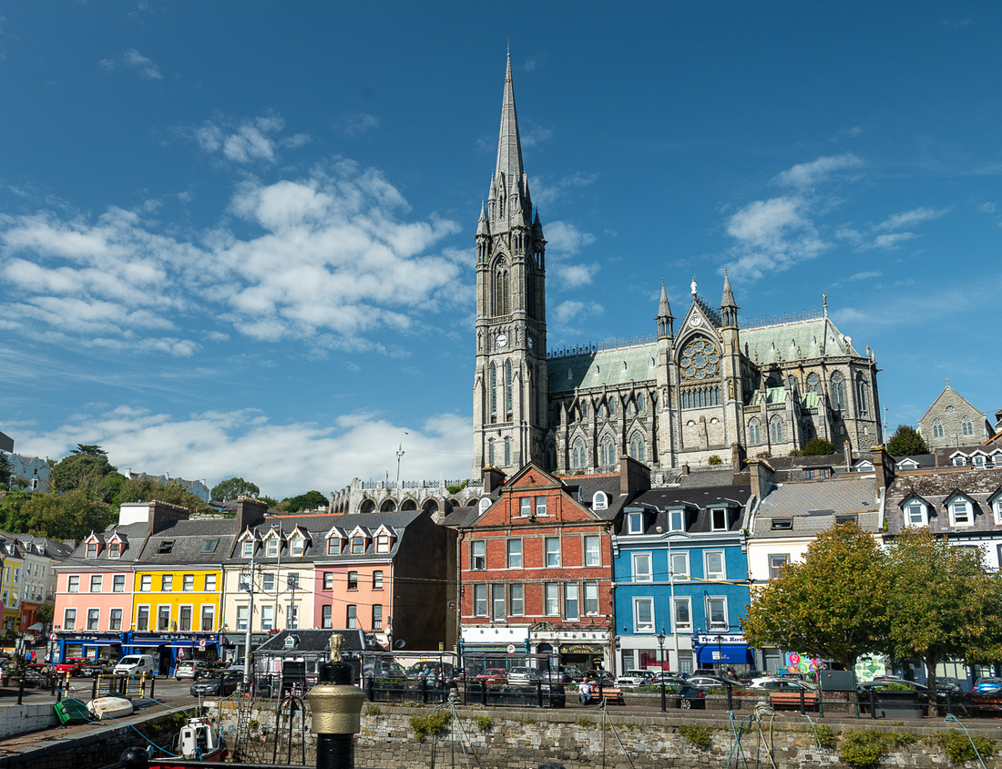
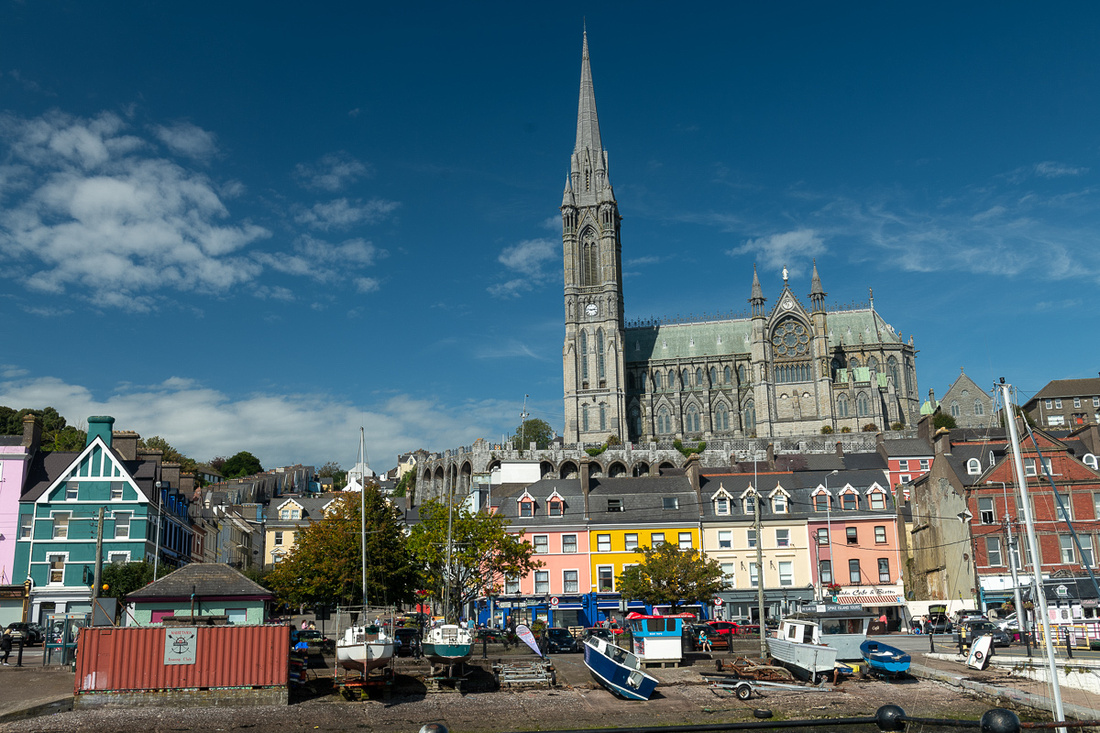
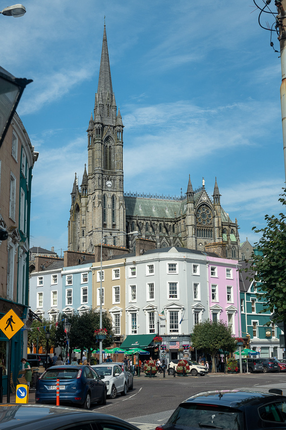
Cobh is the port town for the city of Cork. Many ships made their last European call here before crossing the Atlantic and by the late 19th century it was the primary embarkation point for those emigrating from Ireland. The most famous ship to stop here during this period was the RMS Titanic, just before heading out to her doom. 120 Irish emigrants boarded her at Cobh.
Cobh must have been a prosperous town to have built a cathedral this impressive. It commands the entire skyline and the view of the harbor and it has 49 bells in the steeple.
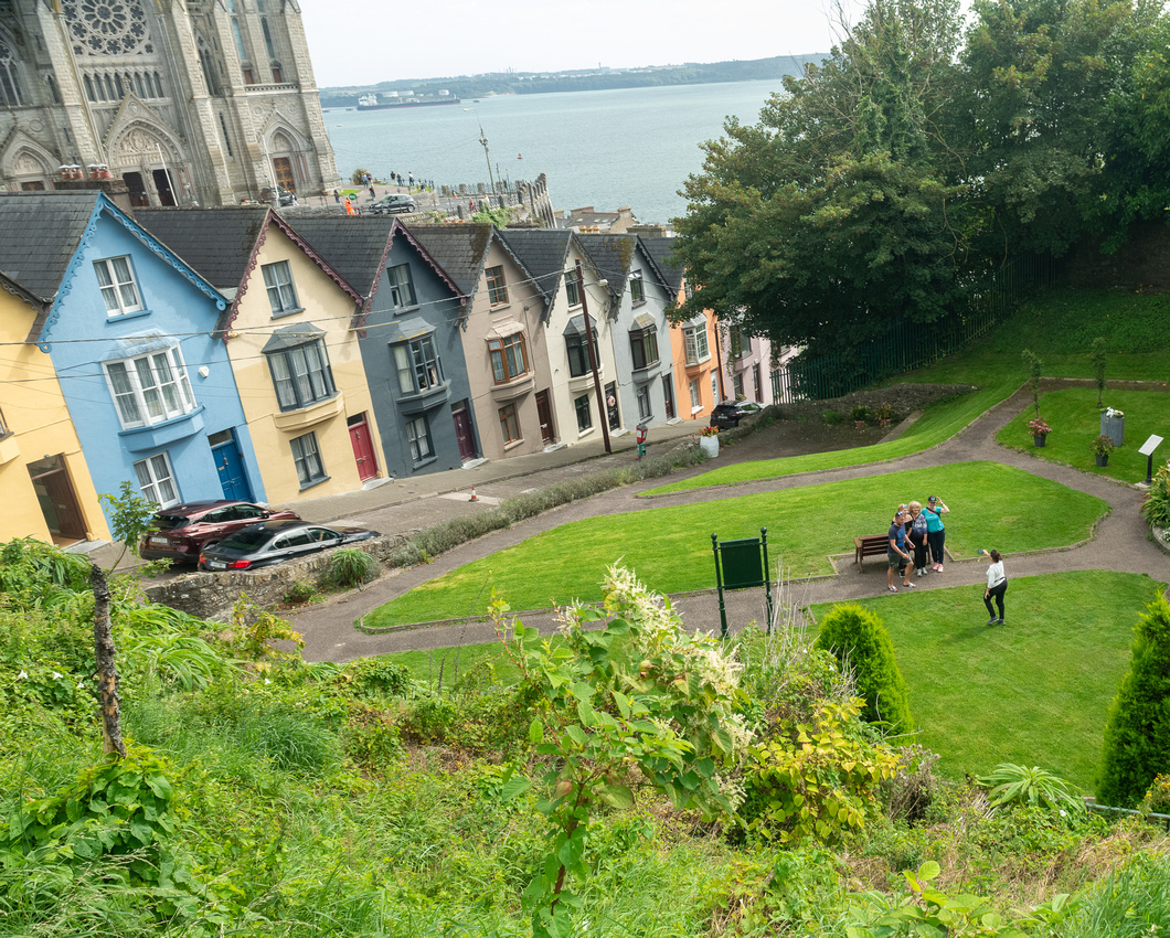
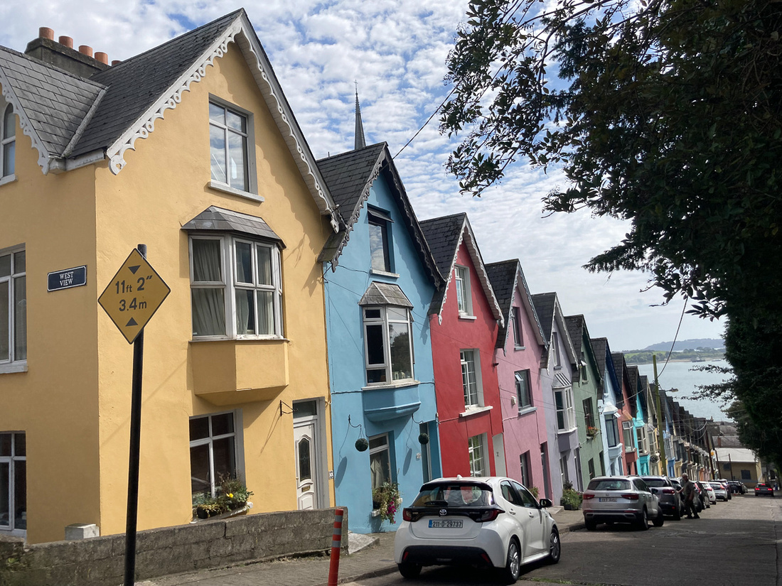
Below is the iconic shot of St. Colmans behind the “Deck of Cards”, the nickname of the row of houses in front.
Ever wonder what Jeanne Marie does while waiting for me to take a picture?
 I'm trying to get her to charge for this service. At $1 a person she could easily make more money in photography than I do.
Below is JM's shot of the Deck of Cards.
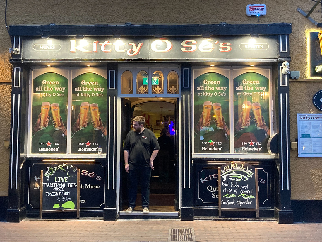
 And Kitty O'Shea's was our Kinsale hangout.
Tomorrow we head for County Kerry where we spend the next seven days.
]]>
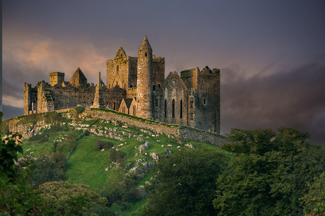
The Above is the view from the Abbey, which appeared to be infested with Little People. They were everywhere you looked

Next morning the sunrise was decent enough to get some color and it would prove to be the best we would get on the trip. I’ve noticed on my various photo expeditions to Ireland that epic sunrises are hard to come by. The clouds seem to form up before dawn and obscure the horizon, not burning off until an hour or so after sunrise. The Abbey had pretty good light too. And the cows came home.
 The Abby grounds are a popular place for dog walking. We met Caesar, an American Bulldog, taking his man on their morning jaunt.
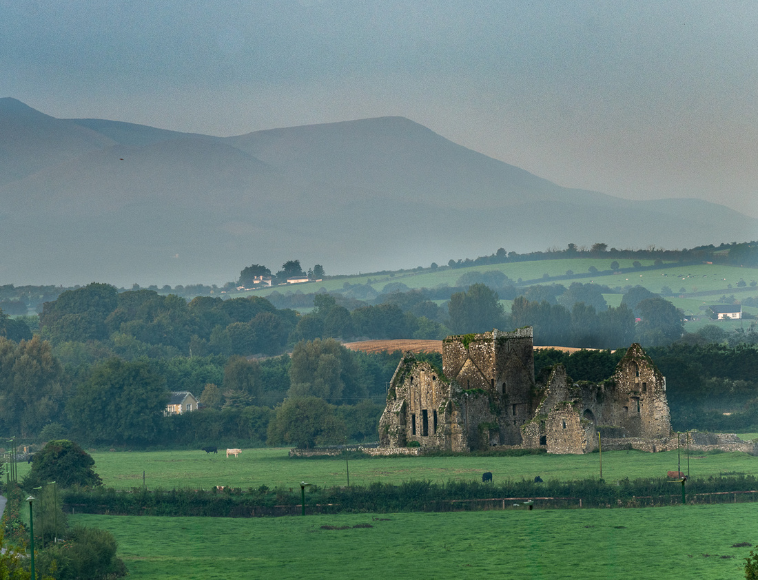
Once the sun was high it was time to head south. Just ouside of Cashel was the village of Golden. It has a cool bridge and the ruins of a guard tower. I’d never seen this place mentioned in my research. A fine example of the kind of thing one stumbles across in Ireland all the time.
Kinsale, in County Cork, would be our destination for the night but we decided to go by way of Castle Cahir, just before leaving Co Tipperary. It was worth the stop. It is a major Norman castle built on an island in the River Suir and it is right in town. We had lunch in a lovely café just across the road.
Then on to Kinsale and Galley Head Lighthouse.
]]>
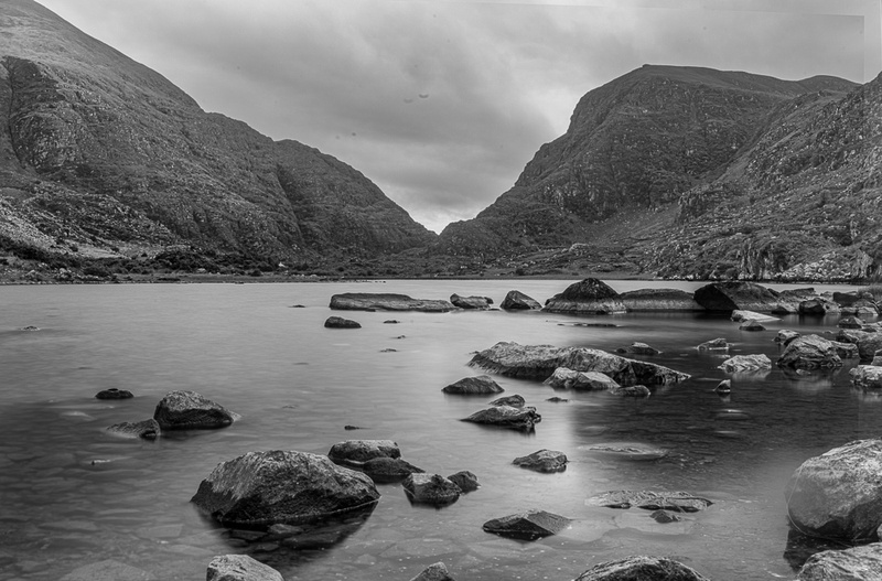
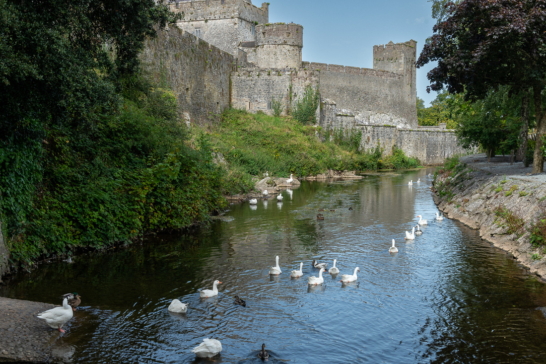
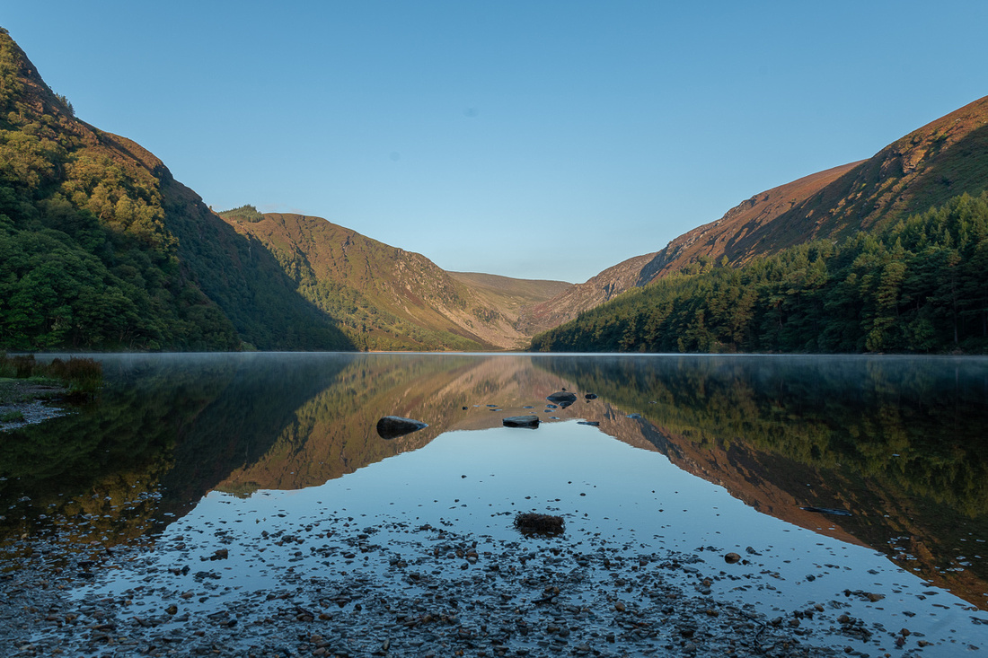
The upper lake was a perfect mirror so I did make a few exposures.
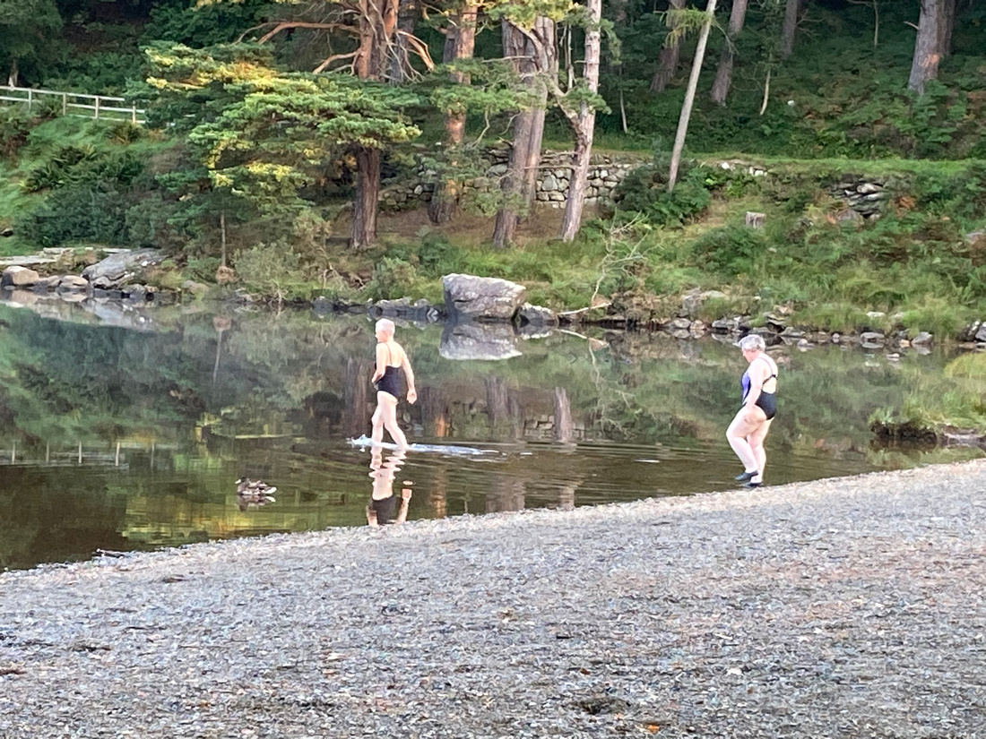
And as if to leave no doubt that we were not in Kansas anymore, just as we were leaving the upper lake to go down to the monastery, two ladies walked out, dropped their robes down to their bathing suits, and waded right in up to their necks. The air temp was 52 degrees.
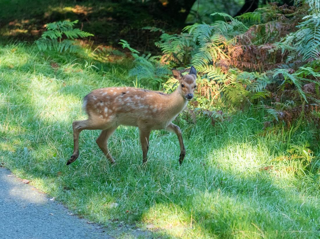
On the way down to the monastery a herd of deer crossed our path.
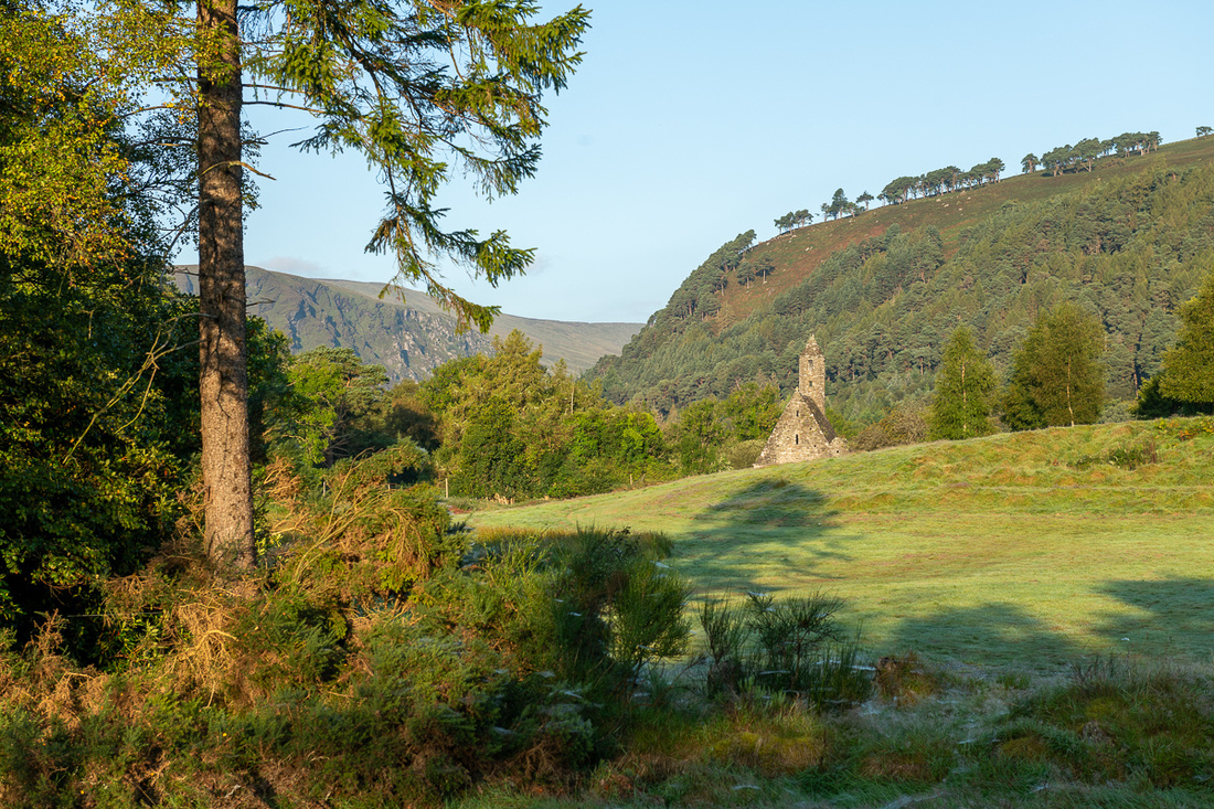
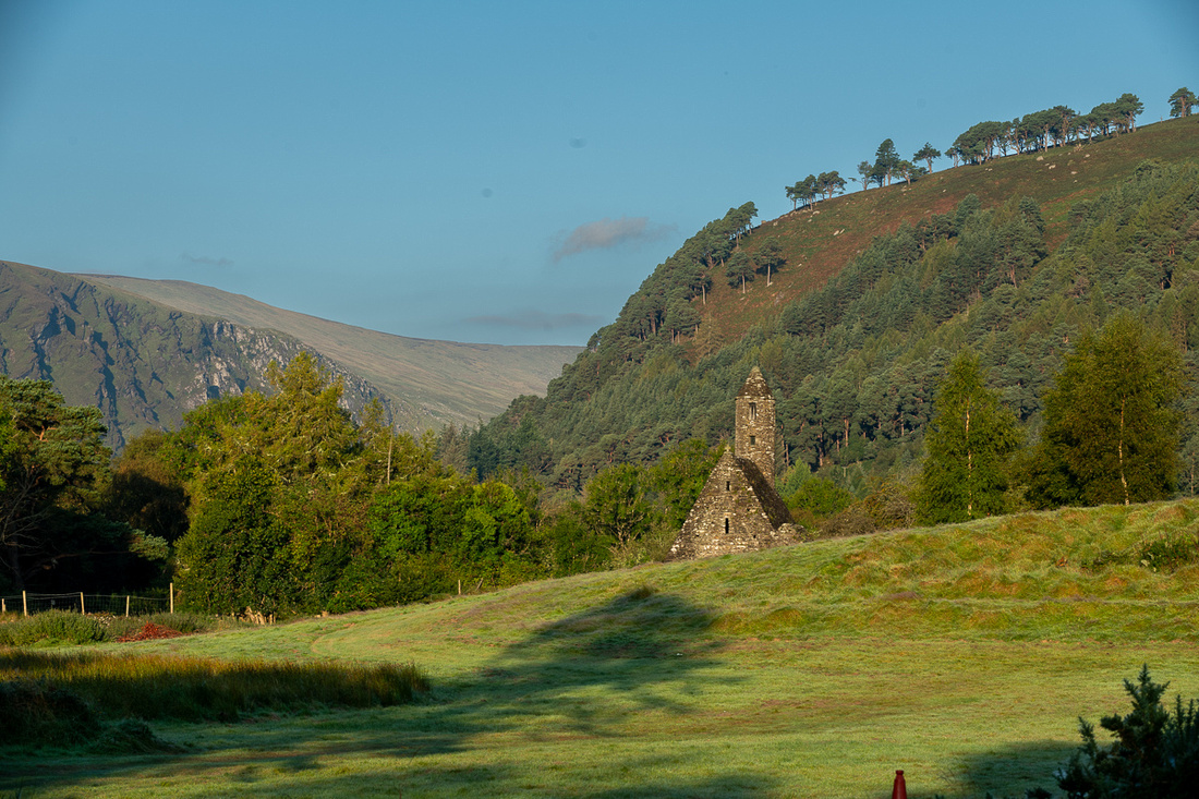
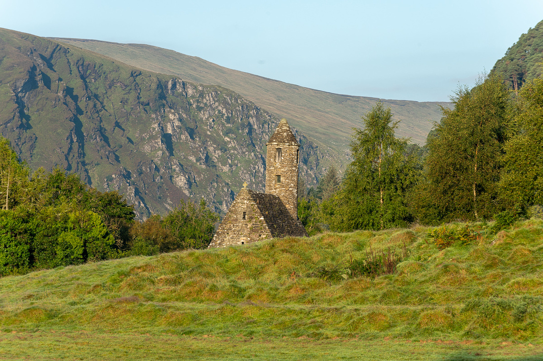
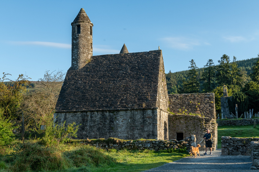
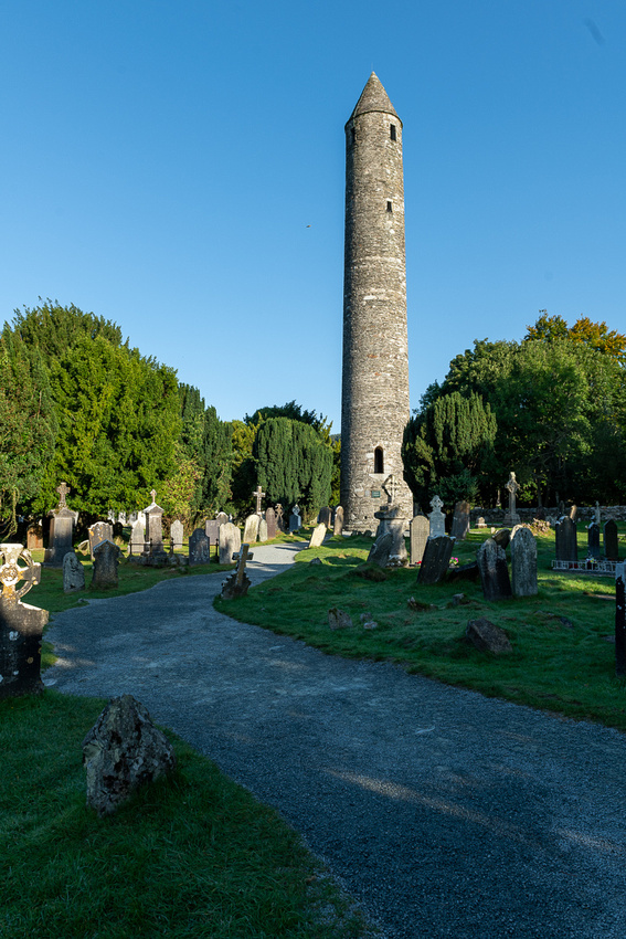
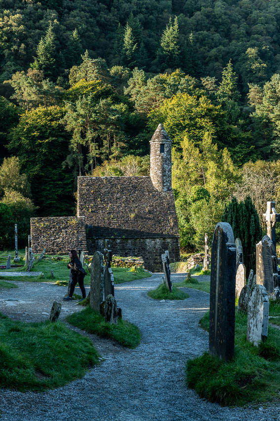
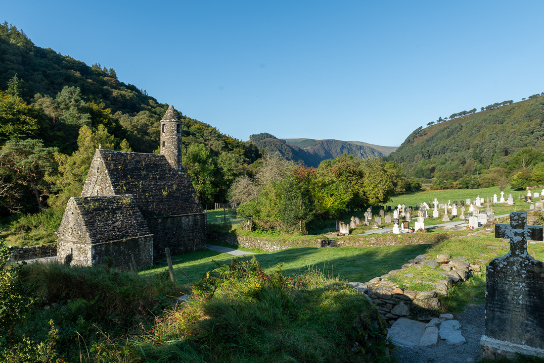
I know the shots I’m posting look like the ones from the last four trips but I love shooting here. And we didn’t really have time to look for new compositions. There were certainly fewer people to worry about shooting around. By 10 we were on our way through the Wicklow Mountains to Cashel where we would spend our first night.
]]>
]]>
As we walked to the train station every church bell in Edinburgh began to ring. We knew this was for the Queen but it was a peel I had not heard before, neither joyful nor was it a funeral dirge. Presently they stopped for several seconds and then started again, same melody. This pattern continued until we got on the train to Uphall. We learned later that it was repeated 96 times, once for every year of her life. Al and Pam picked us up at the train station and we went to their house to watch the last 30 minutes of the funeral. At the very end was the two minutes of silence. The station we were watching had cameras all over the UK and the Commonwealth. This was a very moving thing to see. Large crowds of people all over the world, standing in silent tribute to a great woman.
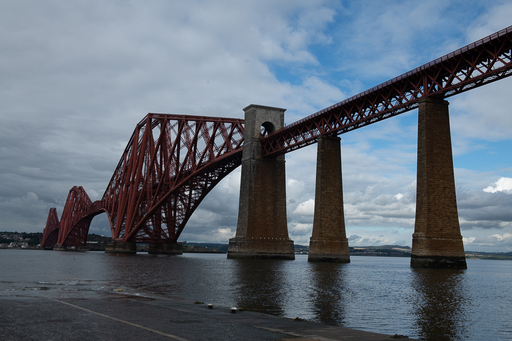
We then watched several segments of a documentary about the building of the Forth Road bridge in the early 60s. It is quite an engineering triumph and is the fourth longest suspension bridge in the world. That's why they call it the Forth Bridge. I think. Not sure about that. It makes sense though, doesn't it? So when we were planning the day Al mentioned that we would be seeing this bridge and that his older brother Hector "had worked on it". When we watched the documentary though it became clear that he worked on it as in "built it". Hector was one of two engineers who were on the site throughout, directing the construction. He was extensively featured in the documentary. The link below is either a shortened version of the film we saw or they used the same archival footage. It all looks familiar. No Hector interviews though. And they also left out the snafus and near disasters. Still quite interesting.
https://www.youtube.com/watch?v=bCVWKZ6OxLQ
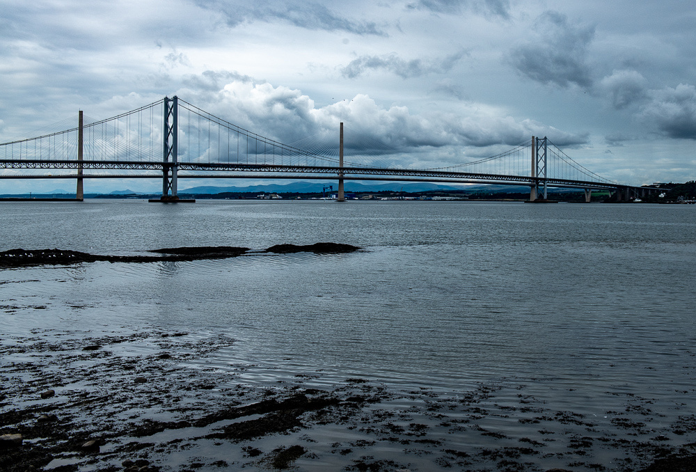
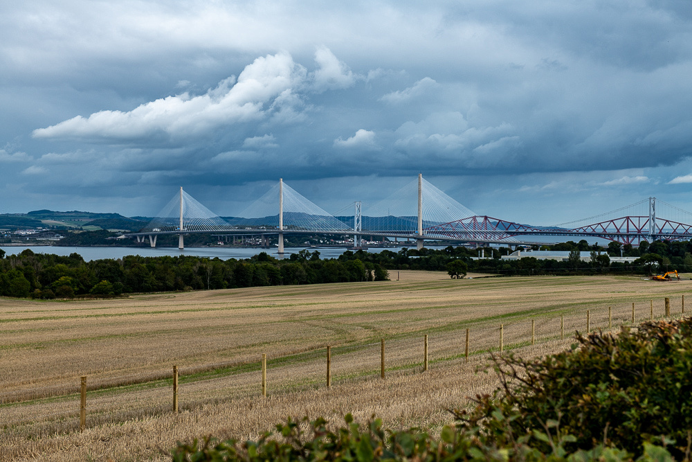
We were observing this from the village of Queensferry which was the site of the main ferry crossing for many centuries. Also here is the iconic Firth of Forth railroad bridge which was built in the 1890s. It also was an engineering marvel when it was built.
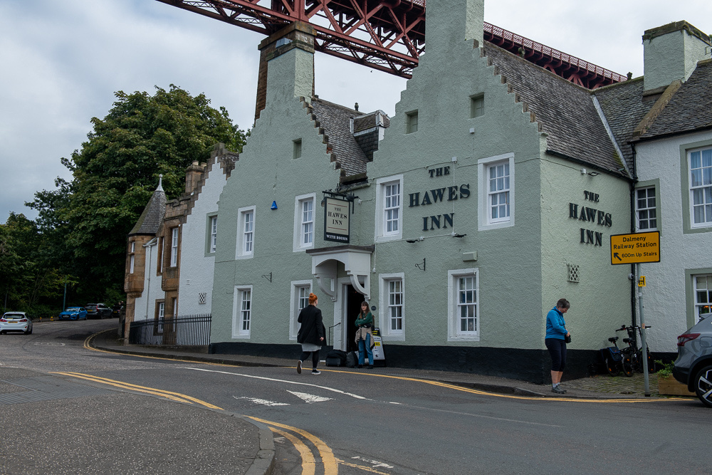
As I took this picture of the bridge, right behind me is the Hawes Inn. It is featured in Robert Louis Stephenson's book, "Kidnapped". In the book this is where the protagonist, David Balfour is actually abducted.
We scouted around the area and checked out the old canal that connected the river Forth to the Clyde which flows to Glasgow on the west side of the island. These canal boats are now pleasure craft.
Another place we visited was Houstoun House and Gardens, just a short walk from their house. Going back to the early 1600s, it is now a guesthouse, restaurant, and event space.
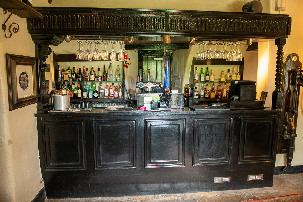
Everything is kept original including the bar.
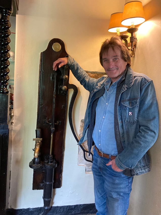
 And Al. He's definitely an original.
Sometime driving around we got this great view of the three Forth bridges. Not the three fourths bridge. That wouldn't be a whole bridge. You would fall in the water.
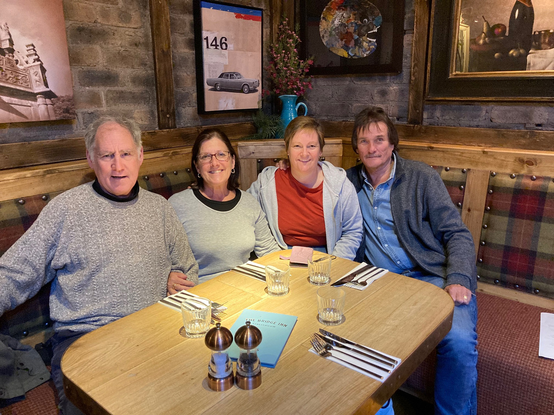
We then had a great lunch at The Bridge Inn in Linlithgow.
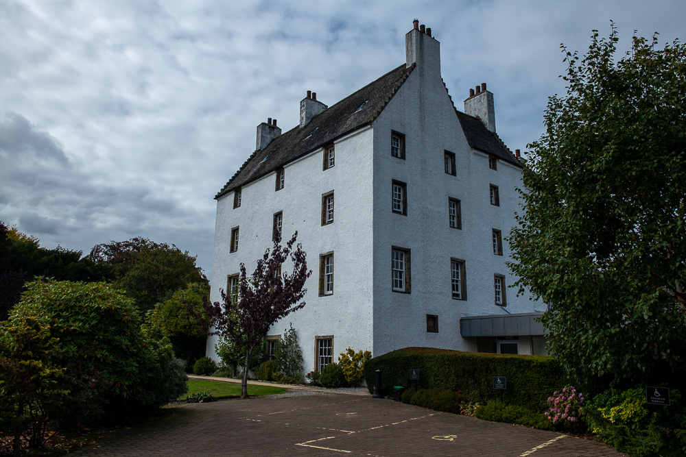
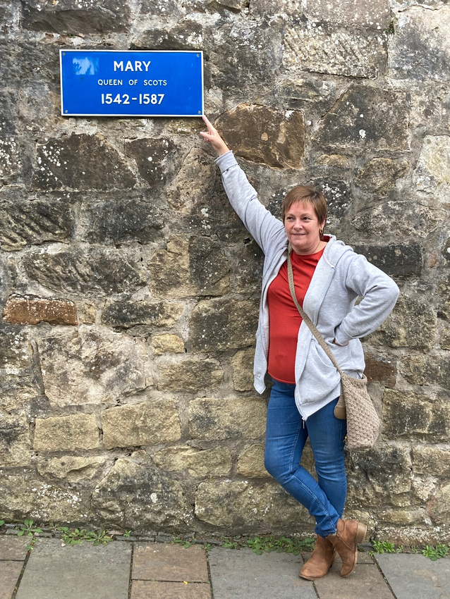
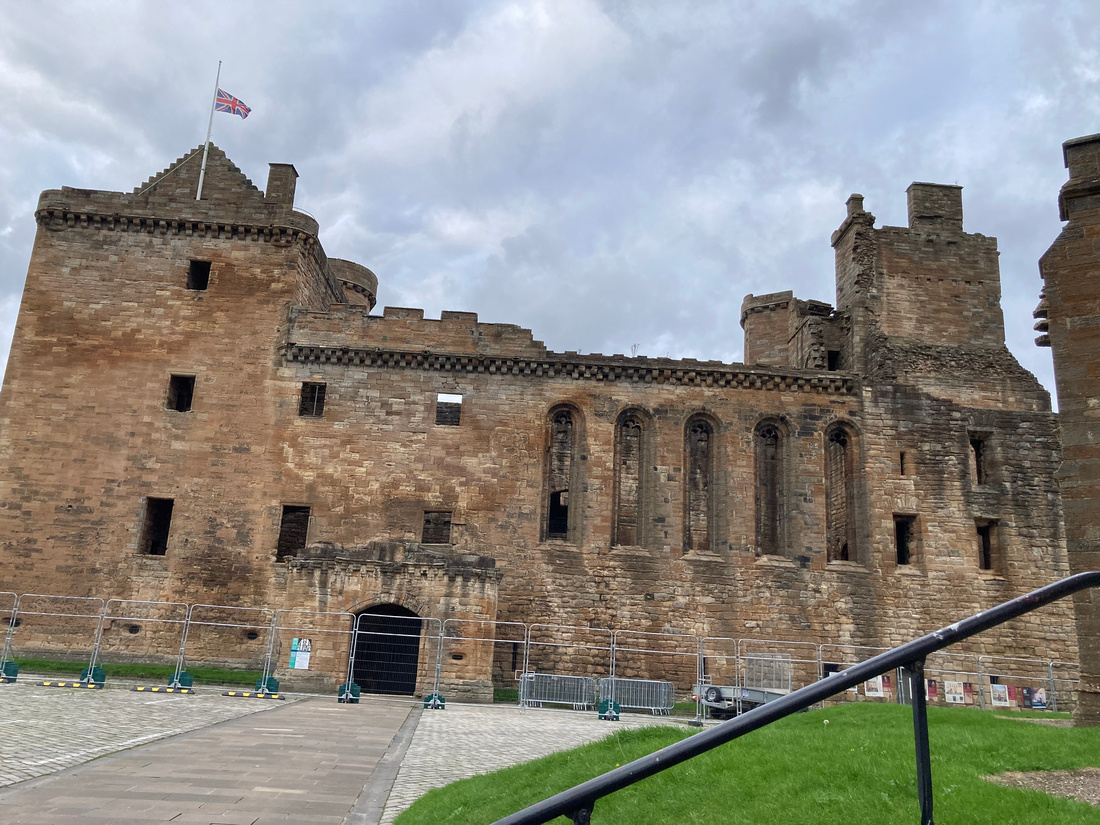
 After lunch we headed over to Linlithgow Palace, birthplace of Mary Queen of Scots. The palace was built by Mary's grandfather, James the IV, at the time that royal residences were morphing from fortresses into palaces. Still, it has very strong walls and originally, a drawbridge; however it is not really sited for defense but more for enjoyment of the countryside. Mary loved staying here. Leading up to the main gate there is a plaque on the wall for each Scottish monarch starting with Mary. Here is Pam with her favorite.
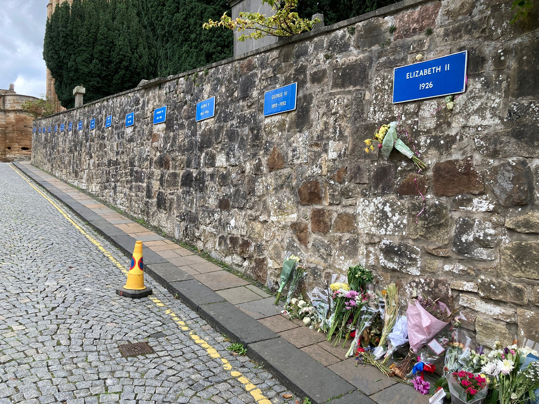
The little town of Linlithgow, Scotland pays its respects to the late Queen.
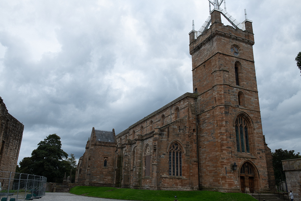
On the palace grounds was this impressive church.
The palace itself had scaffolding up and a metal barrier all around it so it didn't exactly scream, "Photograph me!" and everything was closed due to the funeral. Still all quite interesting. I had read a couple of biographies of Mary so seeing the place where so much of her story played out was very cool.
 We then walked back down to the town. Still full from lunch but maybe room for a wee dram. For once I didn't have to worry about driving. And look at what we found.
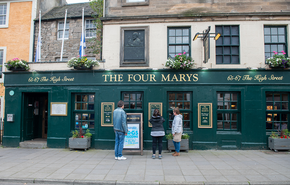
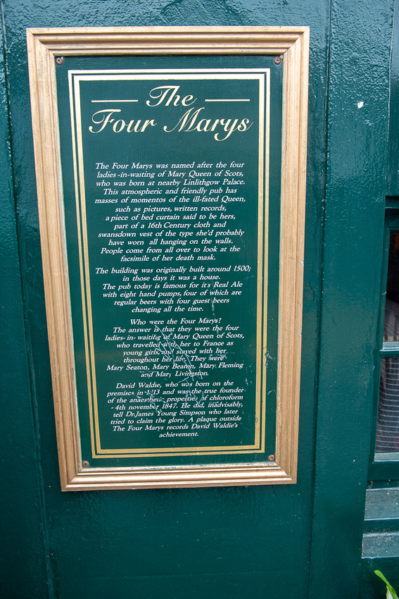
And these four Marys do not include the Queen herself!!
Then back to Pam and Al's for another wee dram, hey it's Scotland and again, I'm not driving! Then back to the train station. The day had been so full and yet too short. The train was coming as we pulled up so we had to rush our goodbyes. We sure hope to see them again in way less than 23 years!!
There are more Edinburgh and Uphall photos in the slide show at the end of the post.
Next day, Tuesday, we had the long drive back to London. Jeanne Marie had found us the perfect hotel for a short stay like we had.
 This is the look of a man who has cheated death again. Two weeks of driving all over England and Scotland on the wrong side of the road and is headed home in one piece.
]]>
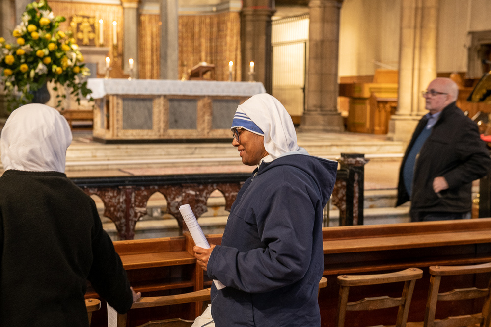
The church has a foundation of Sisters of Charity, Mother Tereasa's order.
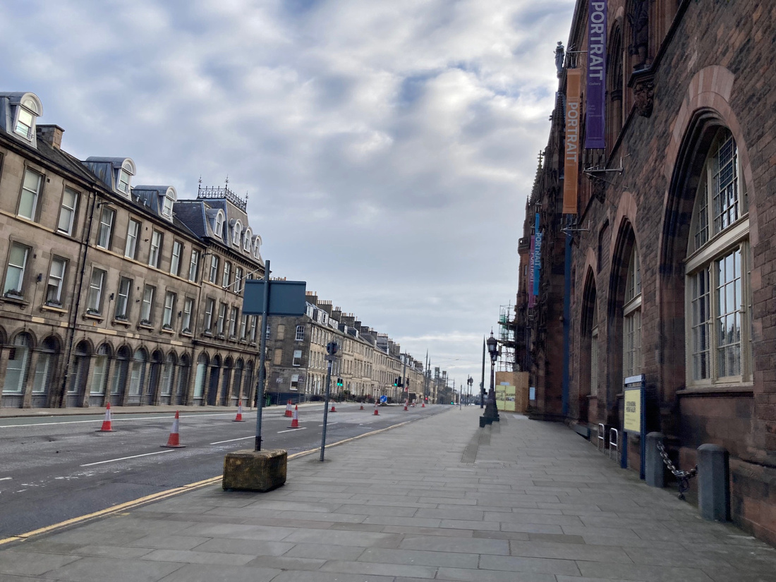
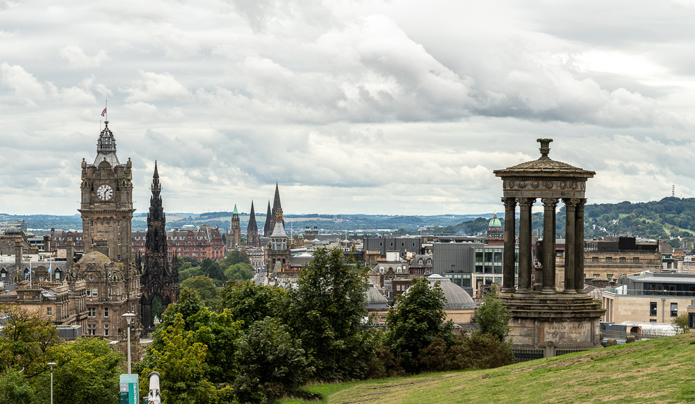
After Mass, being still Sunday morning and little traffic, we took the car out and tooled around to some of the sites. Unfortunately I didn't get very appealing light for pictures. Very flat. Below is the great view from Calton Hill.
 Many of the usual tourist spots were closed until after the Queen's funeral. Reminders of her passing were in every shop window.
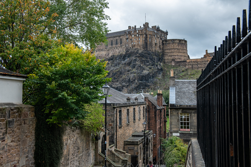
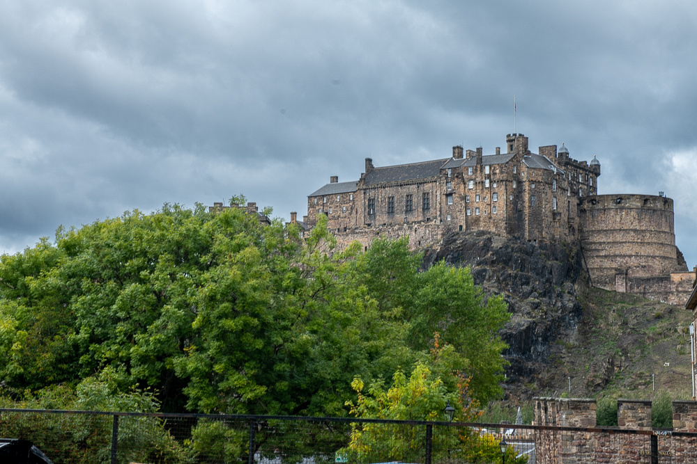
Below is Edinburgh Castle.
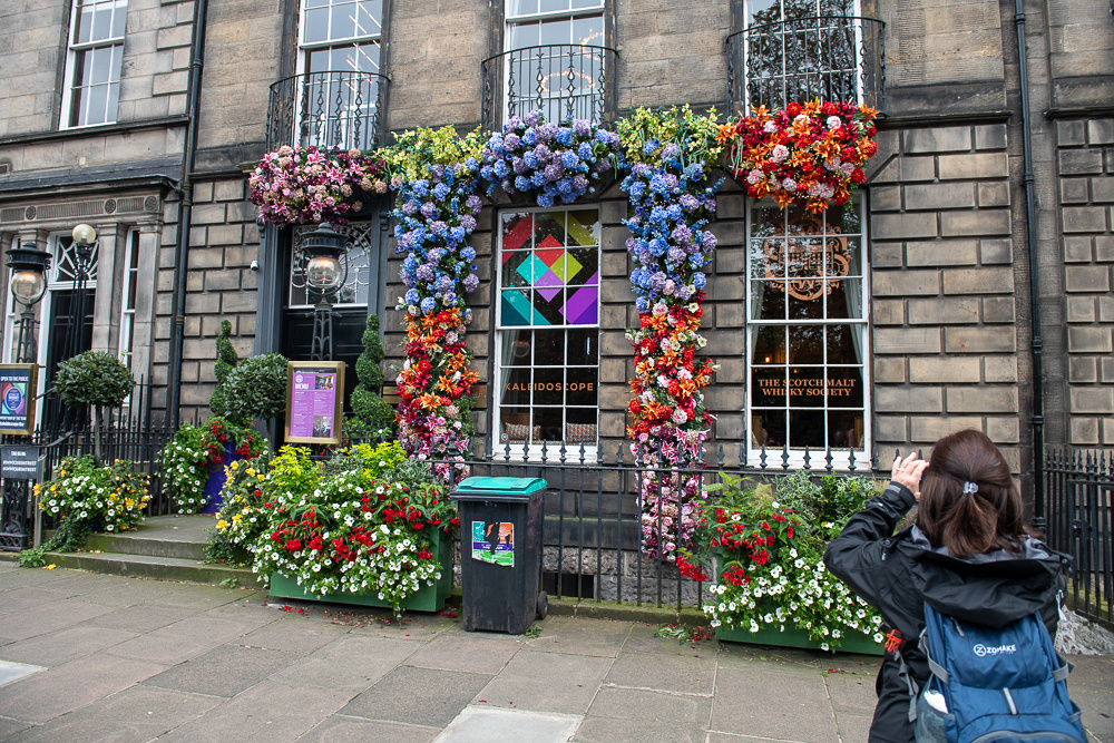
 Our hotel was strategically located within walking distance of everything of interest and just two doors from the Scotch Malt Whiskey Society.
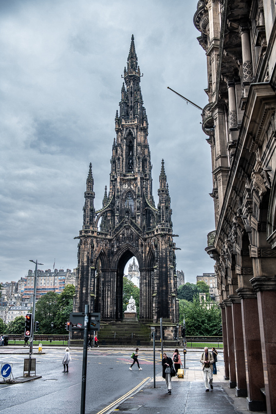
This is the Walter Scott Monument. I sure wish I could have had a little more definition to the light. It has great potential.
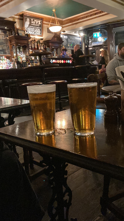
After the long week of marching through the Highlands we were looking for an easy low key day. We had an early dinner and a pint at a cozy pub.
Tomorrow we march through West Lothian.
]]>

We were also able to procure some information about the cows. Precisely where they hang out when they are not in town. Armed with new information we found them easily.

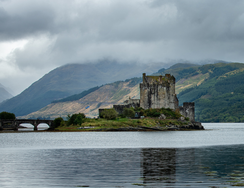
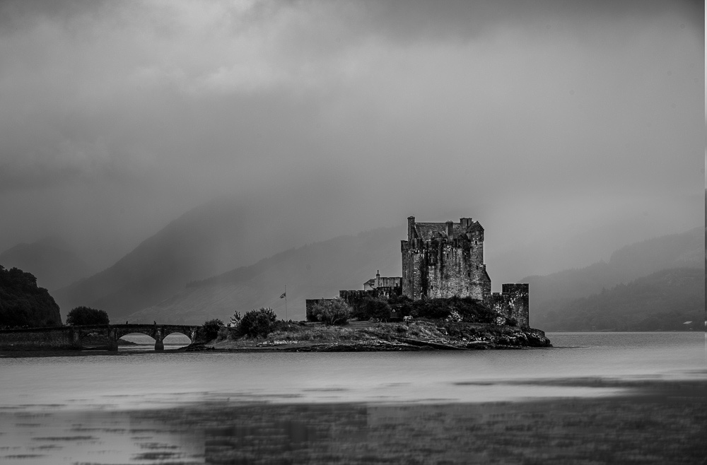
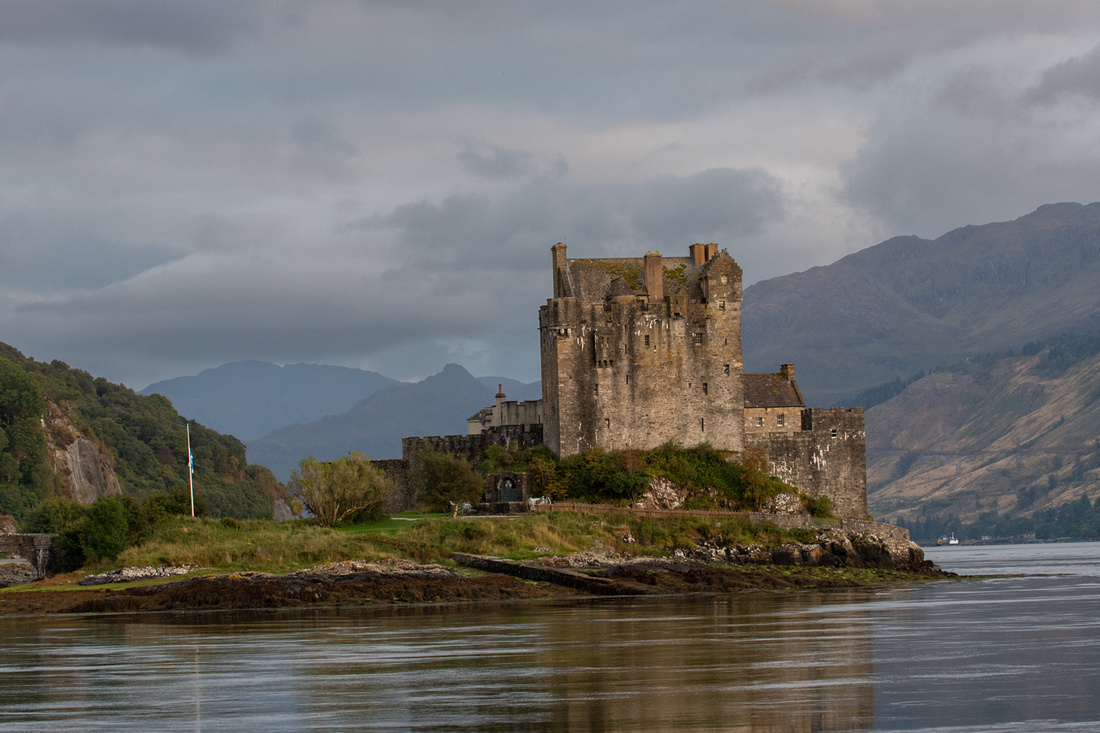
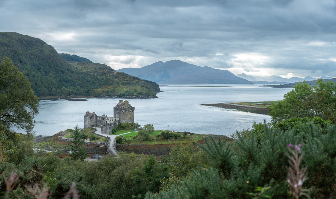
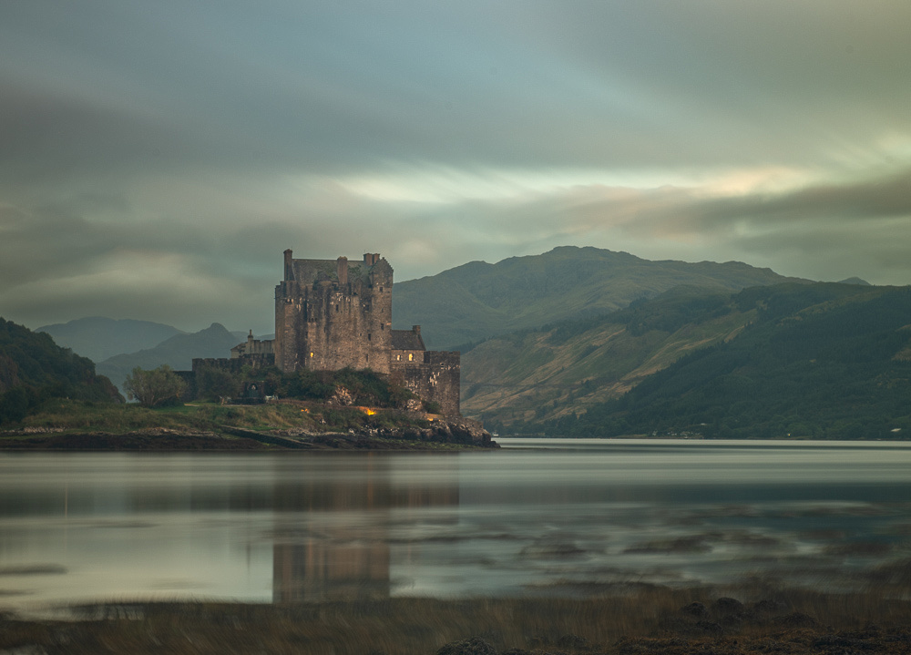
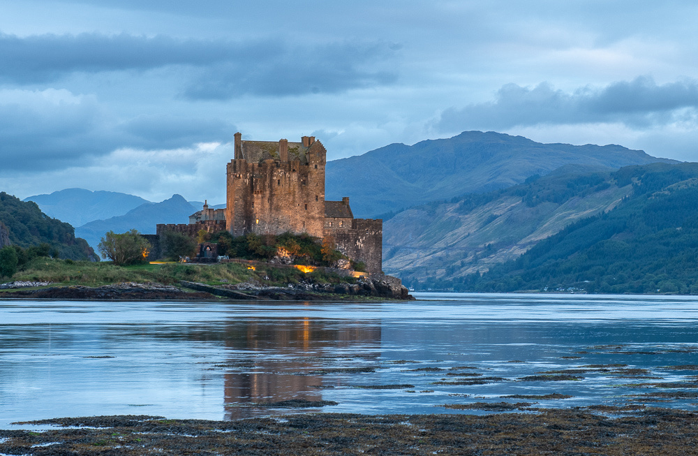
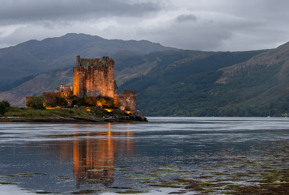
 It had been a drizzly morning since we left Skye and as we drove past Eilean Donan the mist was hugging the hillsides.
I couldn't resist stopping. A castle in the Scottish Highlands, the gloom hanging on the hilltops. I could almost see Macbeth pacing the battlements. Besides, the tide was right at its peak so the castle was fully surrounded by water. It only took a few minutes to get a couple of shots.
Then we had to get headed to Edinburgh. We cut through the Highlands basically due east to pick up the A9 south. We had the hardest rain of the trip on this leg but the weather did clear as we drove south, and we arrived at Al and Pam's, just outside Edinburgh, about 3:30. Just in time for a great steak dinner. I had not seen the two of them since the eclipse cruise of 1999 and of course, Jeanne Marie had never met them. We were waaaaay overdue. Al was the toast of the ship on that cruise, as he waited for the "diamond ring" to appear on the eclipse, to pull a diamond ring out of his pocket and propose to Pam. Those Scots are soooo romantic as you know from reading Robert Burns. I'm kind of glad JM wasn't there. I couldn't have matched that!! And Pam accepted too!!
We would see Al and Pam again on Monday. Then we drove into Edinburgh and found our hotel.
]]>
We promptly came to a ravine that JM knew she shouldn't try to cross so I went ahead and staked out the first promising location I came to, and waited for the light.

Finally a break in the clouds passed over my scene and I got this.
With Jeanne Marie waiting and the sky still mostly overcast I decided to take my winnings and head back. It took longer that I expected because there was a lady stuck in the same ravine that JM had declined to attempt. The lady had to be pushed and pulled out. Jeanne Marie had chosen wisely.
We drove back down on the west side of the Quiraing to a nice little waterfall.
We rested awhile and I wanted to run up to photograph the old bridge at Sligachan. We had passed along side it several times and hadn't stopped yet so I needed to grab my chance. The sky was overcast and foggy when I left the B&B so I was preparing for that kind of shoot.
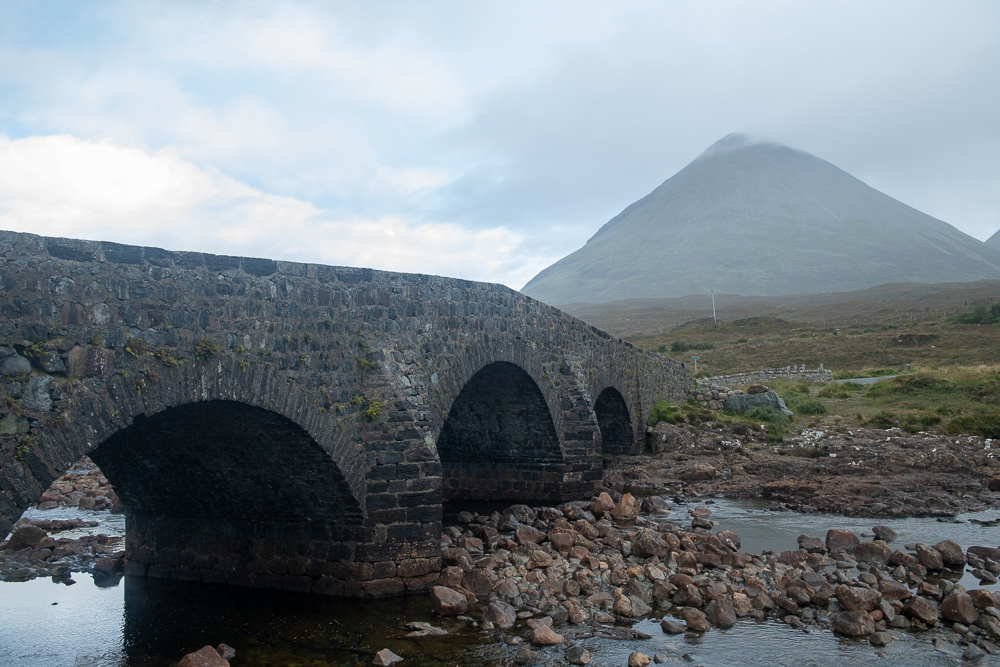 But I no sooner got started than the clouds blew away and it was clear blue. I still got this though.
So the sunset location would be the village of Elgol on the southwest corner of Skye. Another single track road but quite scenic.
 We arrived at the car park at Elgol and as we climbed out of the car were greeted with this.
The photo opportunities were mainly along a very rocky beach, shooting across the water towards the mountains on the other side. JM, again choosing wisely, opted to stay off the rocks. They were quite treacherous.
Another day in Skye, another great photo opp. More day two in the slide show below.
]]>
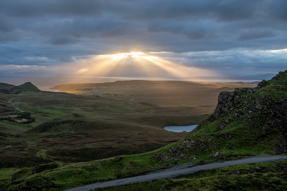
Although the sun was up by this point and we were behind schedule we were not penalized because a heavy bank of clouds on the eastern horizon left the light quite flat. It was clear overhead though so I got this of The Old Man and the third quarter moon.
Below is the conventional iconic viewpoint for photographing the Old Man. You can see that the light is still a little flat.

I wasn't lingering here anyway. My scouts had told me to keep climbing. I had to scramble up the backside of a pretty big hill, out of view of the Old Man. Just as I reached the top and walked onto the flat, the sun burst out of the clouds and this was the scene below me.
And that, boys and girls, is what gets a landscape photographer out of bed at 4 in the morning. I didn't actually stay long. The wind was trying to blow me off the mountain and Jeanne Marie would be wondering. Besides, the spot I was on was quite small so there wasn't much to do with the composition except zoom in and out. I put a few more from this spot in the slide show.
Going back down I got a better shot of the "conventional" viewpoint.
 Jeanne Marie was feeling triumphant, having made it up to the Old Man itself. Her knees aren't so bad after all! I think maybe she could carry a little more camera gear!
We headed back down to the village of Portree for breakfast.

After our early up and long climb we rested for awhile at the B&B. No more hiking but we would be driving across the island for sunset.
And we continued to see reminders of the Queen's passing. This was on the road back from Storr.
Neist Point Lighthouse was the next objective. Jeanne Marie scouted up a pub which was more or less on the way for some good fish & chips.
The scenery on Skye is so terrific that views we would stop and gawk at for an hour are passed without mention. I debated whether to stop and take the image below. It was just sooo routine.
 Most of the road to the pub and the lighthouse was a single track, that is, one lane, so we allowed extra time. But we met very few cars so we arrived at Neist Point over an hour before sunset. The sky showed great promise but our great enemy was once again the wind. At least 30 knots. I couldn't let go of the tripod for a second. I thought the images were worth the trip though.
 The above was the last usable light we got. I was not looking forward to driving the one track road in the dark but it actually was easier. The oncoming car's headlights could be seen further and around corners. And that was our first day on Skye. Slide show with more pictures below.
]]>
Whilst waiting for the light to improve I caught this little tree just begging to have its picture taken.
The clouds played peek a boo with the sun all afternoon so the light kept changing. It actually tried to clear off completely for a few minutes but then the overcast moved back in. Typical Scottish weather.
 Now I know you have only read this far because you are desperate to know the answer to the "What's this Mean" puzzle. Remember? Caution: Heavy Plant Crossing? So the Brits use the term "plant" to mean anything of the flora world. Like we do. They also use it to mean an industrial site where stuff is made. Like we do. But in their usage, the "plant" can be rather temporary. I've never heard it used this way on the west side of the Atlantic. But there were some remnants of some construction near the sign. So I guess it was that kind of plant. We breathed much easier. Thanks to the Saints we had Victoria available to interpret for us. I had a vision of us tipping our fly whilst desperately dodging the heavy plant crossing the road. We worried needlessly. It all worked out.
Now, on to the Isle of Skye!
]]>
We explored around a bit. Found a nice waterfall, and then headed down the glen.
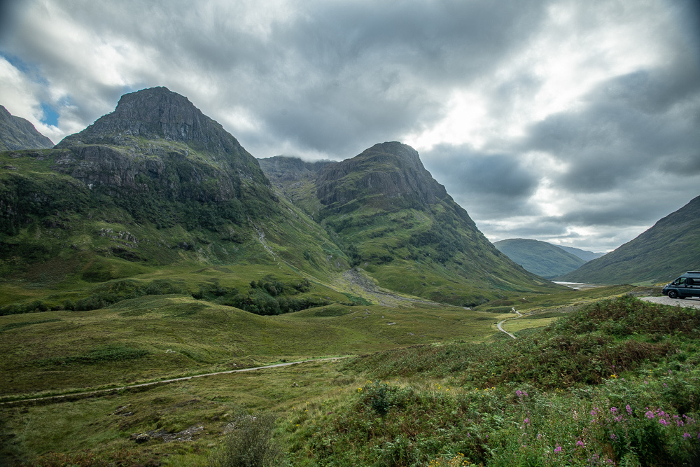
 Glencoe is a narrow river valley that just says "Scotland". The viewpoints are either right on the road or a modest climb.
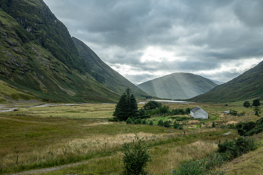
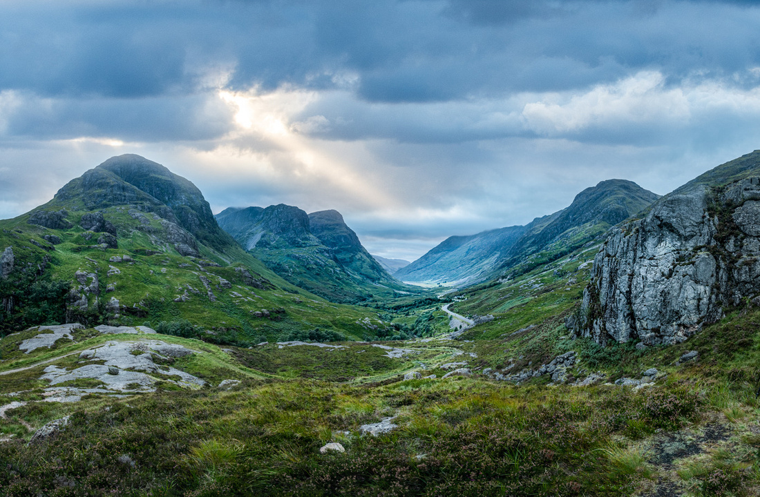
After driving through Glencoe we headed up to Ft. William for the night.
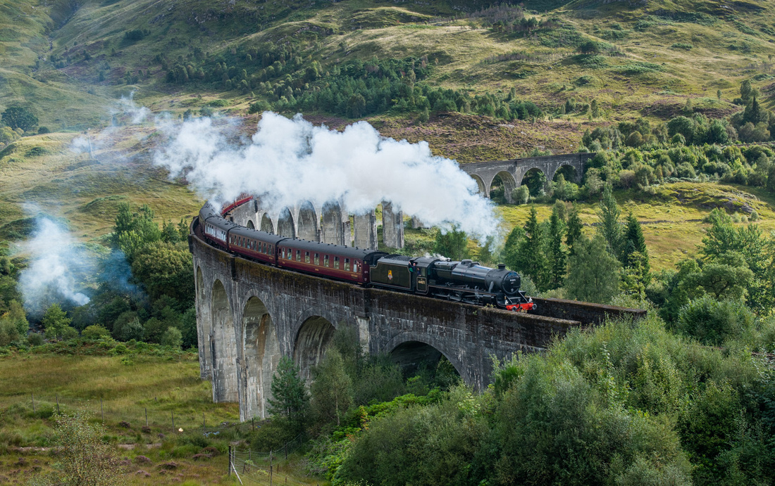
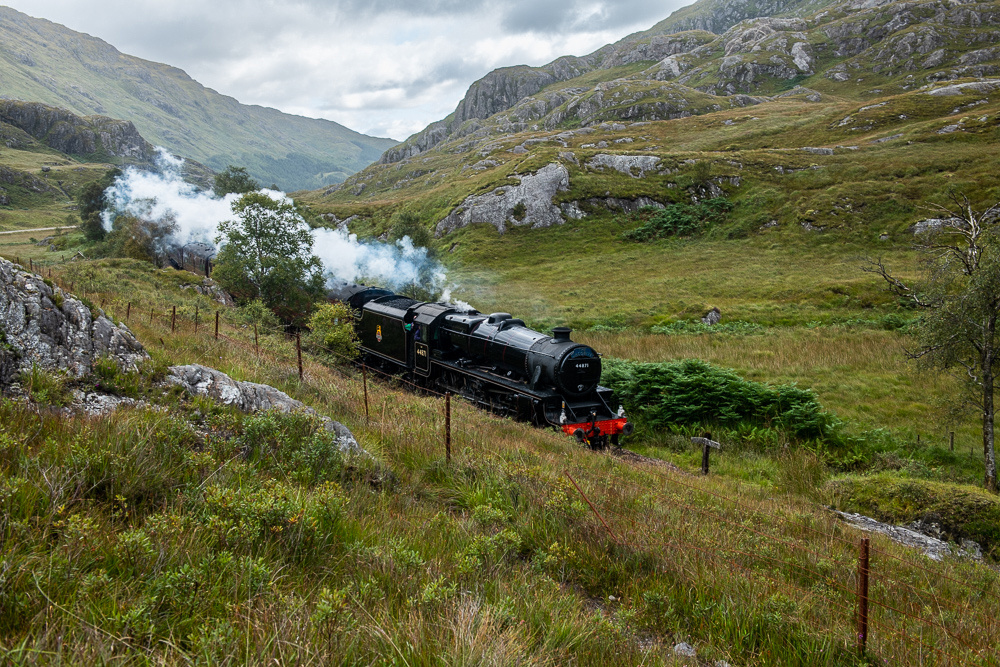
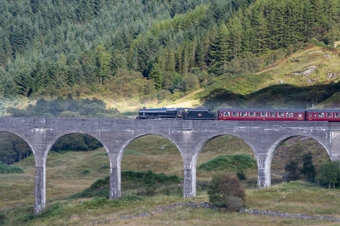
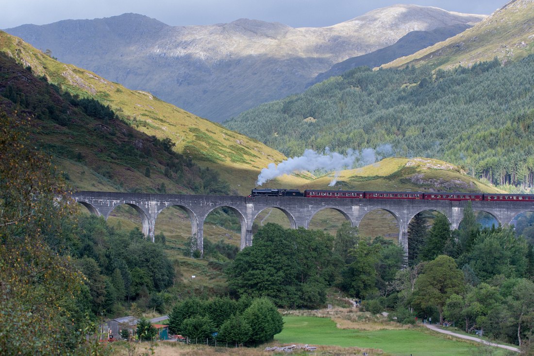
Next day we chased trains. The Jacobite Steam train runs from Ft. William to Mallaig on the west coast. It crosses a magnificent arched viaduct which of course, had to be photographed. If you're a Harry Potter fan this scene was used in the movie as the Hogwarts Express.
The train stops in Glenfinnan which gave us a chance to leapfrog ahead of it and get another picture coming through a little valley.
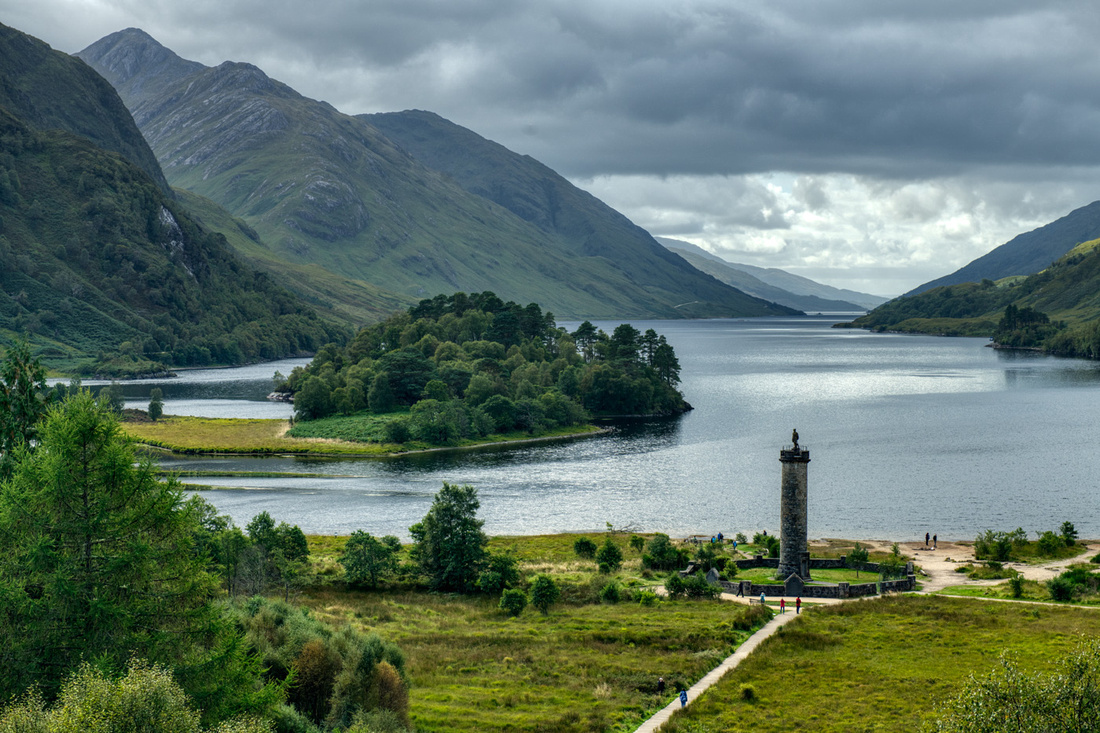
Glenfinnan is the spot where in 1745 The Young Pretender, Bonnie Prince Charles, raised his standard in the last Scottish Rebellion. A monument was put up at the head of Loch Shiel. This is the view from the viaduct.
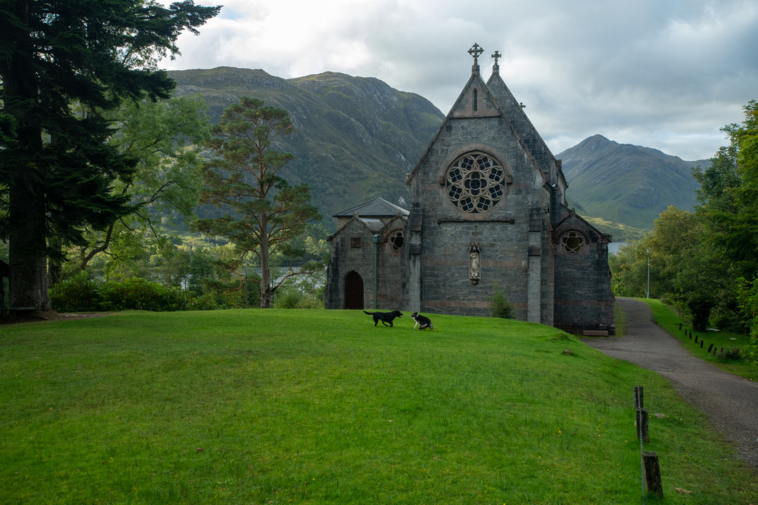
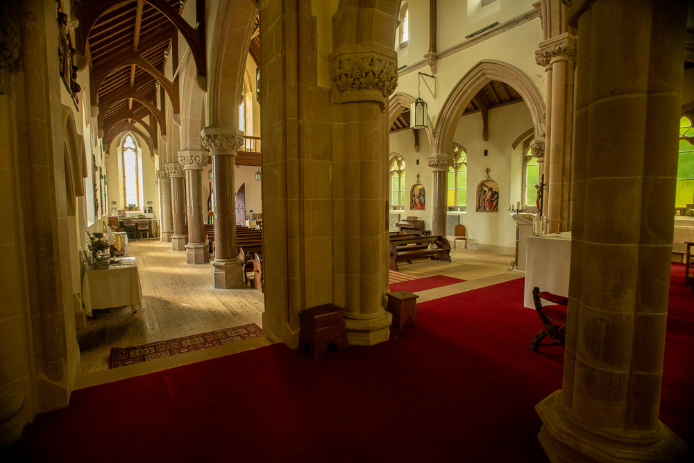
We found this sweet little church, St Mary & St. Finnan, just a short walk from the viaduct. It was built on a shelf overlooking Loch Shiel, in 1872. Queen Victoria visited it a few years later and wrote in her diary, "I thought I never saw a lovelier or more romantic spot, or one which told its history so well".
We then got to see the second train come by. This time we watched from near the parking lot so we could get back on the road quickly.
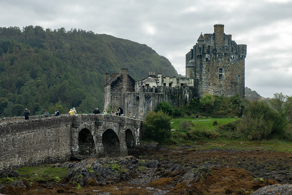
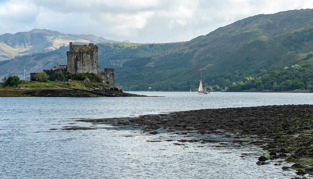
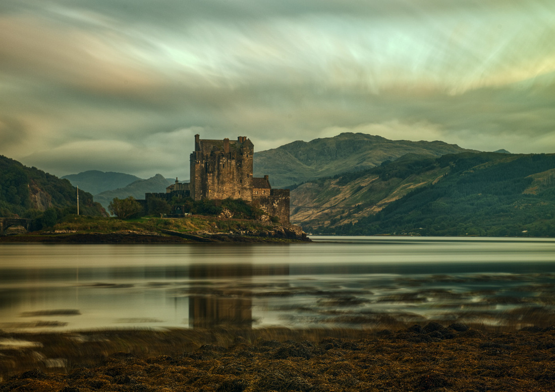
We had already had a good day but we were not finished. Just up the road is the great castle of Eilean Donan. But we will save that for the next post.
But we do get to play another round of "What's this mean". Here's the sign:
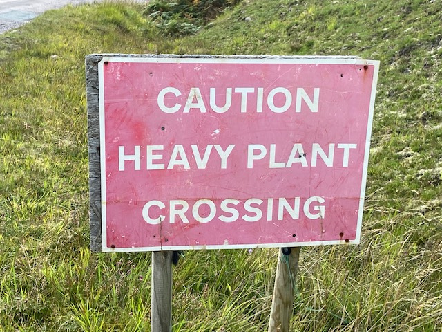
Please rest assured that we took great care at this crossing lest we collide with a heavy plant. The consequences of that would be dire.
]]>
Stayed in a charmingly rustic room that had been converted from a barn.
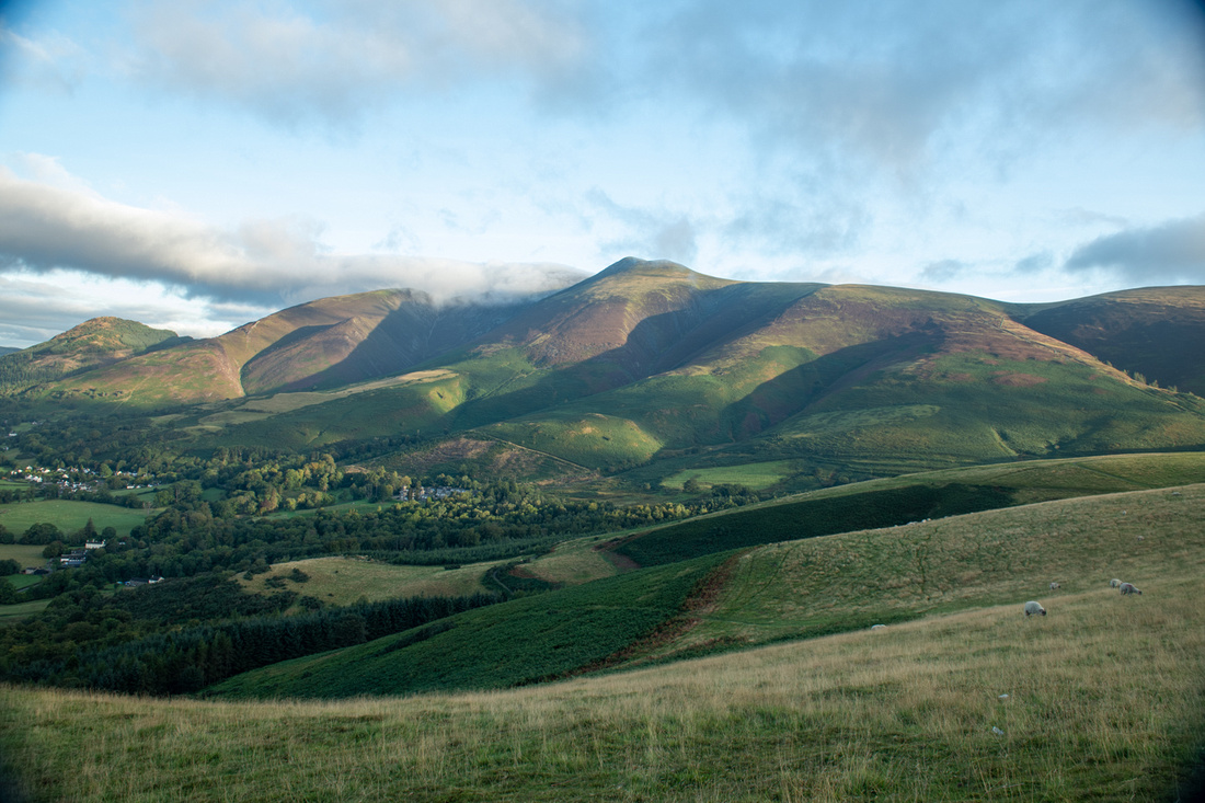
 We got up early to catch the sunrise over the town of Keswick from a public viewpoint and were rewarded with the sun hitting the hillsides as it rose.
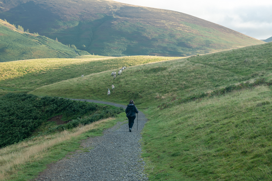
Little shepherd girl following her flock.
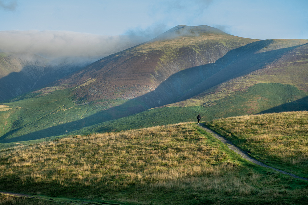 I will confess to being pleased with this image.
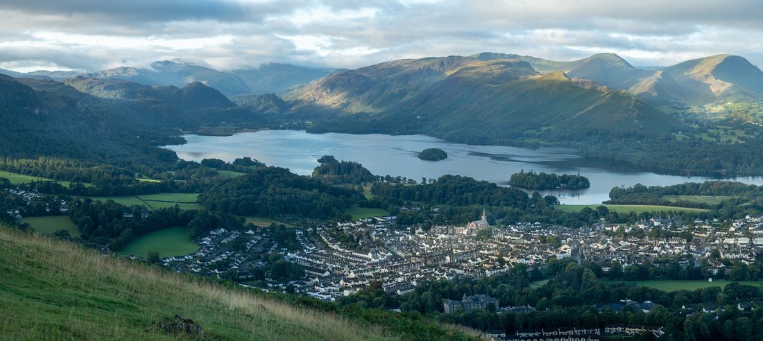
This is all I have to show for 16 hours in the Lakes. I hope we get to come back.
Now, the question you all really want to know- What is "fly tipping?" It's unloading your junk. Usually bigger stuff, too big to go in a dumpster. You could have given me 100 guesses.
Now on to Scotland!!
]]>
I'm typing this on the flight home. No time or energy for blogging whilst stomping about the Highlands of Scotland.
This trip has been long in coming, as our primary objective was to reconnect with Pam and Al Woodhouse, of West Lothian, Scotland. Daughter Shannon and I met Pam & Al in 1999 on the same eclipse cruise when we met Victoria and Diana. We have been trying to get up to see them, and photograph the Scottish Highlands, all these years. So it finally came to pass. But of course we don’t touchdown at Heathrow without running down to Bath to see Victoria Humphries and her husband Jeremy and their son Ben. We saw Victoria for a weekend in Sicily last spring but we had not seen the boys since 2015.
And then, as we were pulling into the unloading lanes at the St. Louis airport another major facet was added to our trip. It was then we got the word that Queen Elizabeth had just died. We would be in the UK for the most momentous occasion in the living memory of most of her subjects. Her reign had spanned 14 US Presidents-Harry Truman to Joe Biden. The reminders were immediately everywhere, from news stands to flags at half mast to little shrines with a picture of the Queen and a vase of flowers.
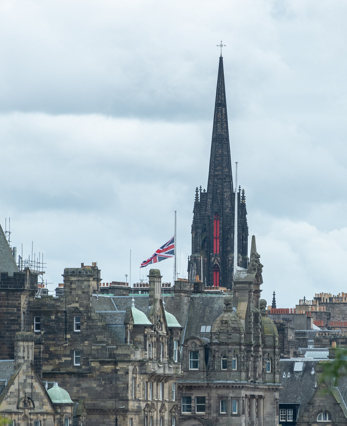
We landed at Heathrow and headed directly down to Bath. Within 15 minutes we got our first "You're not in Kansas anymore, Jeanne Marie" moment.
Not sure how that little car can actually pull all that through the air! Maybe the bikes are connected to the drivetrain to help in getting up hills.
My ambitions for photography on this leg of the trip were modest. For one thing, We didn’t want to push too hard when we were jet lagged, but mainly we wanted to catch up with the Humphries. Besides, their home in Lower Hamswell is so scenic that a shot of some kind will invariably jump out in front of you at some point.
For instance, their closest neighbors, just across the lane from their house, raise and race thoroughbreds. They exercise these horses on a special built track that is lined with shredded carpet. I was invited to photograph these sessions, which given my affinity for photographing horses, was a great opportunity. Massively fun!
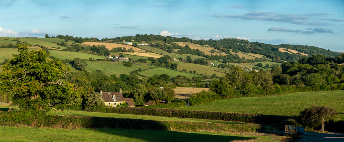 Berrymeade Cottage
Friday evening Victoria fixed us a fabulous dinner that we enjoyed on their Covid patio. This was one of Jeremy's accomplishments during lockdown. We mostly talking about the Queen. The affection these folks hold for her was, of course, easy to understand. She was respected the world over. Even our independence minded Scottish friends held her in very high regard. It was a great privilege for us to share this momentous time with our friends.
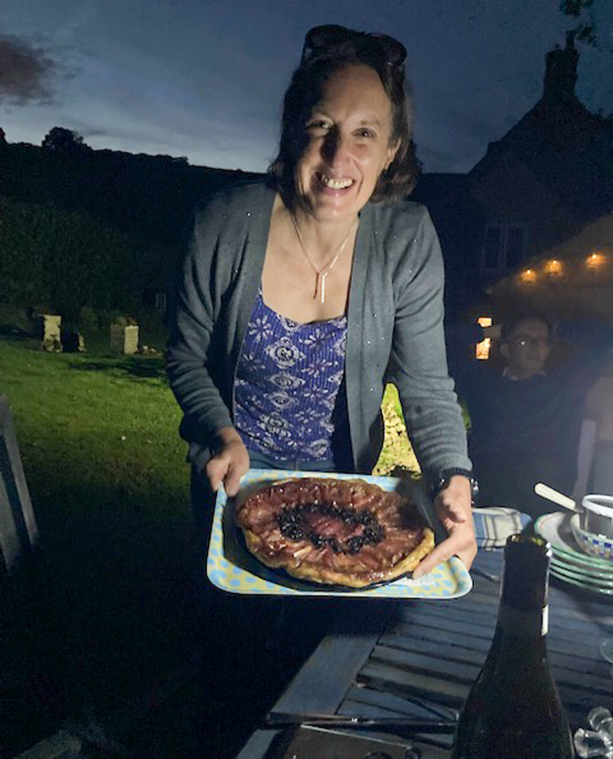
Saturday morning, September 10th found us up in the pasture for some horse photos. Is this a gorgeous setting to go horseback riding? Amanda is the first young lady you see and she is one of the racing family. She was very gracious to us. The other two girls trailered their horses in, taking advantage of the wonderful riding track. They were very accommodating too but we didn’t learn their names. More horses on the slide show.
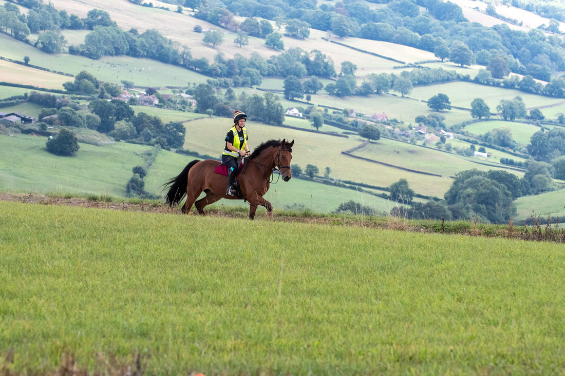
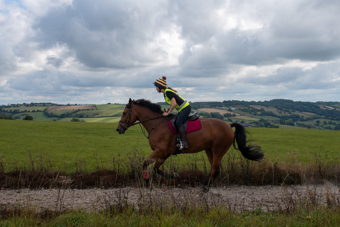
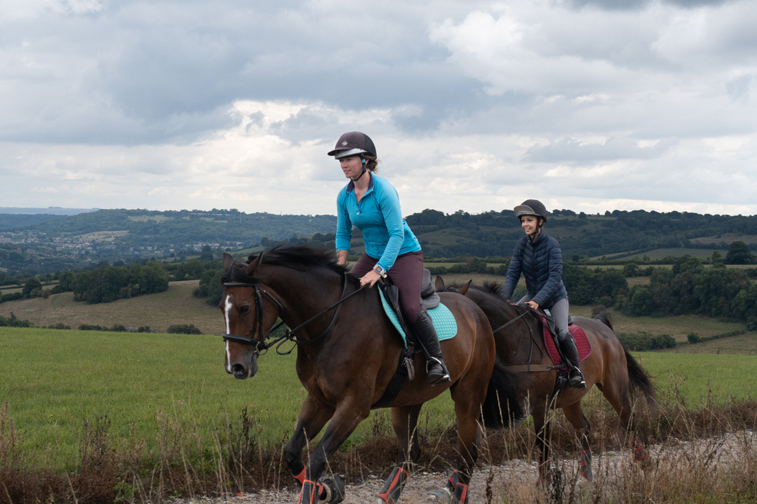
After the horses went home we drove up the road just a mile or so to Beckford’s Tower. This tower was built in 1827 by a rather eccentric Englishman of the same name. It claimed a great overview of Bath so we thought as close as it is we should check it out. The tower was interesting and the overlook was very nice but we were at the wrong time of day for really dramatic photos of Bath. I did find a few subjects in the graveyard on the grounds.

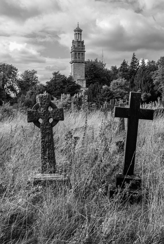
Victoria comes from a family of Jack Russell lovers. She has been raising them all her life. Rhubarb is two years old and Twiglet is one of her pups, now four months old. They made quite a delightful pair.
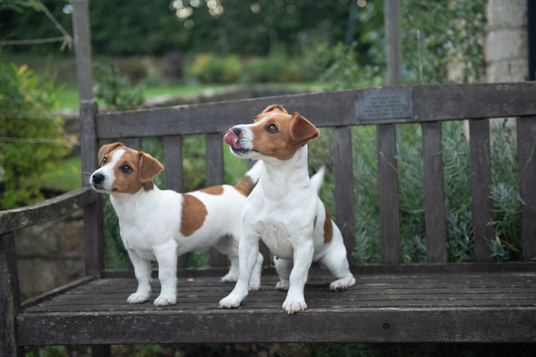
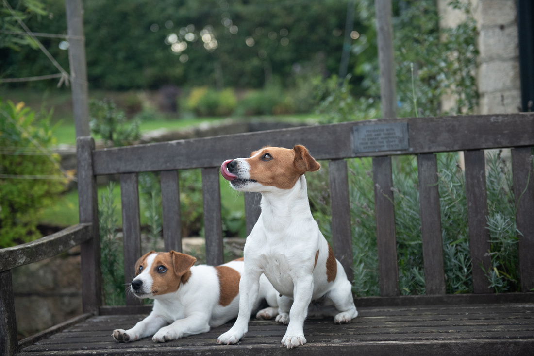
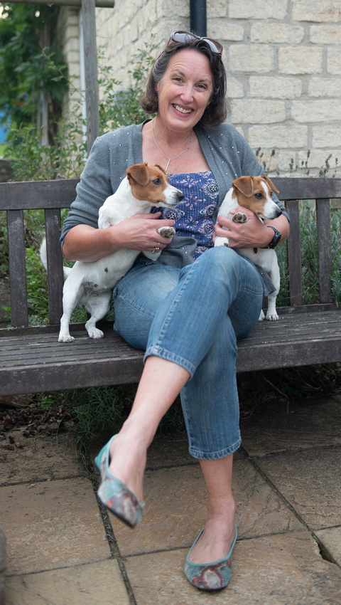
Victoria Humphries- Arctic Explorer, Mountain Climber, Puppy Breeder, Wife & Mom
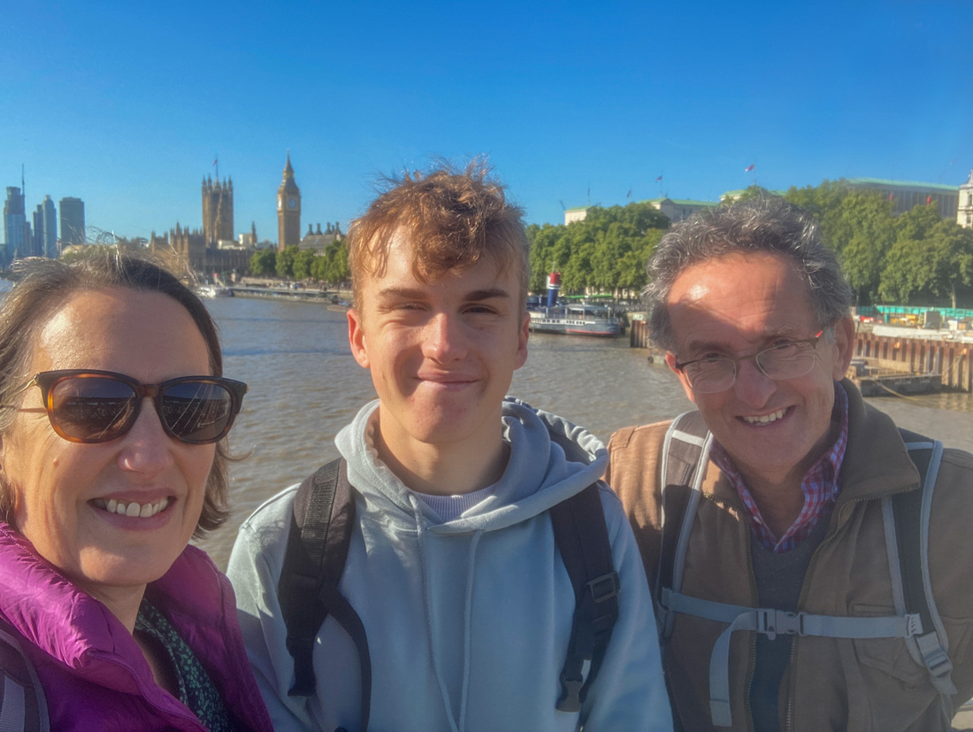 And these are the Humphries-Victoria, Ben, and Jeremy
And now it's time for the game Jeanne Marie and I play on every trip to the UK (or Ireland). It's called "What's this mean?" It's usually a sign, or sometimes just an expression, that we have no clue what is being communicated. Here is the first one for this trip.
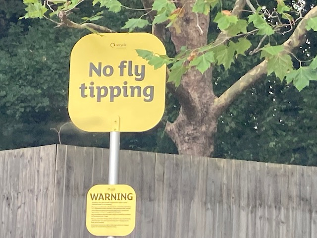
Here's a little hint. We encountered it on the parking lot (oops, car park) of a nice grocery store. There was a tidy row of recycle dumpsters along the edge of the lot. What does it mean? No fair googling. I'll give the answer in the next installment.
Sunday after church Victoria, Twiglet, Jeanne Marie, and yours truly drove across Bath to Prior Park, which is just down the hill from Ben’s school. It also has great views of Bath and a beautiful bridge that wanted its picture taken.
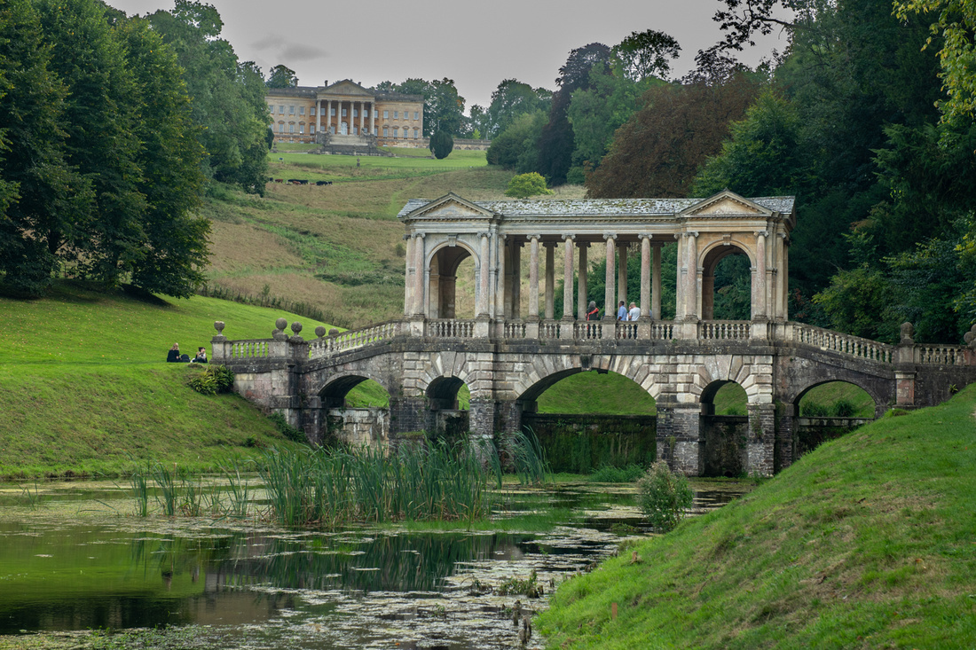 The Palladian Bridge at Prior Park Ben Humphries' school is in the background
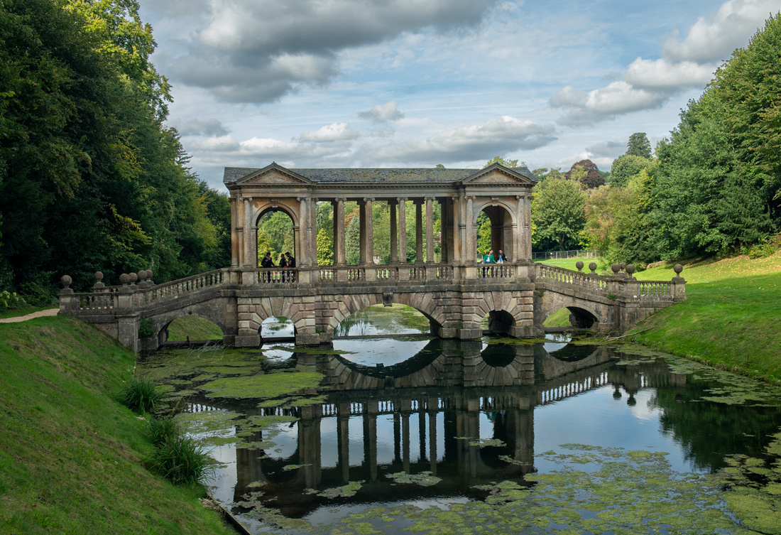
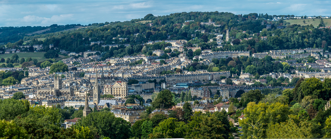 City of Bath from Prior Park
Then another delicious dinner and relaxing evening at Berrymeade Cottage. The Queens’s funeral was again a prime topic, as the plans were unfolding daily. The Humphries had already procured train tickets for the following Saturday, to pass through Westminster Hall as she lie in state. They were expecting a four hour queue.
Then next morning, Monday September 12th, our hosts had to get back to real life and we off to the Lakes District in the north of England. We had resolved to drive up to Scotland but it’s 11 hours from Bath to the Highlands so a one night stay in the Lakes seemed the best way to divide that trip into manageable pieces. And there might be something there to photograph.
Slide show with more pictures below.
]]>
This is the second half of the Black and White images. It's all about the temples and most of them you've seen in color. They just make great B&Ws. The usual format- first a sample, then a slide show.
I've just about got the website updated. I split Italy into three different regions, since Sicily now overwhelmes everything else. I also put a gallery of doors and windows from Italy under the Architecture tab. Anyway, you can look at pkkelly.zenfolio.com and see what, in my judgement, someone might want to hang on her wall. See what you think. I'm open to suggestions.
Finally I just want to say how much fun it has been taking all of you around Sicily. And I'm so very gratified by the response to the images. Everyone is either very kind or in fact quite accomplished and discerning art critics. I prefer to believe the latter.
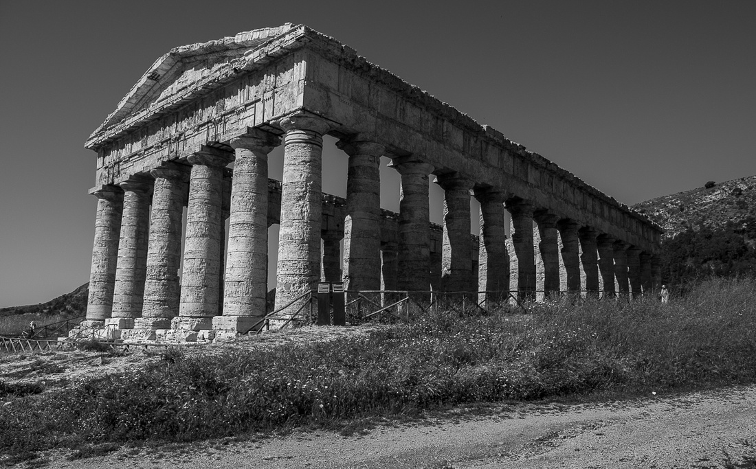 _8506763
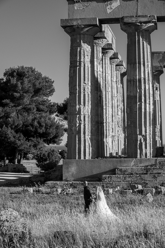 _8507486
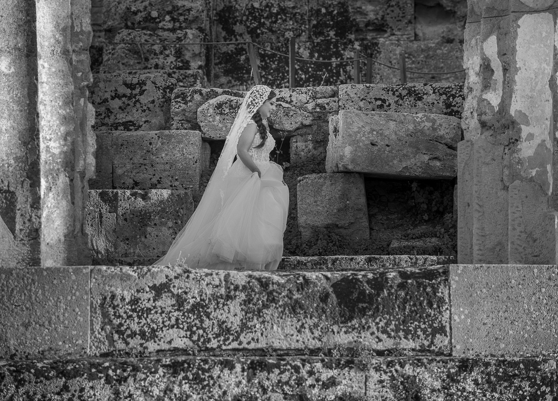 _8507557
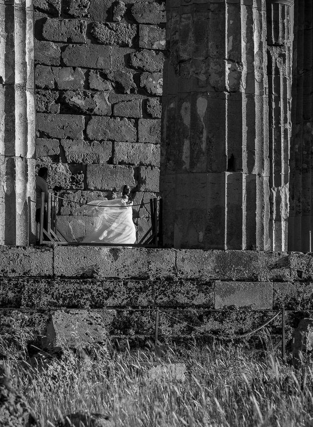 _8507568
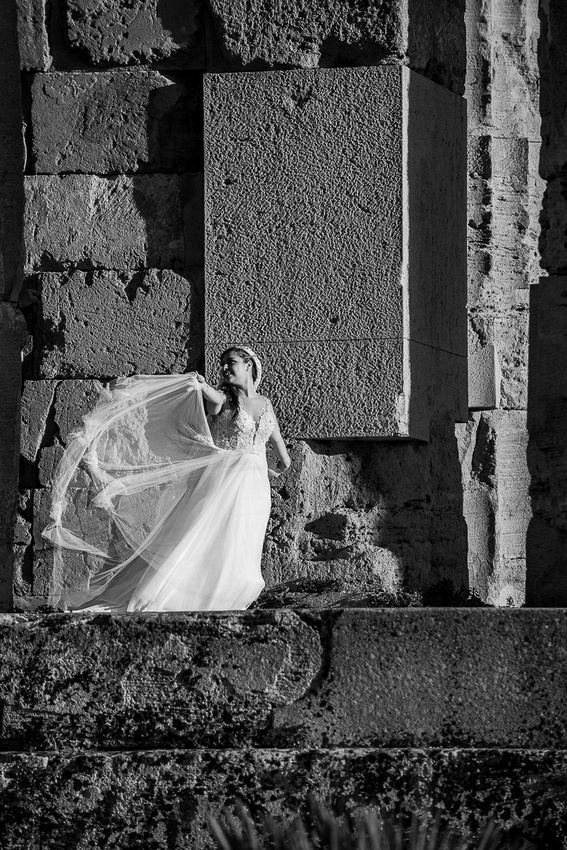 _8507586
]]>
I'm including a link to my 500px account. It is my primary picture sharing site and the easiest way for you to view the best of the images I've posted on the blog. Here's the link: https://500px.com/p/pkkelly?view=galleries
I will soon be putting some images from the trip on this website, of course, and you can always access them through the links I've sent or just typing in pkkelly.zenfolio.com. Give me another week to get everything up. I need to let everything rest for a bit.
So here they come, no particular order. Click on the last image to see a slide show with more.
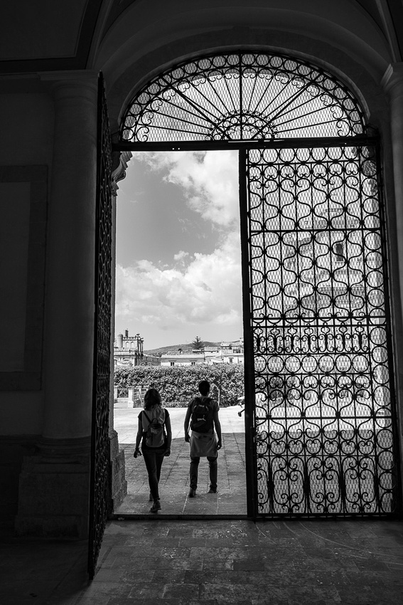 _8503026
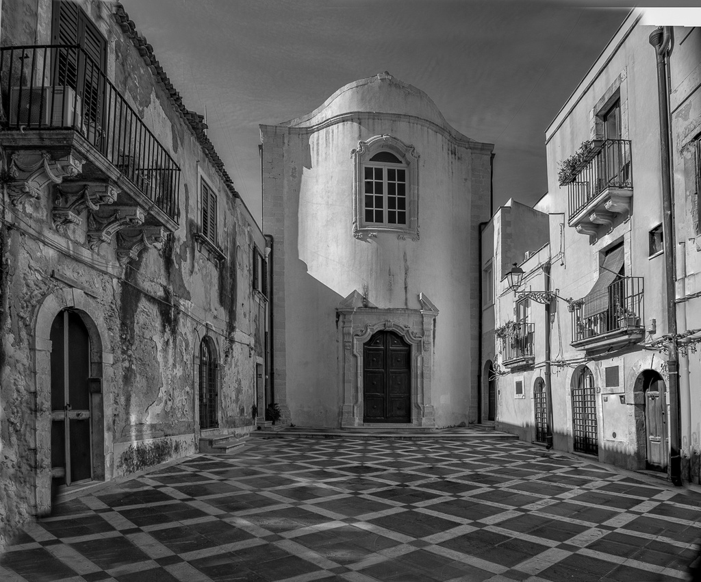 _8503126-Edit
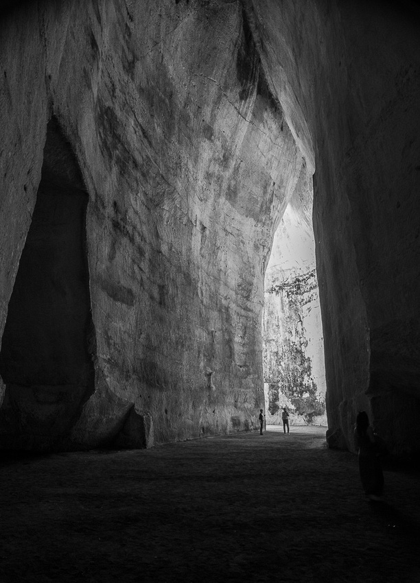 _8503521
 _8503857
 _8504459
 _8505141
Click on the image below for more.
]]>
I wish I could put a "like" button on each image. Then everybody could vote. Overall the images seem to have been well received and I'm very grateful for everyone's kindness. I'll just load some of these up and the last one will be a slide show with more, plus a second slide show below that with just doors and windows.
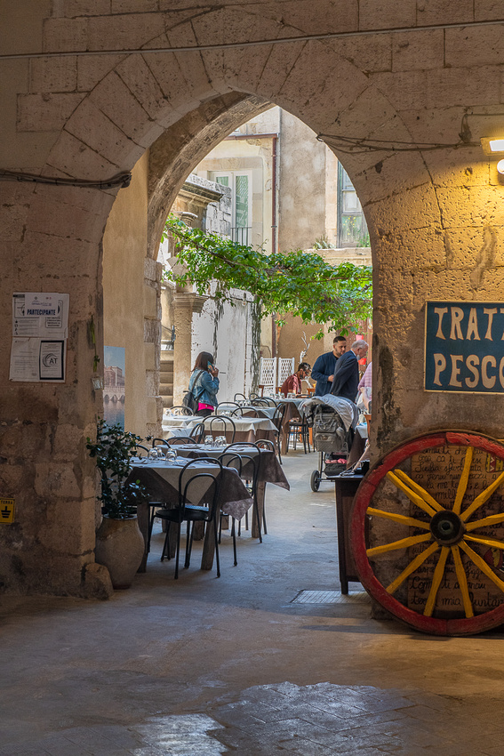 _8503490
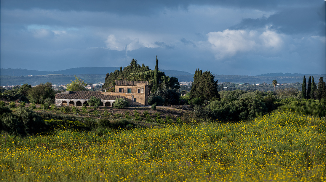 _8504559-Pano-Edit
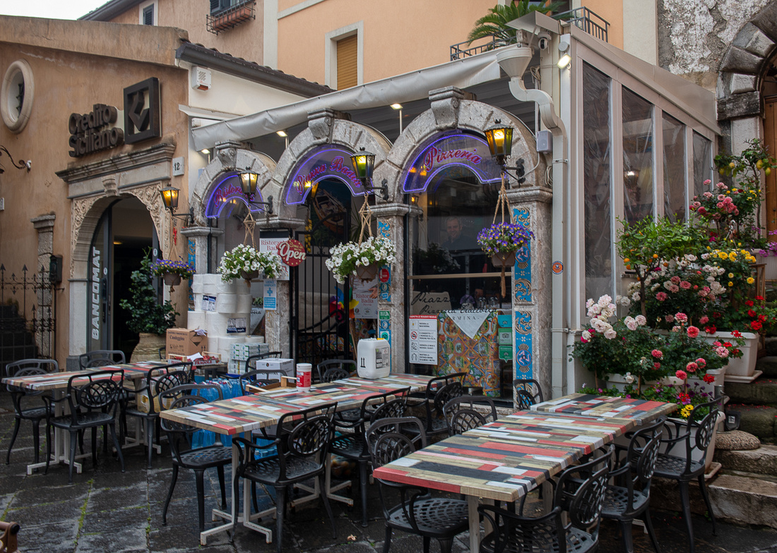 _8505022
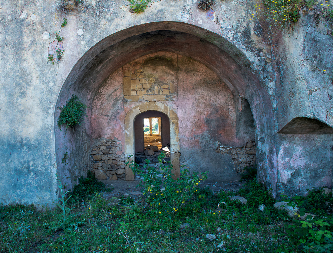 _8508412-Edit
]]>
Dinner was in Brucoli with Joanne and Larry. I'm posting their picture again so I can give them a proper introduction. I did finally figure out my captioning problem with the blog, as you can see by hovering over their image. But I'm not going back and adding captions to all the pictures. Not today anyway.
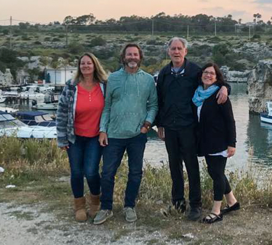 Joanne & Larry Hutchisson with Us
We had scheduled all of Wednesday May 18th to catch our breath and pack. And get started on this blog. I also took the opportunity to get a few more shots. Okay, a few hundred more shots. The pictures on this post will be mostly from the immediate vicinity of Diana's. The majority are from her garden or the rocky beach in front of her house and Mt Etna manages to get into several of them. In the fourteen days we spent there the mountain offered several decent photo opportunities.
The first two below are interesting because they show what an eruption of Mt Etna looked like while we were there. The second image with the helicopter was taken exactly forty minutes after the first one.
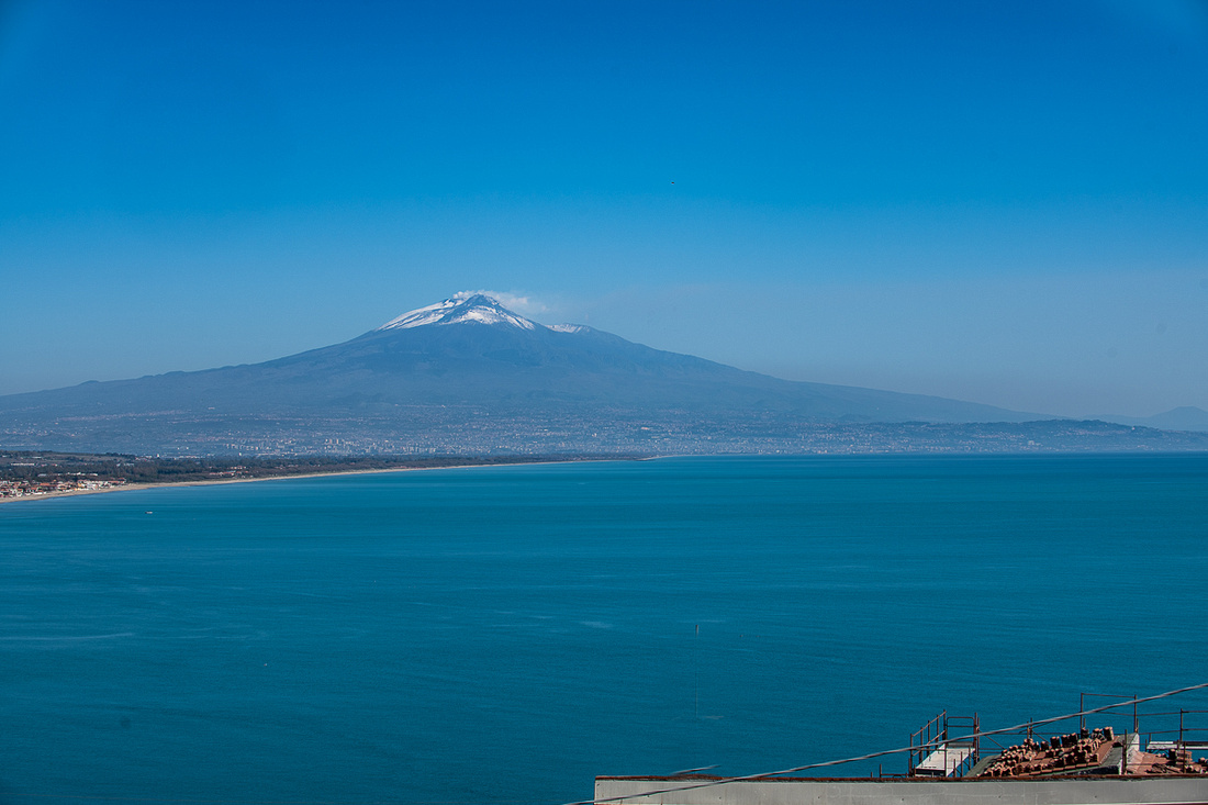 _8502986
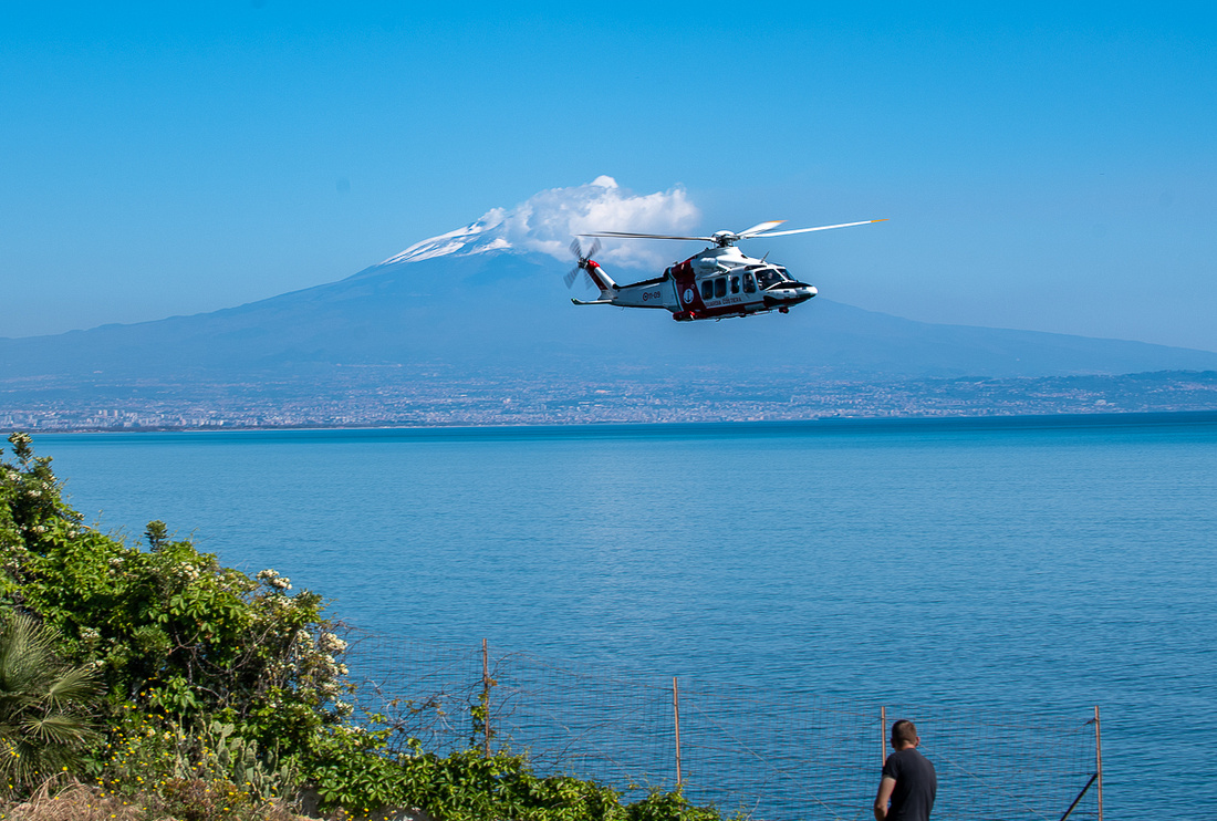 _8502989
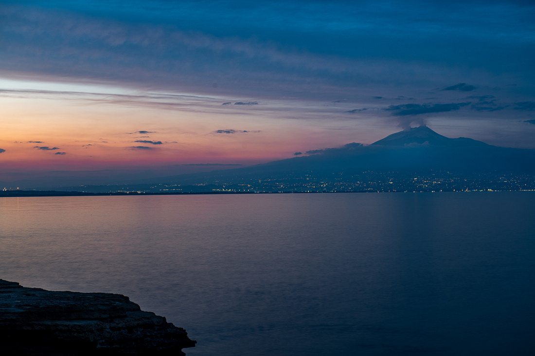 _8502911
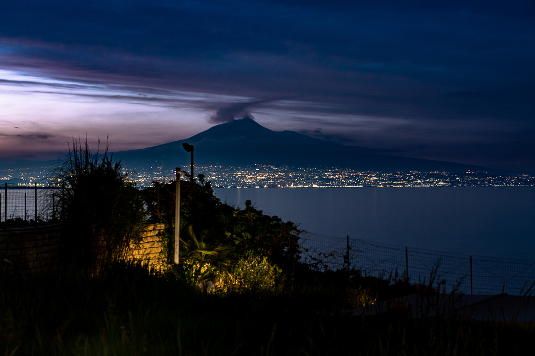 _8502914-Edit
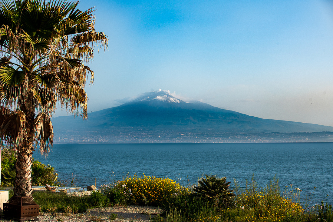 _8502930
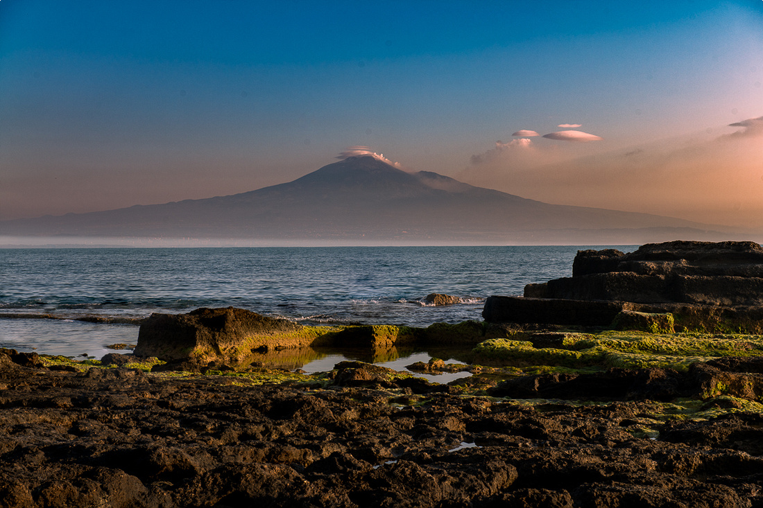 _8503562-Edit
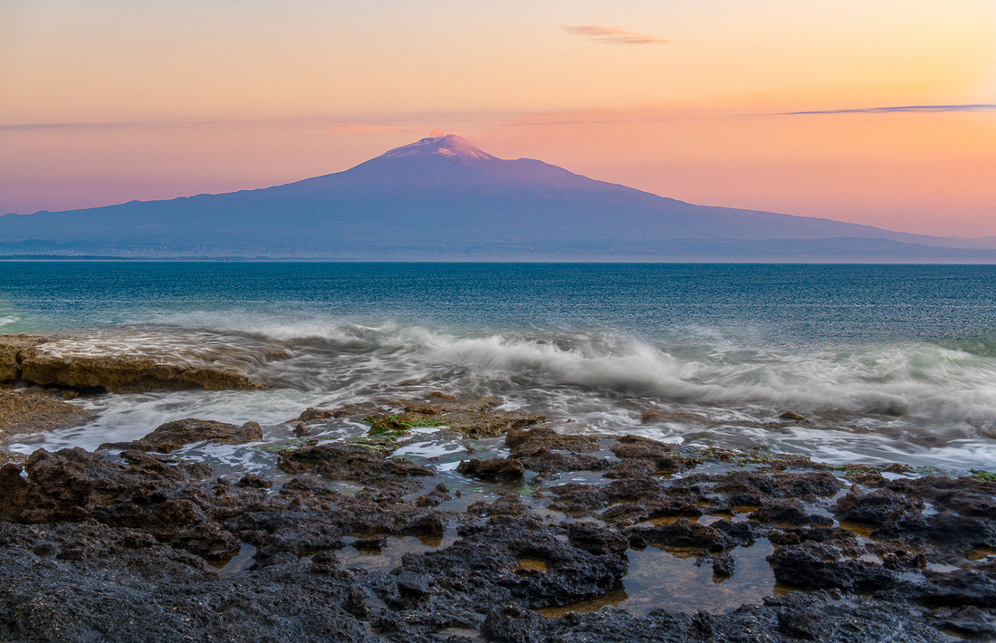 _8503115-Edit
Anybody looking for a nice used castle? "Needs work. Great view!"
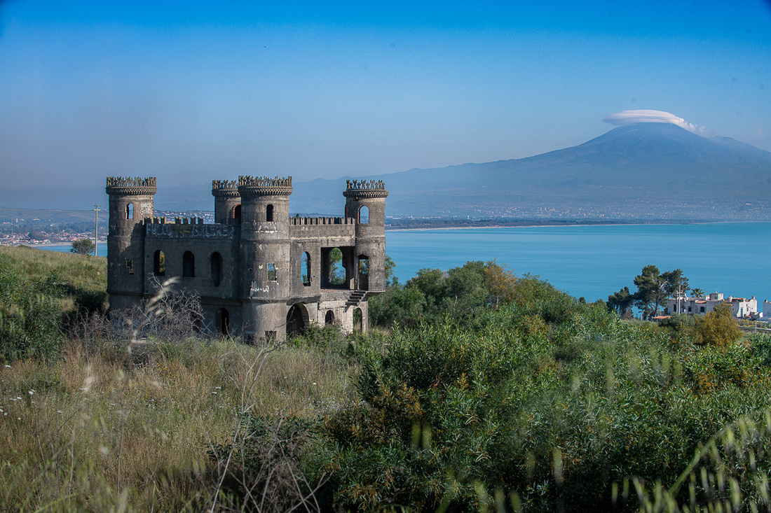 _8503653-Edit
Below are two images that were not taken near Brucoli. The town is Castiglione. This is one of the towns where we were denied access due to the big bike race. I got these on an unauthorized stop and I think I actually got better shots from this spot than I would have gotten from the town itself.
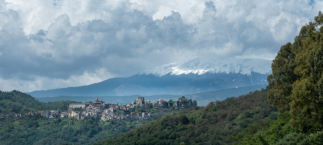 _8506126-Pano
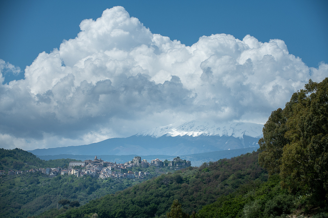 _8506128
I had a decent little shoot down on the rocks the morning of May 19th, the day we left. In fact I was having so much fun I tried throwing a tantrum so I wouldn't have to leave but Diana wouldn't defend me. She and Jeanne Marie dragged me off the beach together.
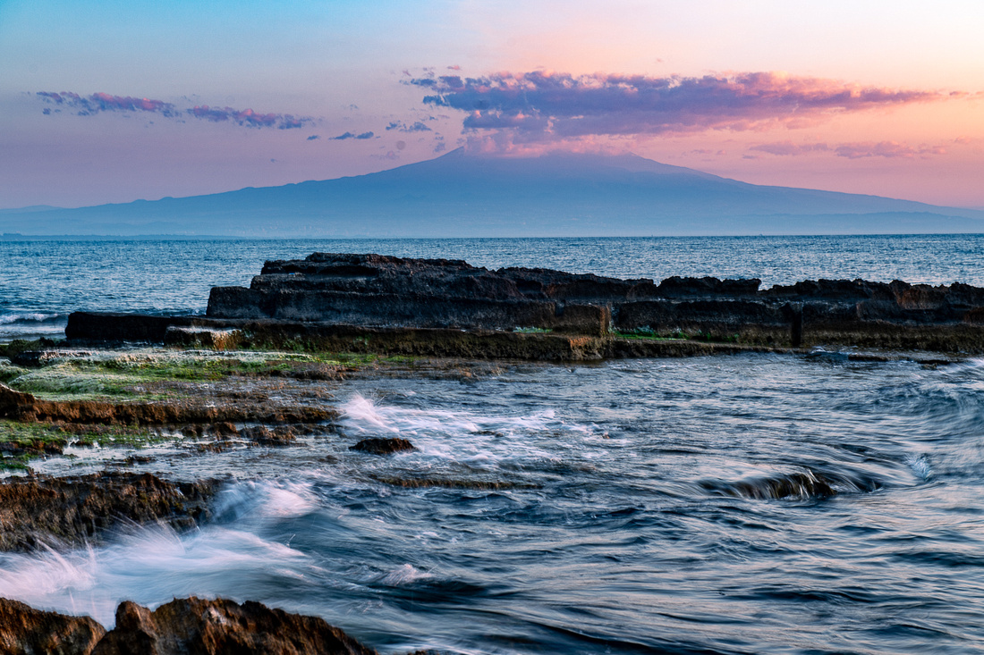 _8508489
All I need in the images below is a sailboat. Diana, don't you and Giovanni want a sailboat? They're really cool and don't use nearly as much diesel fuel.
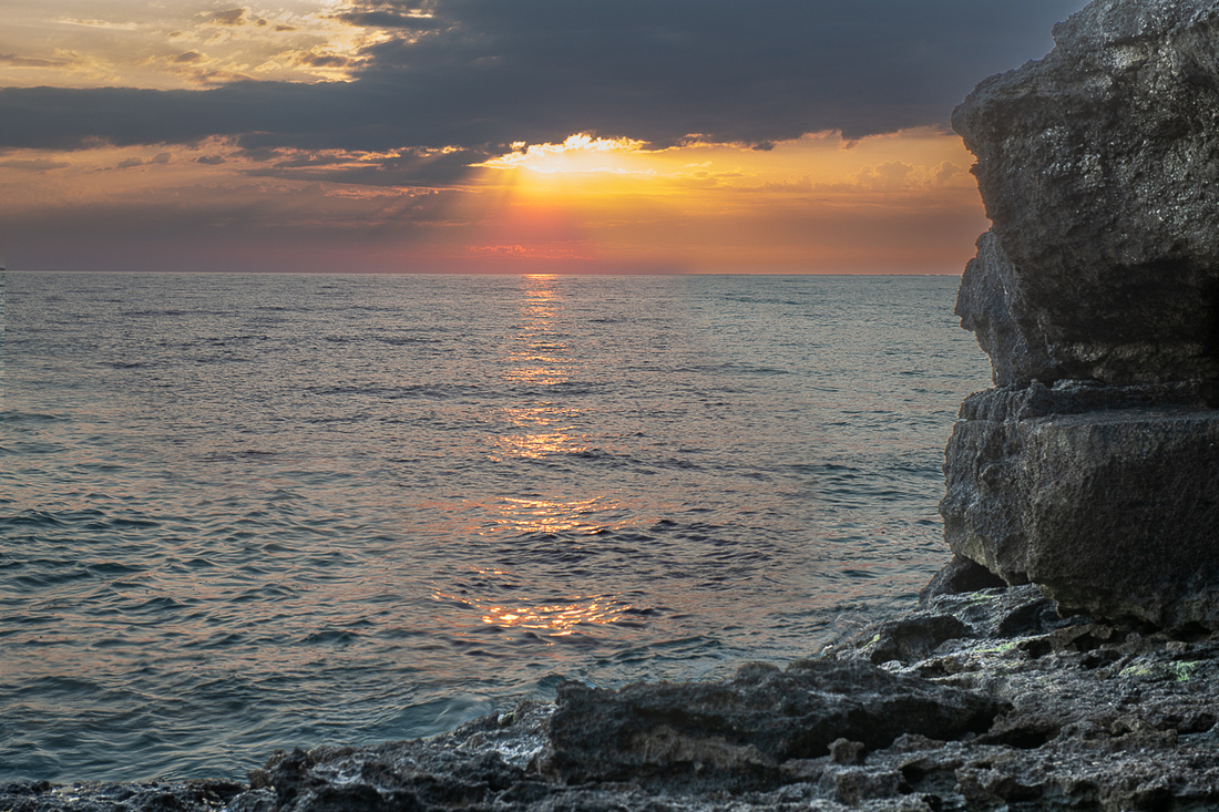 _8508504-Edit
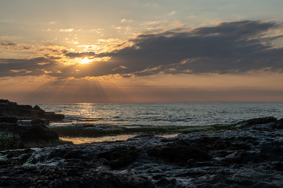 _8508529
Slide show next with more pictures.
]]>
First was the hilltop town of Enna. We'd driven past it in 2012 and couldn't stop that time so we wanted to check it out. The other place was Piazza Armerina. We went to Enna first. It's a good size town with a large fortress and I would have liked to have done the tour but we didn't allocate that kind of time. Next trip.
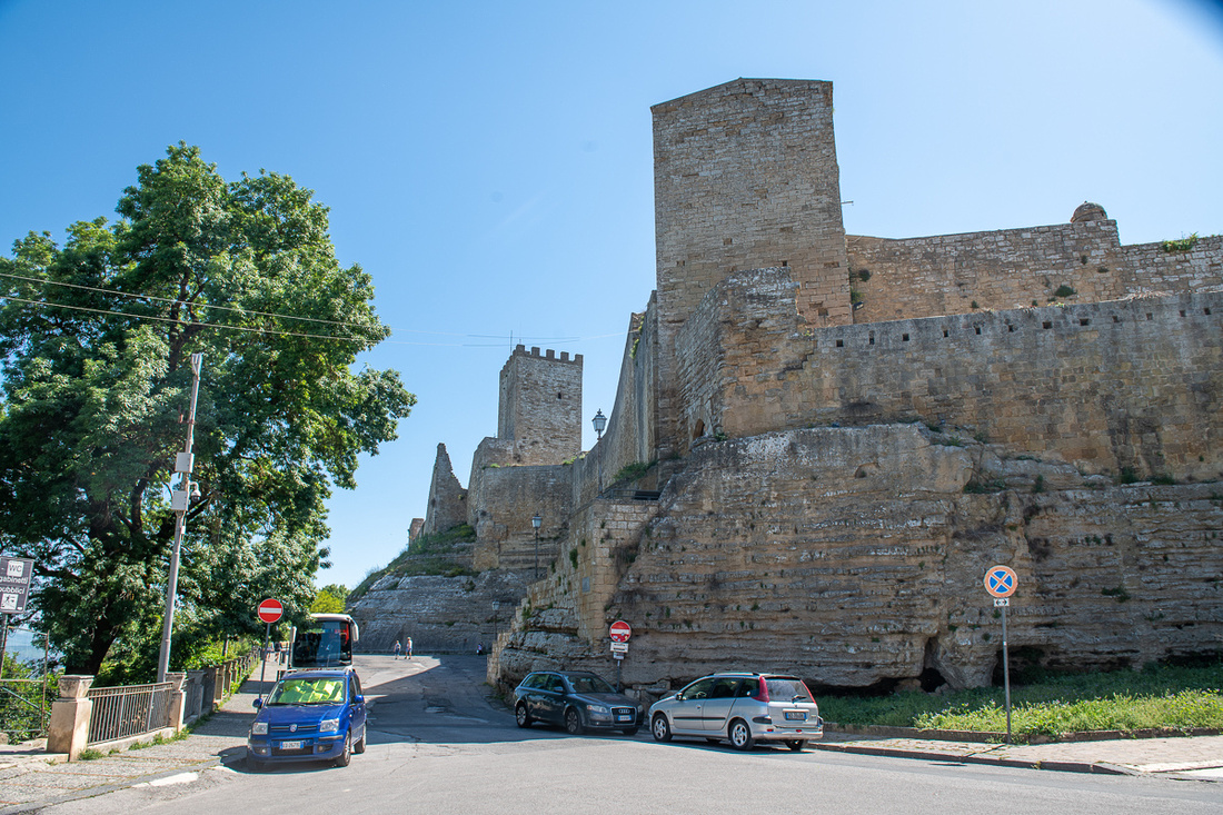 _8508228
Off the north side of the hilltop we had great views of another town, Calascibetta, pictured below.
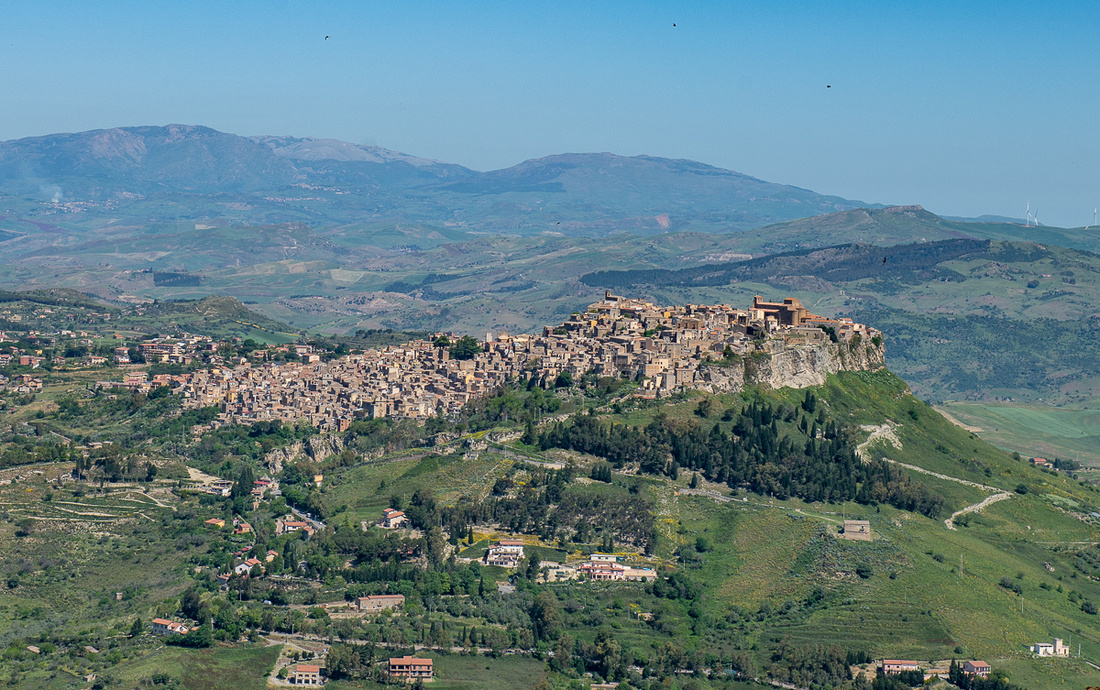 _8508232
This German couple was having fun with their selfies and I was having fun with them having fun.
_8508232
This German couple was having fun with their selfies and I was having fun with them having fun.
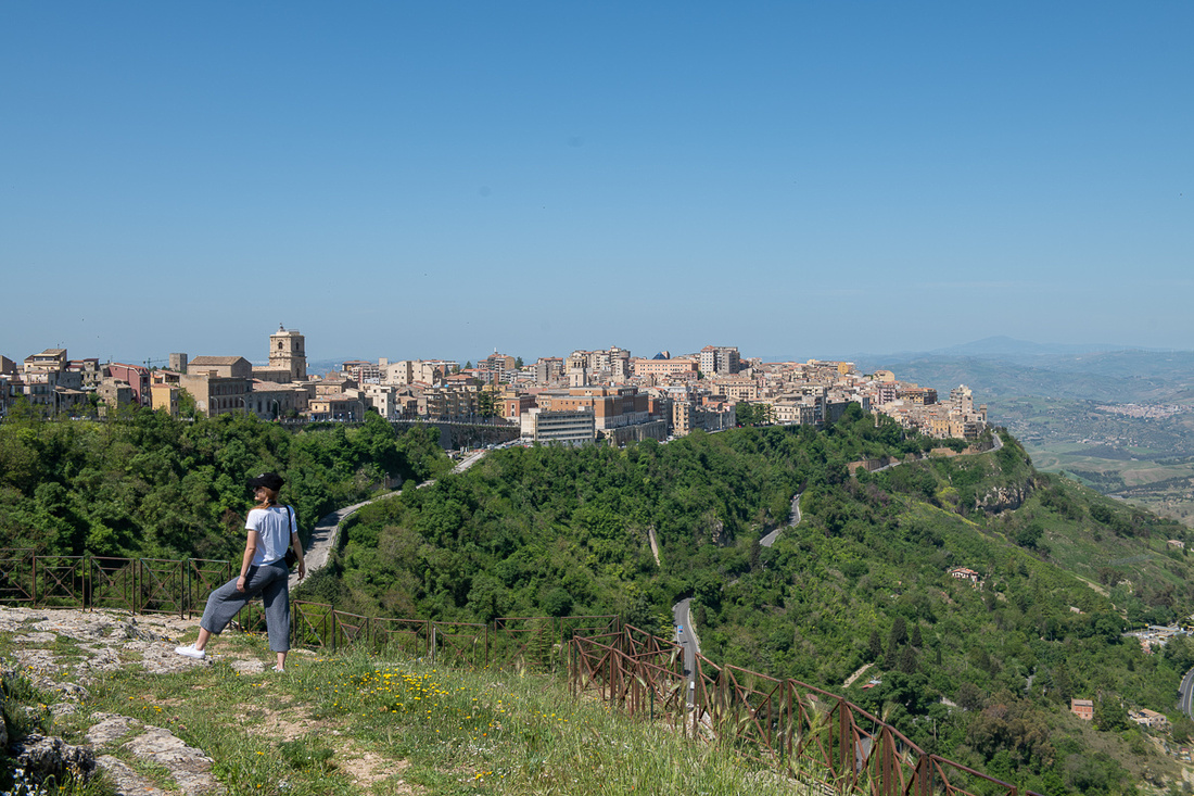 _8508250
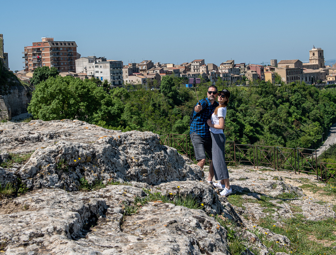 _8508251
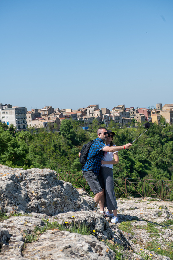 _8508253
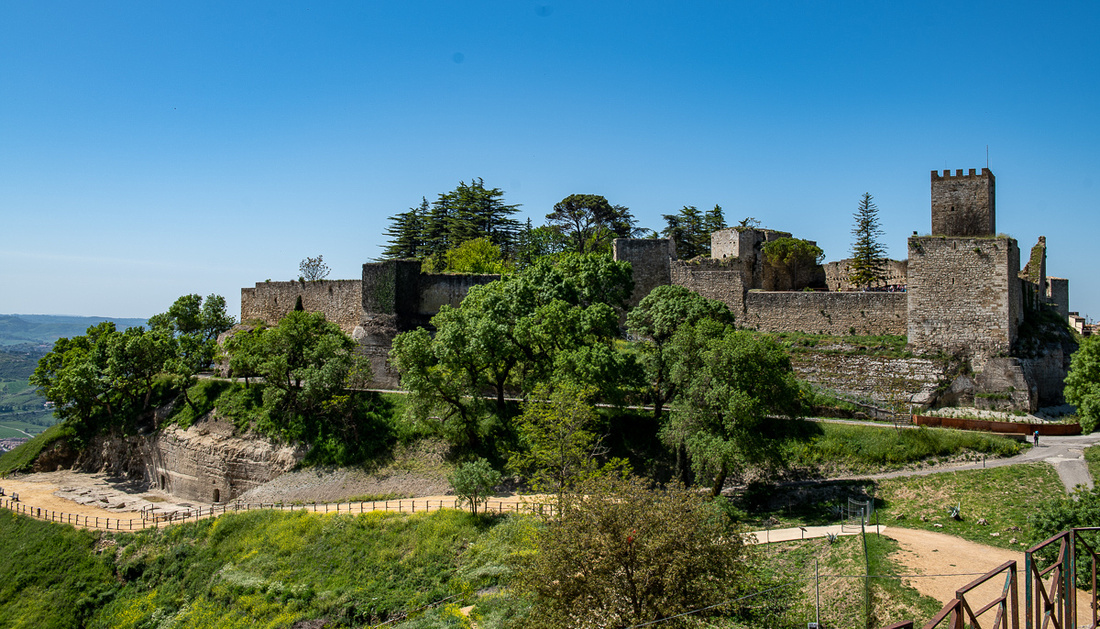 _8508258
Looking due east you get a pretty good view of Mt. Etna.
_8508258
Looking due east you get a pretty good view of Mt. Etna.
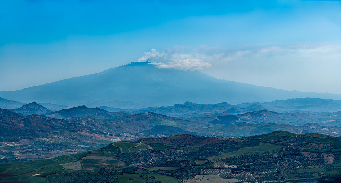 _8508280-Pano-Edit
I zoomed in here so you can see the business end of this beast. That's the best look of the active crater we got on the entire trip.
_8508280-Pano-Edit
I zoomed in here so you can see the business end of this beast. That's the best look of the active crater we got on the entire trip.
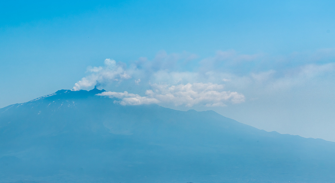 _8508280-Pano-Edit-2
We then headed down to Piazza Armerina. We visited here in 2012 and didn't have time to see everything we wanted to then so it deserved a little side trip. The big attraction of this place is the collection mosaics from a fourth century villa, Romana del Casale. This was the residence and court of a fairly high ranking official and this set of mosaics are the largest, and most varied collection from the Roman period, in existence. We saw them in 2012 and pictures are included in the slide show at the bottom. Our objective on this trip though was the cathedral.
_8508280-Pano-Edit-2
We then headed down to Piazza Armerina. We visited here in 2012 and didn't have time to see everything we wanted to then so it deserved a little side trip. The big attraction of this place is the collection mosaics from a fourth century villa, Romana del Casale. This was the residence and court of a fairly high ranking official and this set of mosaics are the largest, and most varied collection from the Roman period, in existence. We saw them in 2012 and pictures are included in the slide show at the bottom. Our objective on this trip though was the cathedral.
It is perched so beautifully on the high point of the town I just had to see the inside. And it is indeed impressive. After visiting a couple of dozen of these big beautiful churches in these little bitty towns we were getting a little cathedral fatigue. But we were very glad we stopped for this one.
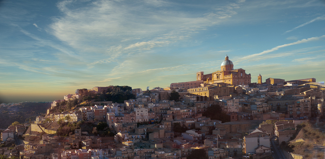 Piazza Amerina town
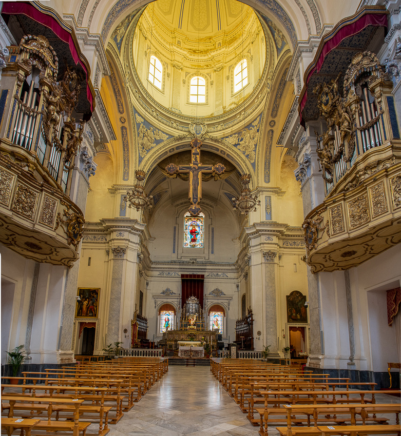 _8508307-Edit
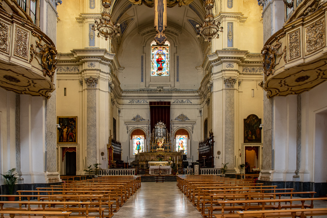 _8508306
It was time to turn back east and head for home. Diana was waiting for us, with a glass of wine ready, and we would join Larry and Joanna (the other Americans) for dinner. Mt. Etna was off our left the rest of the way and we were able to stop for a few shots. Included in the slide show are a few images from 2012. That trip was in late October so you can see how the entire island reverts to earth tones. Not a wildflower in sight. But beautiful all the same.
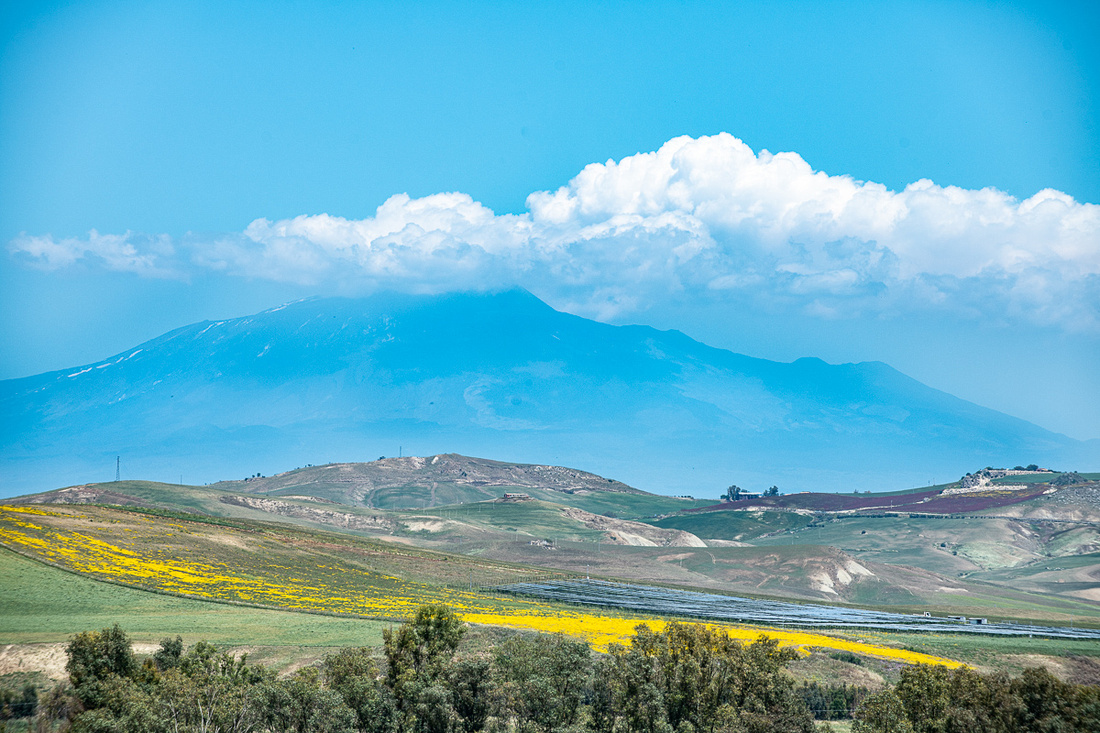 _8508331
]]>
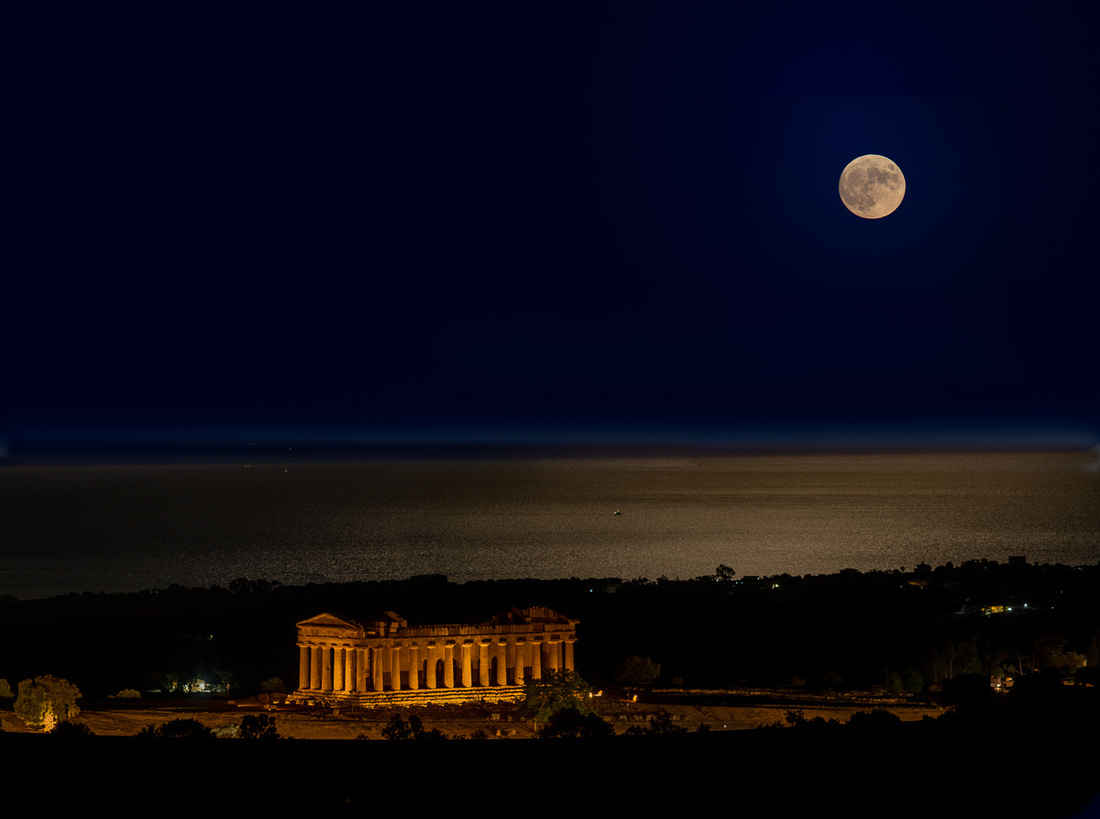 _8508117-Pano-Edit
I then headed over to the scene of my failure the previous morning. I at least knew my alignment was pretty close. I got something out of this full moon.
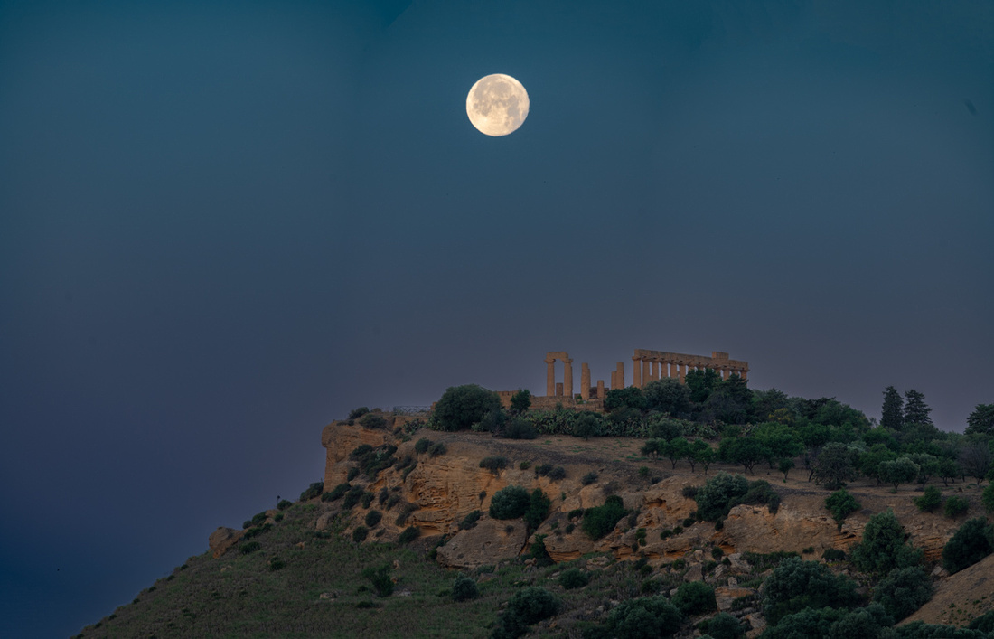 _8508152-Pano
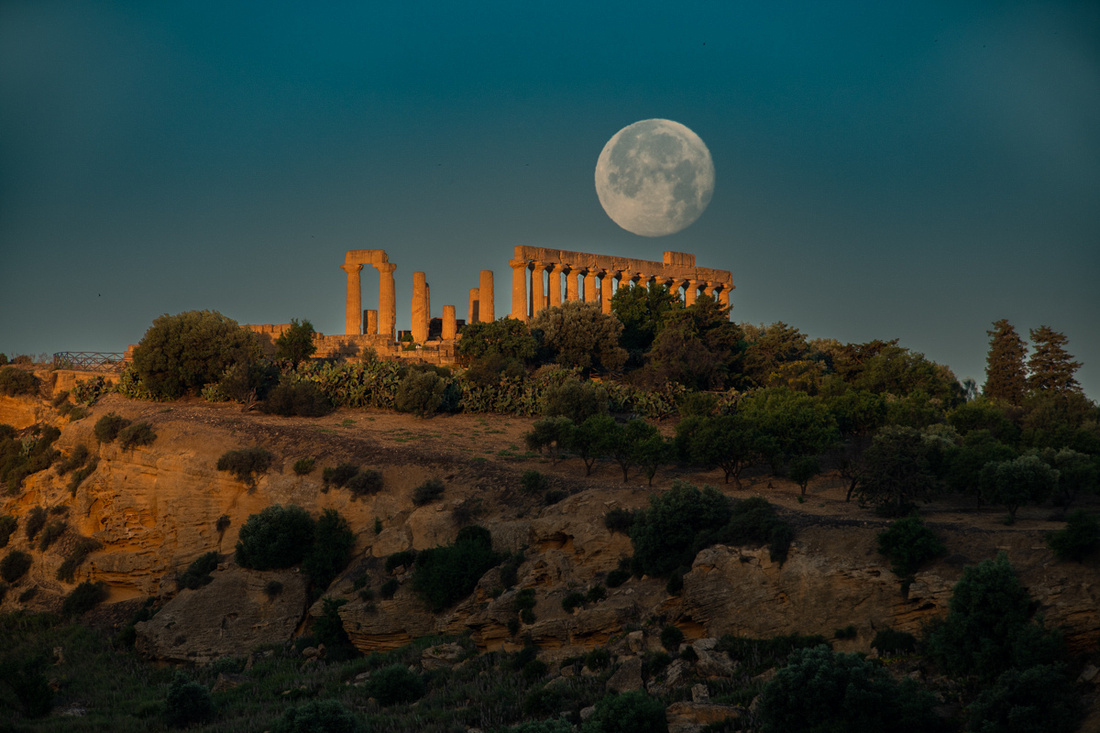 _8508177
In the image above, the sun had just popped above the horizon behind me, lighting up the temple as you see. . But it was evident by this point that I was too far to the right. The moon would go down to the right of the temple. So I threw my gear in the car and went down the hill one switchback and set up again. This was the result.
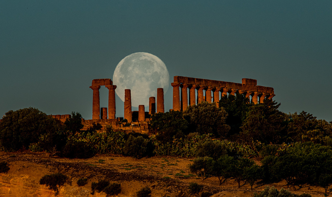 _8508180
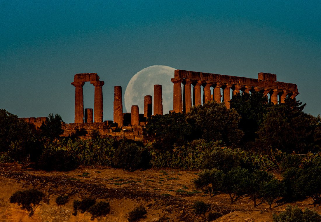 _8508186
At this point I headed back up to the high road above the park to see what else the rising sun might have for me.
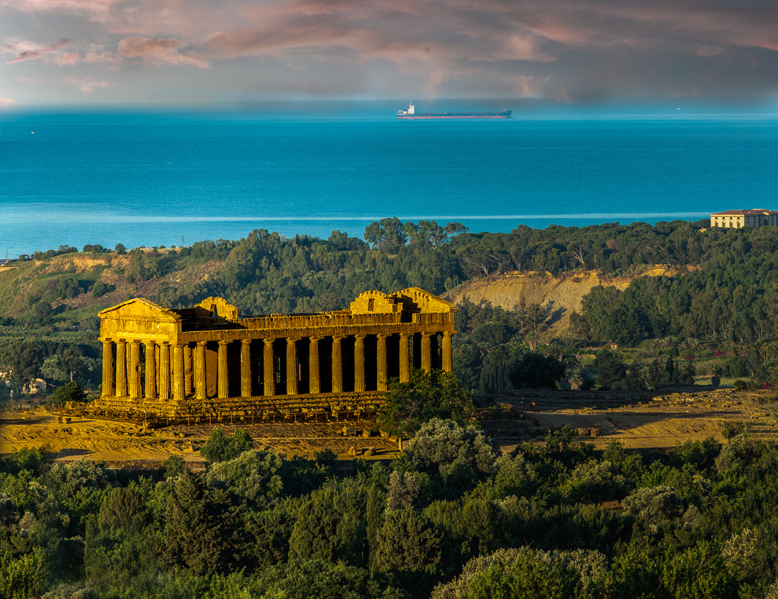 _8508191
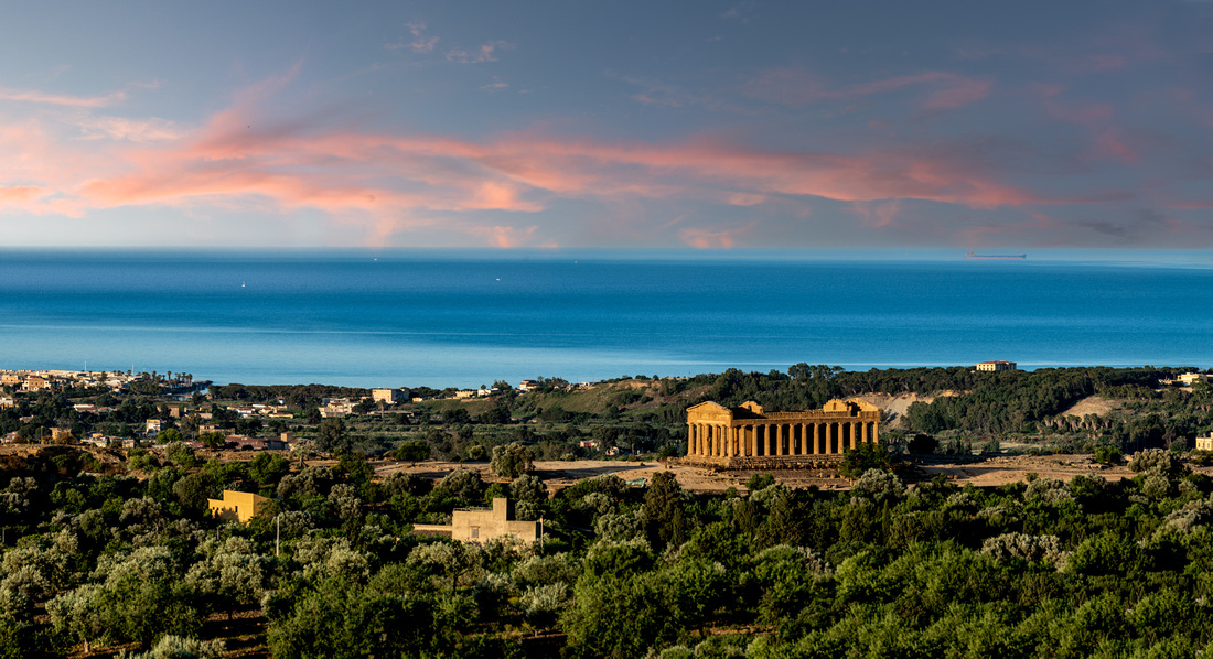 _8508192-Pano-Edit
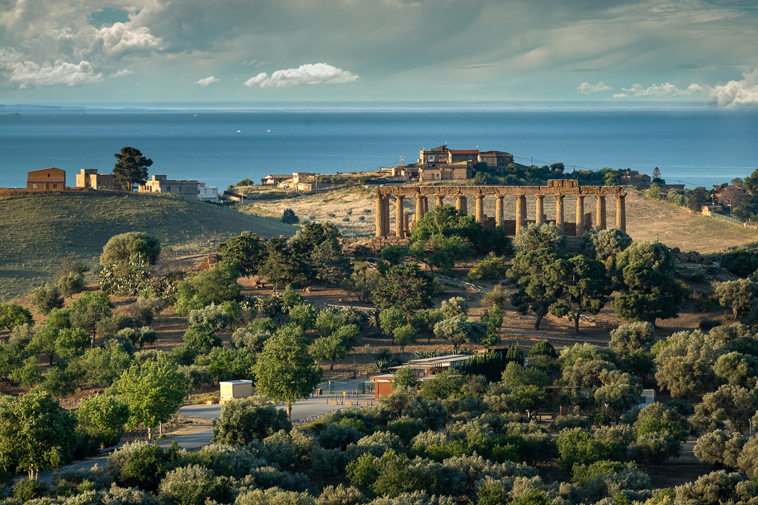 _8508198-Edit
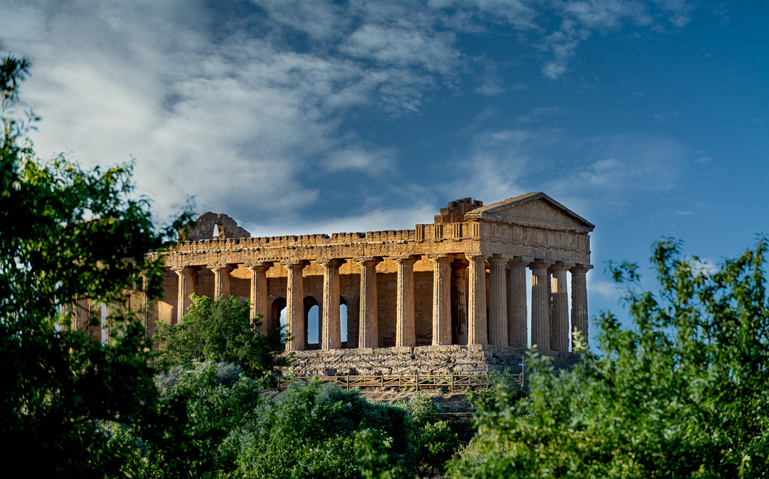 _8508214
And that was it for Agrigento. Time to pack the car and head east.
A few pictures from the 2012 trip are in the slide show below.
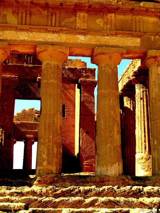
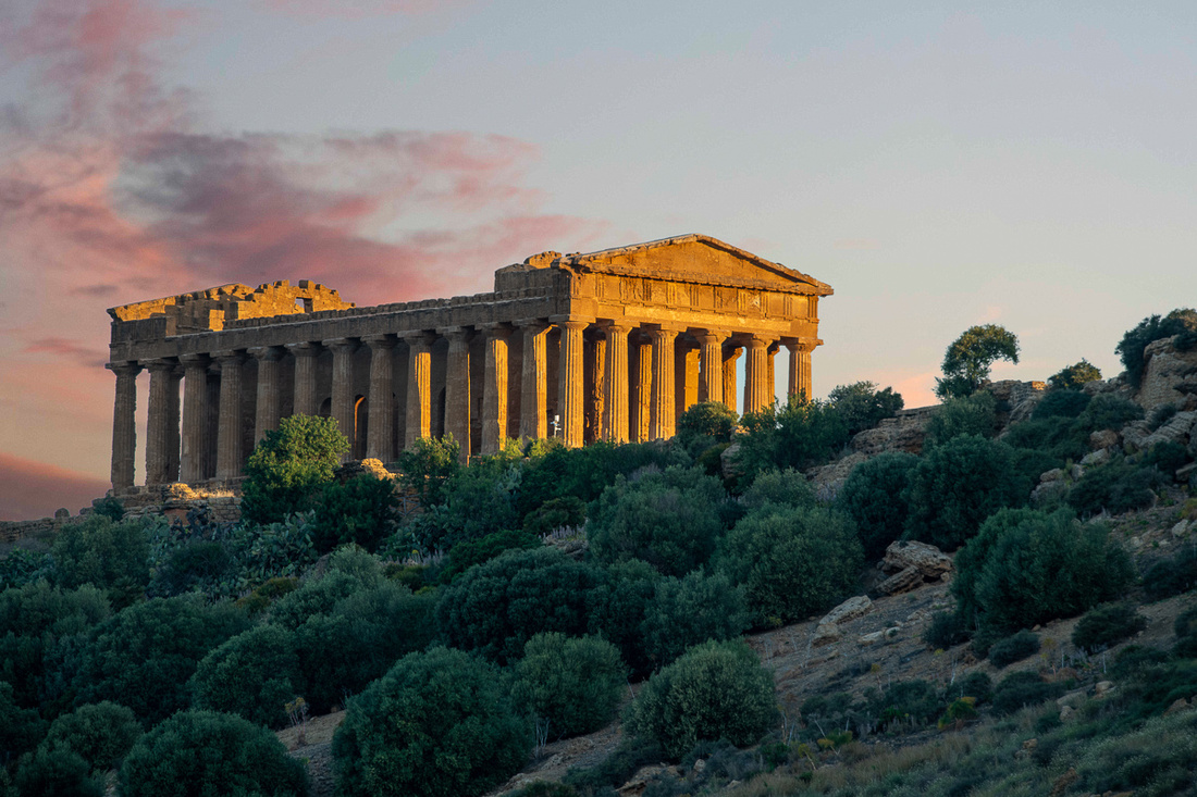 _8508189-EditTemple of Concordia
We then spent a good part of the day scouting for locations to get either promising lighting or a dramatic moonrise/moonset picture. The big advantage of shooting at Agrigento over Selinunte is that there are a plethora of vantage points outside the park that allow you to shoot anytime of the day or night. If you can just find a place to plant the tripod that lines up with the rising or setting moon. That part wasn't easy. The planetary apps for my tablet were essential tools for this.
_8508189-EditTemple of Concordia
We then spent a good part of the day scouting for locations to get either promising lighting or a dramatic moonrise/moonset picture. The big advantage of shooting at Agrigento over Selinunte is that there are a plethora of vantage points outside the park that allow you to shoot anytime of the day or night. If you can just find a place to plant the tripod that lines up with the rising or setting moon. That part wasn't easy. The planetary apps for my tablet were essential tools for this.
The day's work yielded these:
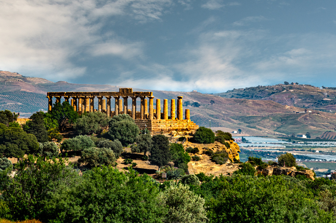 _8508011-Edit-2Temple of Hera
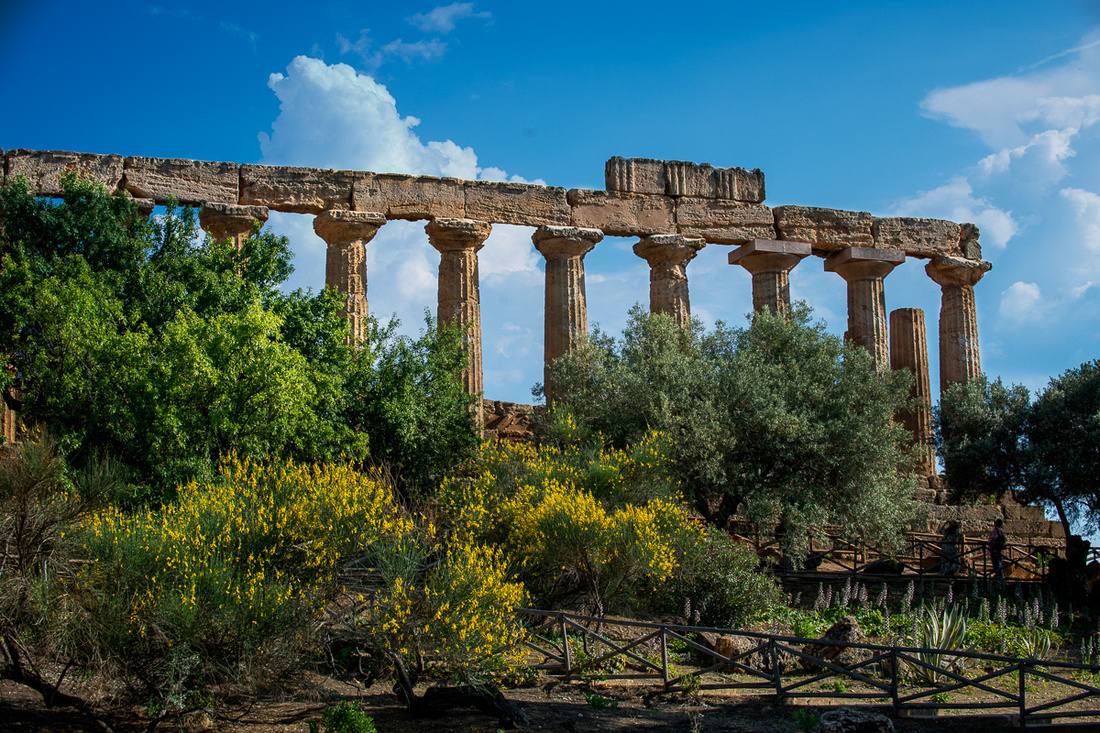 _8508027-EditTemple of Hera
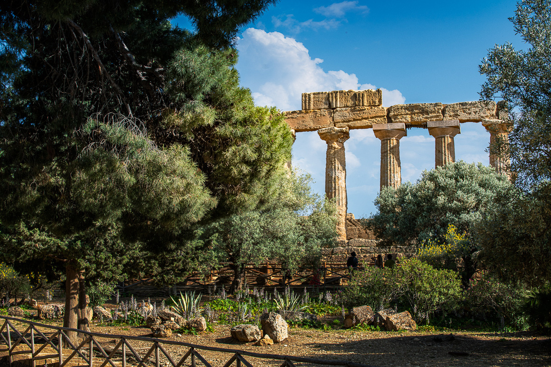 _8508021-Edit
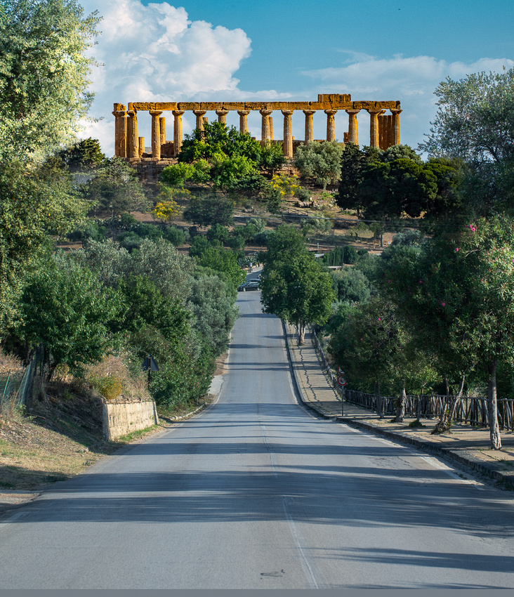 _8508057-Edit
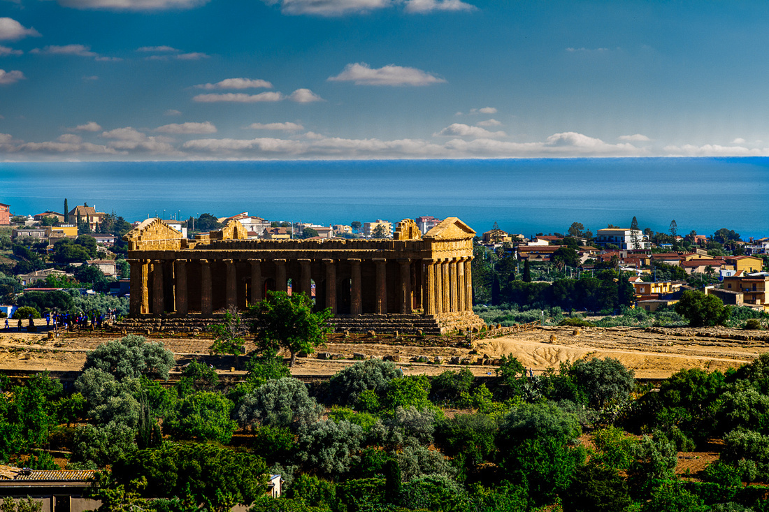 _8508012-EditTemple of Concordia
We then headed back to our quarters to grab a bite and prepare for the evening shoot - the moon rising over the temples. We had pre-scouted a place up a dirt road and we had just gotten far enough ( I hoped) when we came to a chain across the road. Everything beyond that was "keep out!". We got there just as it really got dark and I would soon learn whether my sky alignment app was putting me where I wanted to be.
_8508012-EditTemple of Concordia
We then headed back to our quarters to grab a bite and prepare for the evening shoot - the moon rising over the temples. We had pre-scouted a place up a dirt road and we had just gotten far enough ( I hoped) when we came to a chain across the road. Everything beyond that was "keep out!". We got there just as it really got dark and I would soon learn whether my sky alignment app was putting me where I wanted to be.
The primary target was the Temple of Hercules. We had set up about 500 yards west of the park so it was the closest and I knew from my scouting trip I could get a clear shot at it. I would evaluate the possibility of getting another of the temples after I saw where the moon actually came up.
Here's what I got right at moonrise.
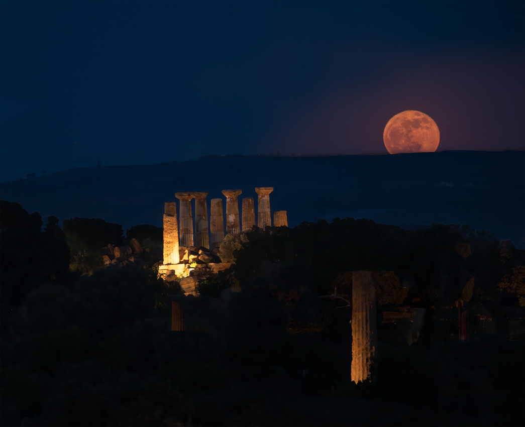 _8508081-2
Success! So I decided to go on up the road into forbidden territory, hoping no dogs were out, and try to get Concordia in a picture.
_8508081-2
Success! So I decided to go on up the road into forbidden territory, hoping no dogs were out, and try to get Concordia in a picture.
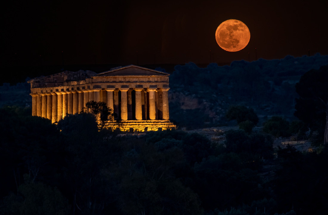 _8508082-Edit
That worked too! Hera was out there as well but I decided not to push my luck. Plus it was farther away. One more shot before giving it up. It's the same one as the previous night but I had scouted a little bit better location.
_8508082-Edit
That worked too! Hera was out there as well but I decided not to push my luck. Plus it was farther away. One more shot before giving it up. It's the same one as the previous night but I had scouted a little bit better location.
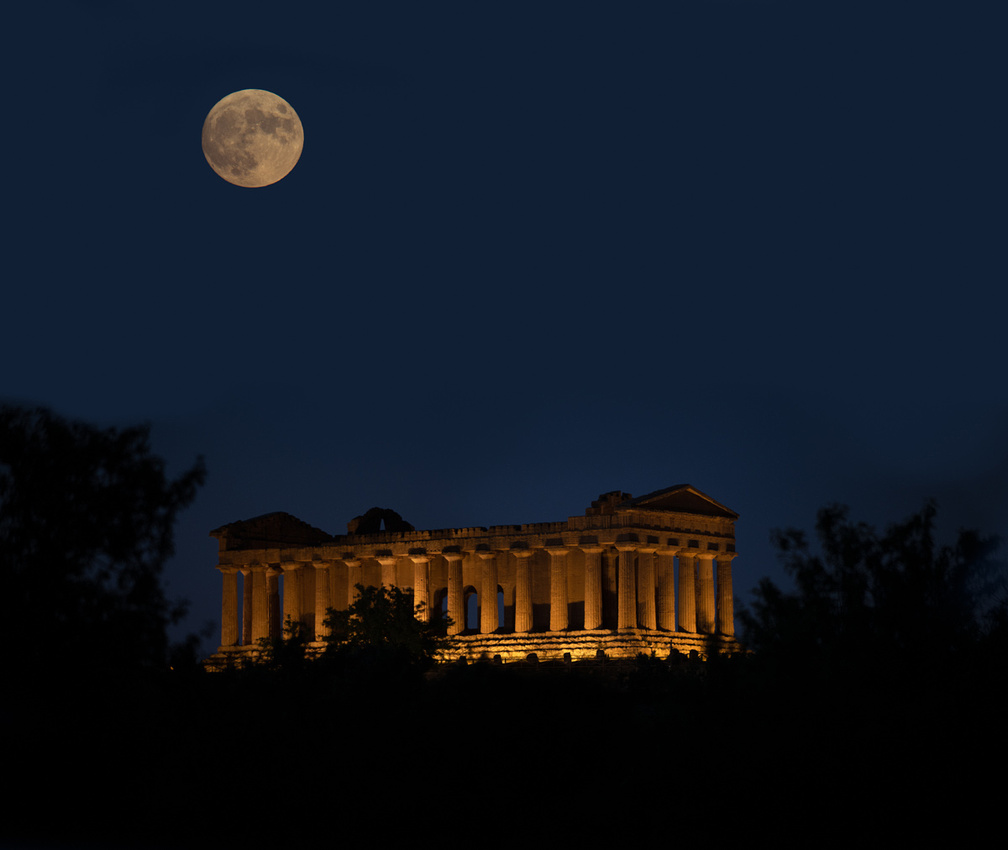 _8508133-Edit
Then home to bed. There would be another early wake up call for the setting moon and sunrise. And then we would be heading east right after breakfast.
_8508133-Edit
Then home to bed. There would be another early wake up call for the setting moon and sunrise. And then we would be heading east right after breakfast.
]]>
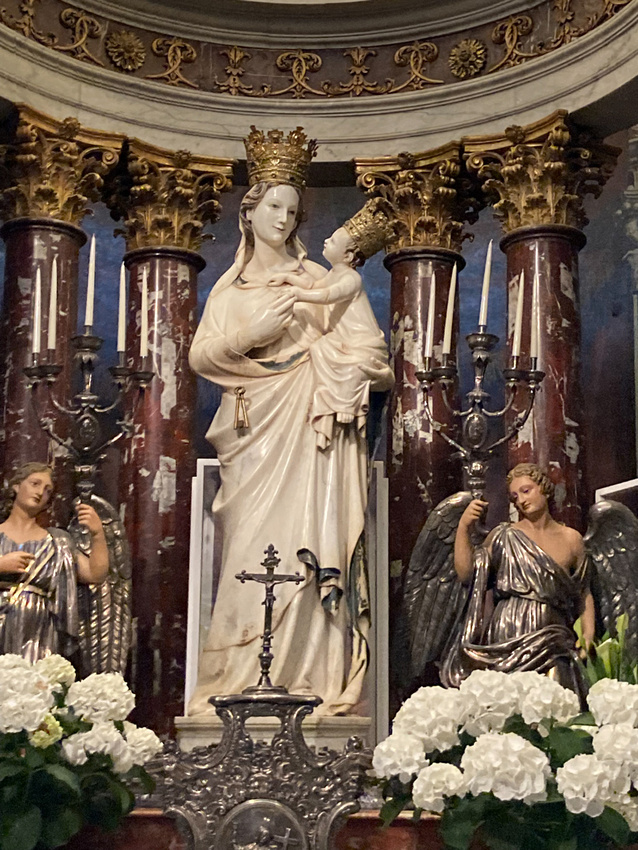
We sat in her chapel for maybe thirty minutes and watched a steady stream of locals, lots of families with children, many of them bringing flowers, come in to ask a blessing.
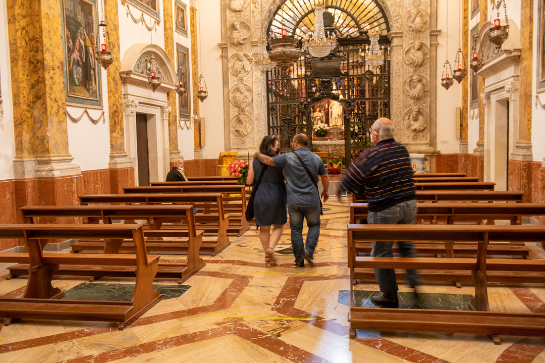 Then on to Agrigento! This was the only one of the three temples sites we had visited in 2012 and it was a prime motive for our coming back. Having had a first look I also thought it would be the best place to get an image of the lunar eclipse.
The Valley of the Temples is sited on a high bluff a short distance from the sea. It is oriented east and west with the Temple of Hera on the east end, the temple of Concordia in the middle, and the temple of Hercules on the west end. There are remains of various other temples scattered around the site. As soon as we arrived we checked in to our AirBnb which was not only very nice but in the perfect location. It was literally a short walk to the west portal of the Valley of the Temples. Jeanne Marie hit another home run finding this place.
So let's get everyone introduced. First, is Hera. I believe most of what you see here has been standing all these centuries. Hera can be confusing because it looks so different from various angles.
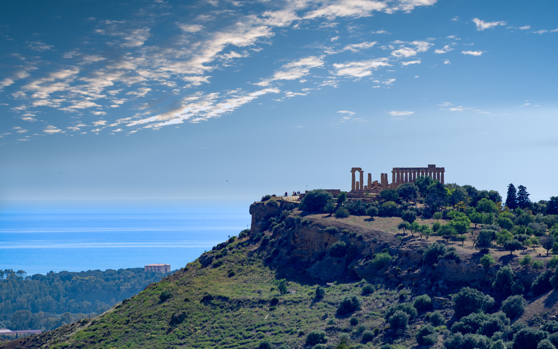 This will be the location for the eclipse shot the next morning. I had scouted this spot with my various computer apps which will tell you exactly where the sun or moon will intersect a feature on the ground. Finding a spot on the map is easy. Whether you can actually get there and plant your tripod is a different problem. We did find this location easily accessible so we went on to find a place to get a sunset shot.
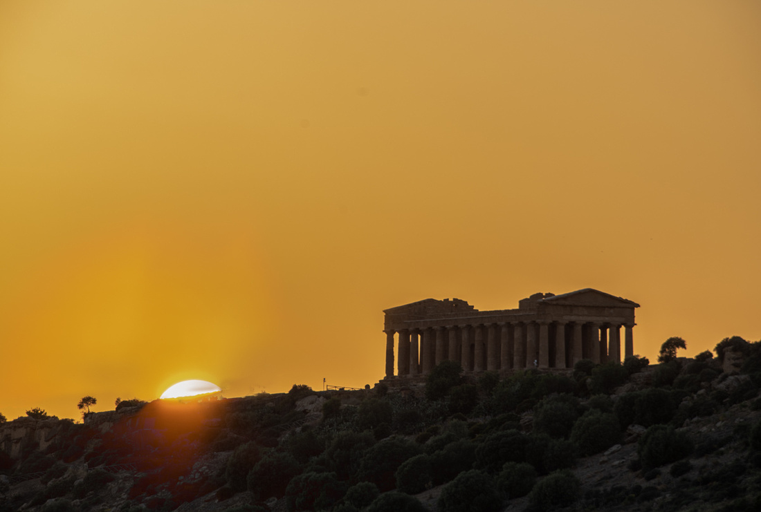 Above is the Temple of Concordia. It has been standing all these centuries and is the most complete Greek temple on the island, maybe anywhere. The inner sanctuary is still there. Only the roof is missing. Here's a better shot of the temple itself.
Next is the remnant of the Temple of Gemini (The Twins Pollux and Castor). It has become a kind of symbol for the whole valley.
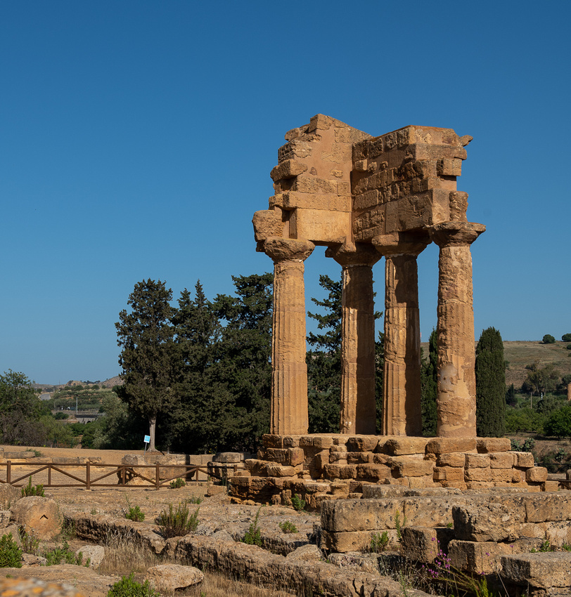
Then there's Hercules. This temple had fallen into rubble and was reassembled. it was only 150 yards from our quarters.
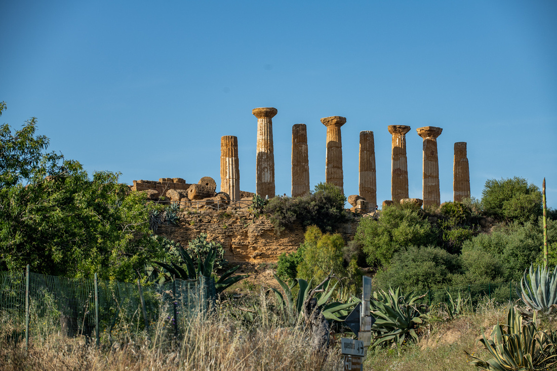
While waiting to cross the street this lovely young lady signaled she wanted her picture taken so I grabbed this as the car pulled away. These Sicilian kids sure seem to enjoy life.
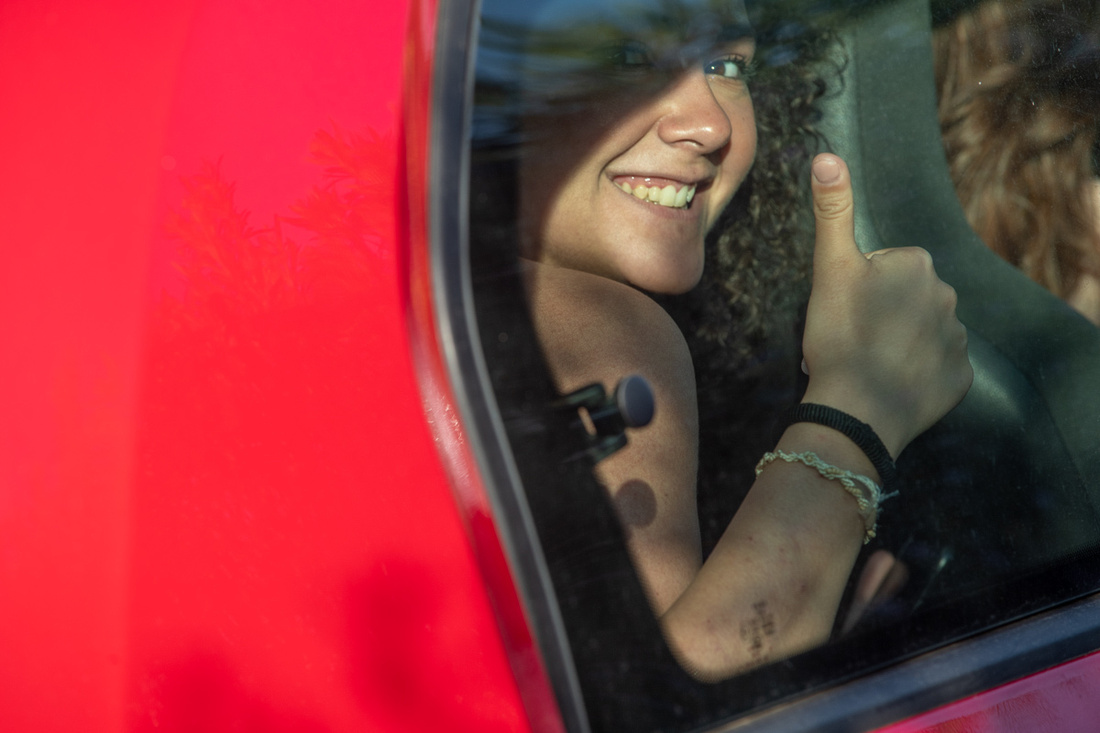
And then we had to chase the rising full moon.
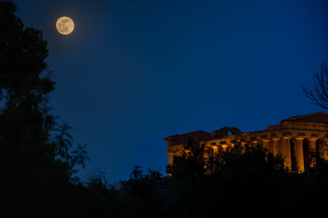
This being our first day in the area we were still getting the lay of the land and trying to find not just access but an acceptable view. We grabbed the above from somebody's driveway. Below is Hercules again. Then we had to get to bed so we could get up at 3:30 for the lunar eclipse.
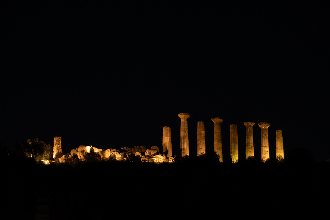
Next morning we took the high road across town and were given the nice little scene below. The picture does not do it justice. I can see why the ancients were brought to their knees to pray when greeted with a scene like this. And you can see that the eclipse was starting.
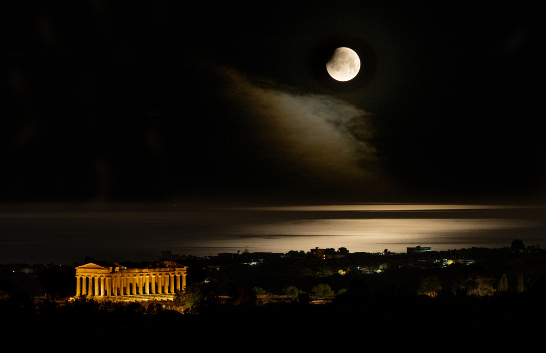
We got to the designated spot and then just had to watch the eclipse progress and wait for the moon to descend into the frame with the Temple of Hera. But as you can see in the image below, in which I overexposed the moon, the weather gods had a trick in mind. The clouds were already starting to obscure the moon.
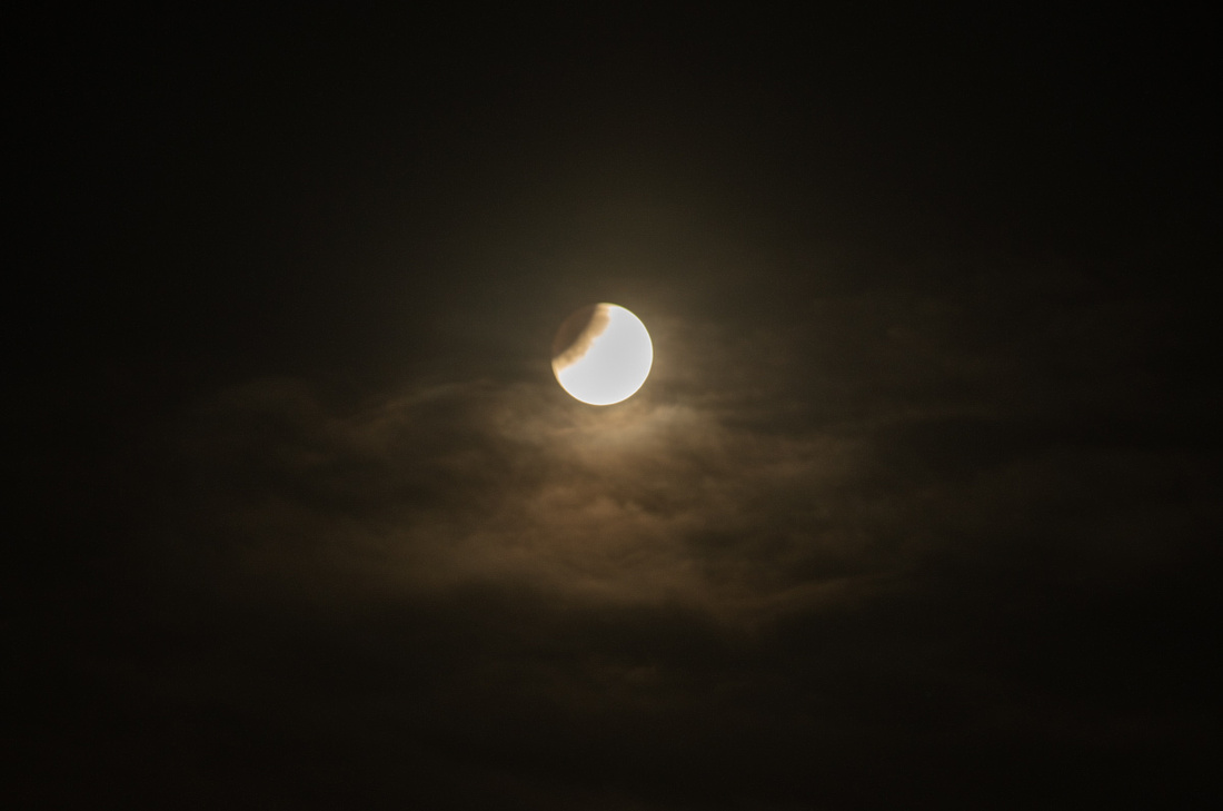
We were still getting pretty good views of the moon until just before it reached the camera's field of view. The image below is actually two images stitched together in Photoshop. It is what we saw, but not in a single frame.
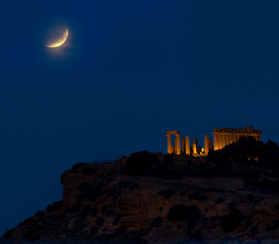
Then below is a few minutes later. This is a single frame but I had to tease out the moon with Photoshop. We couldn't actually see it with the naked eye at that point. The clouds might not have been the only factor. The moon was getting darker and the sky was getting lighter. The eastern sky at that point was rather bright.
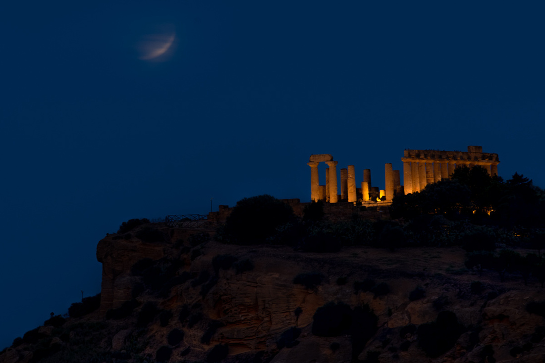
So I didn't get the picture I wanted but as my shooting buddy Al says, "Don't cry over spilled pixels." Or as I say, "If at first you don't succeed, take a couple thousand more images. Even a blind squirrel eventually finds an acorn." We still had two sunrises, a sunset, a moonrise, and a moon set before we departed the area. Lots of pictures were waiting to be taken. Slide show of this first day below.
]]>
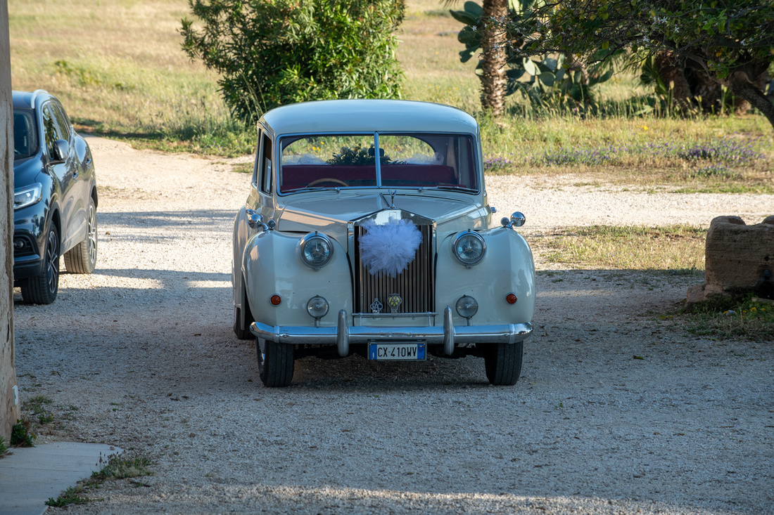
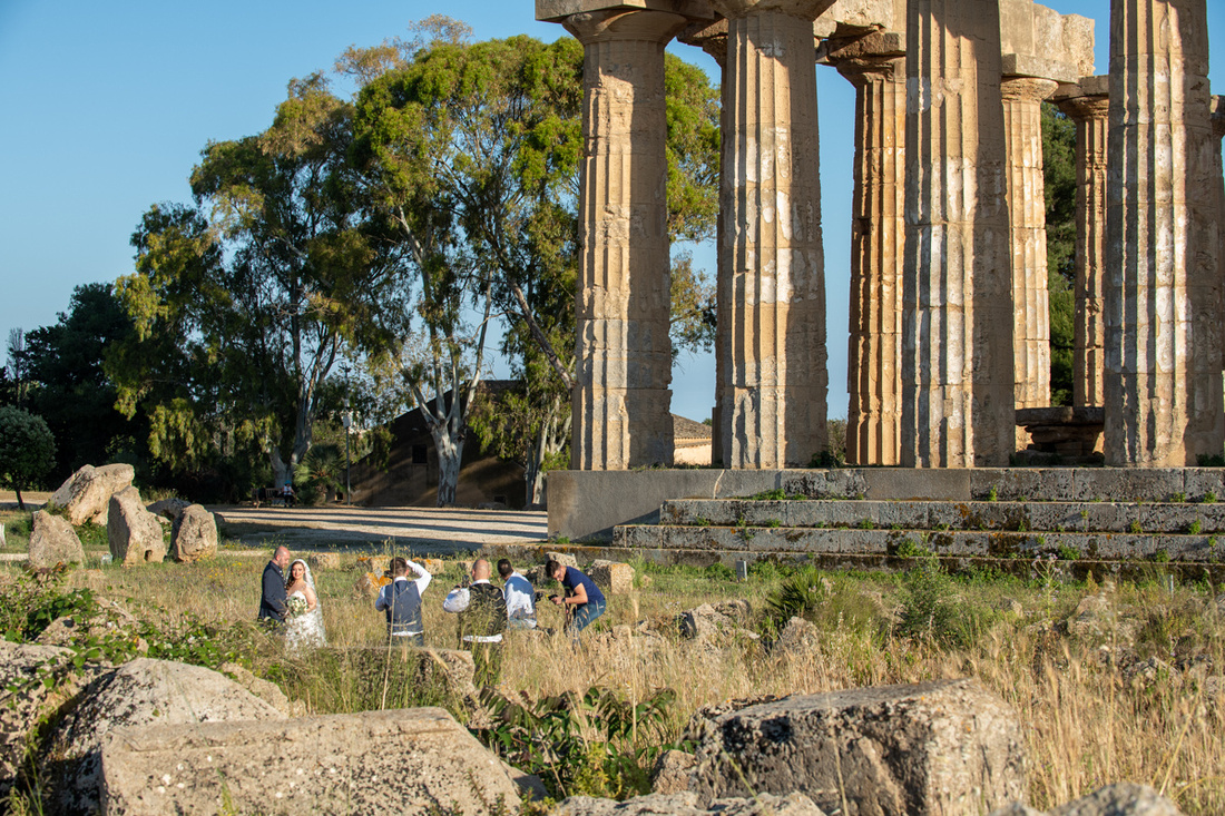
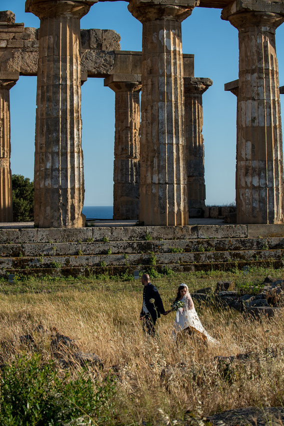
We and the wedding party had the whole place to ourselves and the light was as beautiful as the bride. I'm just going to run through the whole shoot right here. No need for a slide show at the end. This is the story.
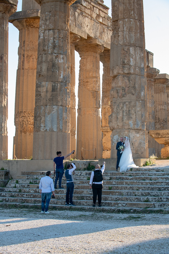
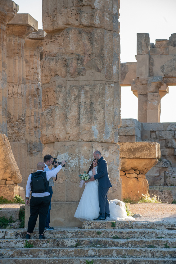
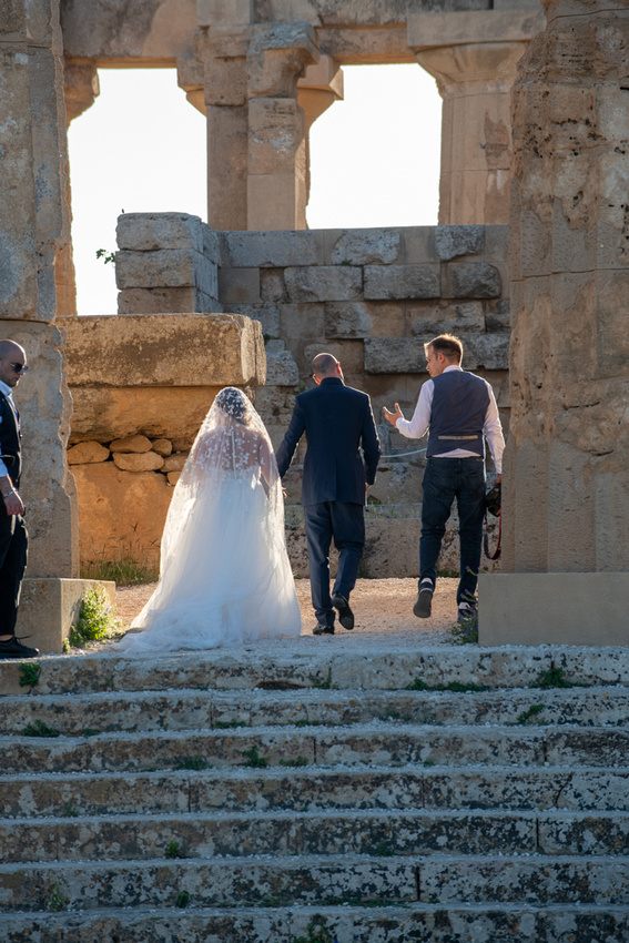
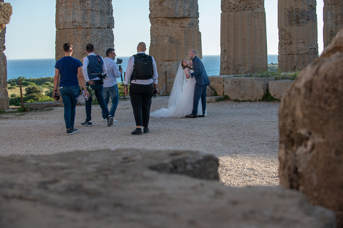
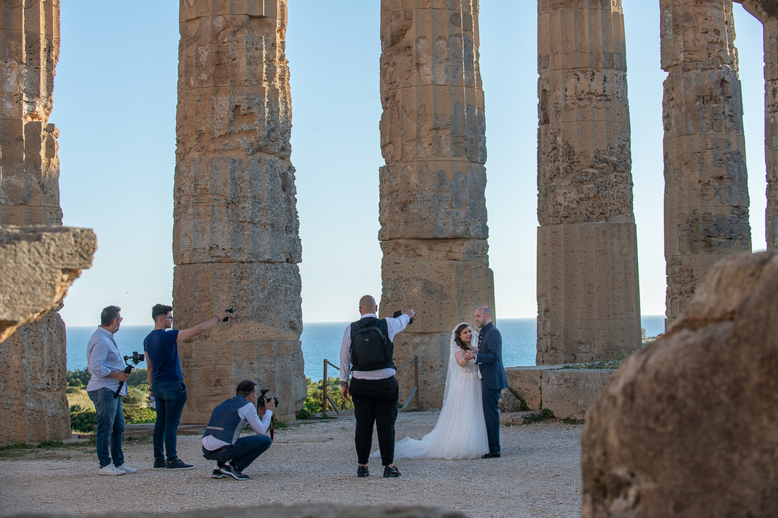
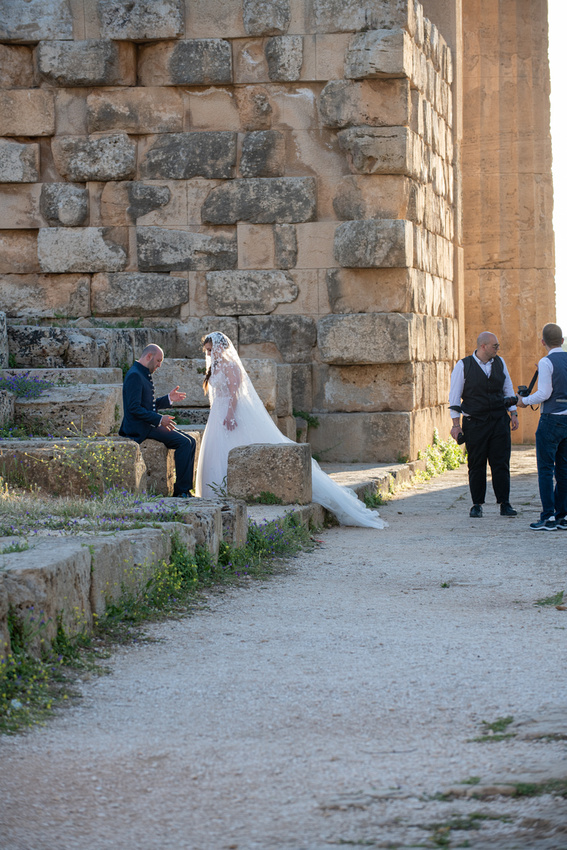

I think she was having fun too.
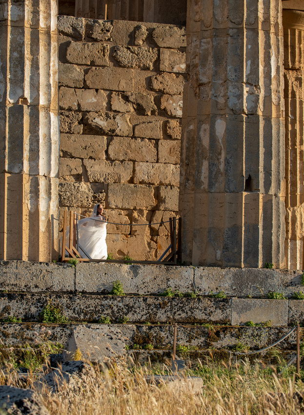
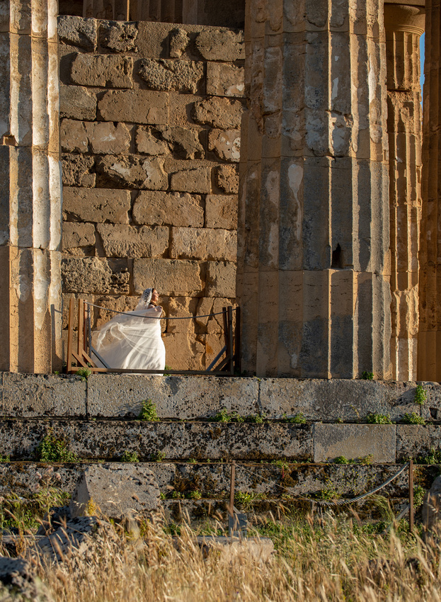
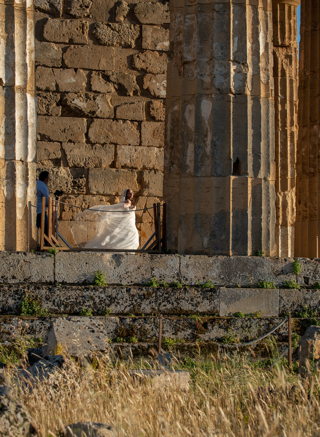
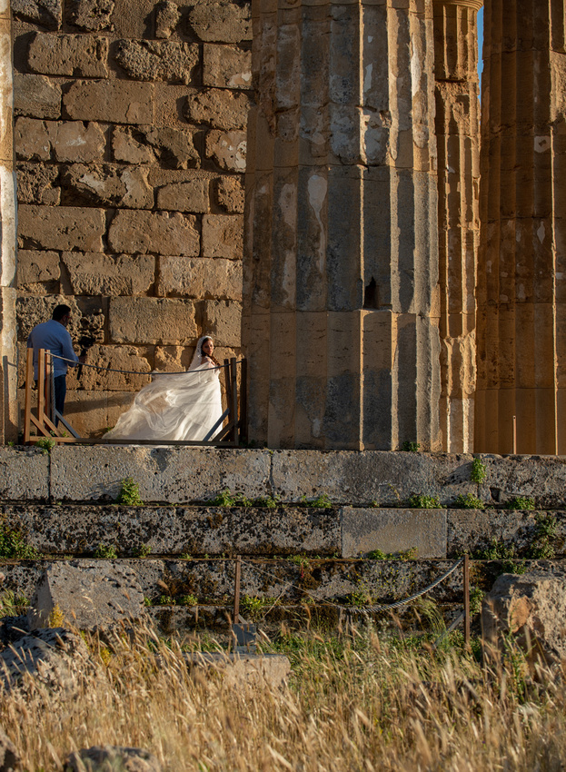
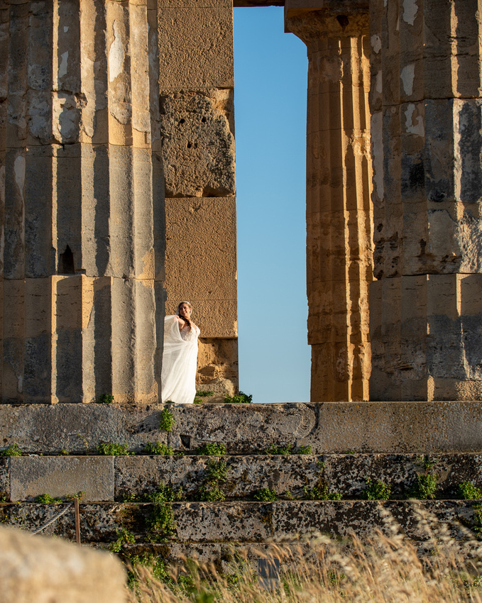
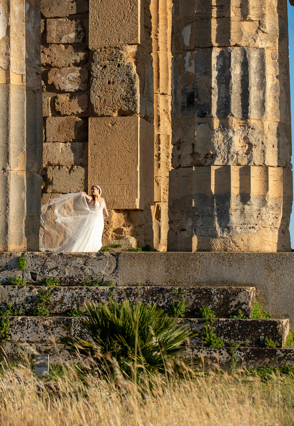
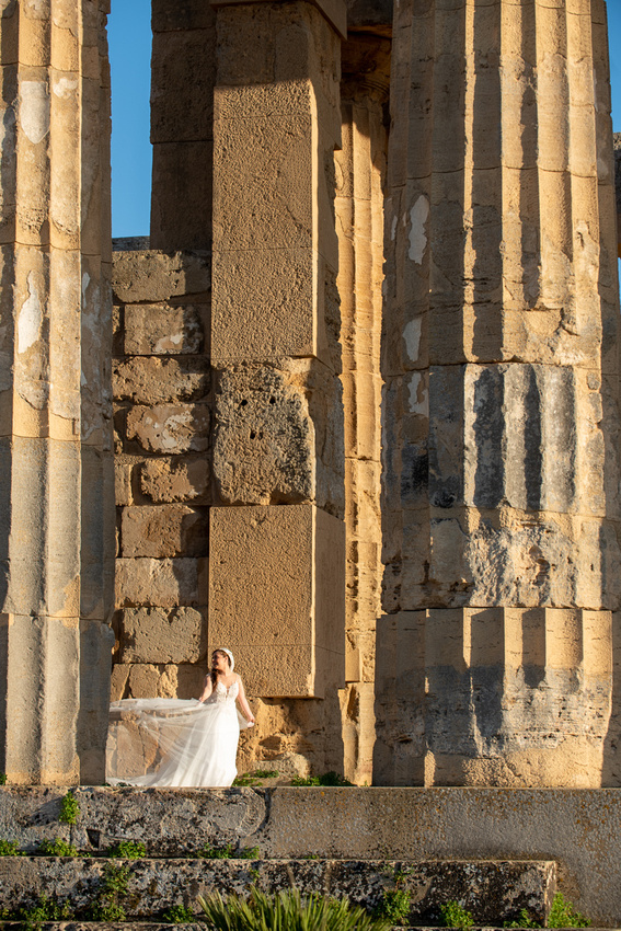
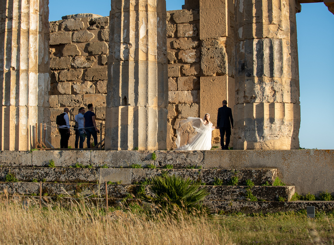
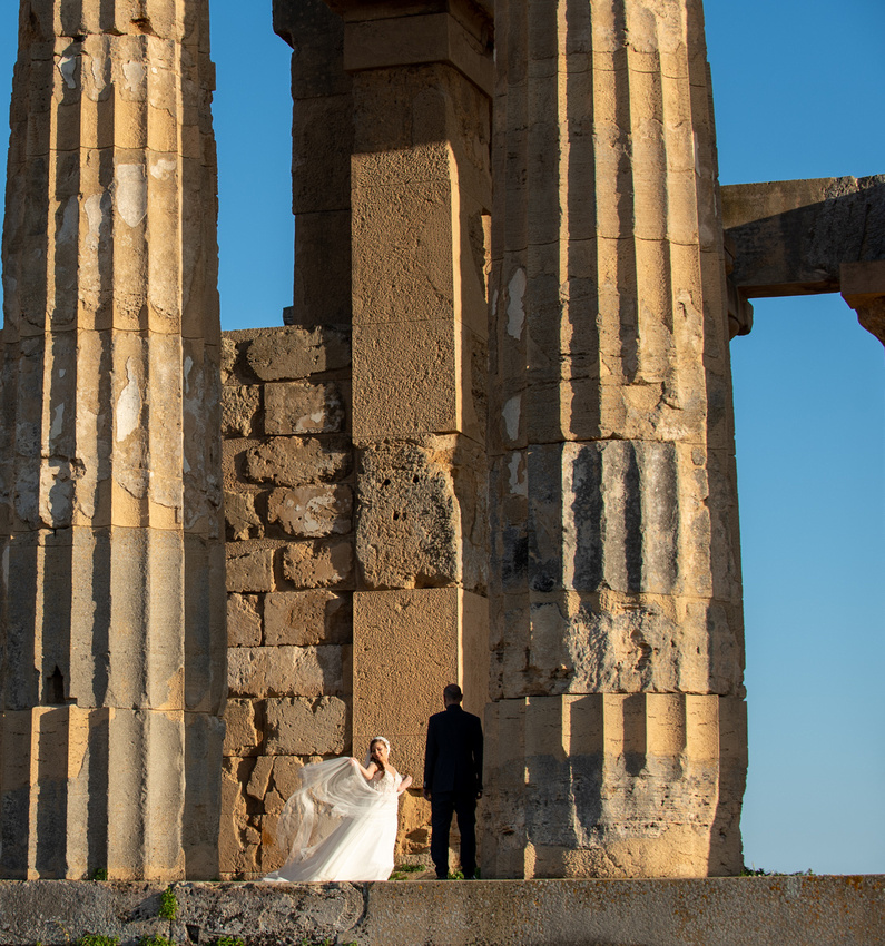
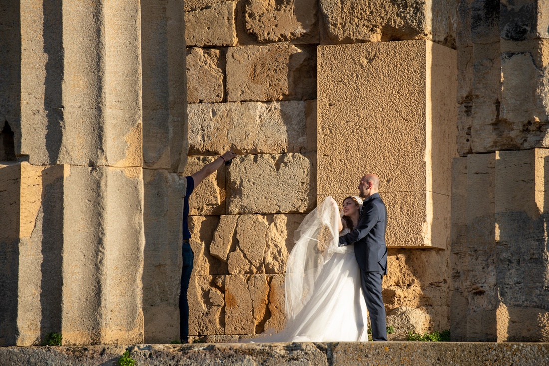
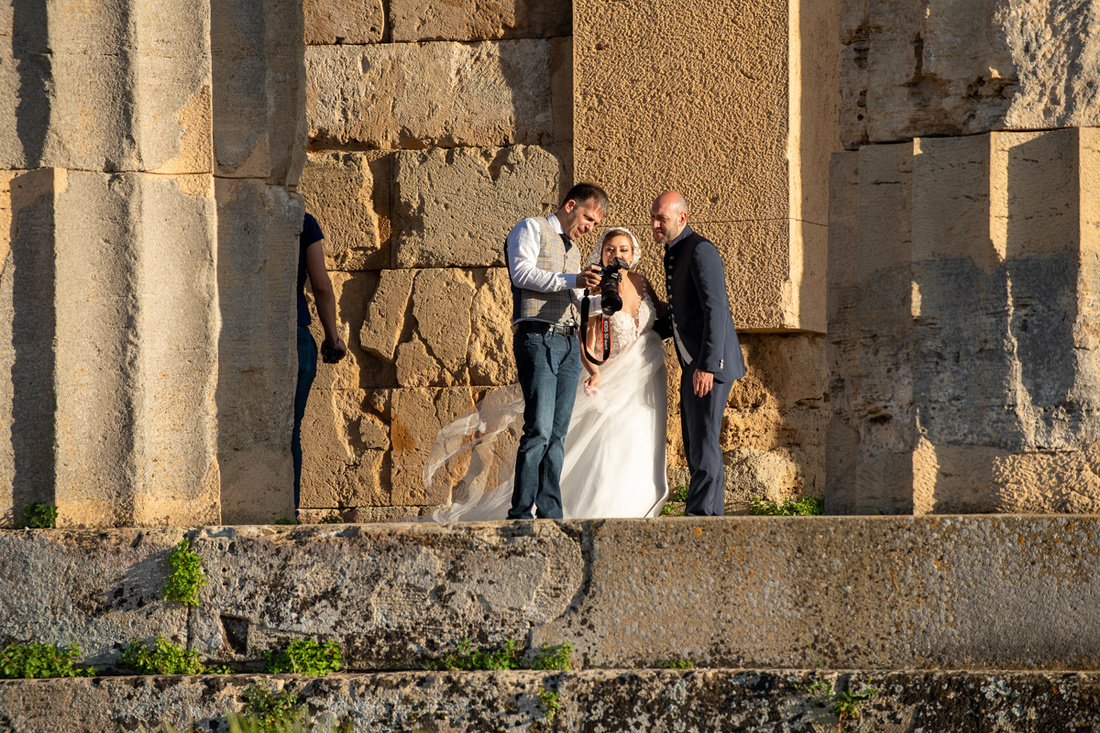
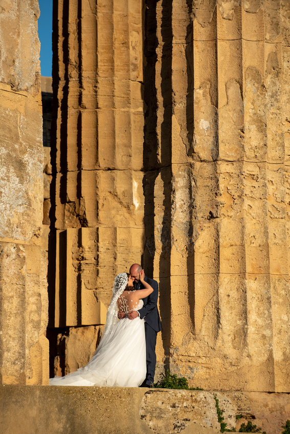
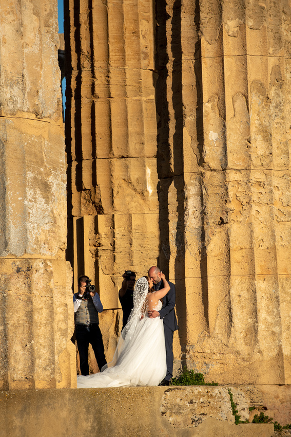
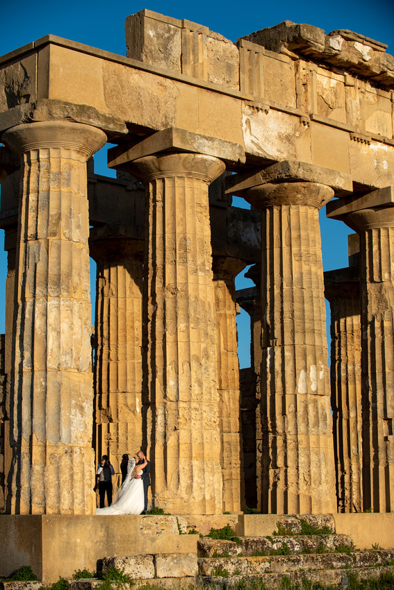
About here I remembered that I was here to capture the great evening light. I turned around and saw this pile of rubble so I took a picture of it and then went back to the wedding party. It was just tooo much fun.
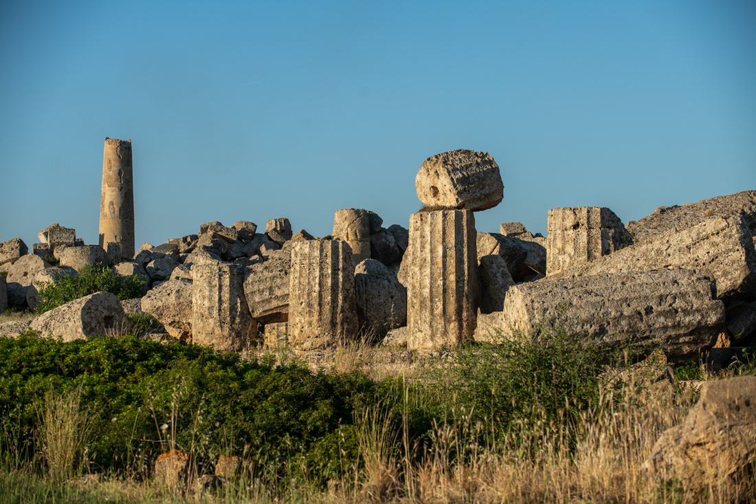
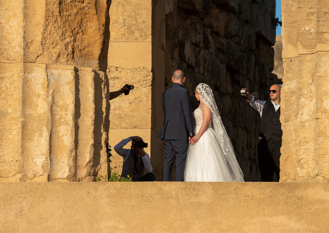
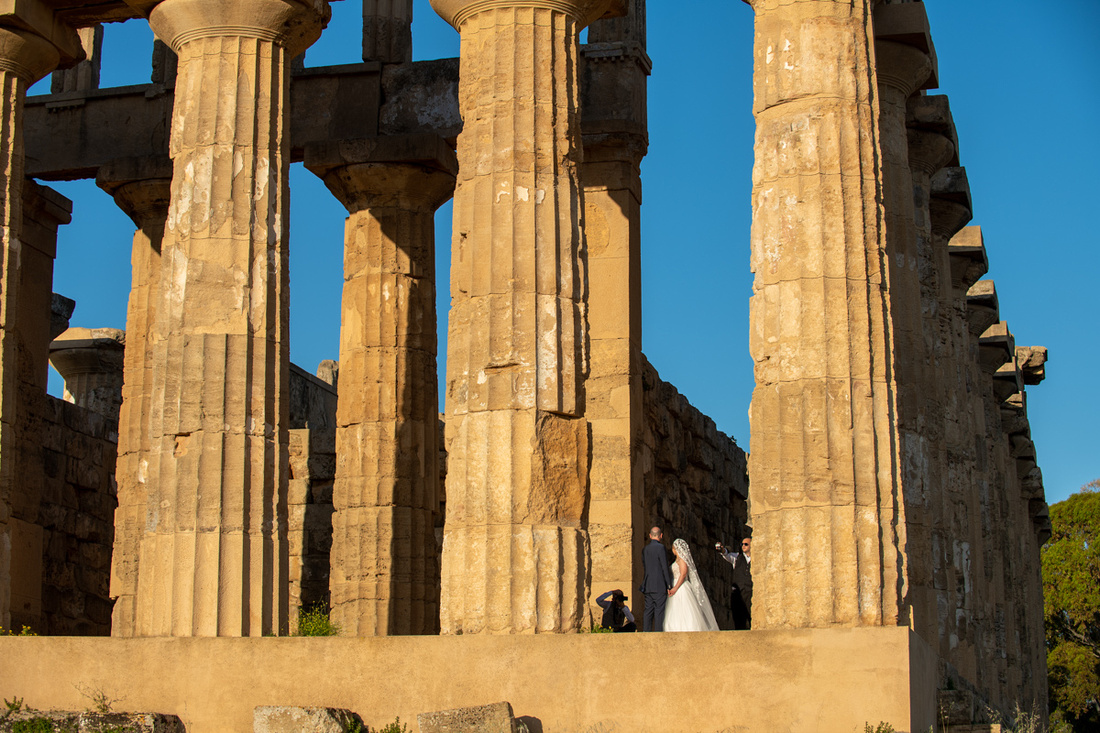
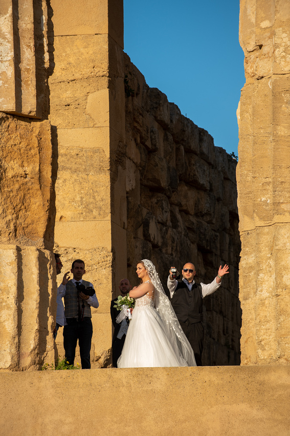
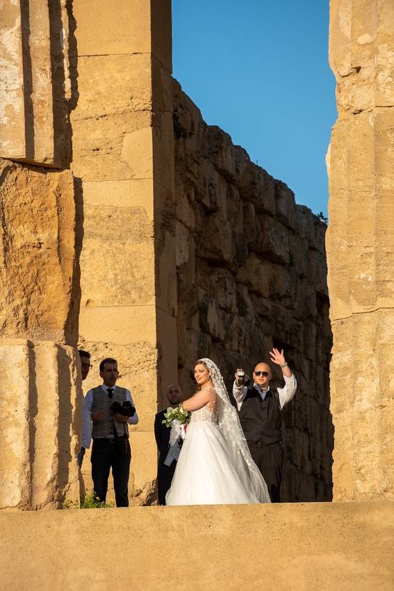
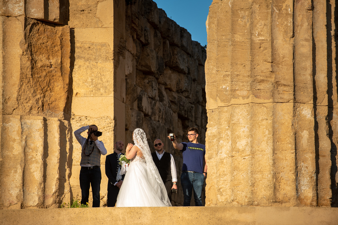
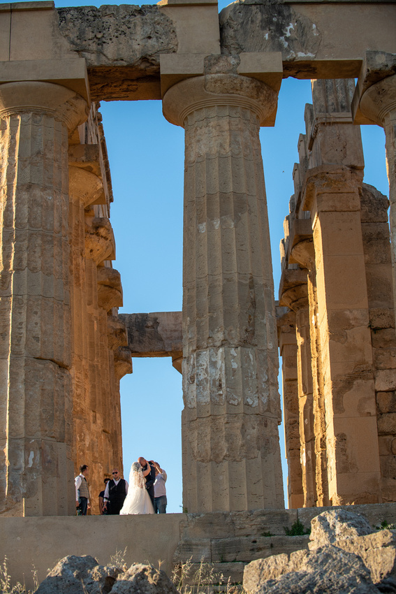
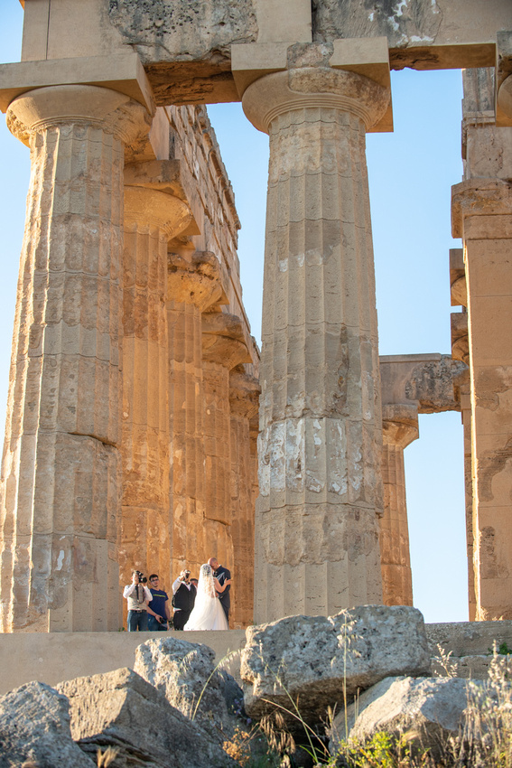
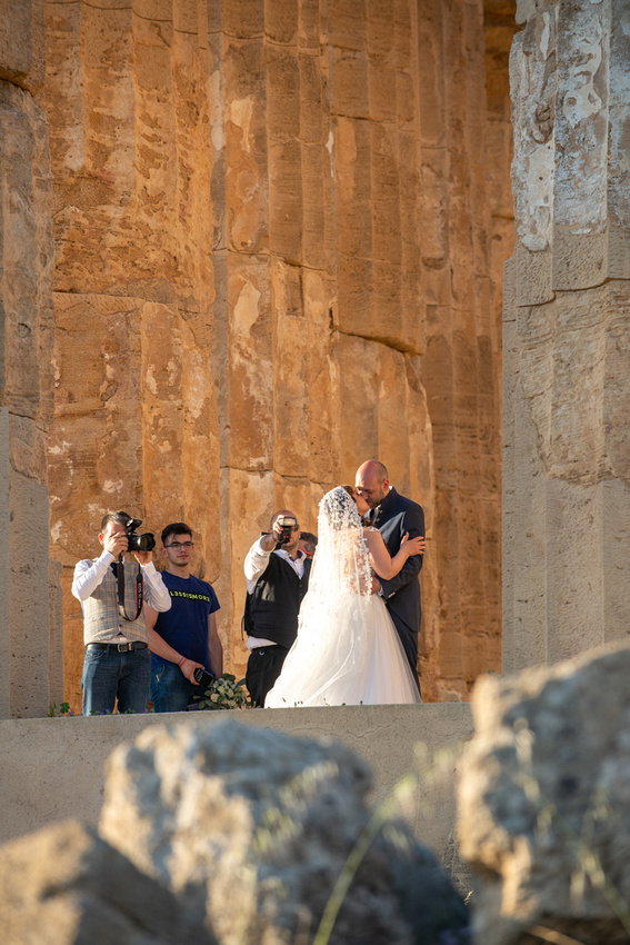
One more kiss then back in the limo. Just as well. The park was closing in 20 minutes so I had to get what I came here for. Just then I noticed the nearly full moon rising over the temple. As you progress through these images you will see the light get better with each shot. Then go back to the last post and compare them. You will see why photographers love this kind of light.
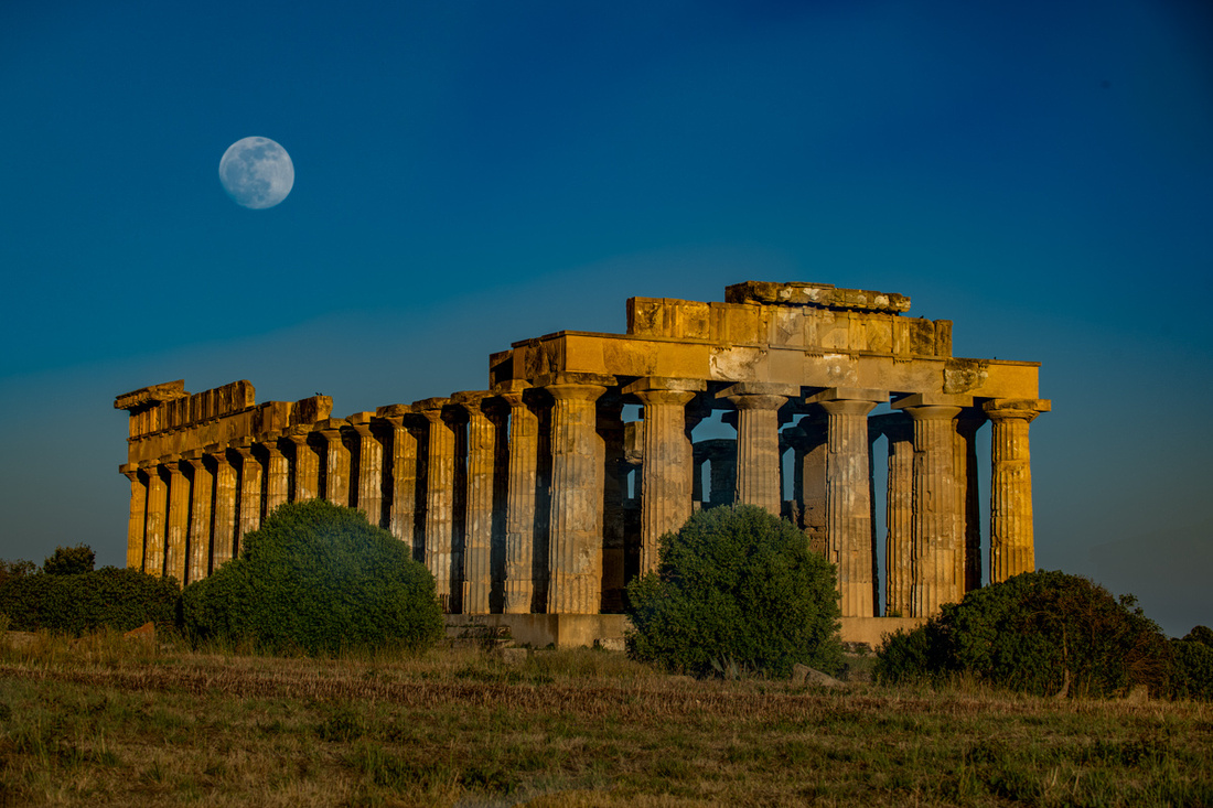
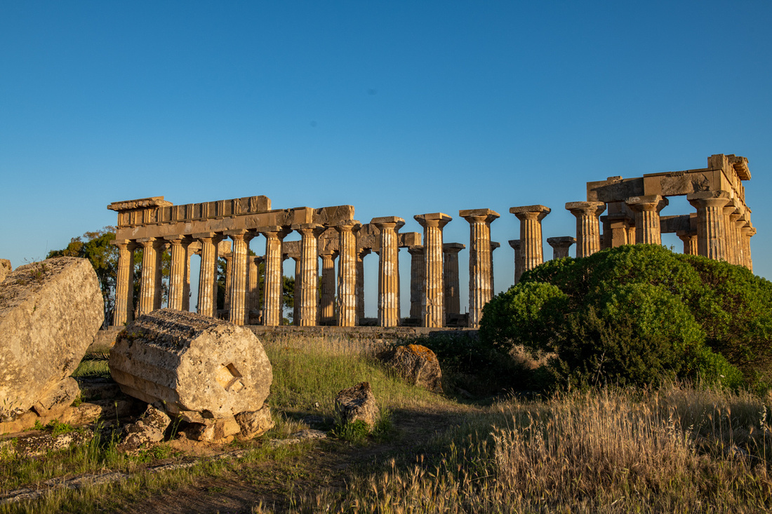
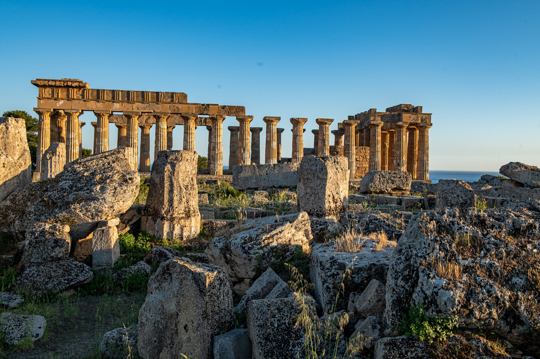
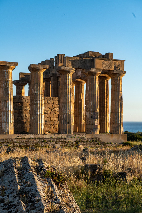
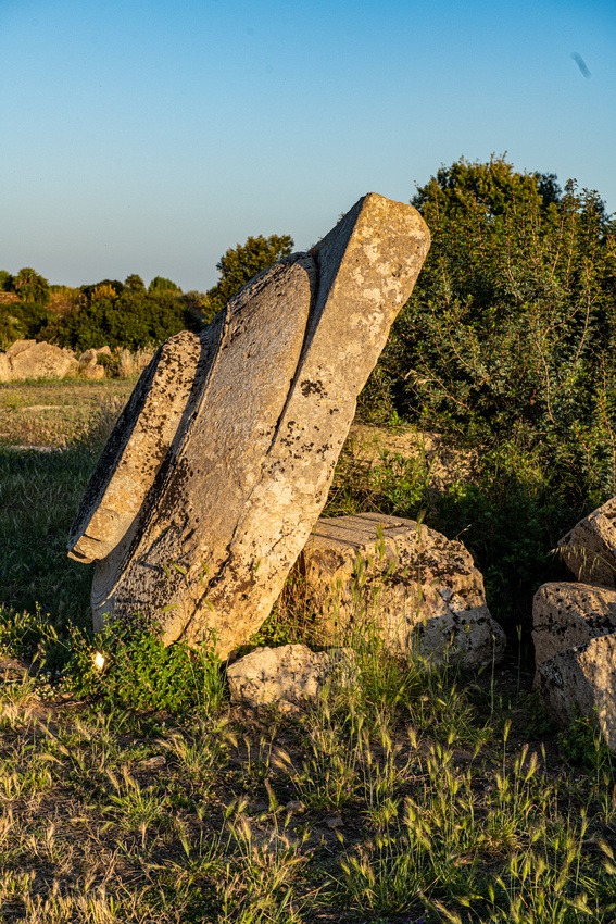
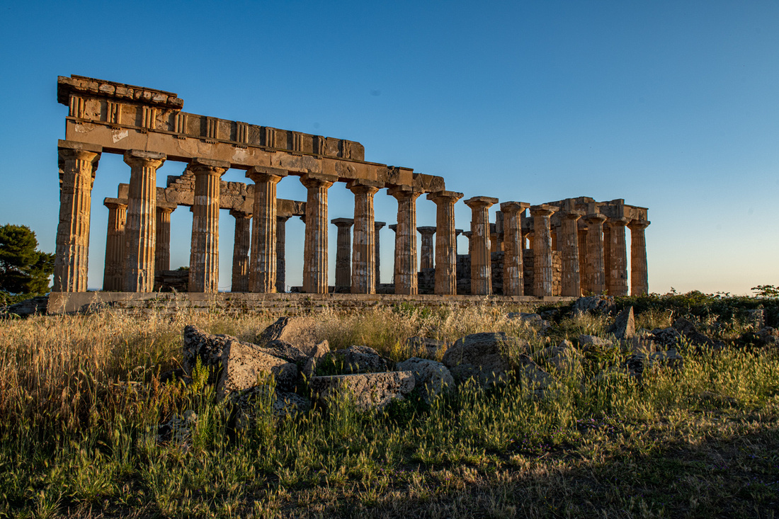
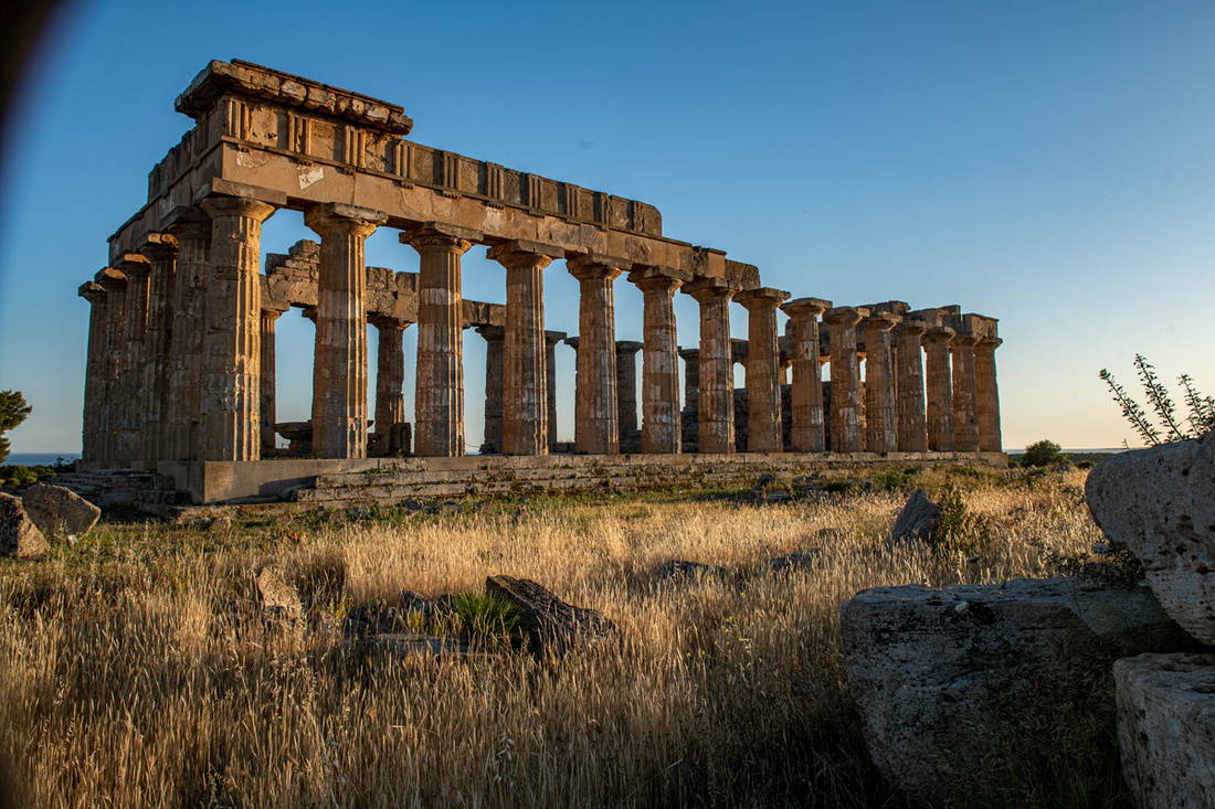
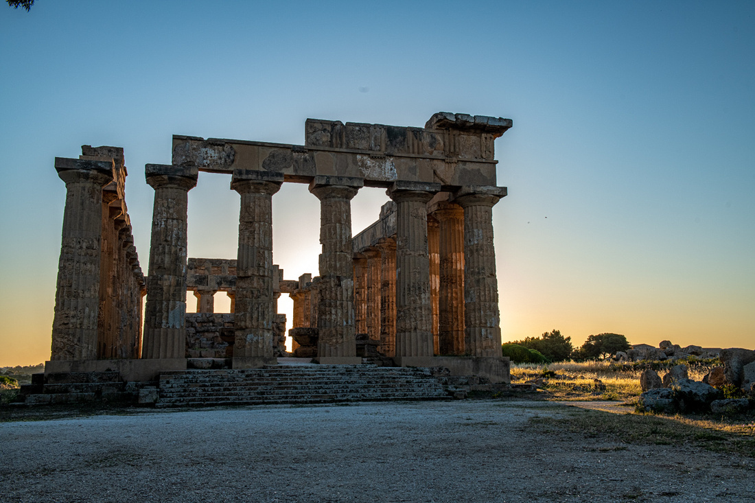
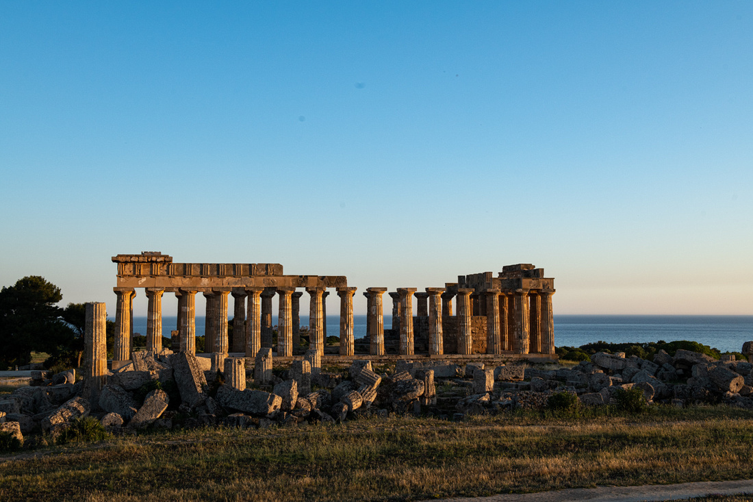
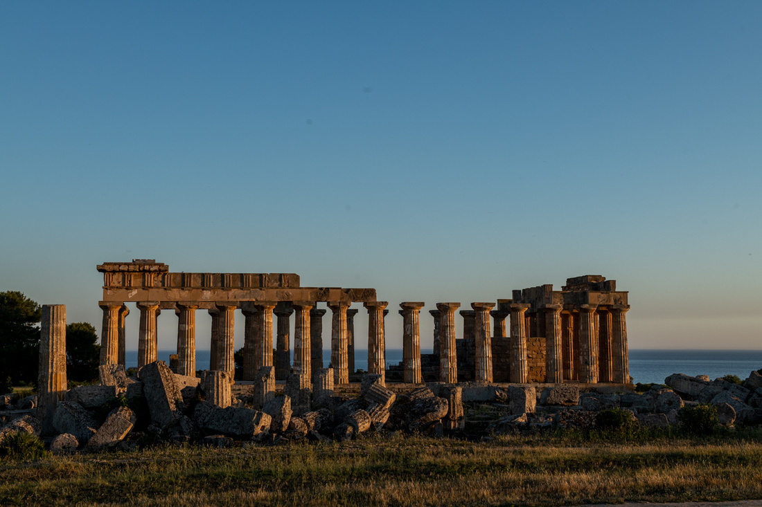
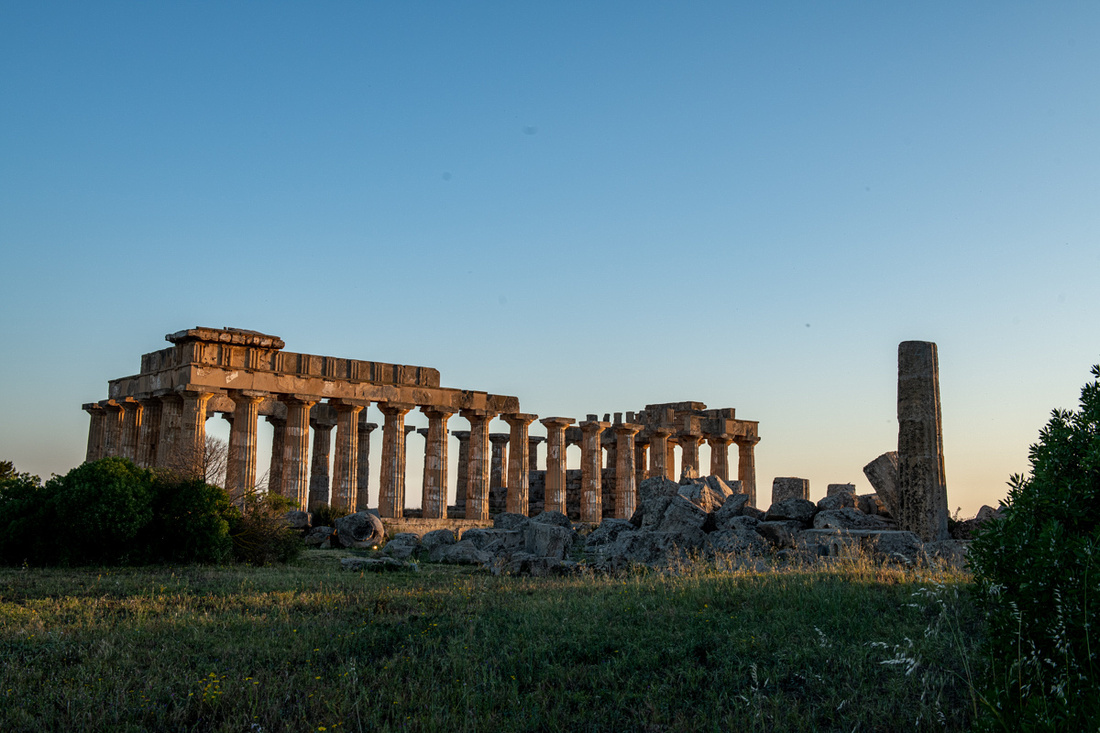
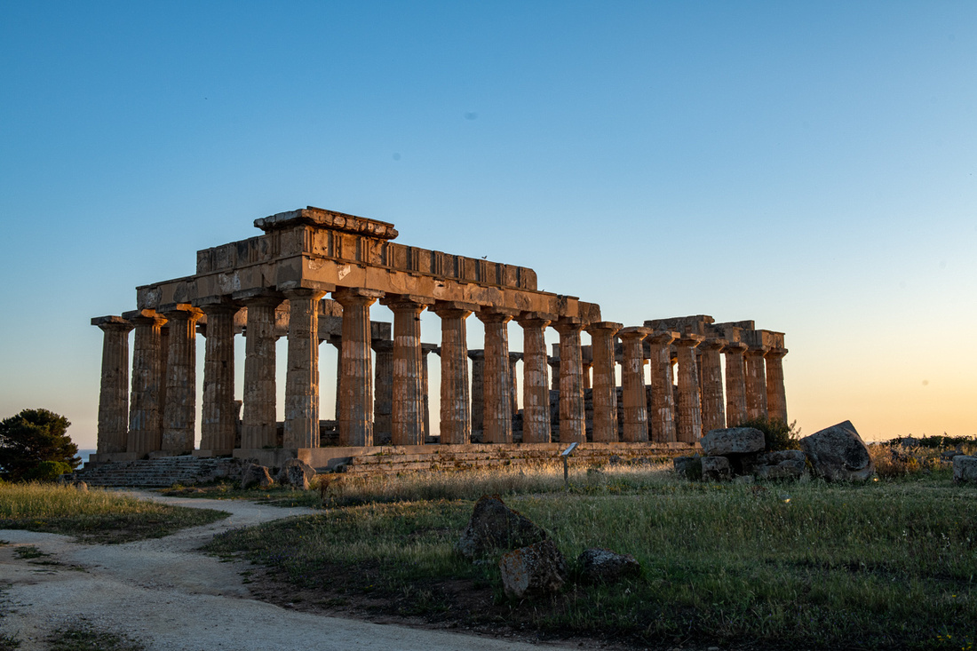
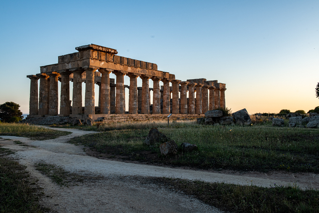
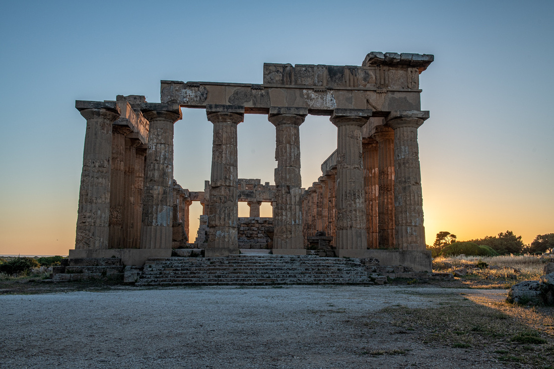
The entire shoot took one hour fifteen minutes.
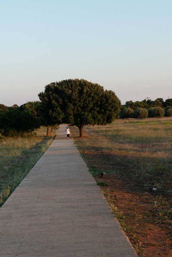
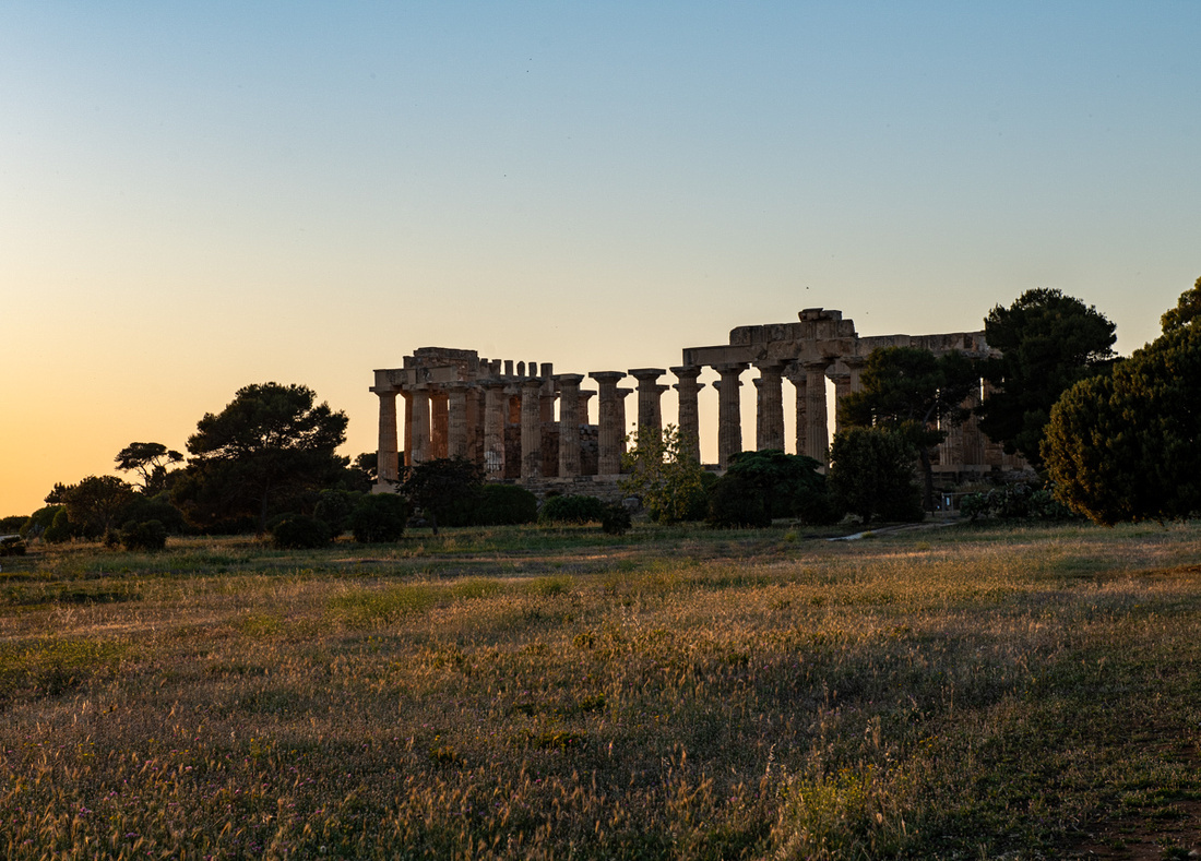
So on Saturday May 14th, first on the agenda is the temple at Segesta. Displaying the Doric style which is the oldest of the three Greek orders, it is the best example of Doric architecture anywhere. It was built about 420 BC but never completed. Very little of the city of Segesta remains, there is an amphitheater at the top of the hill, but the temple sits by itself nestled against a large ravine and the hill you see behind it.
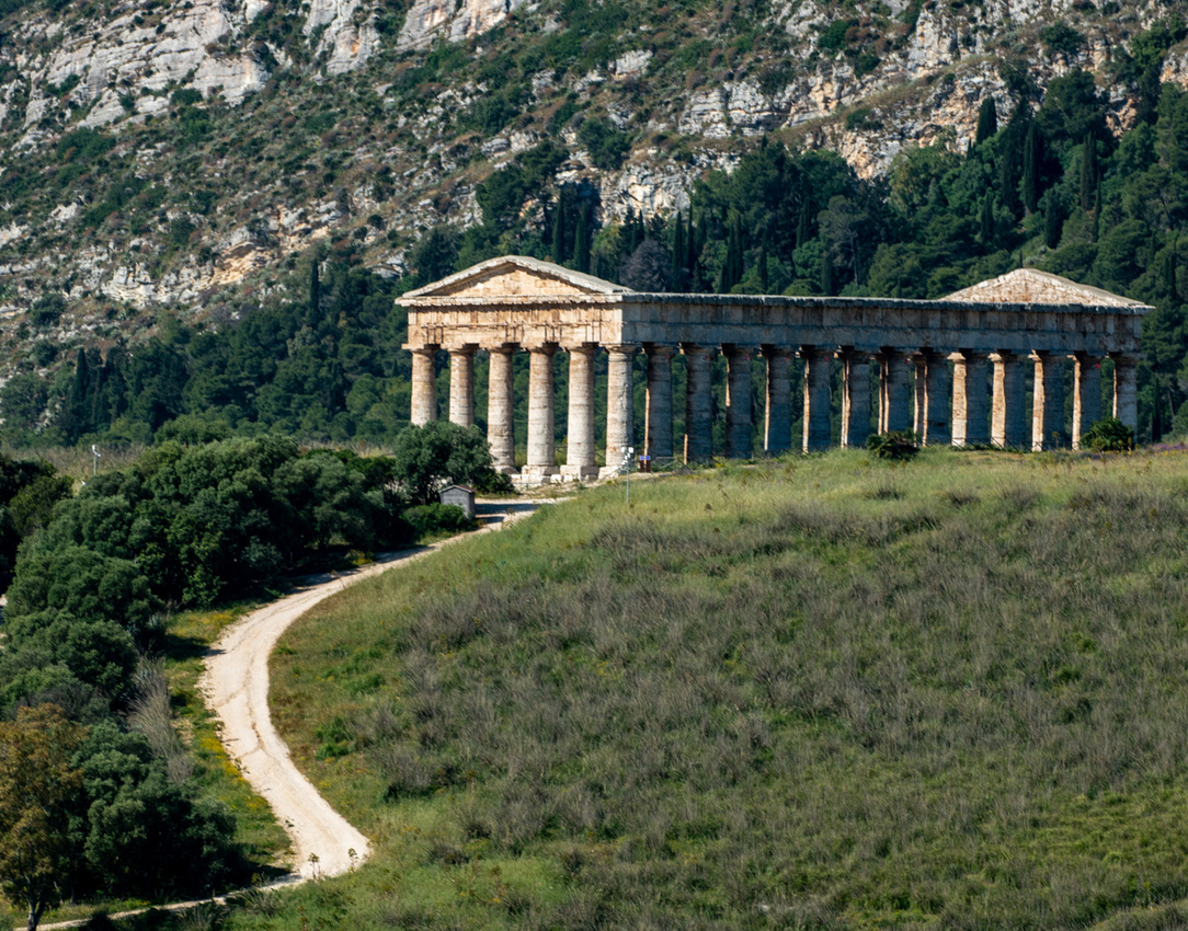
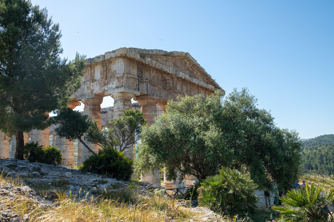
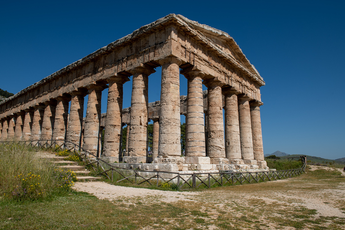
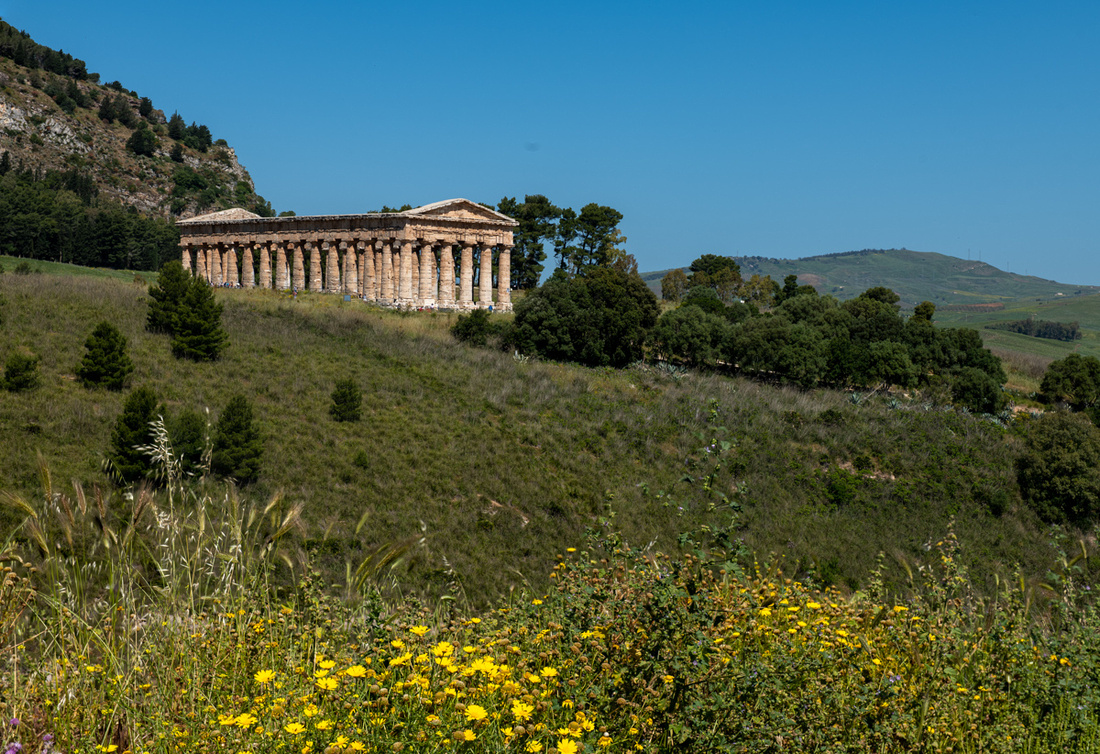
After spending an hour or so shooting the temple we headed south to the next temple complex, Selinunte. But first we had to make a quick side trip to Castelvetrano, the ancestral home of our dear friend, Suzanne Palumbo Tushar. It was just off the highway so we pulled in and went straight to the cathedral. Found it locked but there was a smaller church right next door that was closing in five minutes. So we got a very brief visit. The church had a very unusual carving over the sanctuary.
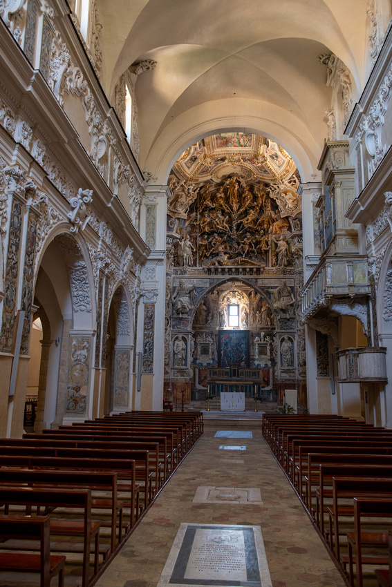
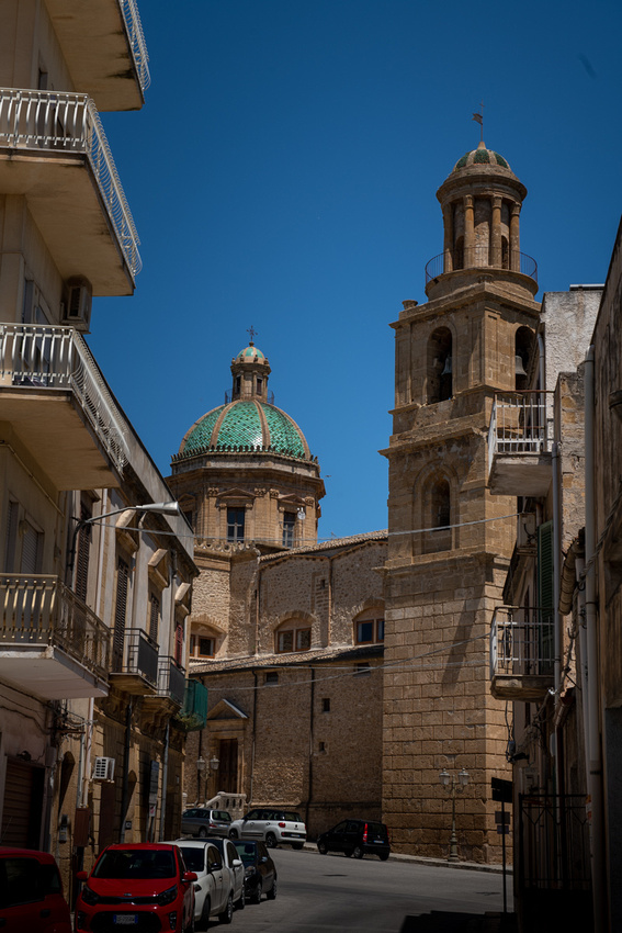
We then went scouting for a better vantage point to photograph the cathedral. No luck. This is the only town in Sicily with no hills. But we did get an excellent lunch. We found the nearest thing to a New York deli we saw on the whole trip.
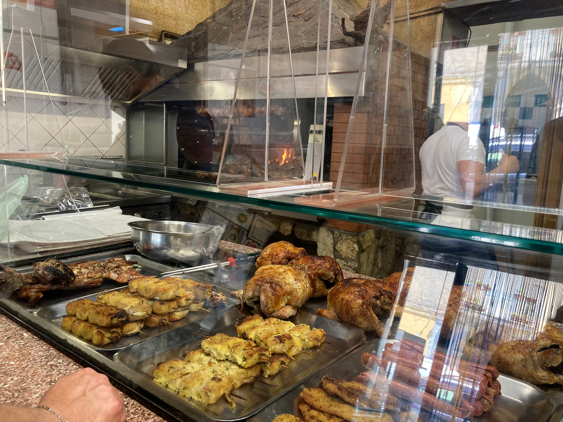
Then on to Selinunte. In ancient times this was the largest of the three sites and is the largest archeological site in Europe today. Well over 100,000 people lived inside its walls and it was the western boundary of Magna Gracia. This put them in conflict with the non Greek Sicilians and with Carthage, the superpower of the Mediterranean at that time. It was they who destroyed the city in 409 BC. Today the most intact of the five original temples is the one dedicated to Hera. And it is the only one, in any of the three temple complexes, that visitors are allowed to enter and walk through.
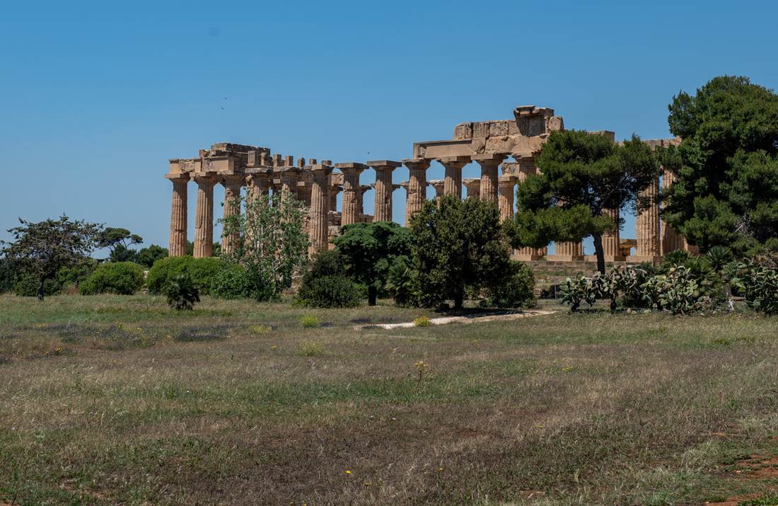
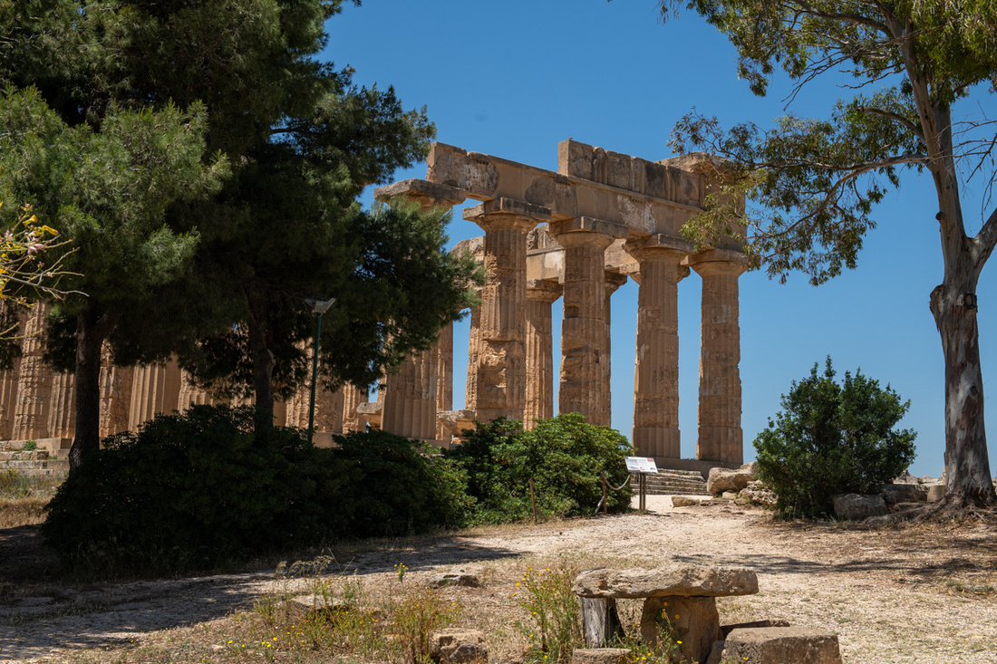
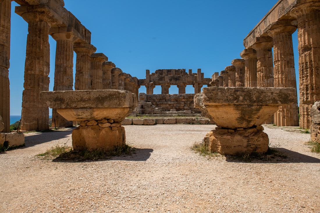 The other temple in this complex worth seeing is on the Acropolis, overlooking the sea.
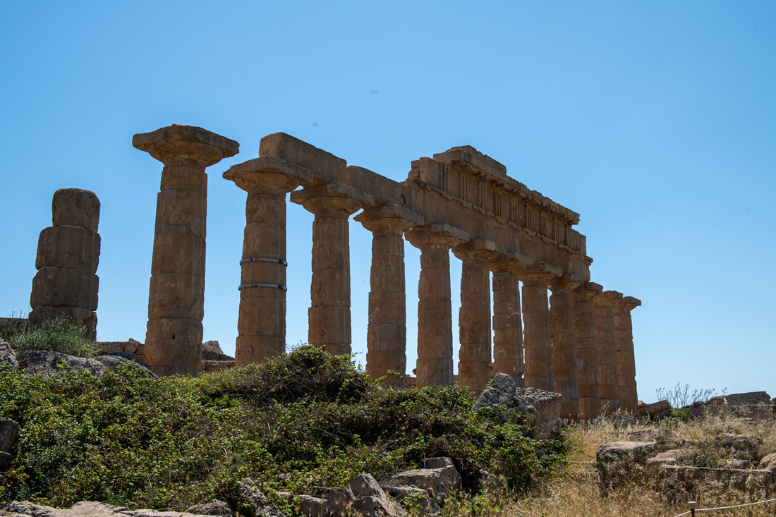 We finished this shoot about 3:30 in the afternoon and found a vendor selling granita di mandorla (almond). As we dipped our little spatulas we discussed our next move. I really wanted to get some better light for my pictures. Any photographers who have been reading this blog have noticed by now that a lot of my pictures have been in high, harsh, mid day light. And blank blue skies. I really was hoping to get some evening light for these temples but sunset was not for almost five hours. So we decided to go down to the beach, dip our toes in the Mediterranean for a little while, try to find a place to relax, and come back later. This plan came off splendidly.
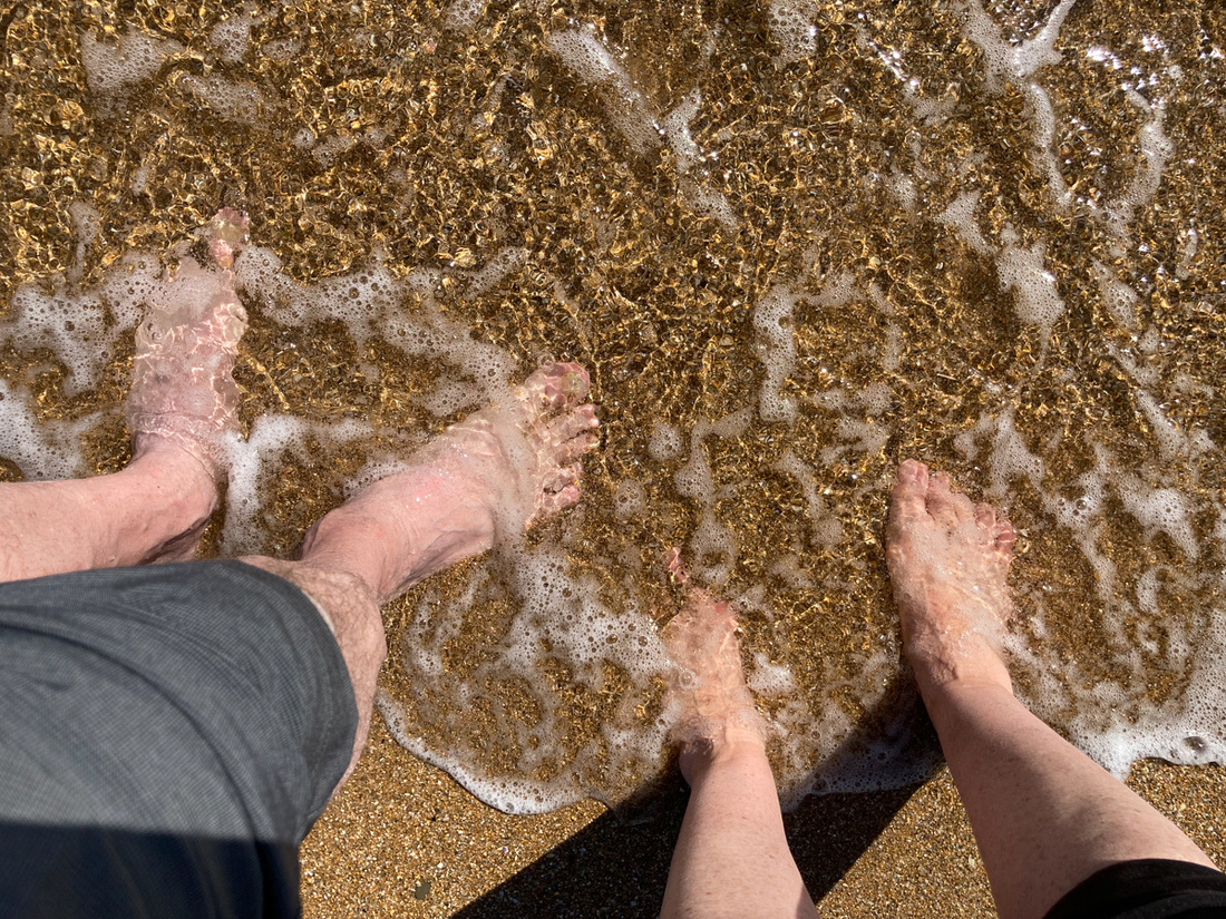
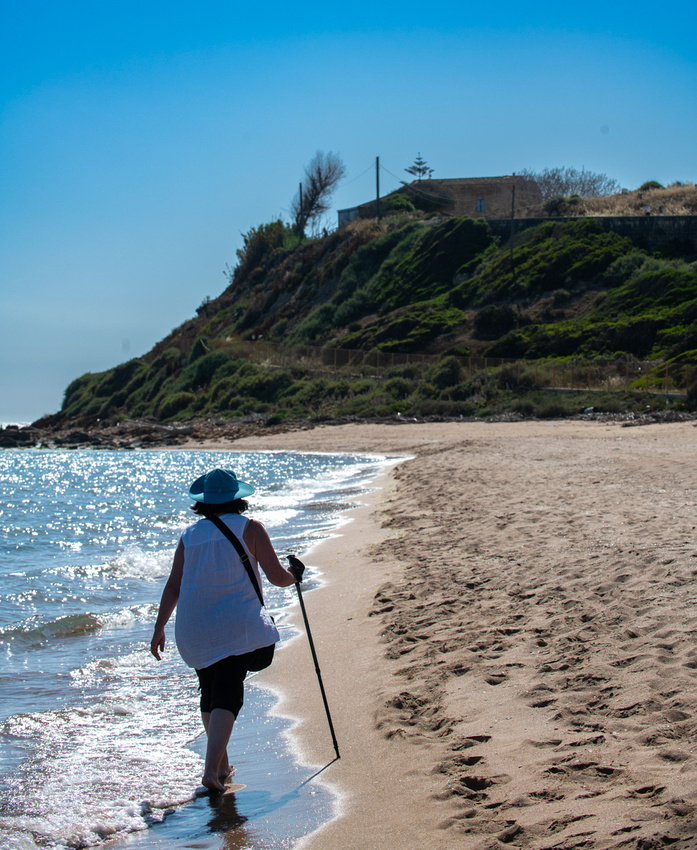
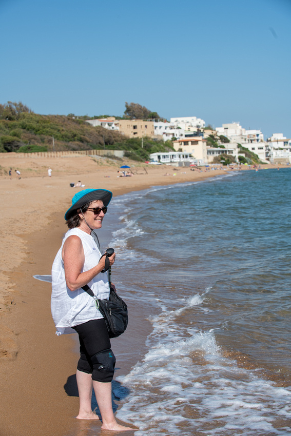
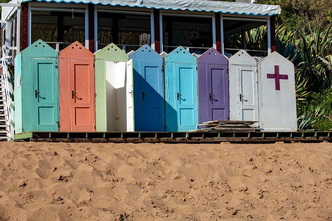
We came across these four young Sicilian gentlemen who insisted that we take their picture. This seems to be a thing with the teenagers here. They just like to have somebody with a real camera take their picture. They all spoke good English so we chatted for awhile.
Then we found a nice bar with a veranda overlooking the sea and killed about an hour with a glass of wine and an Aperol spritz . About seven we headed back up to the temple for the evening shoot. And there the serendipitous photo gods would have a nice little present waiting for me.
Click the image below for a slide show of more pictures.
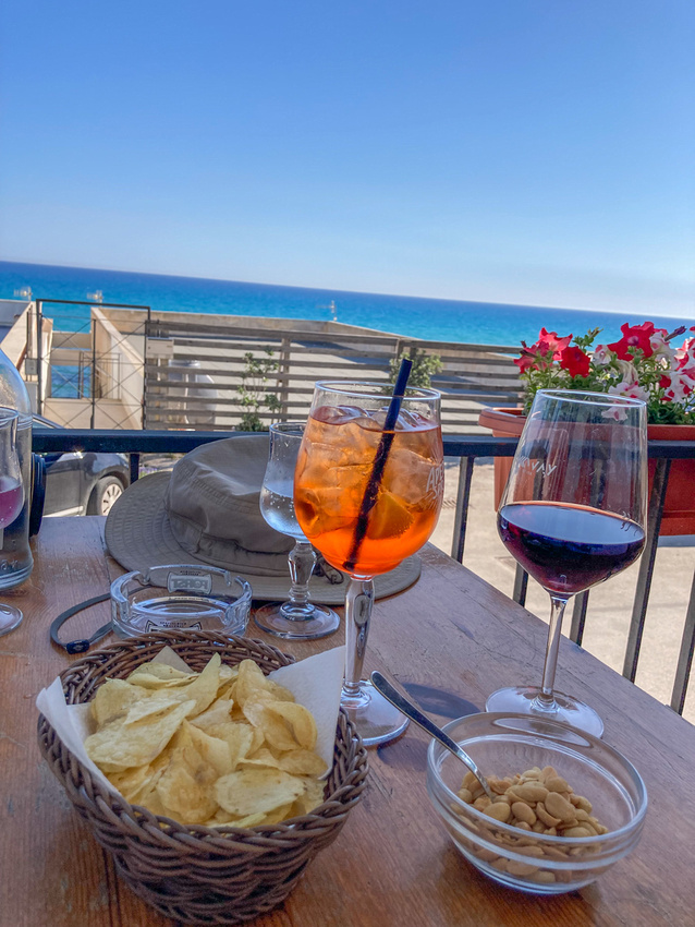
The hill rises 2500 ft above the sea so the views from anywhere in the town are fabulous. Below is the view of the town of Trapani.
First we did the churches. This little town had at least six and they were arranged on a self guided tour which cost a few euros but it assured us that after hunting and finding them they would be open.
Below is the oldest of them. It was built by Roger the First, the Norman conqueror of Sicily so it dates to the 11th century. The inside is very beautiful but not original.
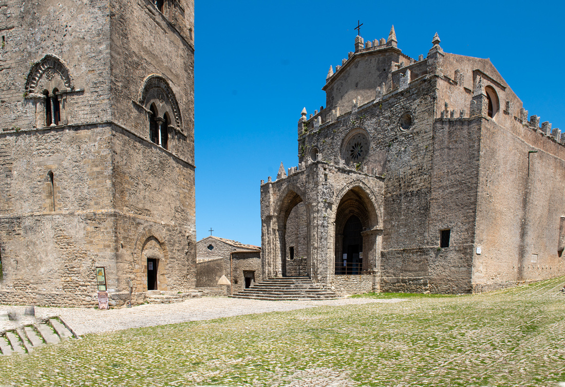
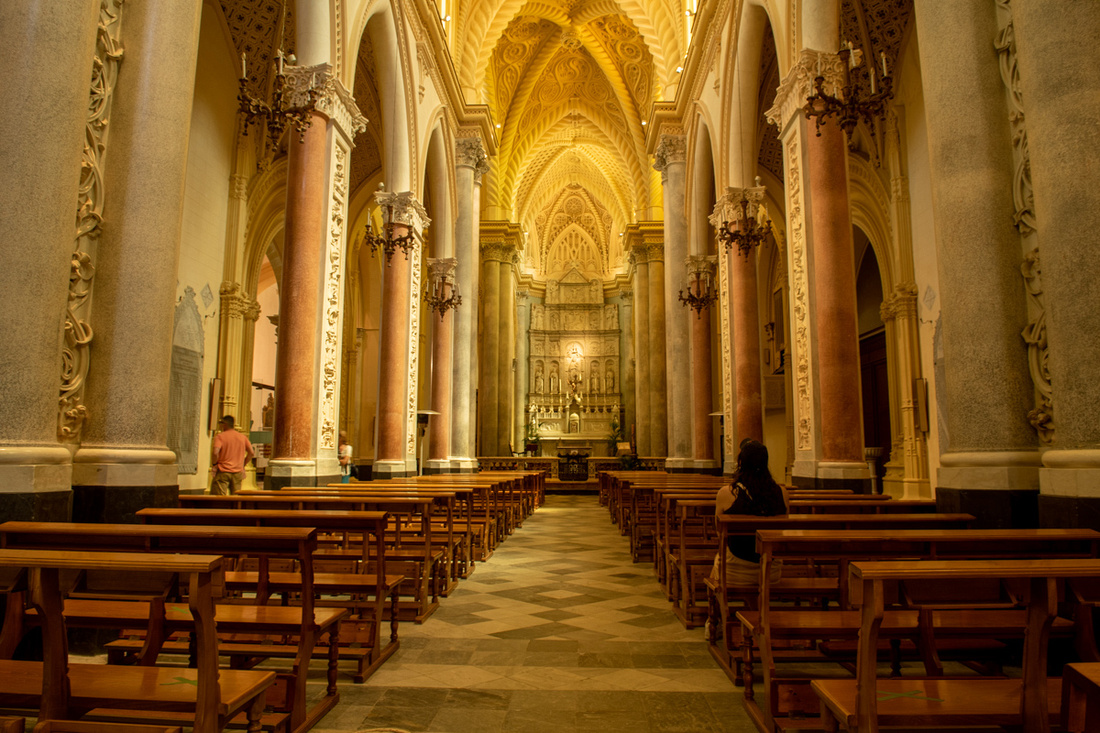
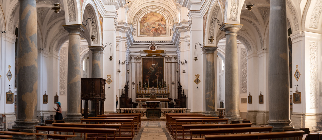
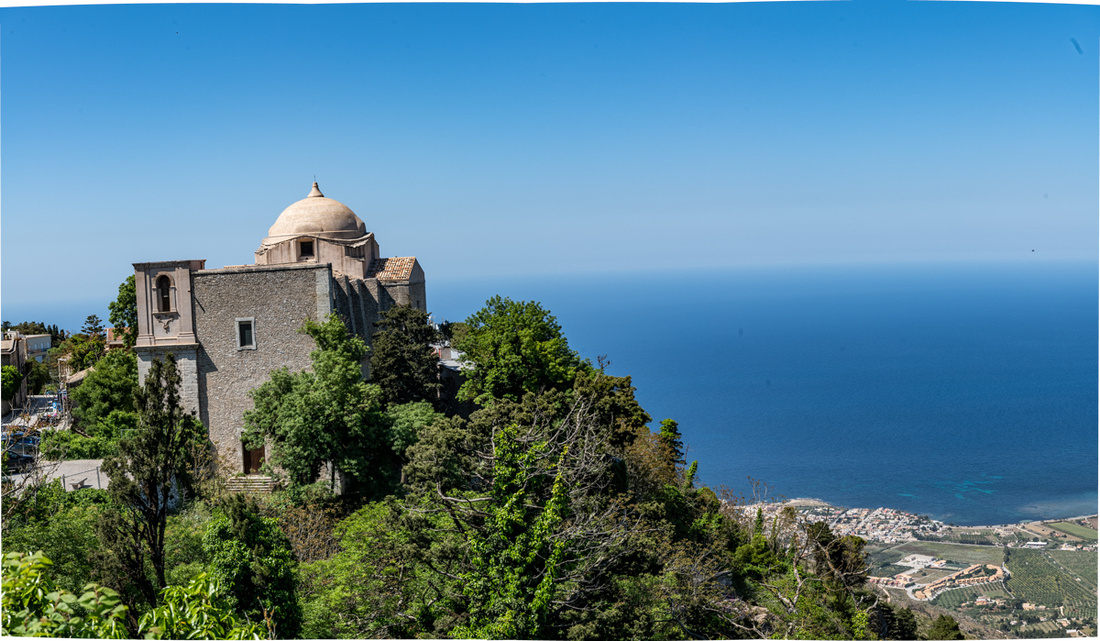
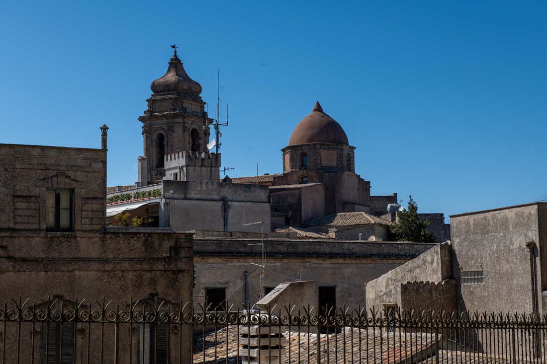
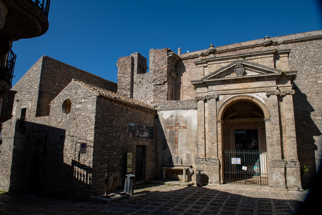
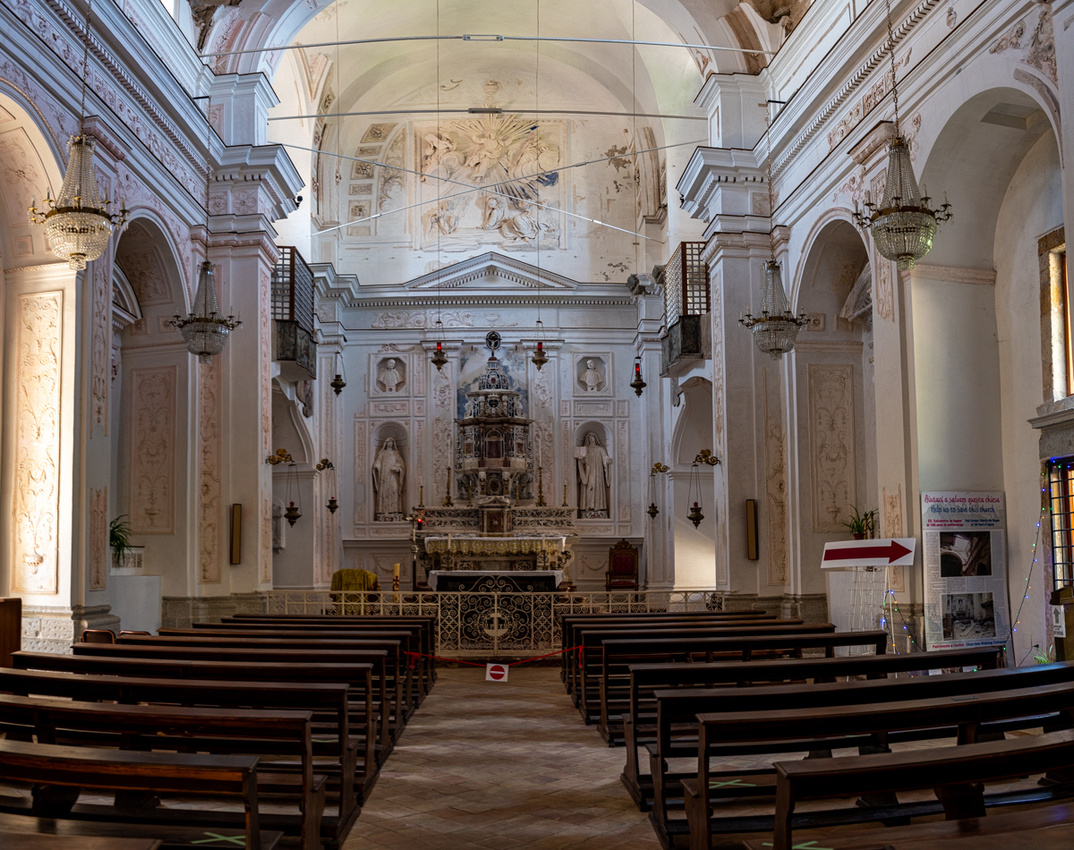 After marching up and down the cobblestones on our church tour we felt we deserved a visit to the bakery. Its reputation is well founded. Totally scrumptious!
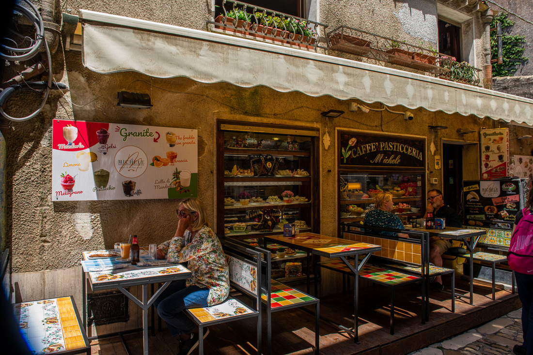
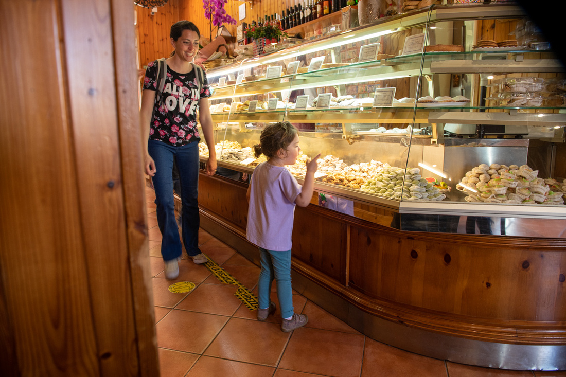
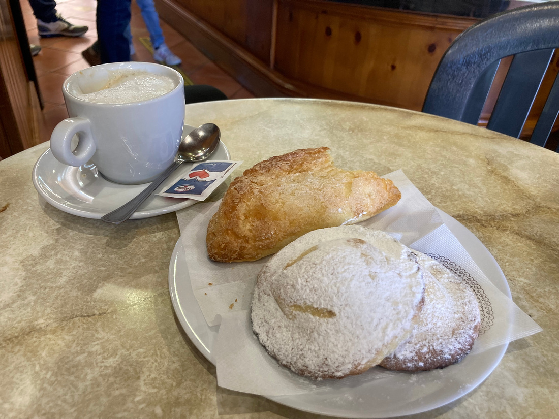 Then it was time to see some castles. The whole hill top is a fortress so the castles were not really massive or elaborate. But what a view!
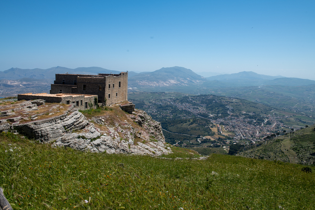
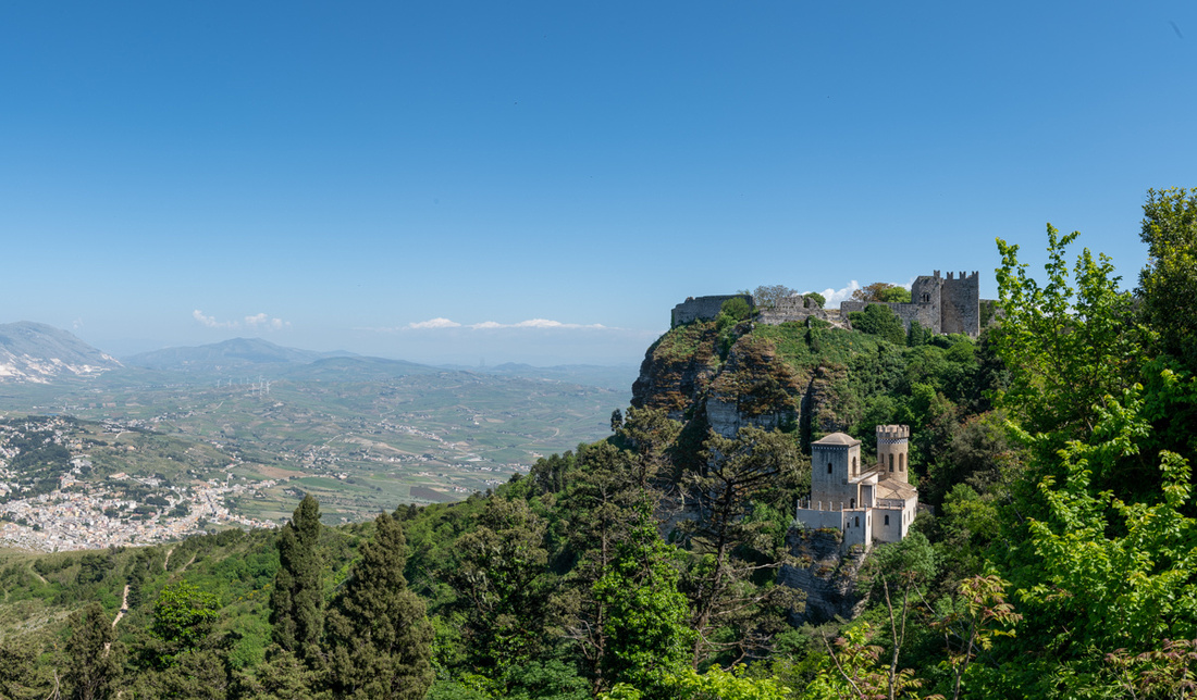
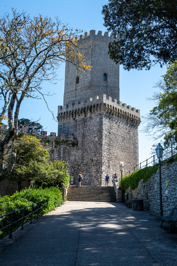
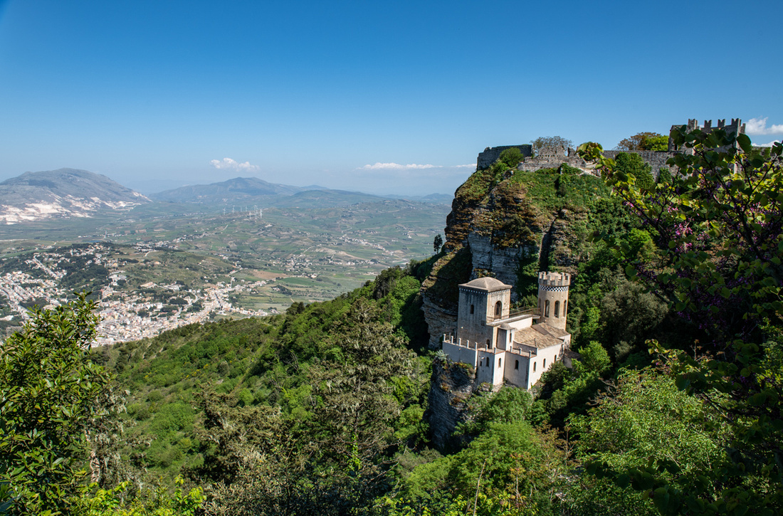
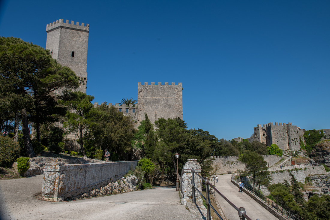
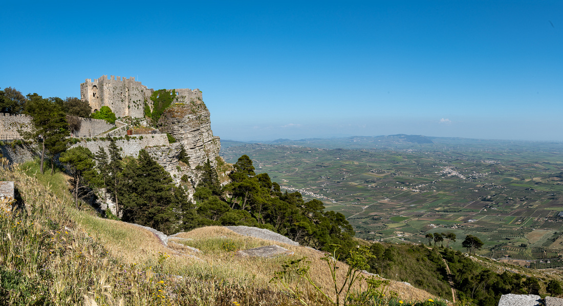
At the top up against the walls of the tallest fort was this gentleman, entertaining the tourists and selling photo ops with his pony and cart. He was pretty good too. I suspect his real job is playing somewhere professionally. We dropped him a tenner and got him to do O Sole Mio. And does he not bear a resemblance to Vinnie Valenza? Vinnie, are you sure you're not from Erice?
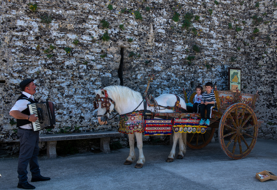
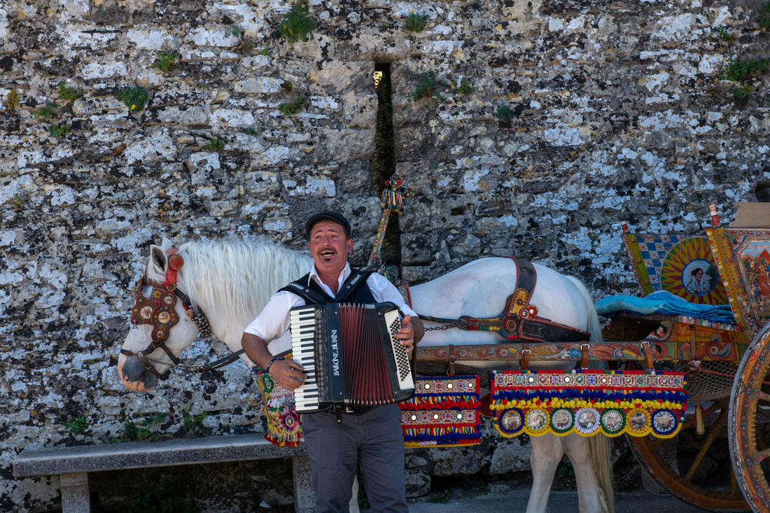 We left in late afternoon and have a beautiful descent with the sun headed down over Trapani. I would have liked to have stayed for sunset but the winding switchback road and getting through Trapani at night had me spooked. So we went back over to the salt flats for another attempt at the windmills. More pictures in the slide show. Click the bottom image to view it.
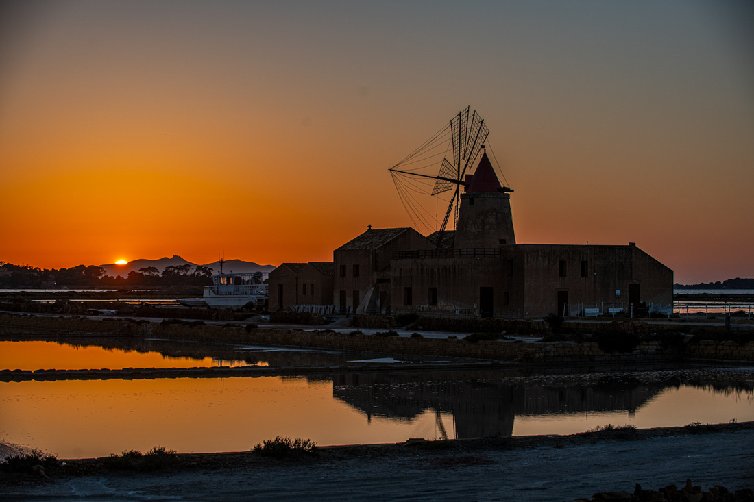
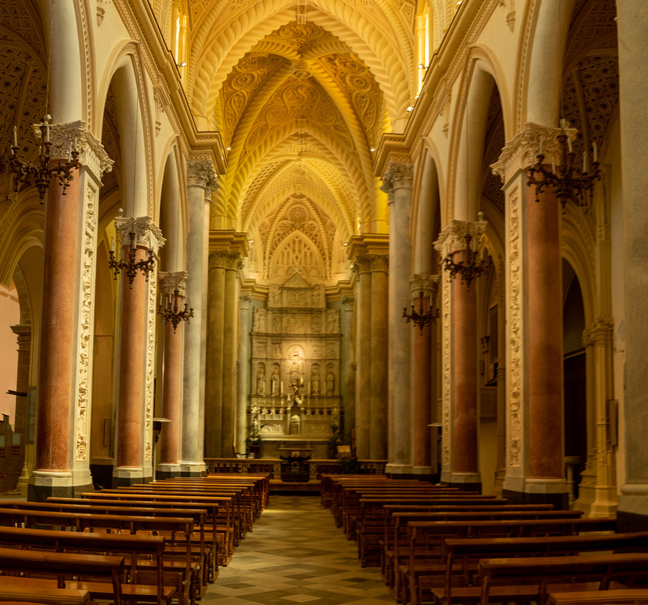
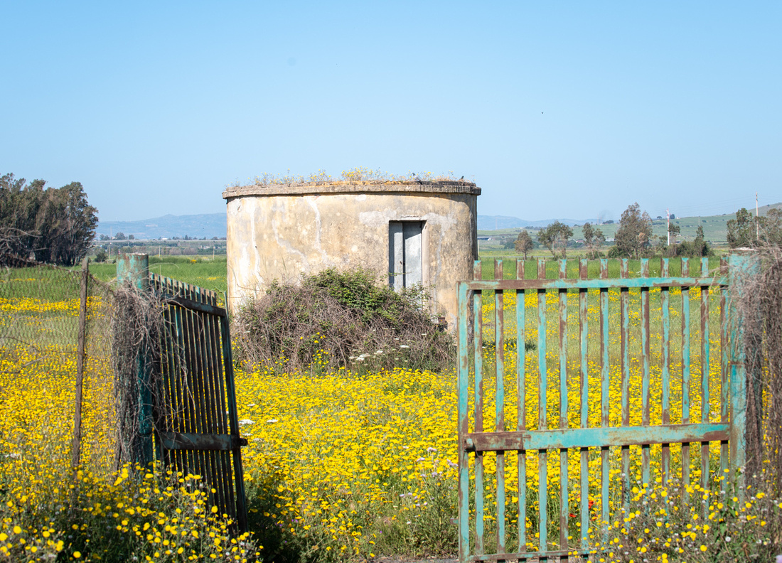 We started seeing them as we left the airport. The image above was on the way to Diana's. And her grounds were full of color, mostly wild. They come up on their own.
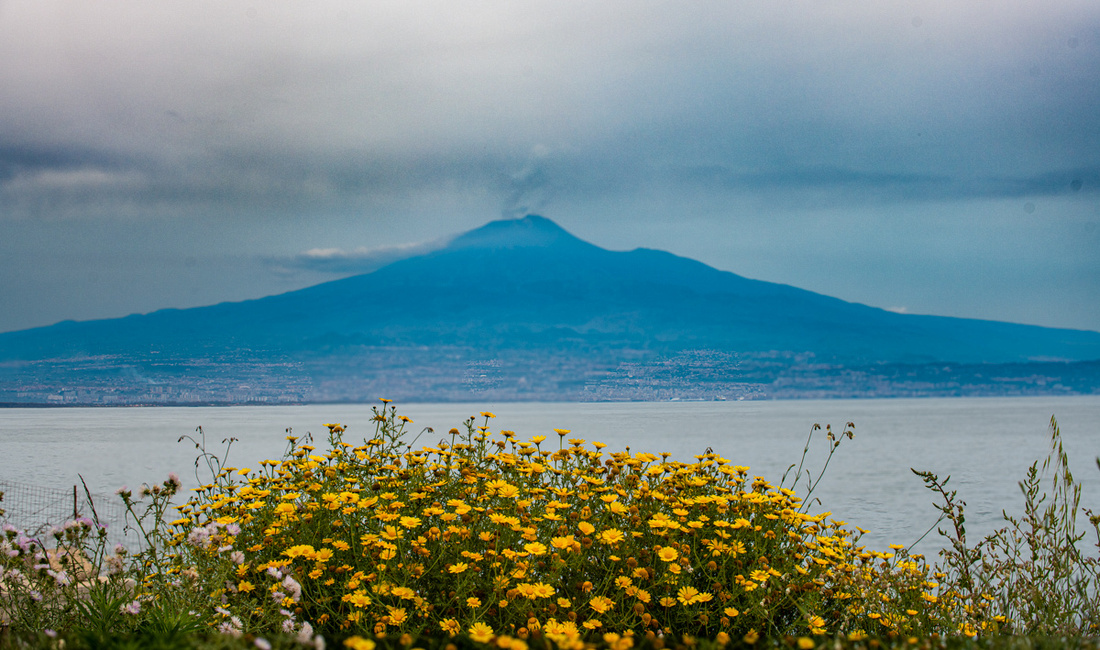
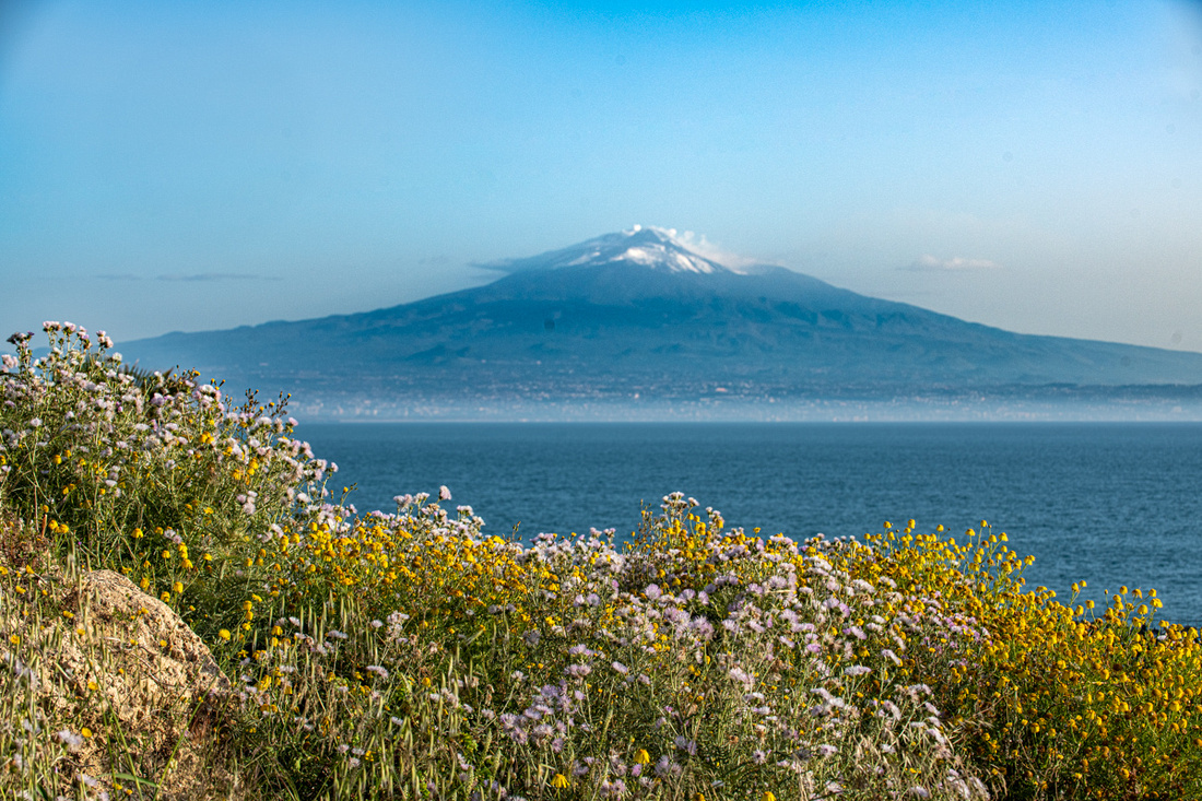 Roadsides were everything from a few scattered volunteers to solid walls.
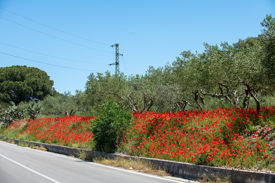
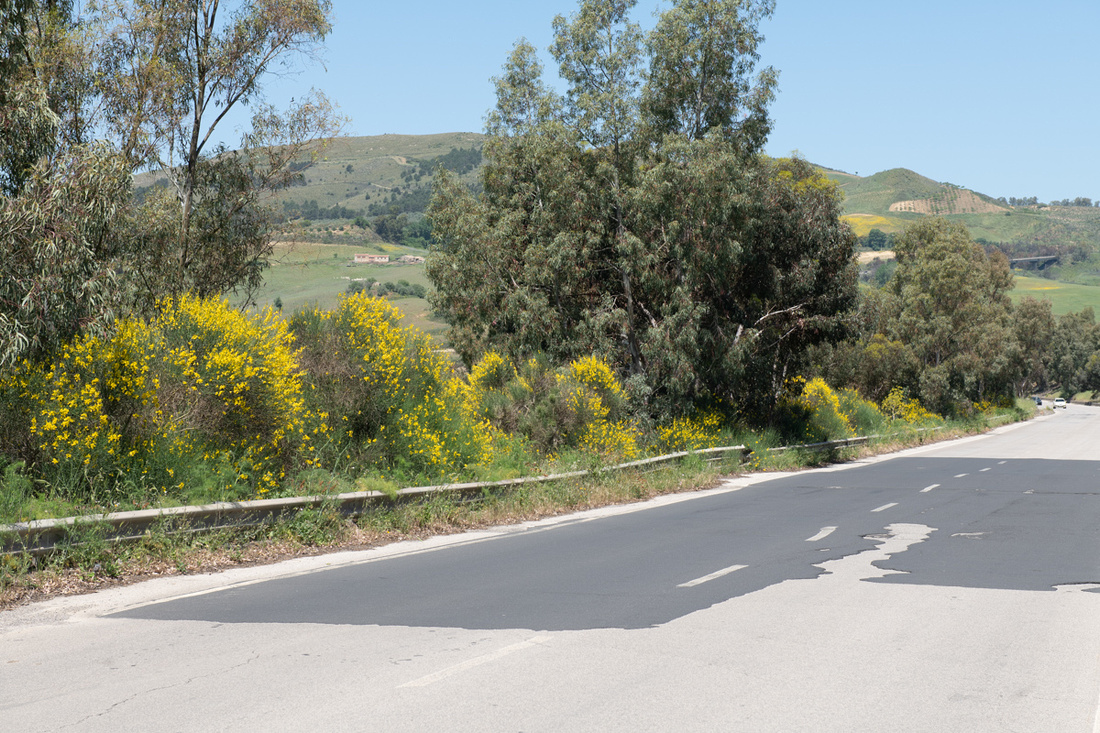
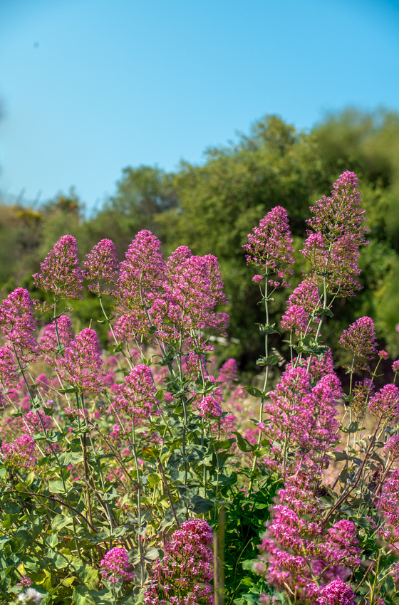
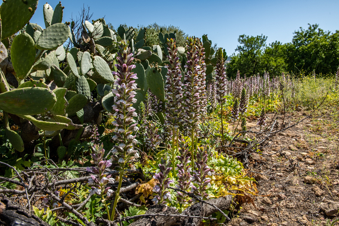
And then there were whole massive fields.
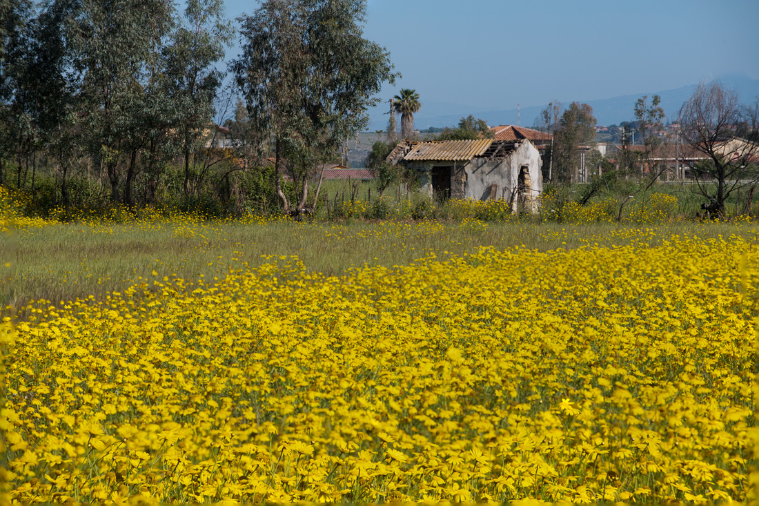
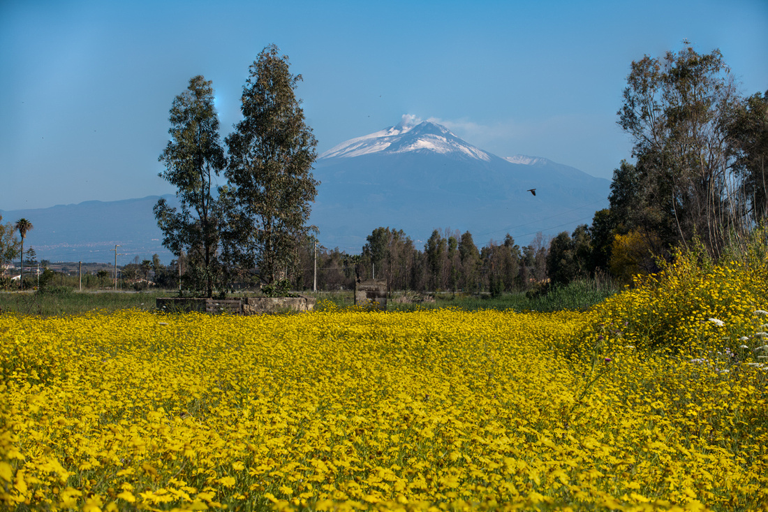
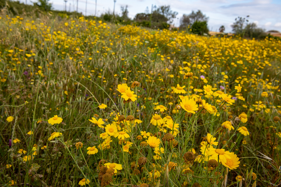
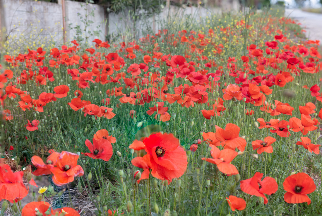
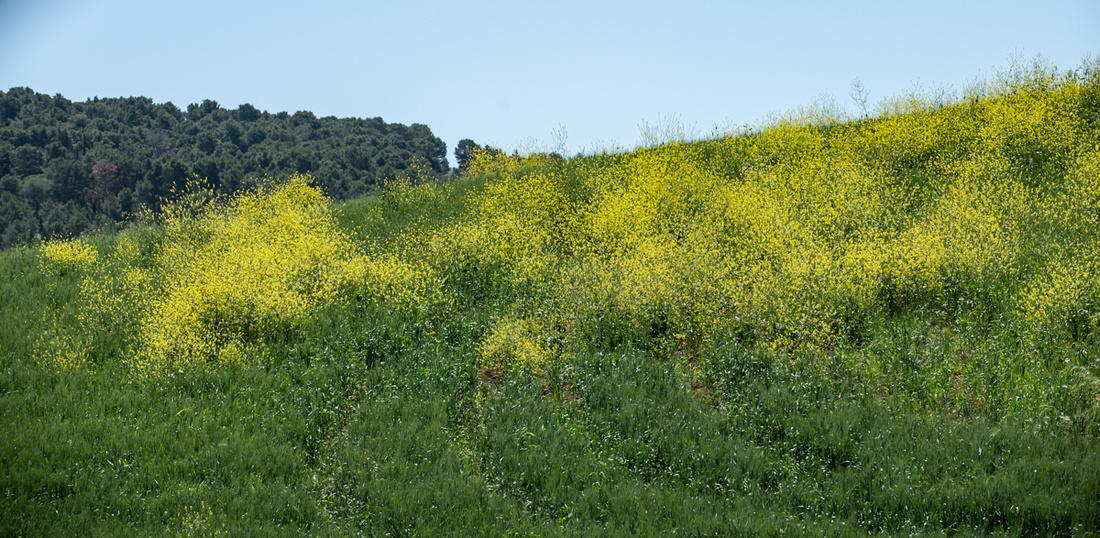
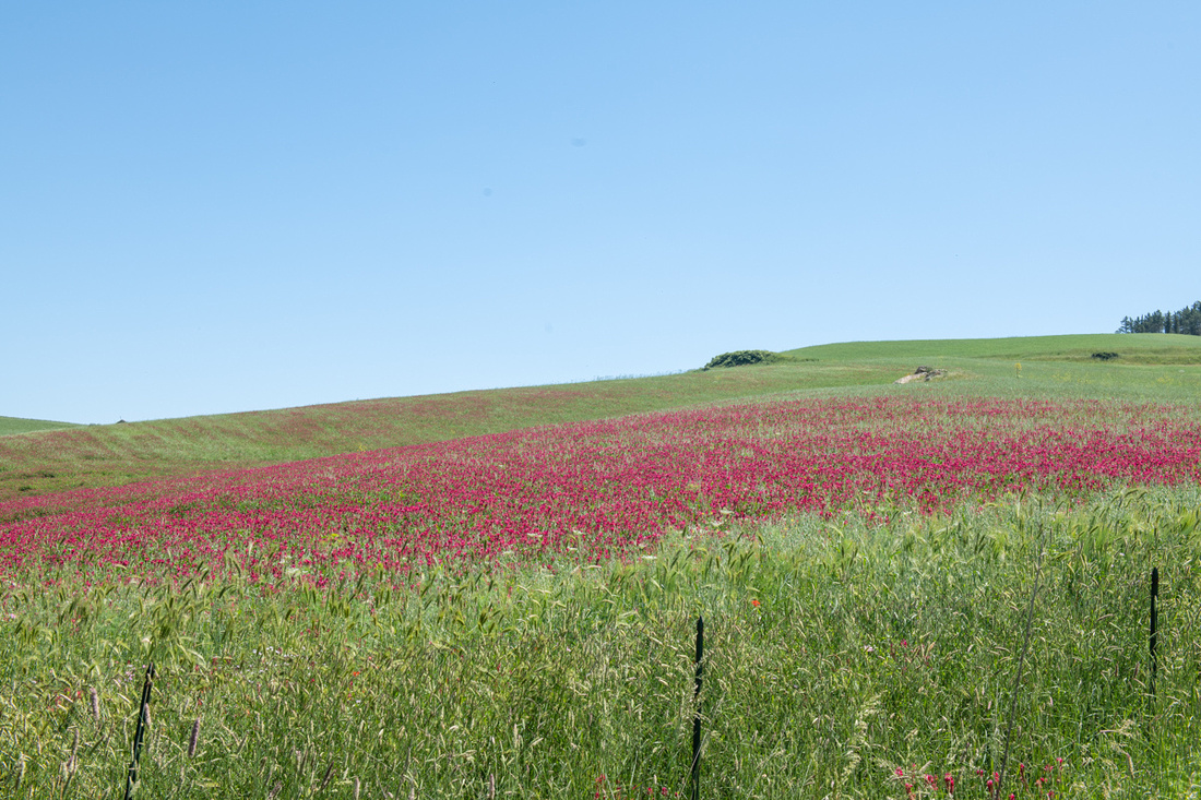
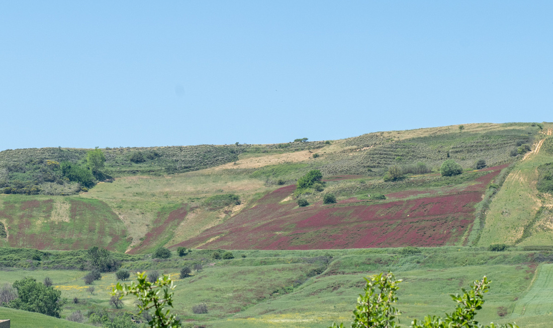
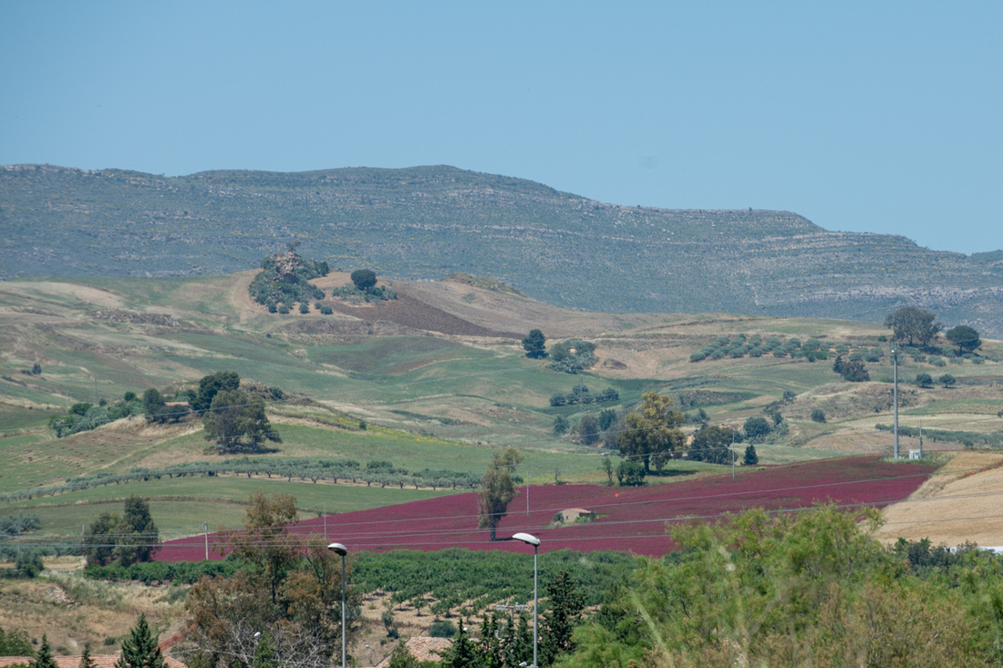

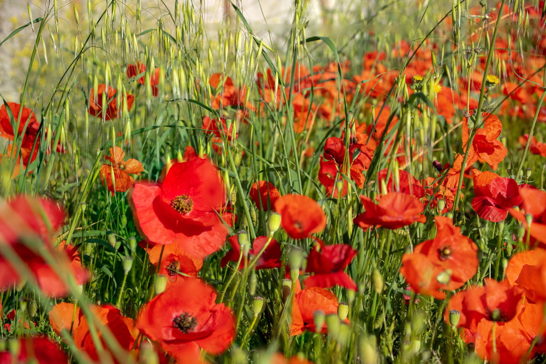
I wish I knew the names of all these different flowers. They sure dress the place up.
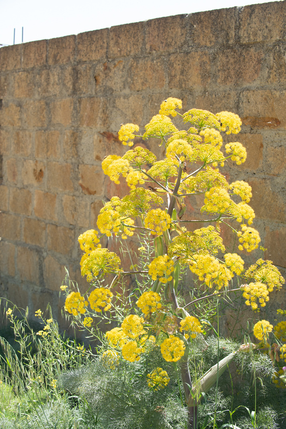
These are thistles.
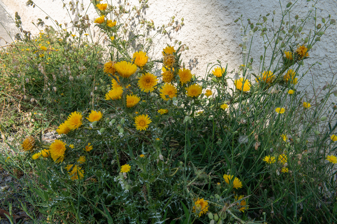
Poppies
 Looks like a wild petunia.
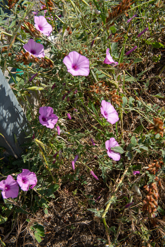
We were a little early for the bougainvillea. It was just getting started on our last few days. That would be one advantage to going in the fall. It runs riot cultivated and wild.
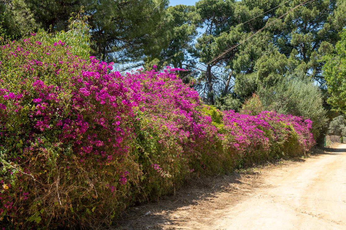
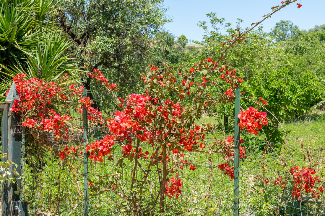
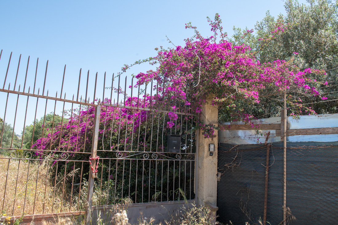
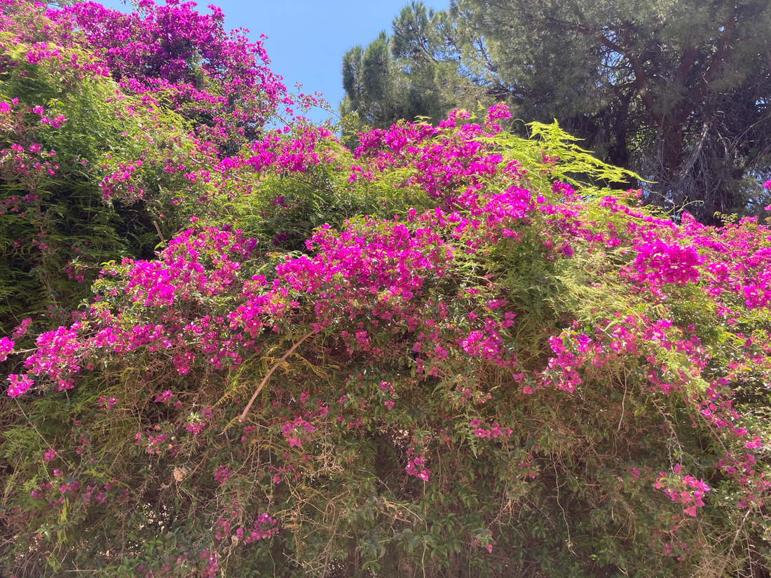
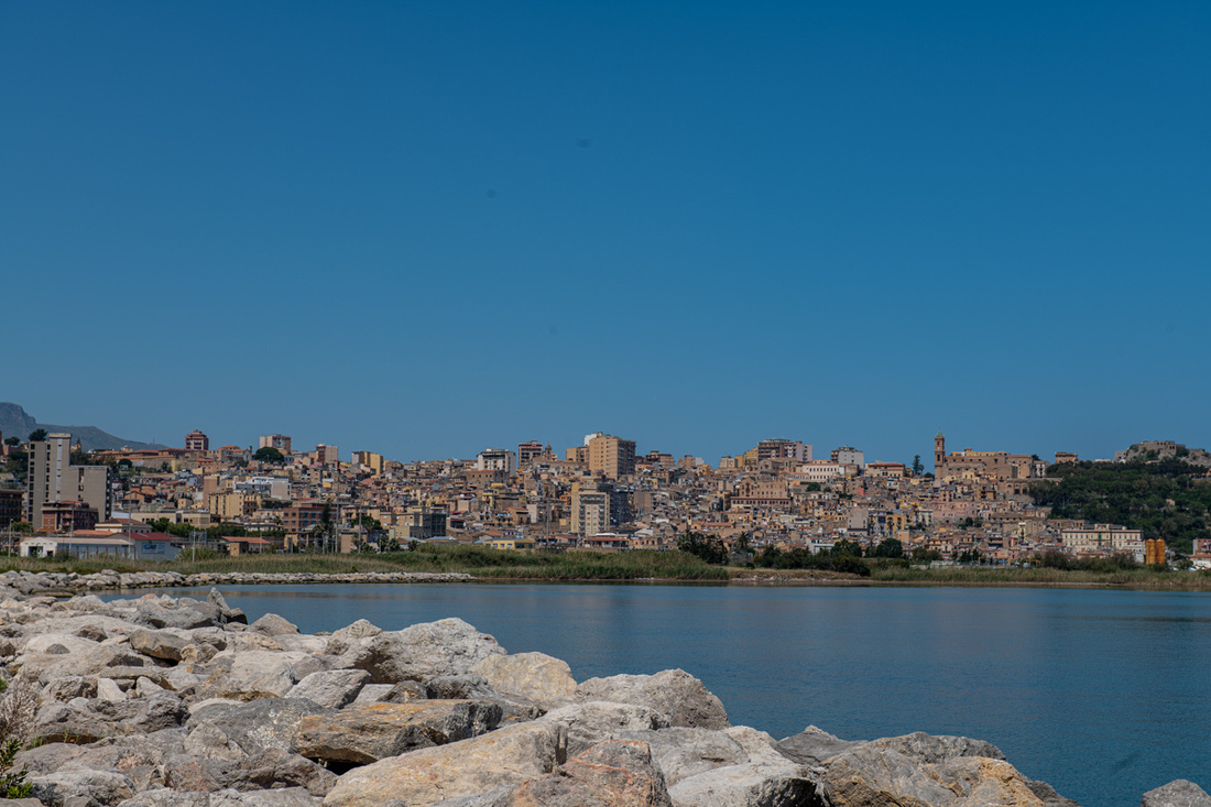
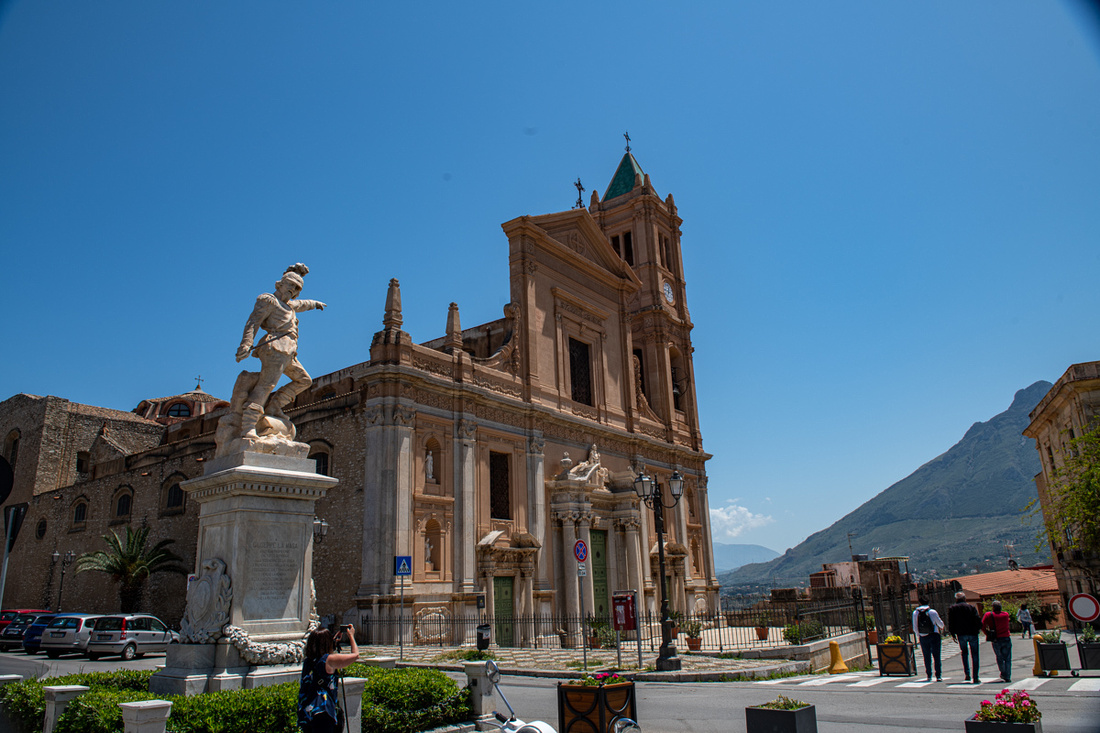
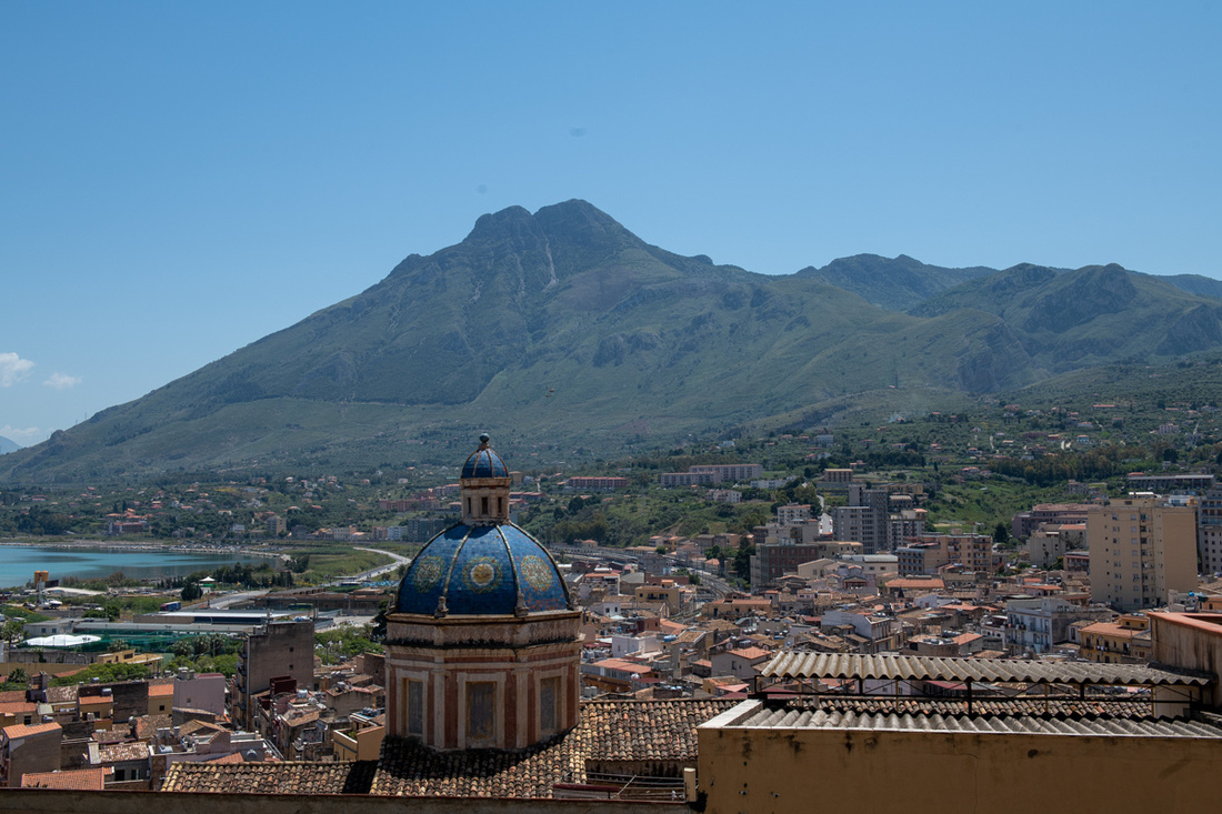
We headed on west and had already decided, while still in the States, that we would bypass Palermo on this trip. We just ran out of days. And besides, there's a consolation prize. Right outside the city is the cathedral of Monreale. It is probably the most beautiful cathedral on the island. I can't say that with certainty because I haven't seen the one in Palermo but it is stunning. Built by the Normans, again borrowing from the Byzantines, it is all mosaics throughout.
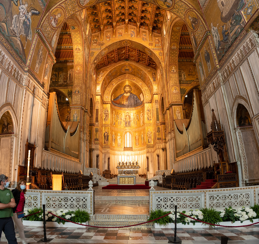
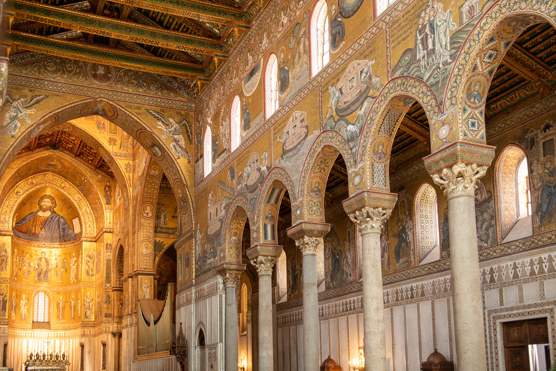 And while exploring the church Jeanne Marie made a fabulous discovery. Never will you guess who's heart is buried here. St. Louis! Yes that St. Louis! Our St. Louis! King Louis IX of France! I did know he had died on crusade in North Africa and I guess they stopped in Sicily on they way home and were talked into giving up his heart. There were great squabbles in those days over the remains of saints.
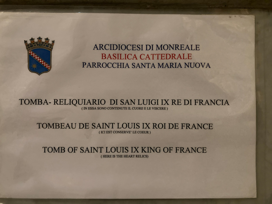
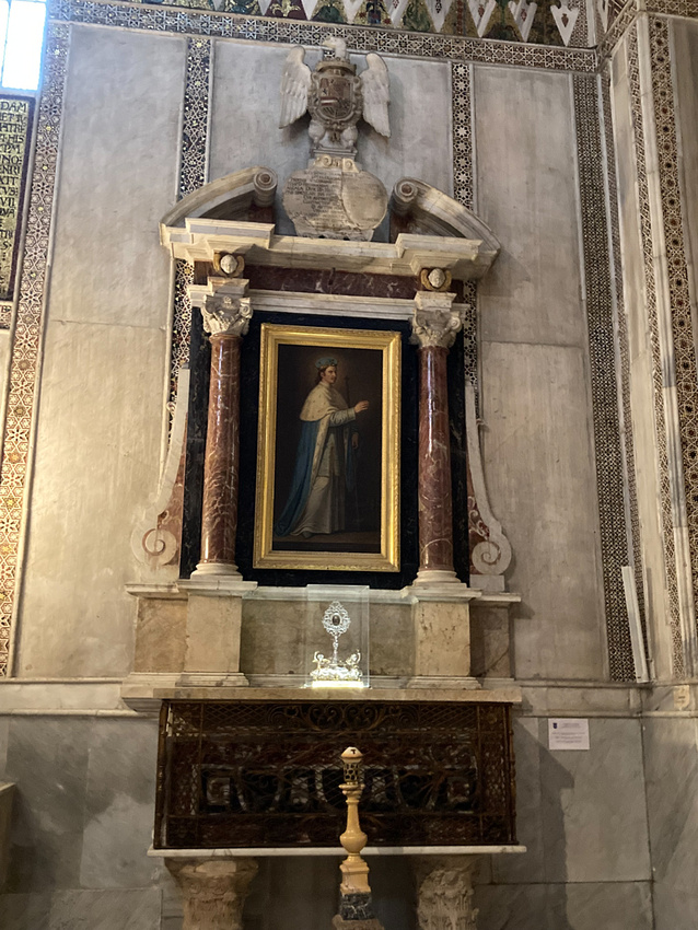
We would like to go back here and spend a little more time in this great church. We had committed to meeting our B&B hostess in Trapani so we moved on. Next time.
After checking into our quarters in Trapani we had the rest of the afternoon and evening so we decided to check out the old salt works. The west of Sicily between Trapani and Marsala was until a few years ago a great sea salt producing area. The shallow water, high salinity of the Mediterranean, strong winds, and hot Sicilian sun made it the ideal spot to recover salt from the sea. This industry is many hundreds of years old but has now shrunk down to providing sea salt for gourmet cooking. The windmills were the means of moving the brine from one evaporating pool to another. Good photo op. As we headed down though the first thing we saw were the windsurfers. Many dozens of them. We then worked our way to one of the few windmills that has been preserved. There was a nice outdoor cafe right next to it so opted to wait for sunset there.
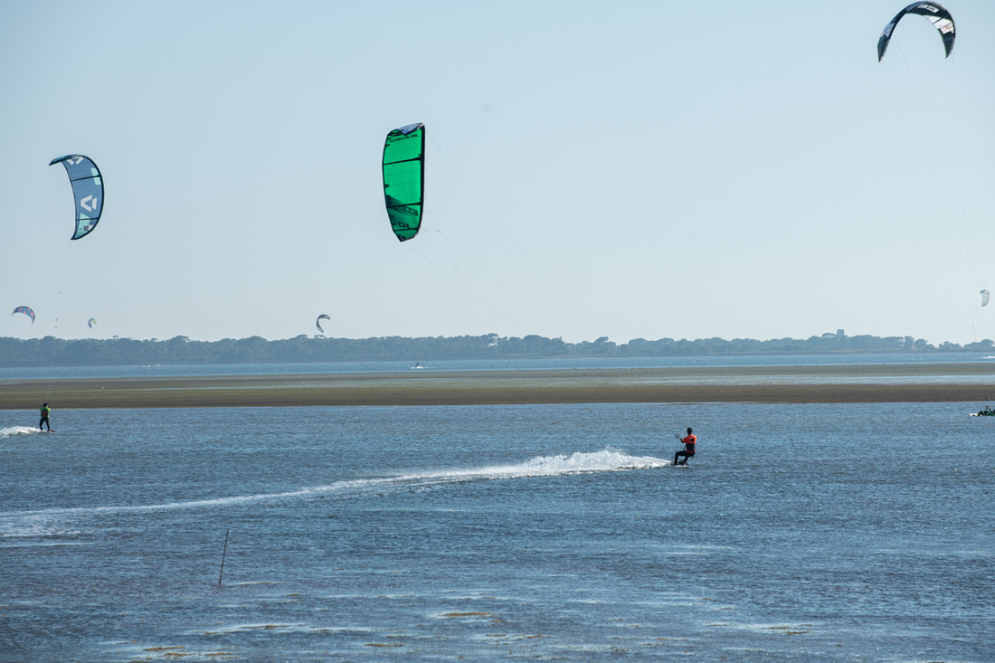
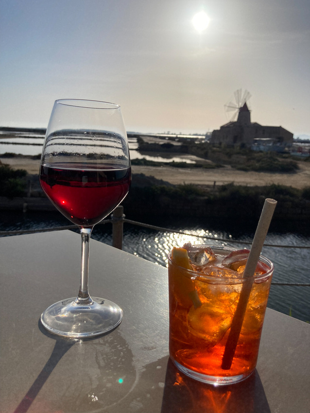
We noticed as we waited people kept coming in and by sunset the place was full. Apparently quite the spot for finishing up the day.
This was a big day. Besides driving from Cefalu we checked out three places. No bicycle races or cruise ships to run interference. We were starting to get the hang of traveling in Sicily. Click the image below the windmill for a slide show with more pictures.
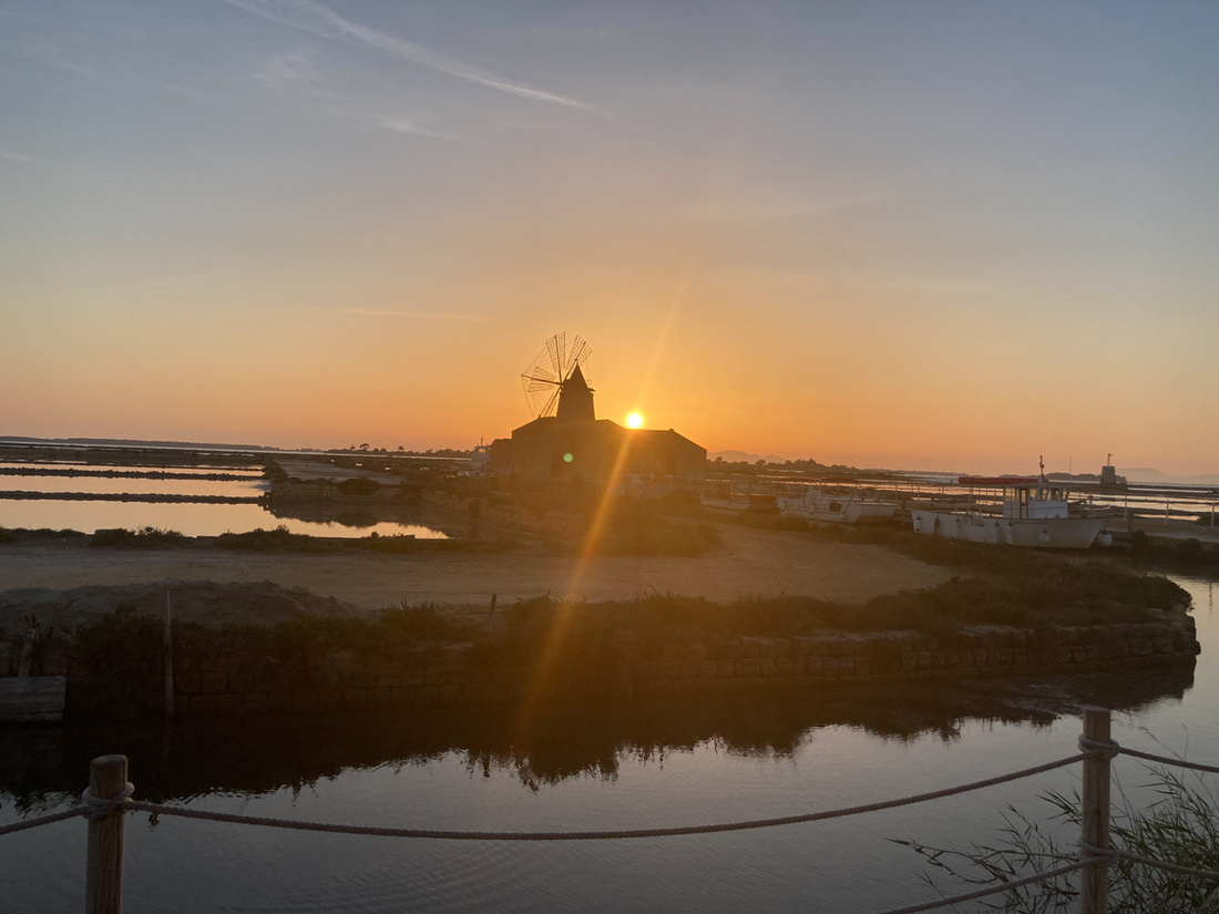
]]>
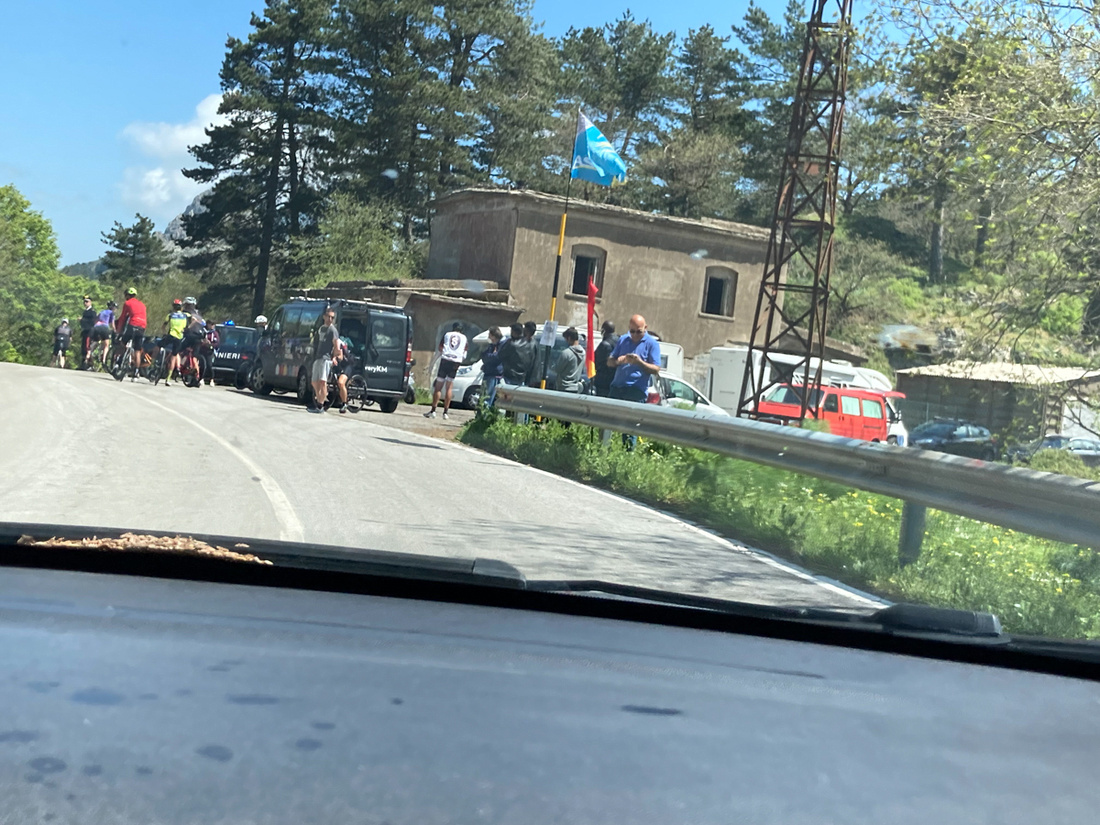
The fellow directing traffic was franticly waving us through but we had to know, "what's going on?" so we stopped and asked him. It was the Giro d'Italia, the runup to the Tour de France. And this leg was Catania to Messina. So this was not the finish line, it was the high point of the race course. On through we went, not dallying. The riders behind us would be going downhill now. Before long though we heard sirens coming up behind us so we pulled over. A police car went blowing past us and a motorcycle cop pulled up beside us and explained in his best English that there was a long caravan of trucks coming and we were to wait until all of them had passed. These were the trucks for the team sponsors, about two dozen, and they went blowing by faster than we wanted to go on this little mountain road anyway. So we were glad to be behind them.
Just as we decided it was safe to pull back out onto the road what pops out in front of us though but this:
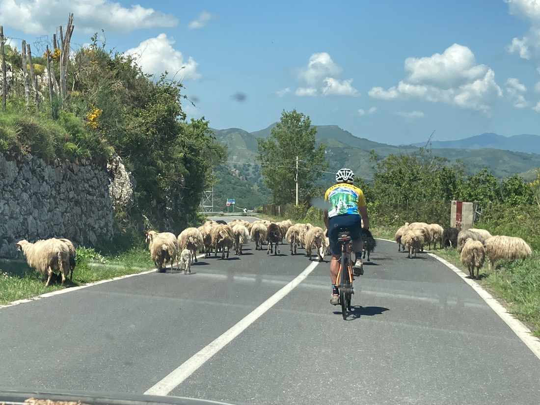
I guess sheep on the road are a natural hazzard to bike racing but American tourists are not.
As we drove down the mountain every village looked like this:
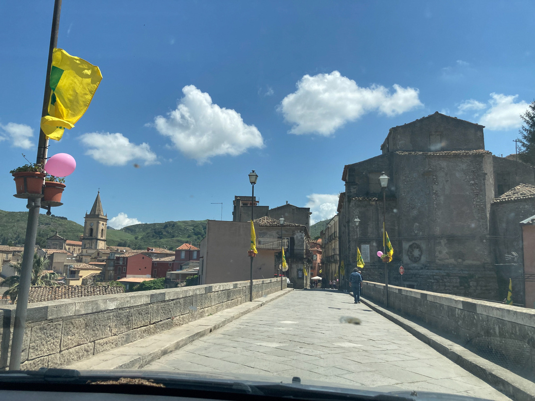
All the town folk were out watching so we waved graciously. This is Novara di Sicilia, the second of the towns I had wanted to visit, but we were not allowed to stop. I grabbed the picture below from a spot no one was guarding.
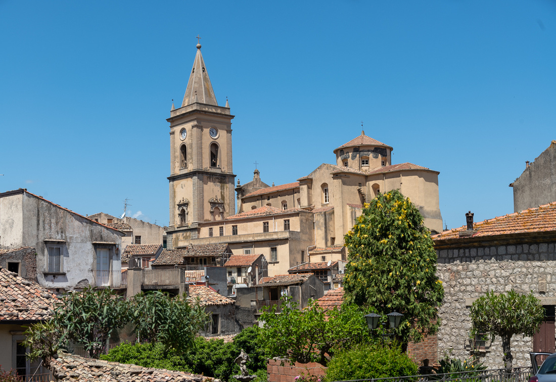 This continued all the way to the coast where the race course went east and we went west. So they had to manage the rest of the way without a pace car. It was all rather fun.
So west we went along the coast to Cefalu. One of the draws for us is that this is the ancestral home on Vinnie Valenza, owner of Blues City Deli in the old neighborhood on Victor St. We thought dropping his name might get us a free pizza. Didn't work though. His reputation has not quite reached back to the old country just yet.
This is a very old town. Much of what is here goes back to Norman times. But it has a nice beach too so it has kind of morphed into a resort town for tourists and Sicilians. Lots of little kids running around in swimming suits. We stayed here just one night and it was the only night we spent in a hotel. Everything other night was an Airbnb or Diana's. The hotel was right on the beach and very convenient and comfortable. The big photo attractions are a lighthouse, a Norman stronghold, and of course, the cathedral.
The Normans, besides being great soldiers, were very innovative in architecture too, or at least good at copying the best ideas of others. This cathedral is one of the first they would build. Given that none of the great cathedrals of Europe were built yet and the dominance of Greek culture on the island, they naturally looked to the Byzantines for ideas and artisans. And that meant mosaics. The crowning glory of this church is the large luminous mosaic of Jesus behind the altar.
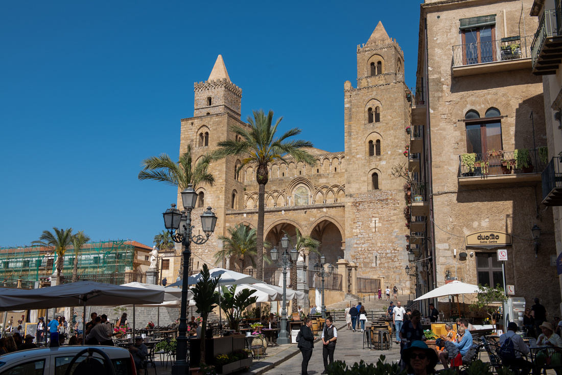
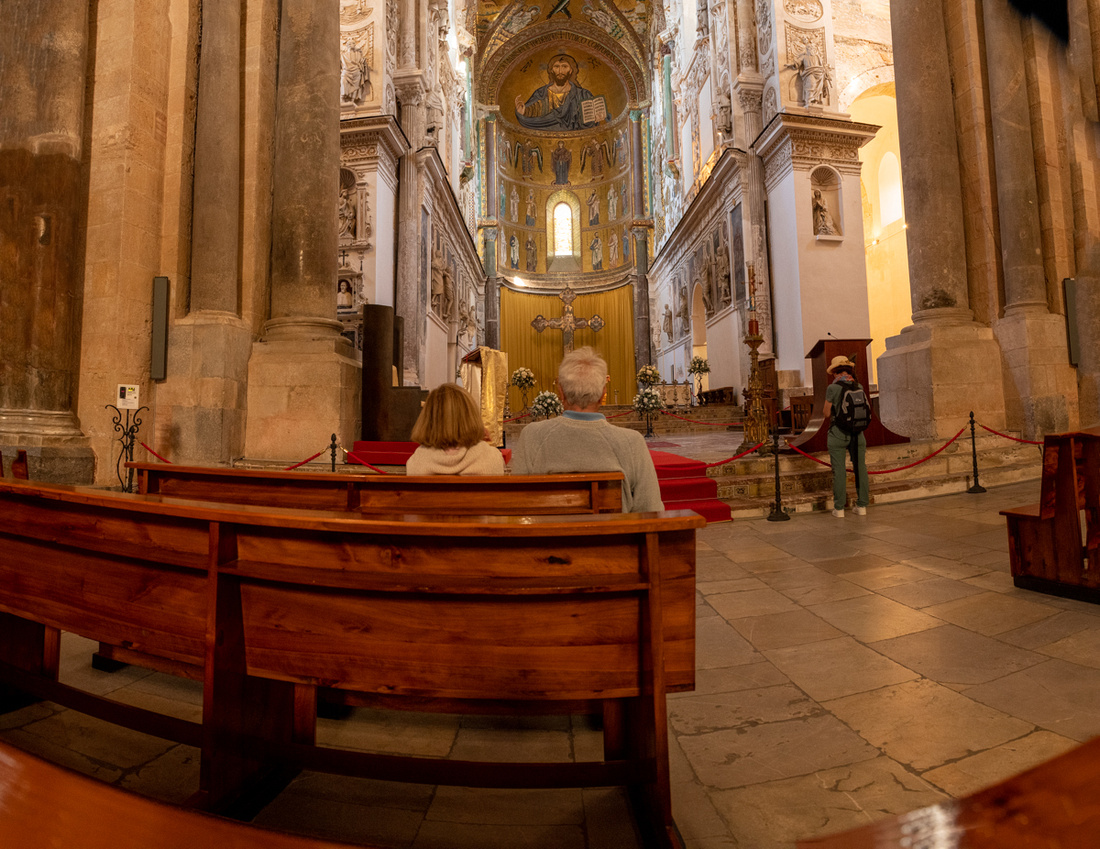 We could have easily done another day here. Next time. Click the bottom image for a slide show.
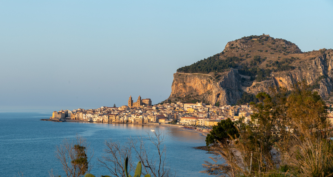
]]>
Forza d'Agro was the first one. The drive up was very scenic with a cool Norman castle to photograph. You see this same design of castles all over Sicily, southern Italy, as well as Ireland-everywhere the Normans went.
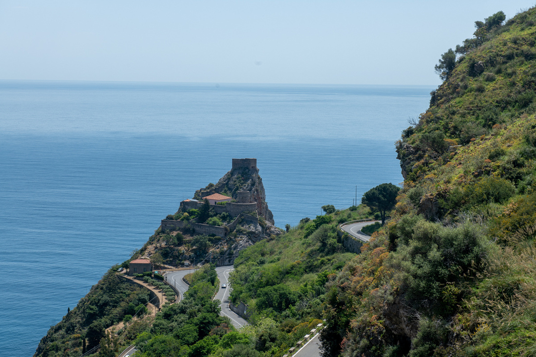
The town of Forza d'Agro sits on a hill top with magestic views all around. The church, one of them anyway, we saw at least three, was used in the filming of "The Godfather". When Michael is married in Sicily while on the lam from the US, the exterior shots of the wedding were filmed here. I can see why Francis Coppola used this location. The church is elegant in a peasant sort of way and very old. Now that we are on the north side of Etna we will see more Norman influence than Spanish so the churches and buildings are much older.
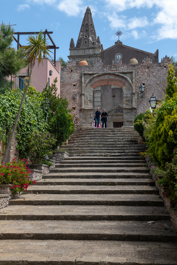
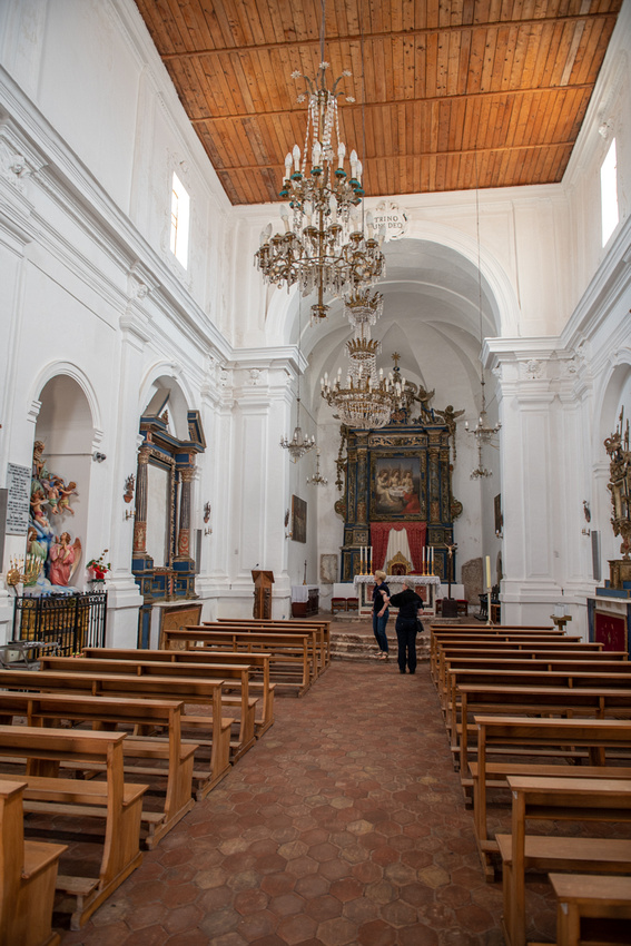
We had lunch at a cafe in the piazza. The picture below is this cafe's pizza oven. If you don't recognize him that's Michael Corelone on the side.
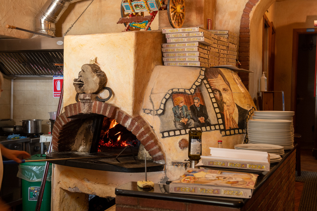
Savoca was the other town we checked out. Of course we had to drive all the way back down to the sea and back up. How did people live this way!? I guess they liked the views.
It also has a Godfather connection and they don't mind if you know it. The same movie poster of Marlon Brando pops up all over Sicily and there's little embarrassment about the Mafia. You can take "Godfather" tours in several towns in western Sicily. So he has essentially been coopted and Disnified.
The main point of interest is the church of San Nicolo/San Lucia which was used for the interior shots of Michael's wedding. It was quite a hike up a hill in mid afternoon over the cobblestones. Thinking of Jeanne Marie's knees we opted for a ride in this very cute three wheeler. I had not been in one of these since Vietnam and I'd forgotten how loud they are. And bumpy. I think they are completely without springs.
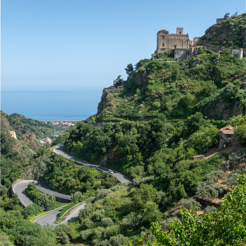

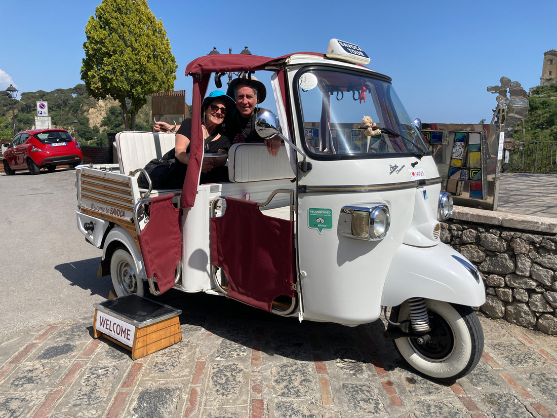
This little side trip was very worthwhile. Despite the Godfather promotions these are quiet, sleepy little Sicilian towns. There were only a handful of tourists and this was as close as we got to just observing people living out every day life. We particularly like watching this precocious little girl and her family as we ate lunch in Forza d'Agro. People, and kids, are pretty much the same everywhere. Well, until they get behind the wheel of a car.
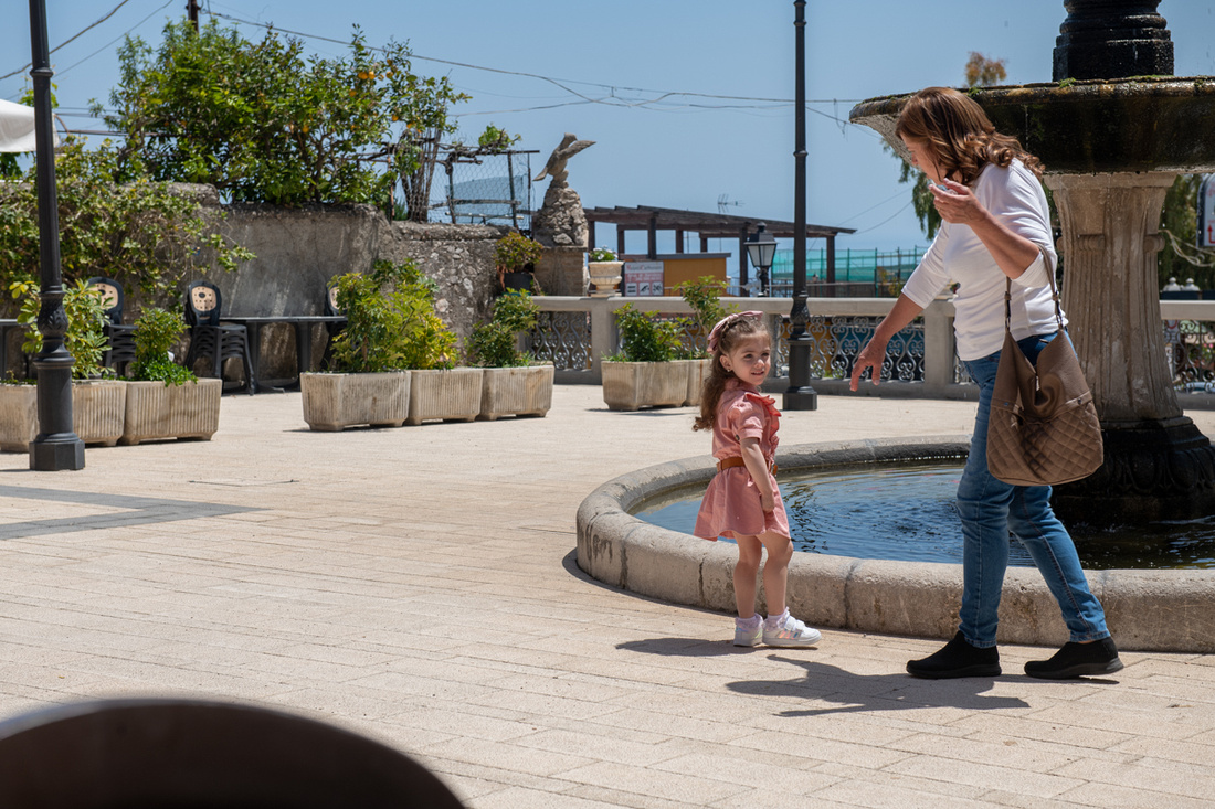
Click the image below for a slide show with more pictures.
]]>
We visited Taormina in 2012 and it is one of the most impressive Greek sites in all of Italy. The town itself is very reminiscent of the Amalfi Coast on the mainland. Back in the days when only the aristocracy traveled for leisure this was a stop on the Grand Tour of Europe. So it has been accommodating tourists for quite awhile. The main attraction is the ruins of a Greek amphitheater that sits high on a hill overlooking the town, the seacoast, and Mt. Etna. We actually spent the better part of three days in and around this spot so it may turn into two posts.
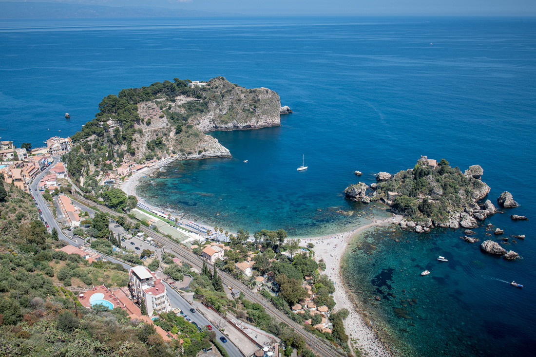
Here are my images of the amphitheater. I was very pleased to have Mt Etna clear with a nice snow cap. The wooden stage in the front is constructed every year about this time for the concerts that are held through the summer and fall. It intrudes into the picture but not too badly.
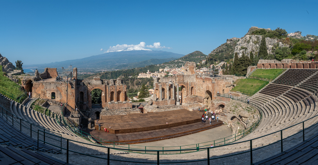
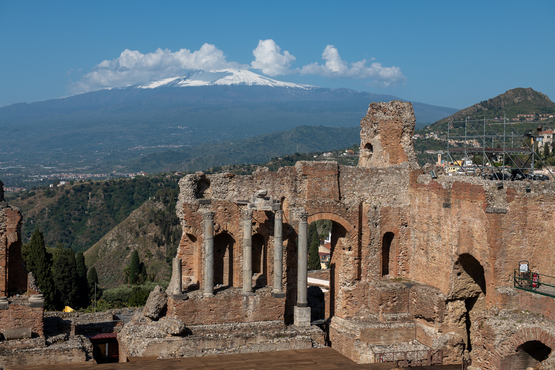
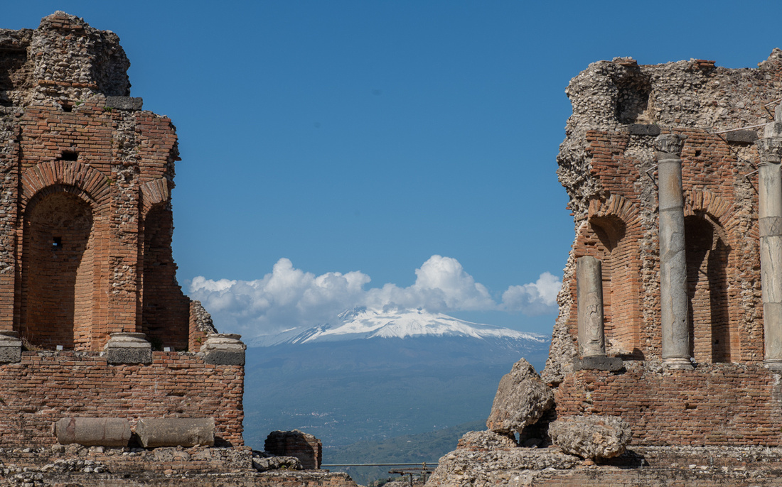
The amphitheater didn't open until 9 AM so the light was already getting a little harsh but I won't complain. By 10 AM we were finished with that shoot so we went walking around the town. Lots of subjects so check out the slide show at the bottom. Later in the afternoon we got the car out to go further up the mountain to a shrine that overlooks the town. The cross on the picture below marks the location.
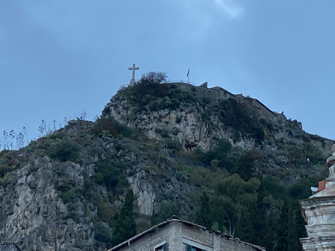
There was an apparition of Mary there in 1640. A shepherd boy had sought shelter in a cave there during a storm. Mary appeared to him and left a picture of herself on the wall. The little church was built into the cave. It is all very beautiful.
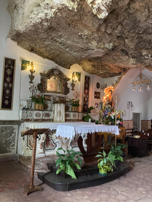
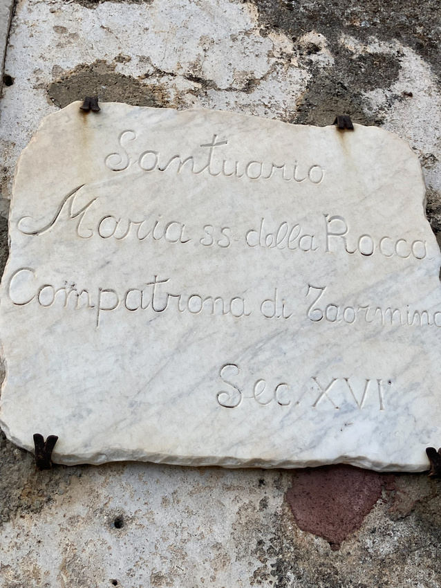
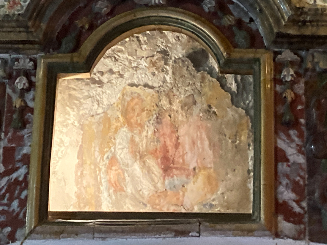
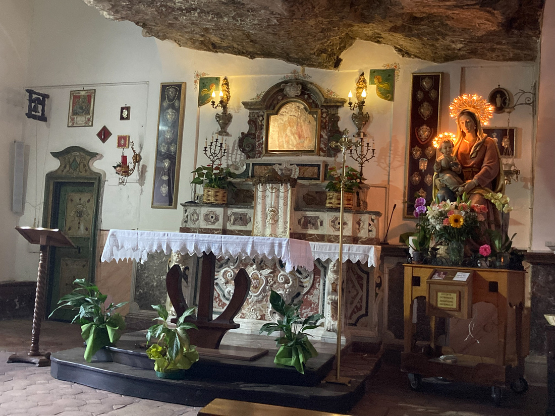 As we came out of the grotto church we saw something ominous coming into the harbor.
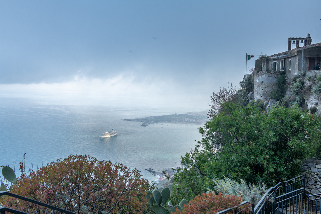
Yes, it's a cruise ship! The same one that plagued us in Siracusa! We're to be over run again by the Great Horde, clogging up the photos, foraging through the cafes! I had to do something! Otherwise they would follow us all the way around the island! I placed an emergency call to Diana. She has contacts in the cruise industry. She merely said, "I'm on it." And that was the end of our cruise ship problems. A small one did approach Taormina the next night but didn't attempt to land anyone. I don't know what her methods are, it's best not to ask. But it all worked out. More on Taormina in the next post. Click the image below for a slide show with more pictures.

]]>
The weather did move in and kicked up just enough waves on the Ionian Sea to be interesting. We kept our rain gear handy but never did really need it.
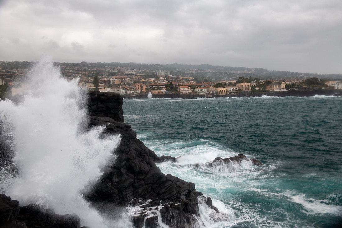
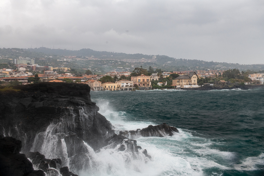
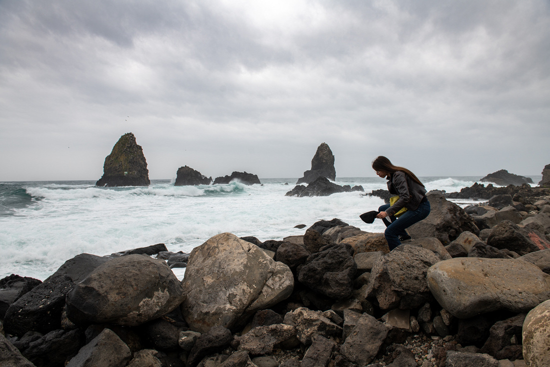
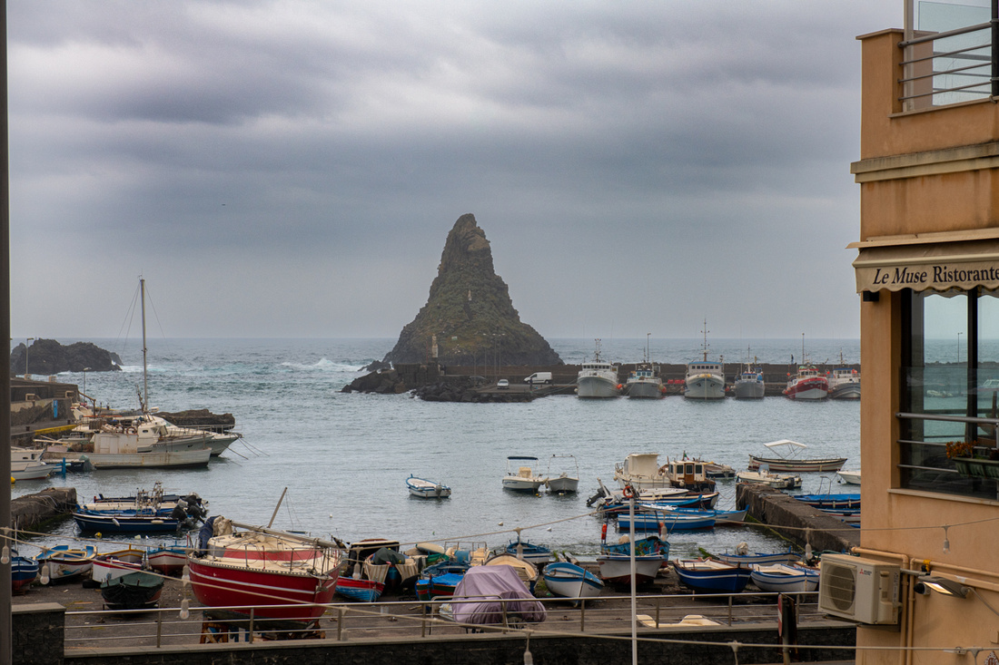
On Saturday we hung around the house, did some laundry and went to dinner in Brucolli with Diana and Giovanni. On Sunday the weather cleared off and we wanted to go to Mass at the Cathedral in Catania. Our assumption was that the piazza would be relatively empty on a Sunday morning. Wrong again. The place was thronging with people by 10 AM and they were mostly locals. A sizable open air market had sprung up in the streets around the cathedral and some kind of techno fair was going on in the piazza. Tents and music. If my pictures look like they are at funny angles it's because I'm trying to keep the tents out. Mass was lovely and we then walked a few blocks to an area where we could find some food. This was the area with all the umbrellas. It was a very creative way to dress up this little district. And we did find food.
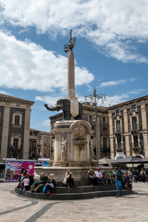
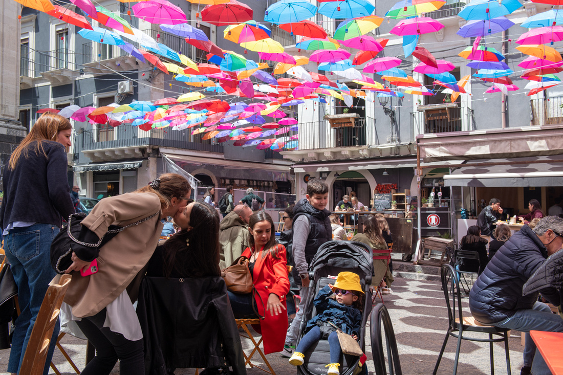
This was Jeanne Marie's dinner at the restaurant in Brucolli. Yes that is octopus on her plate. She's totally gone native.
Click the image below the octopus and see another slide show.
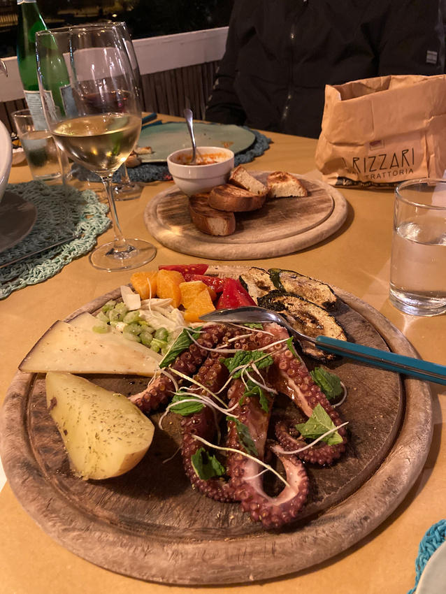
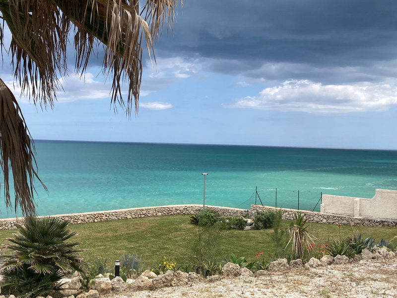
]]>
The Prezzavento boys were born and raised in Belpasso, right on the southern slopes of Mt Etna. Tommaso took us around town and showed us his and Joe's childhood home, took us to the cathedral and got permission to climb the bell tower.
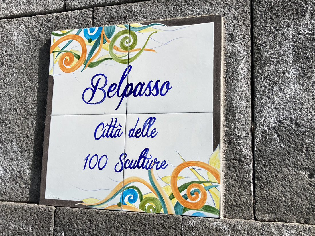
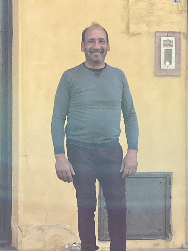
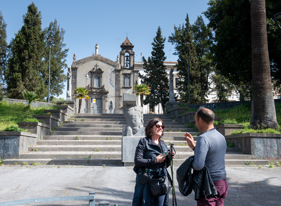
Did I mention that this town is literally in the shadow of an active volcano?
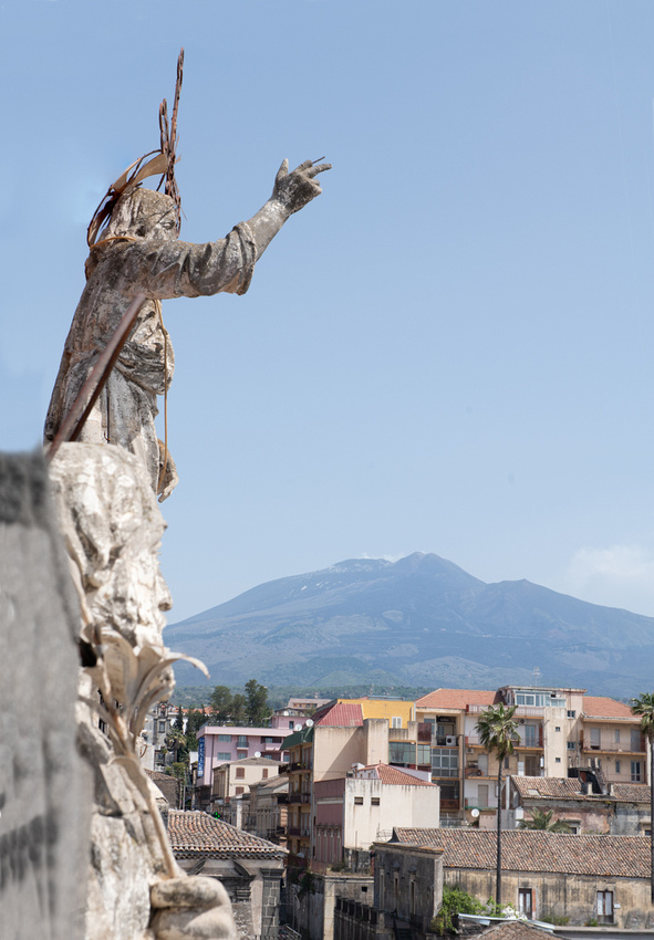
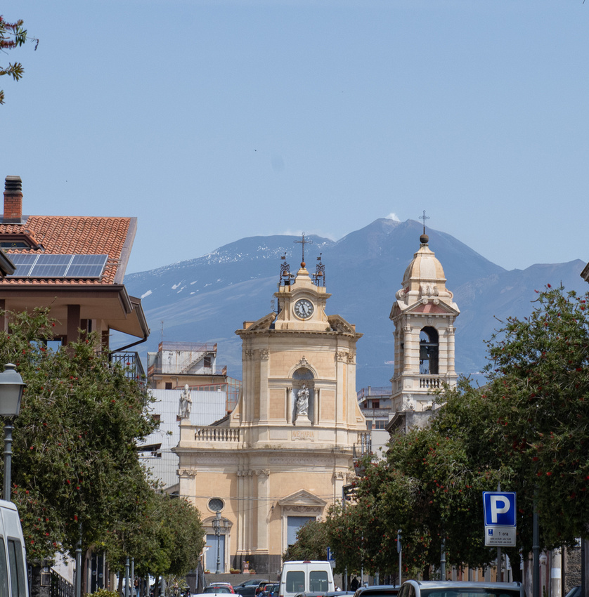
Then after taking us for coffee and pastries to the pride of Belpasso, Condorelli's, we embarked on our assault of Etna. Jeanne Marie and I would both admit that this was not in our plans and we were a bit hesitant to do it. We were afraid it would be too challenging for her knees and then she would have to wait for us or something like that. We shouldn't have worried. It all worked out and it was an exhilarating experience. And the mountain didn't blow up or even belch. In fact the weather was ideal. Sunny, great visibility, and not much wind.
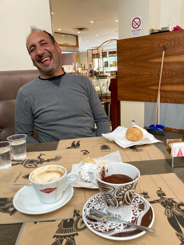
Our assault on the mountain was executed flawlessly. We took a cable car to the base camp at about 7500 ft. Then the final push by diesel powered bus to 9000 ft. (Etna is just under 11,000 ft.) Further ascent by foot with a guide is sometimes permitted but due to recent activity it was not allowed that day. We were disappointed, of course, but you can't challenge Mother Nature too much. We were pleased with our accomplishment.
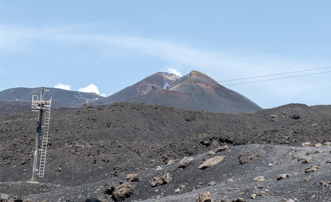
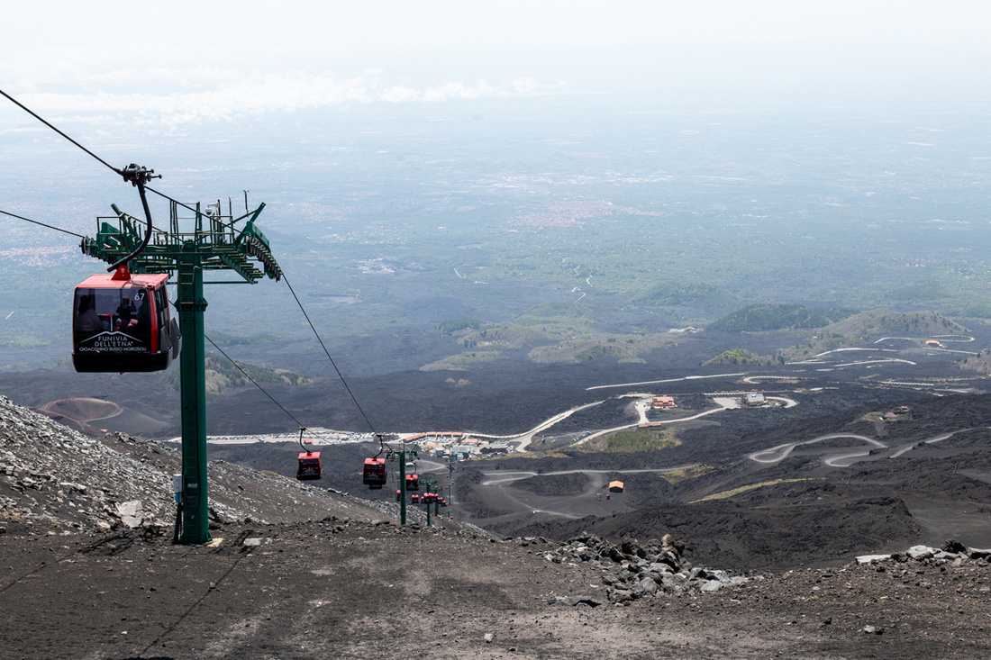
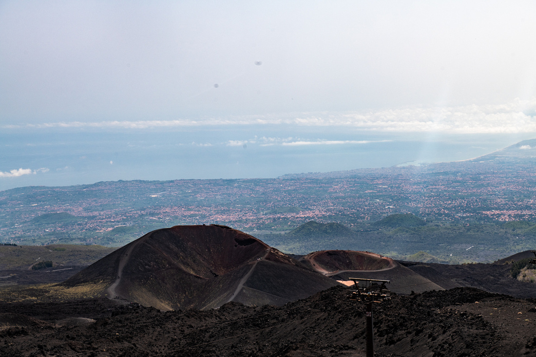
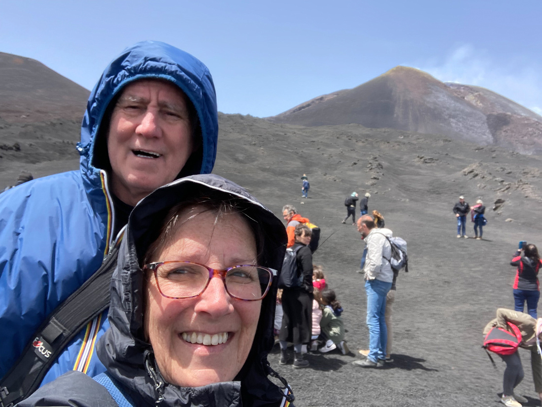
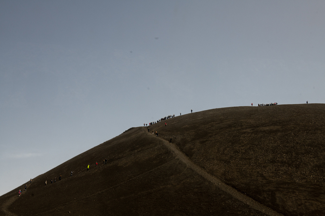 Then we went back to Tommaso's home to relax and taste some of the wine he makes. The southern slopes of Mt Etna are an up and coming fine wine region and Tommaso is doing his bit for the Prezzavento family's commitment to good Sicilian cuisine. Joe does the food, Tommaso does the wine. The wine he's making is quite good and he's planted more vines which should start yielding next year.
We also got to meet his youngest, Carlo. Meeting Tommaso was a big bonus. We sure hope to see him again when we go back.
]]>
Also of historical note is that this was the home of Archimedes. His mathematical discoveries, inventions, and just pure genius are legendary. He died here in 212 BC when the Romans stormed the city.
The first item of photographic interest is the open air market including several fish stalls. A good percentage of Sicilians still like to shop this way and we will see more of these.
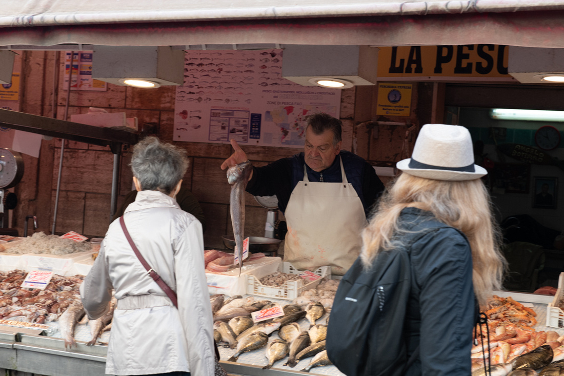
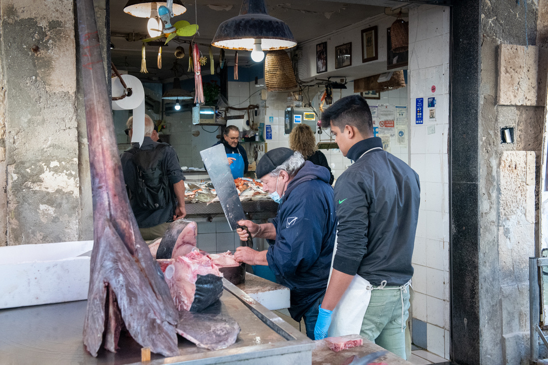
The quarry where the Athenian prisoners were worked to death is now a garden. In it is a large cave known as Dionysius' Ear. You can see that the shape of the cave funnels the sound to a point at the top. Supposedly Dionysius, the Tyrant of Syracuse, would put his political prisoners in the cave together and he could eavesdrop on every word from a chair at the surface. Neat place to photograph anyway.
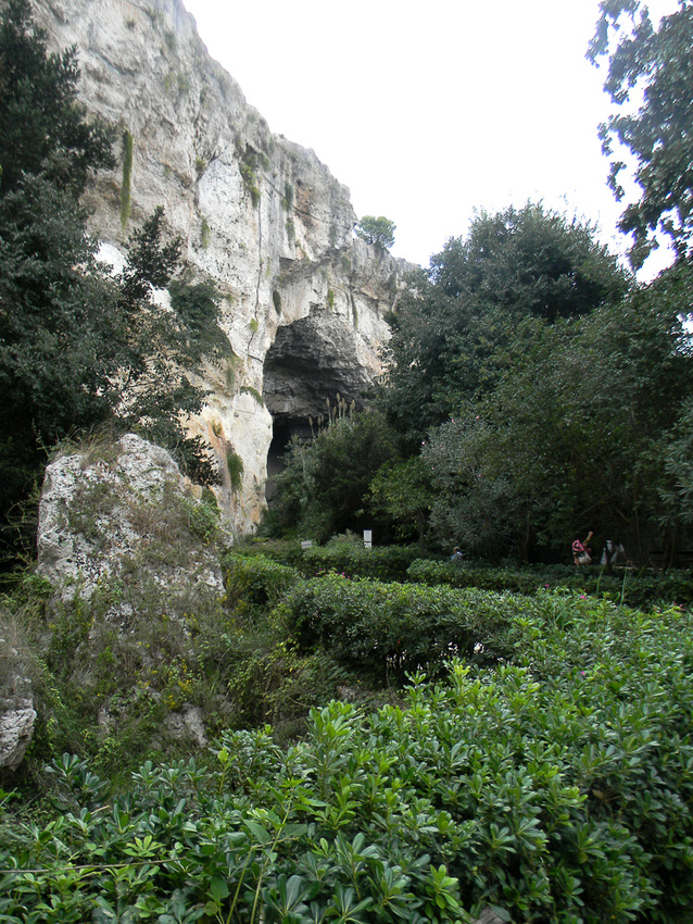
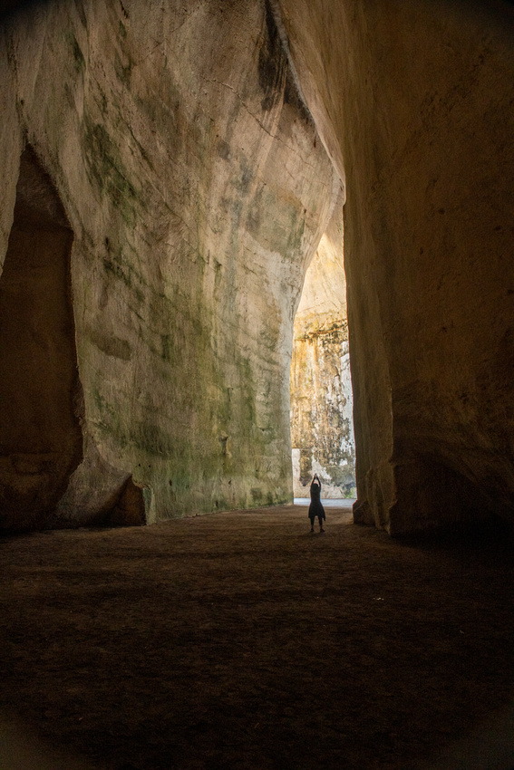
Below is the Fountain of Arethusa. It has several myths surrounding it but it is the main reason the fortress is so secure. It is fresh water surrounded by salt water. We are looking straight down.
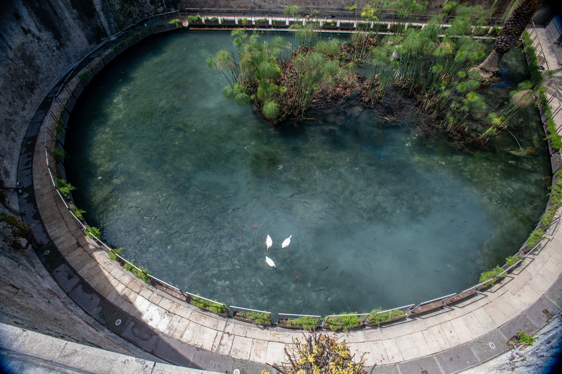
The cathedral was damaged in the earthquakes of the 17th century so it has the typical Spanish Baroque front but some of it survived because the walls are from the pagan Roman period.
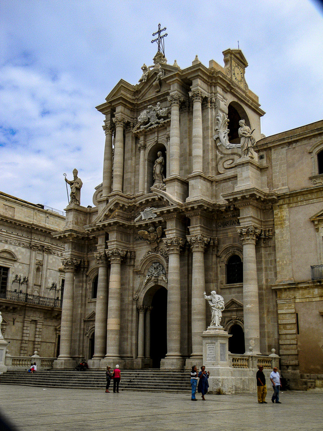
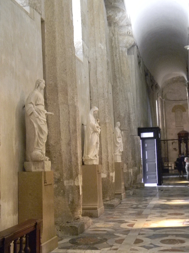
Unfortunately we ran into a problem with the photography we did not anticipate. Tourists! There was a large cruise shop docked in the harbor when we got into town and it disgorged about eight battalions of them onto this little island. We gave up on climbing up to the amphitheater when we saw a large gaggle heading there. So we wrapped up early and headed back to Diana's. I did get a photo though of a guy carrying a giant table lamp!
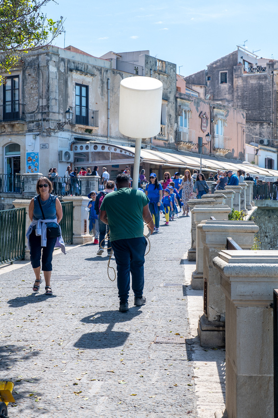
And here's a picture of the amphitheater from 2012.
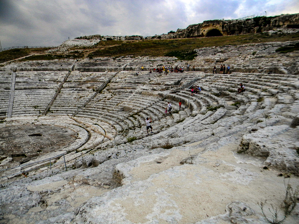
On Wednesday we went up to Taormina because the forecast for the weekend and early part of the following week was for rain and I sure wanted good weather for that. But I'll include what we saw when I report on Taormina. Then on Thursday we ascended Mt. Etna. That will be next.
]]>Jeanne Marie and I, with Boo & Rollie, our traveling companions on several trips, visited here in 2012 and we knew right away we would return. So much to see, so many beautiful churches, a very dear friend, and sooooo much to photograph. And so the covid gods finally consented.
We've had so many of you express interest in this trip I guess we will just do a travel blog and keep everyone up to speed this way.
The trip across was brutal but unfolded according to plan. Three plane rides, an airport change, and finally by car it took exactly 24 hrs from door to door, arriving on Wed April 28th. And the door we arrived at in Sicily is the home of our dear friend Diana Thompson Nicoletti and her partner Prof. Giovanni Nicoletti. We Americans would address Giovanni as "Doctor Nicoletti" He is head of neurosurgery at Catania Hospital. They have a lovely sea front home just south of Catania near the village of Brucoli. I met Diana in 1999 when my daughter Shannon and I took a cruise in Europe to see the solar eclipse. Diana was on the cruise because her flat mate, Victoria, was lecturing about her trip to the North Pole. We've all been friends ever since. And Victoria flew in on Friday to spend that first weekend with us. Great reunion for all!!
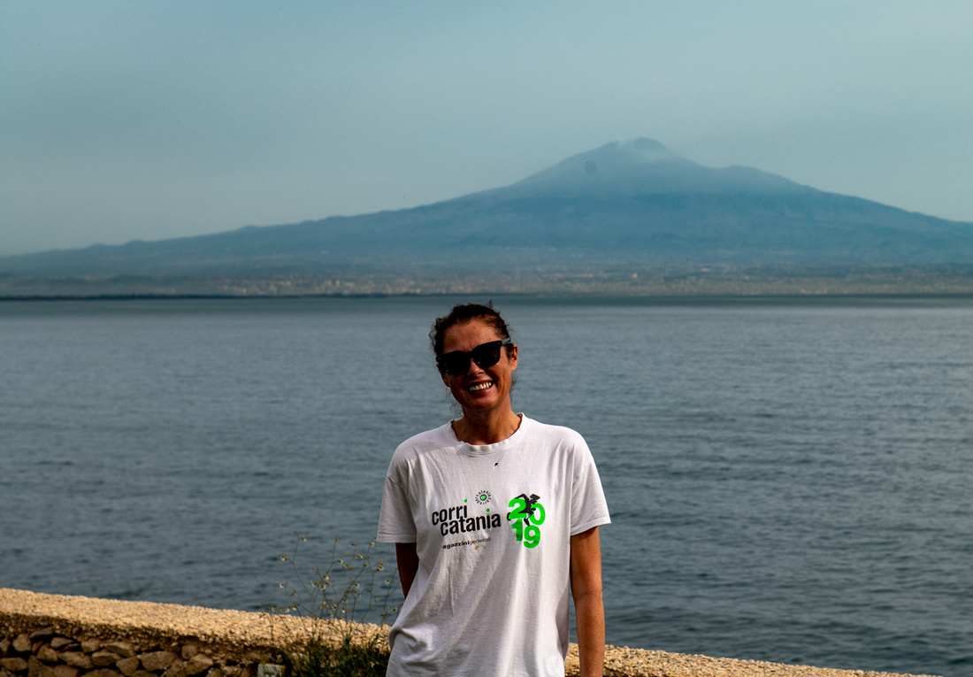 DianaDiana
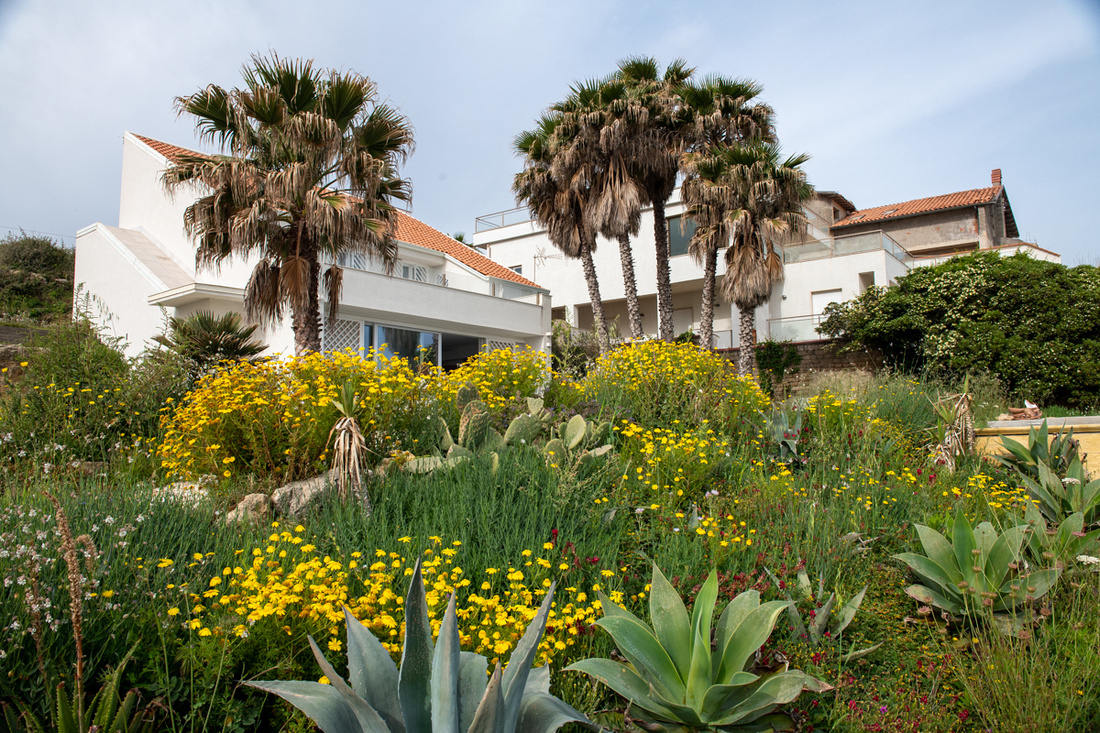 _8502369The Nicoletti Home
Introduction would not be complete without showing off Diana's delightful little dogs, Poppy and Ponga. Sweeter, better behaved little dogs would be hard to find.
 Poppy & PongoPoppy & Pongo
We picked Victoria up on Friday and just spent the rest of the day catching up. On Saturday we went out on the boat. This is Dr. Nicoletti's primary way to unwind. We observed in the 12 days we were there that he is never really off duty. The boat lets off some of that pressure.
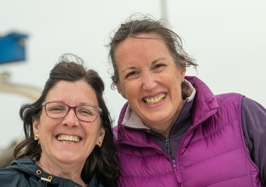 Victoria & Jeanne MarieVictoria & Jeanne Marie
The boat was great. We had the best weather all week and it was just warm enough for swimming. Victoria wanted to swim the Straits of Messina but the ferry boats kept getting in the way.
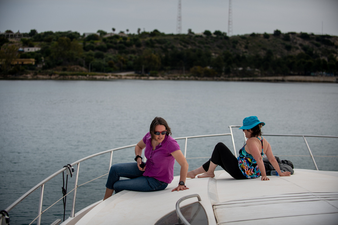
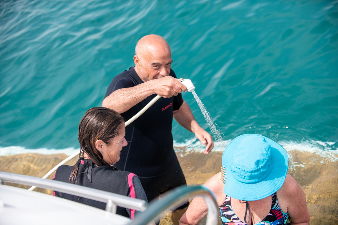 Dr GiovanniDr Giovanni
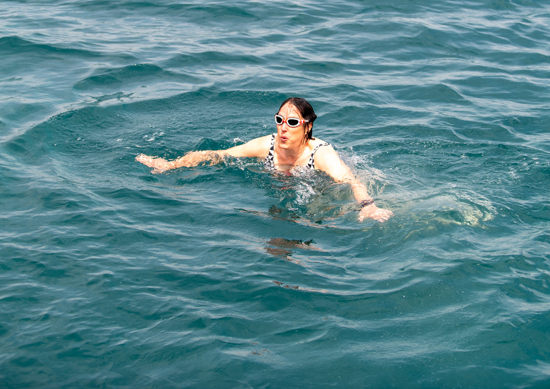
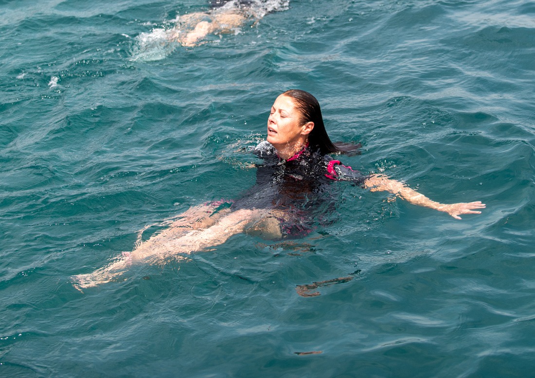
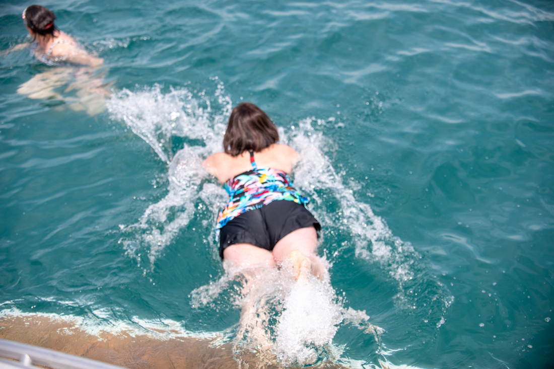 So does anyone else think Diana has been in Sicily too long?
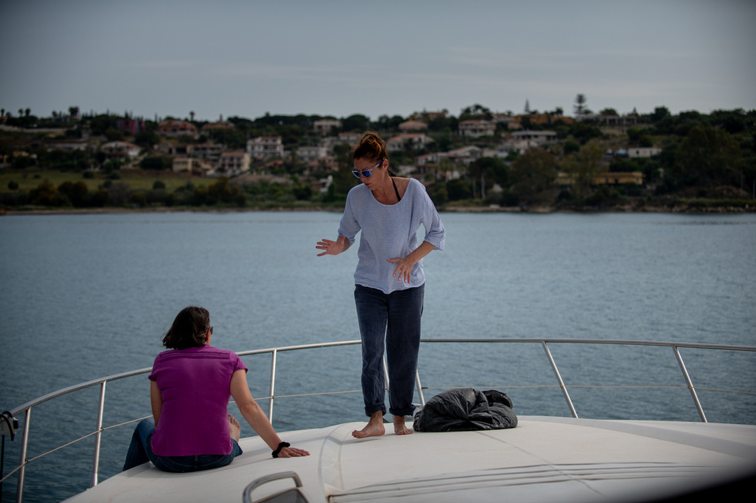 On Sunday we went to Mass at the little village church in Brucoli. Like all of the Masses we attended on the trip it was very nice. Victoria, Jeanne Marie and I then walked around town a little and met Diana and Giovanni to go over to Augusta for lunch. The fish market and doorway pictures are in Brucoli, as well as the lighthouse. And if you look at the slide show, yes that is an octopus the guy is holding.
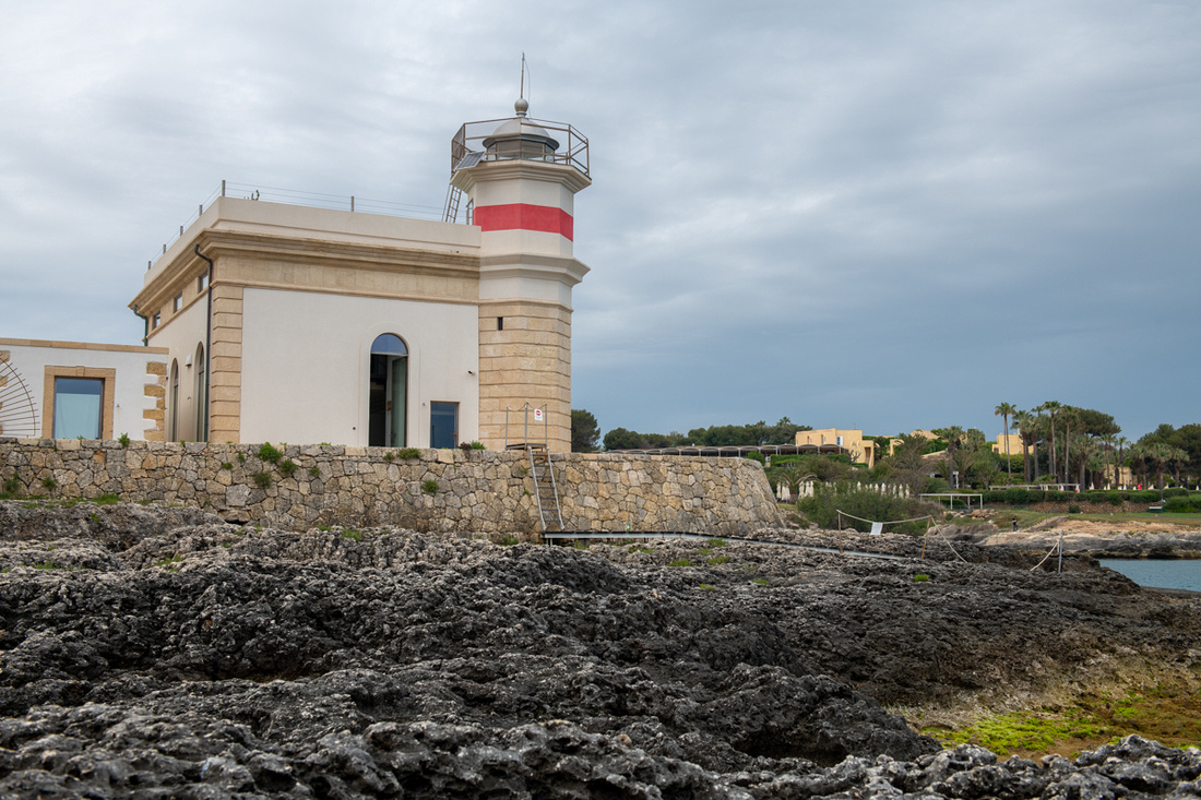 Broculi LighthouseBrucoli Lighthouse
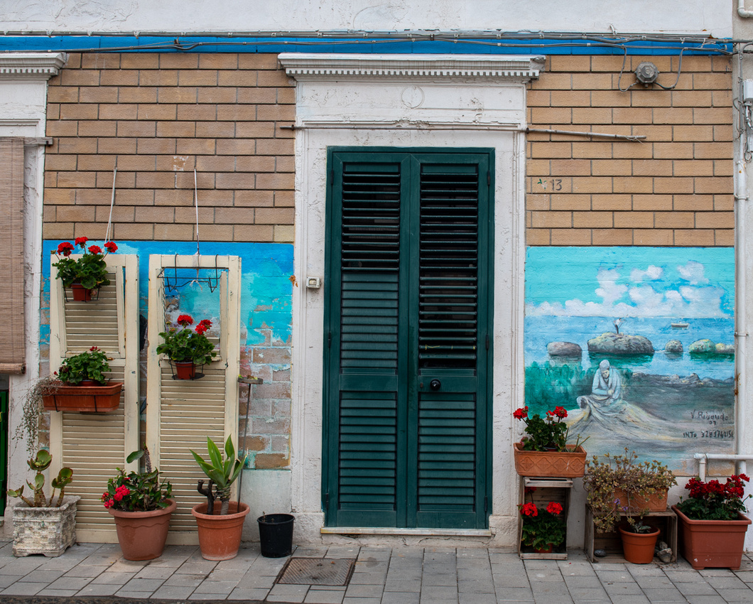
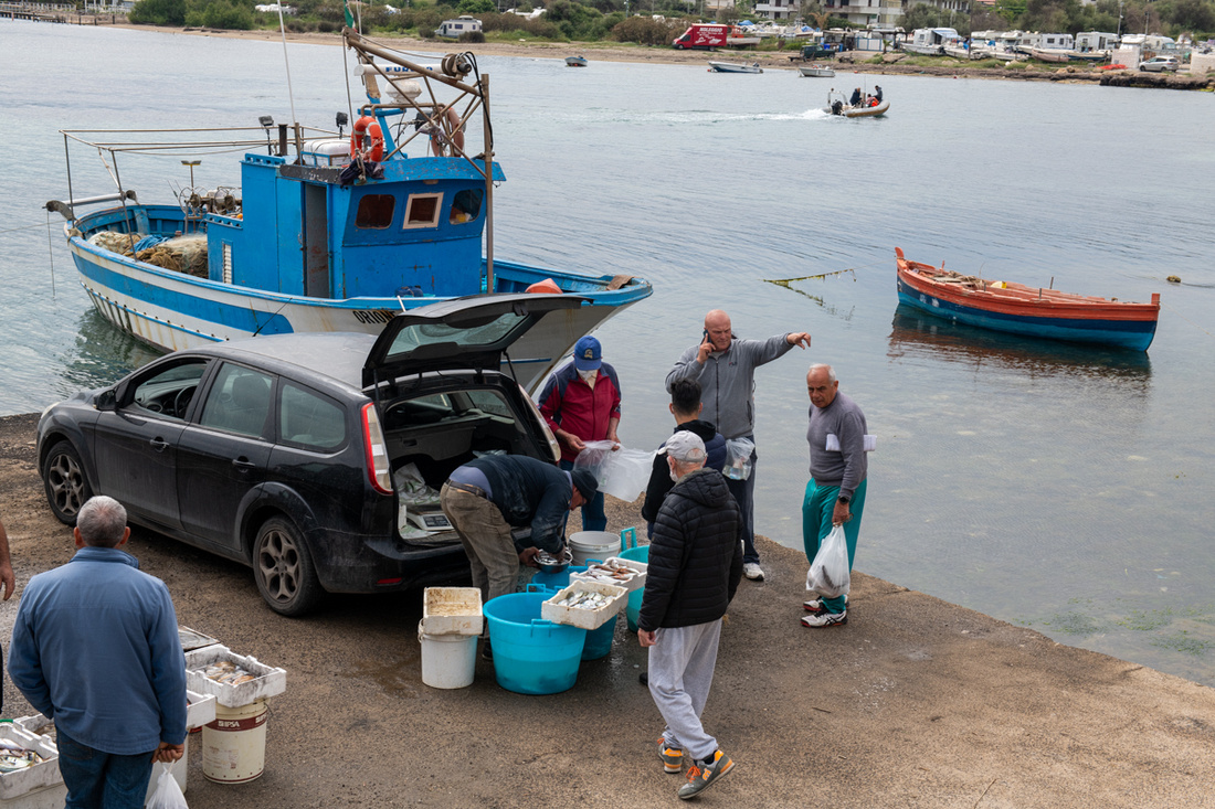 If you crave seeing more of these images you can click the image below. It will bring up a slide show. Next installment of the blog will be up when the pictures are ready.
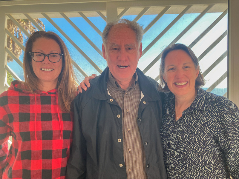
Noto and Ragusa
So Monday morning Victoria had to go back to England, Diana had to go back to translating, and Giovanni had to go back to brain surgery and we had no one to play with. So we made the best of it by starting our exploration of the eastern end of the island. One of the things that make Sicily so interesting (the other being the active volcano that overlooks its largest city) is the amount of history on display. And those of you who have read my other stuff are now muttering, "Look out! He's using that word! Brace yourselves everyone! Here comes a history lesson!" And alas yes. It must be so. Here it comes. But at least a thumbnail sketch is necessary to convey to you the interesting attractions of this place.
Sicily was part of Magna Gracia and was heavily colonized by the Greeks starting several hundred years BC. Most of the inhabitants of the island today are descended from these people. The later invaders came in as overlords. The Romans, Vandals, Arabs, Normans, and Spanish all ruled and left their mark and much of what they built is still here for us to inspect and photograph.
After we got Victoria safely off, Jeanne Marie and I set off to check out the baroque towns of the southeast. They are called this because in the 16th and 17th centuries the southeastern part of the island was hit by powerful earthquakes, as well as a major eruption of Mt. Etna in 1693. The Spanish were ruling at the time so most of the major buildings, especially churches, were rebuilt in the Spanish Baroque style. As in "You can't have too much ornamentation. When you think there's enough add more!" They are of course very beautiful.
We picked Noto and Ragusa to visit. Noto was first. The route we took gives a full overview of the town and one is impressed by how small it actually is. But it has this big beautiful cathedral. This is a common experience all over Europe. We inspected the church, I climbed the bell tower, and we decided we had to go on to Ragusa if we would make it home by dark. We were a little too green to be traveling country roads in Sicily after nightfall.
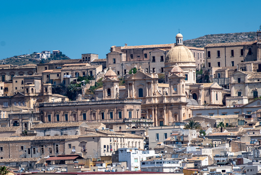
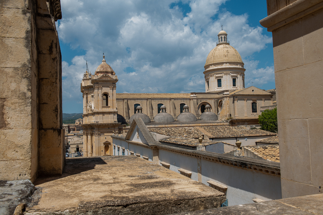
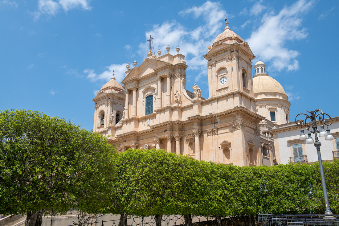
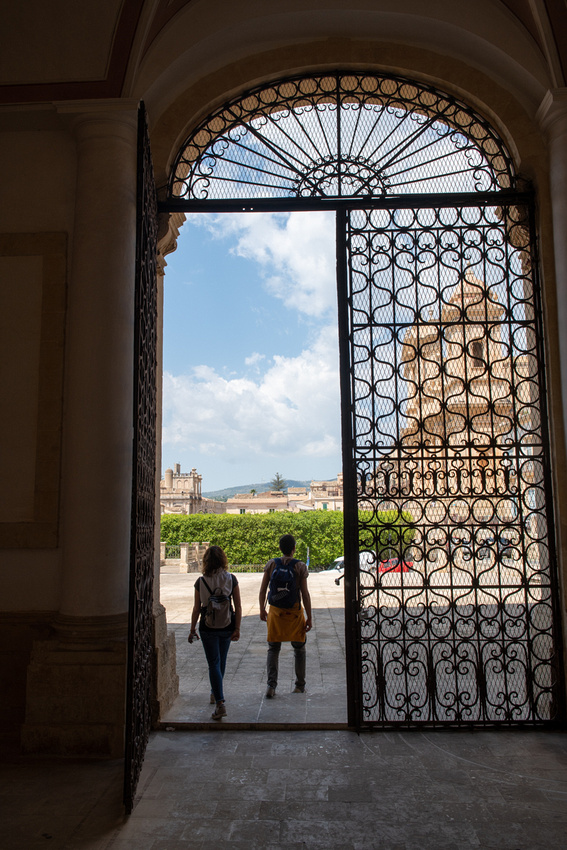
Ragusa is a much bigger town, built on top of, and down the sides of, a large hill. Well okay, it's a mountain. This is the rule rather than the exception all over Italy, as the towns were sited for defense. We got lost several times. Gladys (the GPS) is amazing and we couldn't have done without her but these old medieval towns seem to confuse her as much as us. But it was worth it. It's just amazing that these towns could function with just horse and human power to get stuff up these hills.
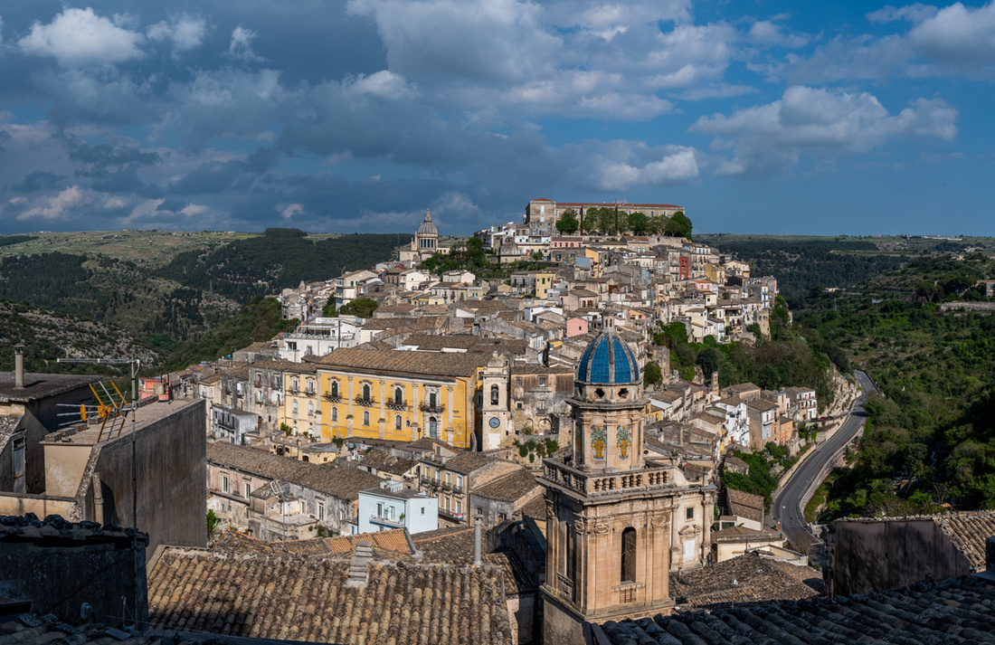
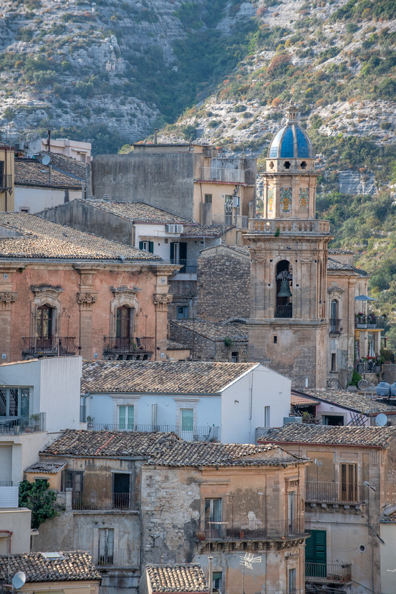
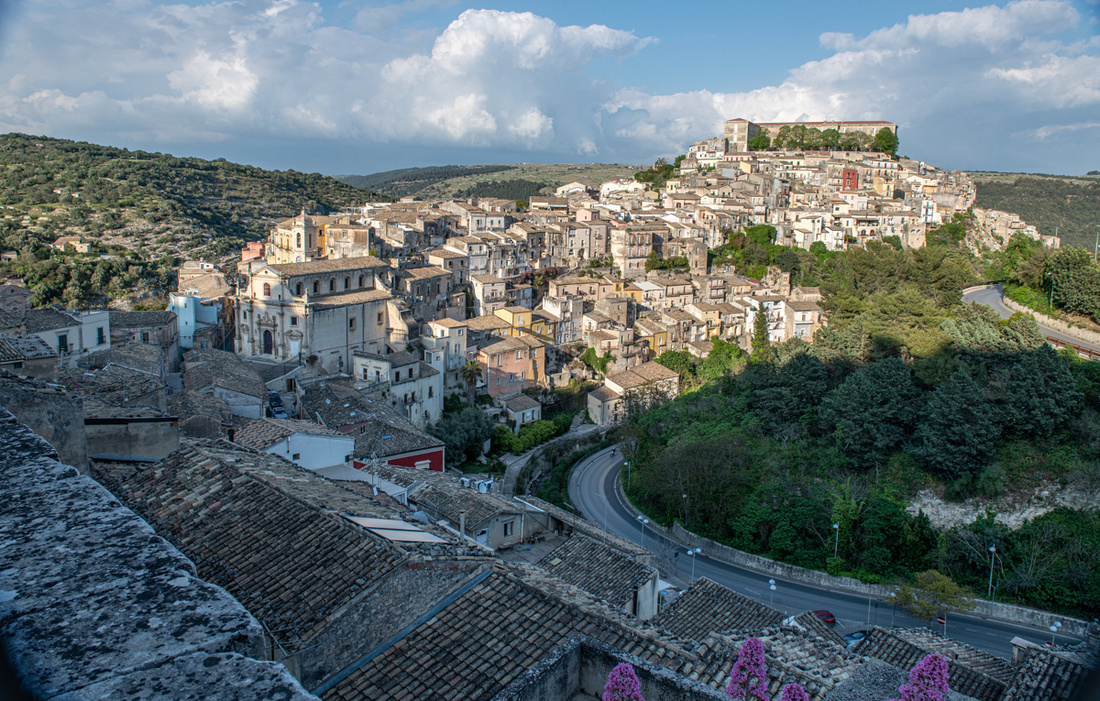
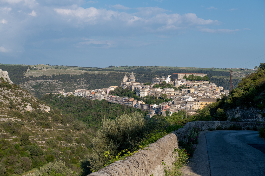
Tomorrow, Siracusa
]]>It's been a tough winter all over the Midwest. I got no new eagle pictures and very few swans. Egret season is just around the corner. Hoping for improvement.
]]>
Come on down. This is my first solo exhibit so when I'm famous you will be able to say you were present at the creation. Besides we'll have food and wine.
]]>
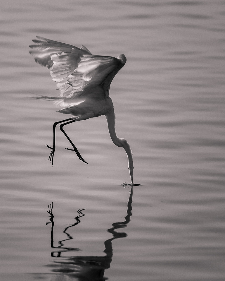
Greetings everyone. Welcome back
The Soulard Coffee Garden and Cafe will have 20 of my images hanging from March 6-April 16. There will be an opening reception there on March 10th from 2-4. The theme of the exhibit is "Nature in Monochrome". It will be landscapes and birds.
Over the last couple of years I've been gradually channeling more of my work into monochrome. Not a radical shift, but I feel like I'm slowly learning how to interpret a scene in black and white and that makes me want to do more.This shift in my vision actually rather surprised me. I've always considered myself a color guy. Any B&W images worth a second look were pretty much coincidental. But my wildlife work handed me a nice present here-egrets and swans. We have lots of those birds around St. Louis and I could see right away the possibilities they have for B&W. Then late in November last year we went to Eastern Pennsylvania for a wedding. I took my camera of course. All the fall color was gone. But we found some covered bridges that were begging to be photographed in B&W. I had a ball. Instead of lamenting the lost opportunity for fall color pictures I was rejoicing that all those pesky leaves were out of my way. That's new thinking for me.
So now my monochrome work has landed me in my own exhibit. I hope lots of you can come. This is my first time at this. I need my hand held. JM says if this is a success I can quit my day job.
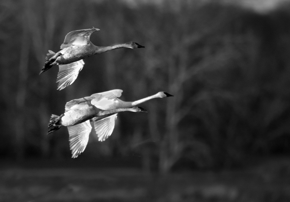
]]>