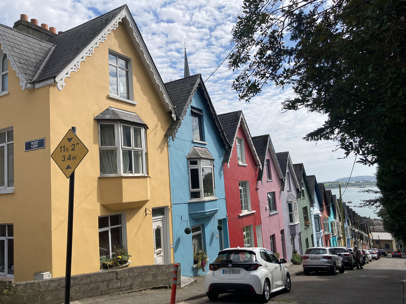
County Kerry-Day TwoI’m reluctant to favor one Irish county over another, they are all so very beautiful, but for sheer volume of highly photogenic spots I don’t think Kerry can be touched. For one thing, it is one of the largest, it has lots and lots of coastline, and the highest mountains on the island. A landscape photographer is like a kid in a candy store. He doesn’t know where to start. Or when to stop. So patience please, Dear Reader. We spent seven days in Kerry, the weather held up nicely, and by the time we crossed the River Shannon to the north my memory cards were rather stuffed. There are lots of pictures. Our first four days were spent on the Iveragh Peninsula, the larger of the two that point out into the Atlantic, the other being Dingle. Iveragh has attracted tourists since the 19th Century, the most famous of whom was Queen Victoria who visited in 1861. She stayed at Muckross House near Killarney and when she and her entourage returned to England extolling the striking beauty they had seen, Killarney would forever be a tourist town. In 1932 the Muckross Estate was donated to the government and was made a National Park which has preserved the pristine beauty.
Below is Lady's View. So named because Queen Victoria's ladies in waiting were brought here to see the view of the valley.
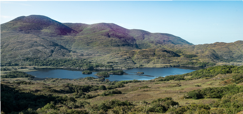
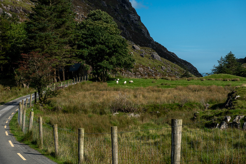
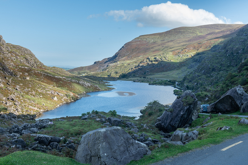
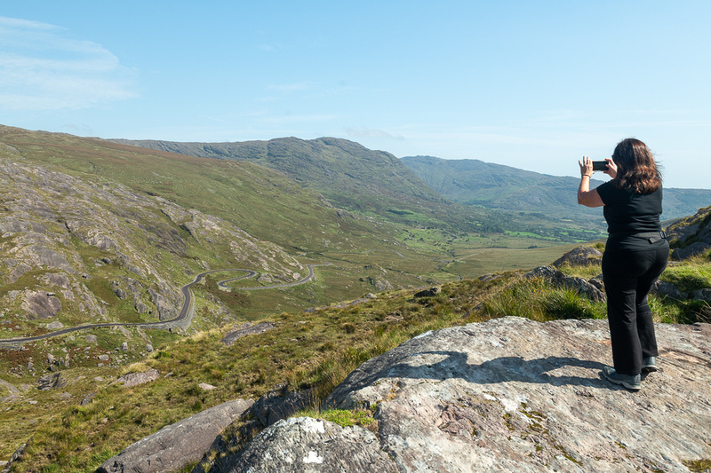
We had enjoyed stellar weather from the time we arrived and this promised to continue for at least a few days so we decided to check out the areas that needed clear skies. The Black Valley and the Gap of Dunloe were high on that list so that’s where we decided to start.. Going through the Black Valley is the shortest route from Kenmare to the Gap of Dunloe. But of course, in Ireland shortest is not the same as quickest. The Valley runs through the heart of the wild & wooly part of the peninsula and bumps right into the highest mountain in Ireland, Carrauntoohil, which is just over 3900 ft.
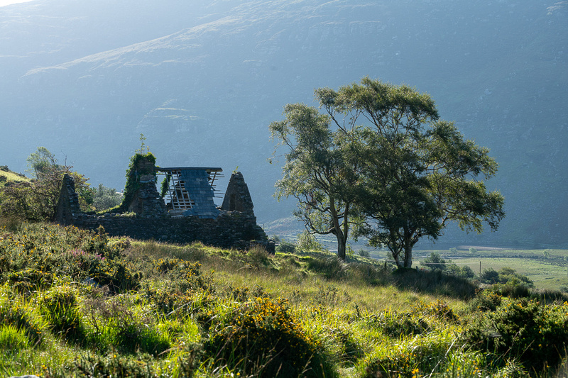
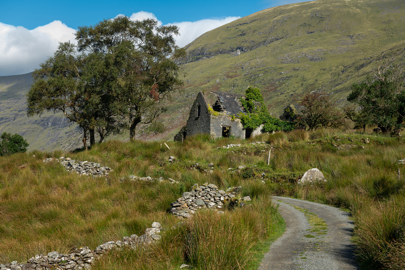
There was a lonely little ruined cottage that wanted its picture taken.
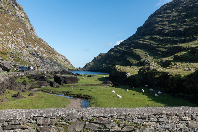
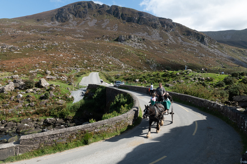
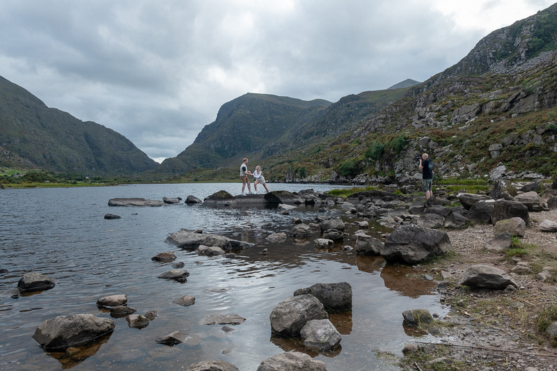
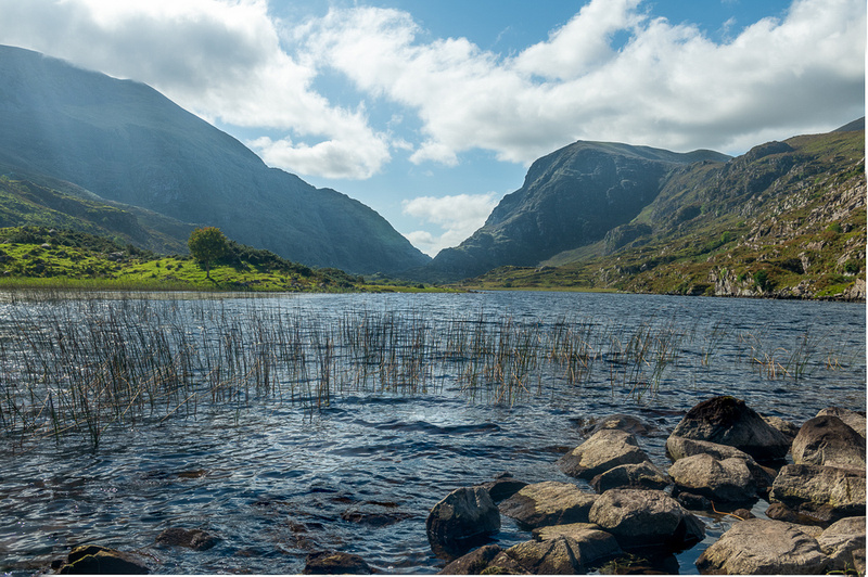
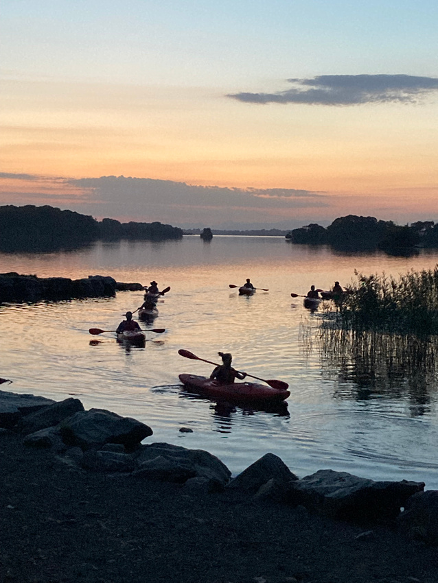
Going this way brought us to the top of the Gap of Dunloe at the south end. This is one of the primo photography spots in Ireland as the River Loe cuts through the mountains but then pauses on the way down to widen into pristine lakes. We traversed the one lane road that runs through the Gap several times. It was a fun day.
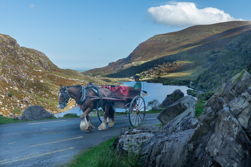
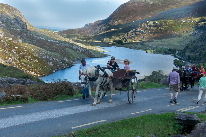
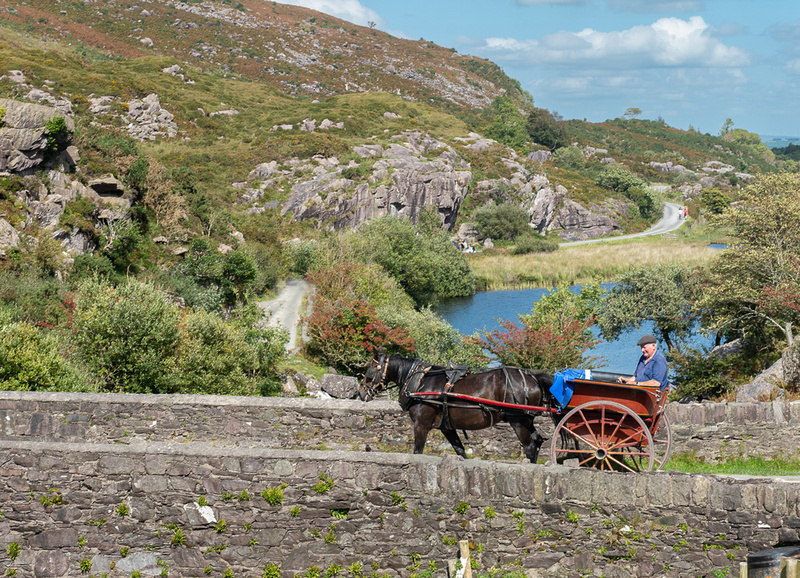
And then there are the jaunting cars. They are really fun to photograph.
The bridge above is the Wishing Bridge. I don't know where that name came from, it is not the only arched stone bridge in the Gap, but it gets the romantic name. The jaunting cars were back and forth across it all day.
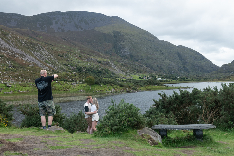
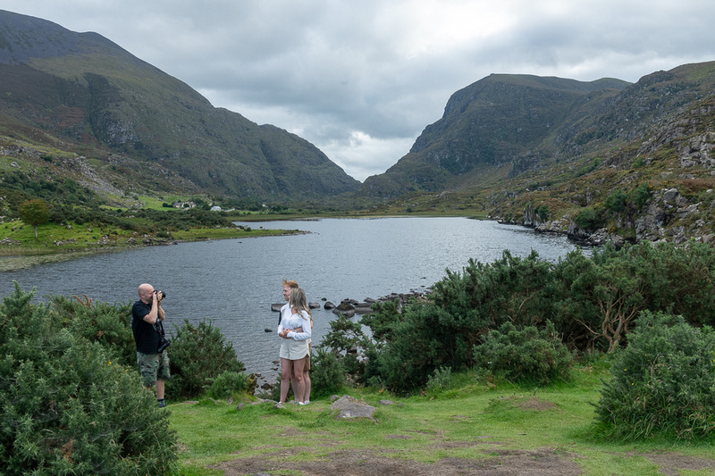
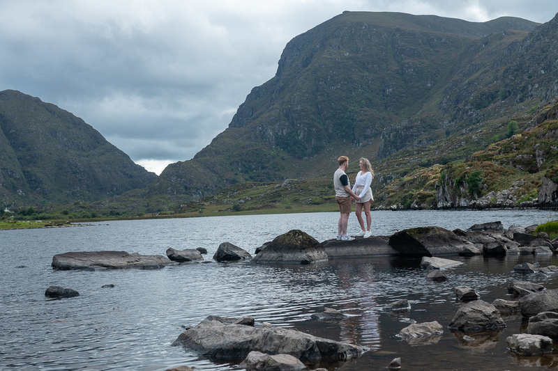
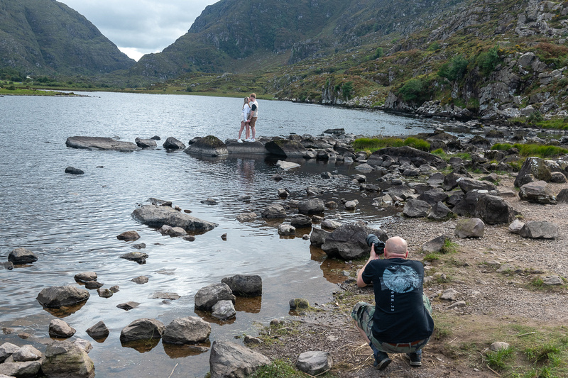
And now its time for our first visit from the serendipitous photography gods. As you who have read the blogs of earlier trips might recall, the serendipity gods sometimes give me a chance at a little something extra, something I cannot set up for myself. Or maybe its just that if you spend enough time at jaw droppingly beautiful places, eventually someone will show up to use it for engagement pictures, wedding pictures, or even the wedding itself. This young couple was probably the former.
Below is a slide show with more pictures of the Gap of Dunloe and the jaunting cars. And by now you're probably asking, "Can't this guy spell cart? They are carts, not cars." Yes I know. But the Irish call them cars. The slide show includes a video of a jaunting car.
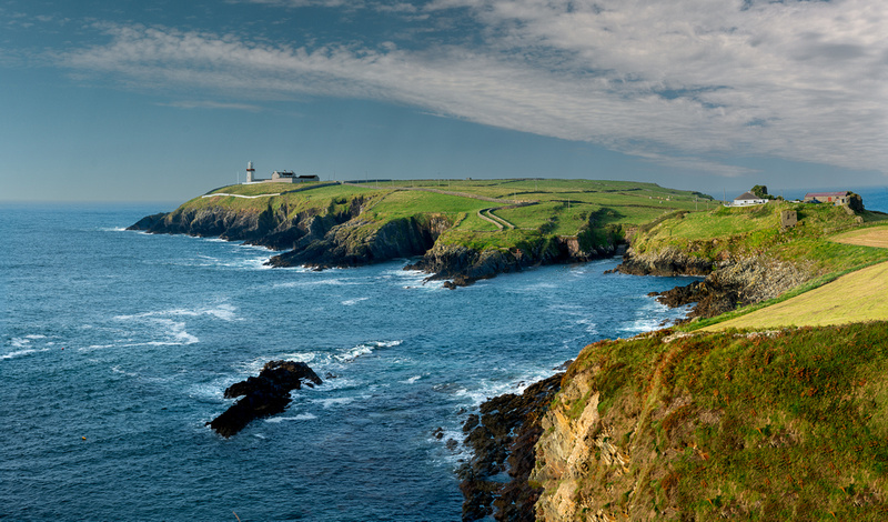
More West Cork and BearaNext morning we were going west and we had a choice of two routes, one of which took us back by Galley Head. So we decided to see how the lighthouse looked in morning light.
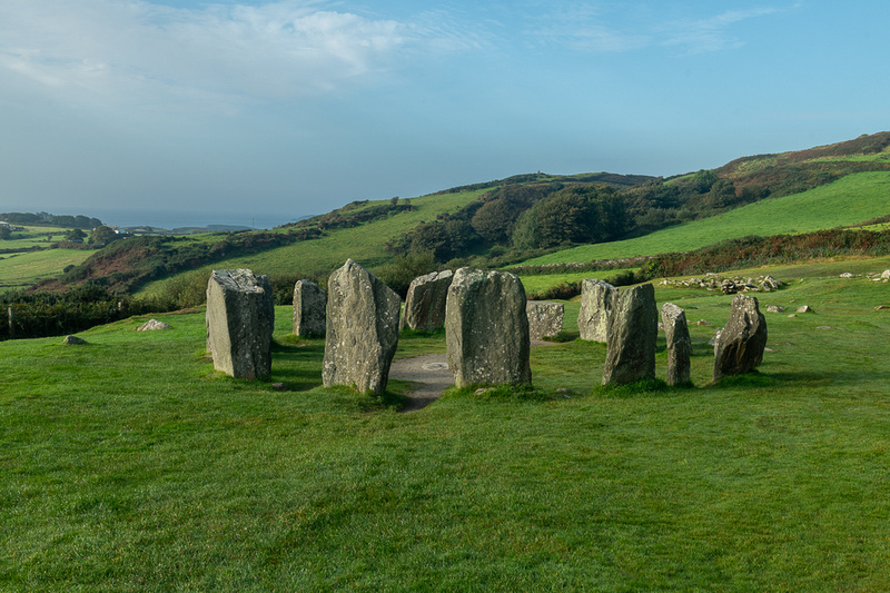
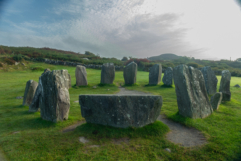
The other benefit of the route we chose was the Drombeg stone circle. There are at least ten of these that I know of along this southwest Irish coast. This one is fully intact and beautifully sited on a flat spot overlooking a valley.
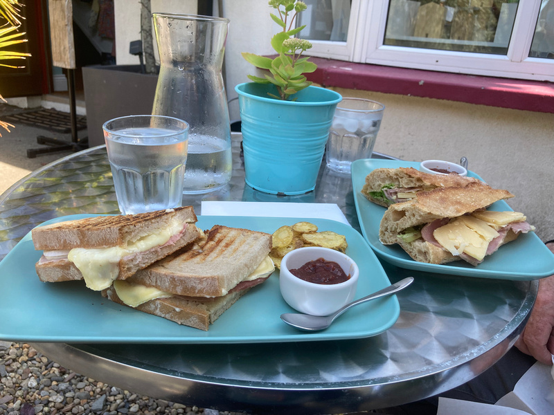
We then worked our way up to Bantry and stopped for tea. Bantry is one of the spots that claim to be the departure point of St. Brendan on his transatlantic voyage.
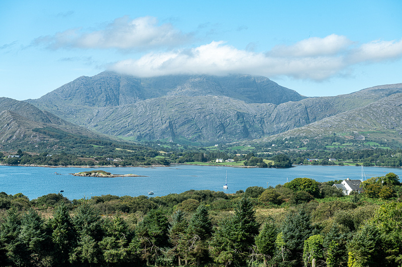
Then around the end of Bantry Bay and onto the Beara Peninsula. Going onto Beara one sees immediately that he has entered the wild and wooly part of Ireland. Wild because the terrain is largely untouched by the hand of man. The rocks are just too big to move and if you do you simply uncover more rocks. And wooly because the only thing the land is good for is grazing sheep and goats. This extends west through large swaths of counties Kerry and Clare. The mountain below is Hungry Hill which has had that name since before the Famine but I don't know why. We are looking across Bantry Bay.
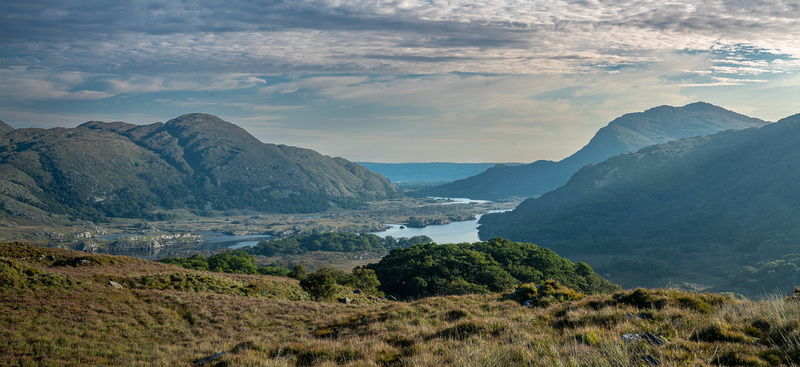
We had a lovely lunch at a little craft and sandwich shop and had to make a decision about the rest of our day. I had a couple of places I really wanted to photograph near the tip of Beara but they would be sunset shots and it was still early afternoon. So we decided to go over the Healy Pass to our accommodations in Kenmare and try to get back down Beara on one of our four nights in that spot. At the top of the Pass we entered Co Kerry and would be there seven days, between Kenmare and Dingle.
Jeanne Marie chronicles our crossing of Healey Pass
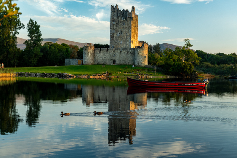
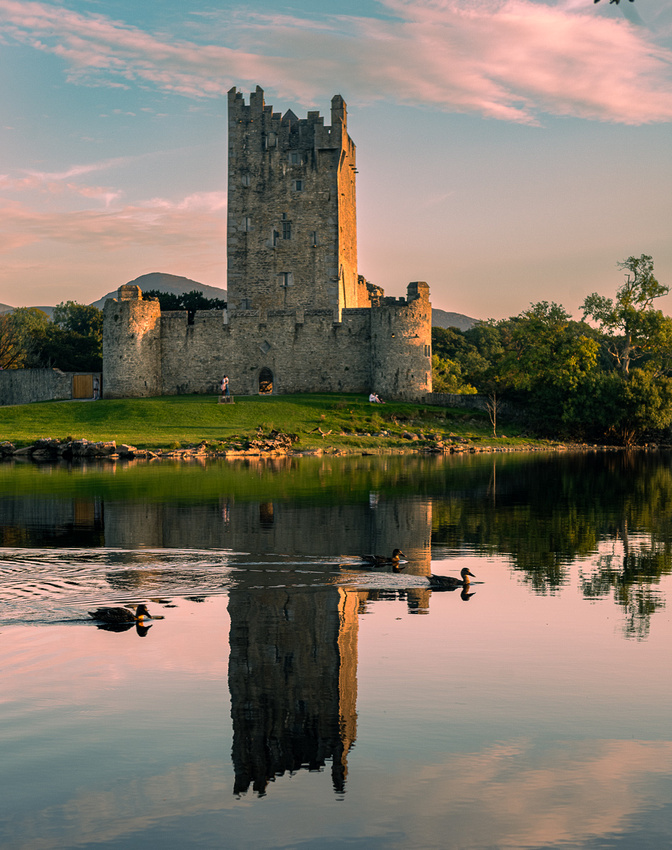
Above is Glanmore Lake, just below Healy Pass. Very typical of County Kerry. By the time we got settled into our quarters, just a three minute walk from Kenmare’s main street, it was late enough that we would have to pick a subject for sunset that was close by. So we headed over to Ross Castle in Killarney National Park.
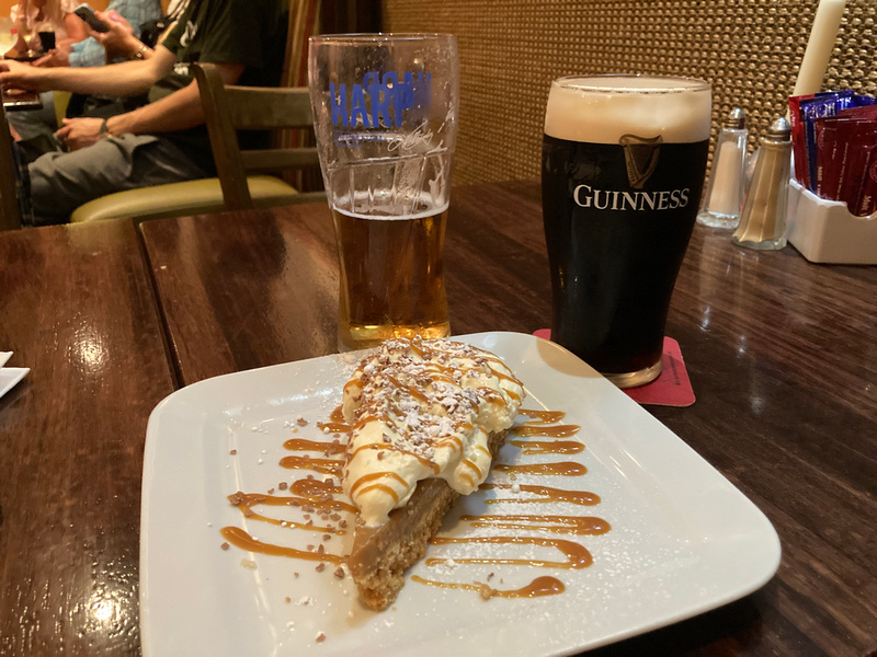
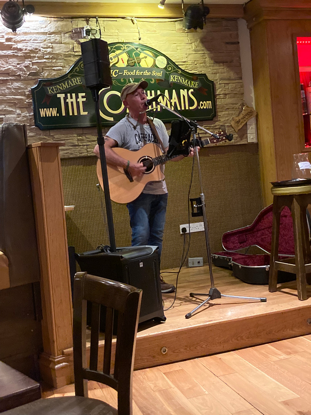
We got back in time for some music, banoffee pie, and a pint. The musician is Frank O'Sullivan and he was good.
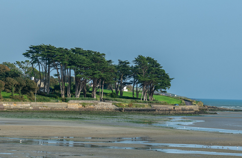
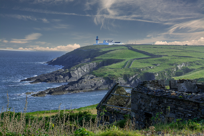
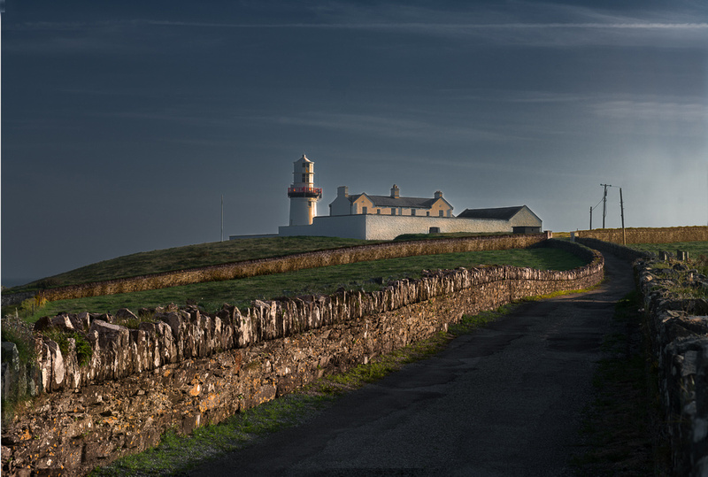
Kinsale, Galley Head and CobhOne reason we picked Kinsale, besides just wanting to see the town, was that it is about half way between Galley Head and Cobh, our other photo destination for County Cork. So after checking in to our B&B the sky looked promising so we headed out to Galley Head to see what the photo gods would give us at sunset. Ireland, as one would expect, has lots of lighthouses but the really good candidates for photography are rather few. They require a fairly serious expedition, as they are stuck out on these long peninsulas, or actually on islands, with a mix of public and private land, so extensive scouting is needed to get the best angle. And some have not reopened to the public since the covid lockdowns. We drove the coast road which took us along the undulating coastline of West Cork, as it is called. The tide was out so the vast tidal flats were on show.
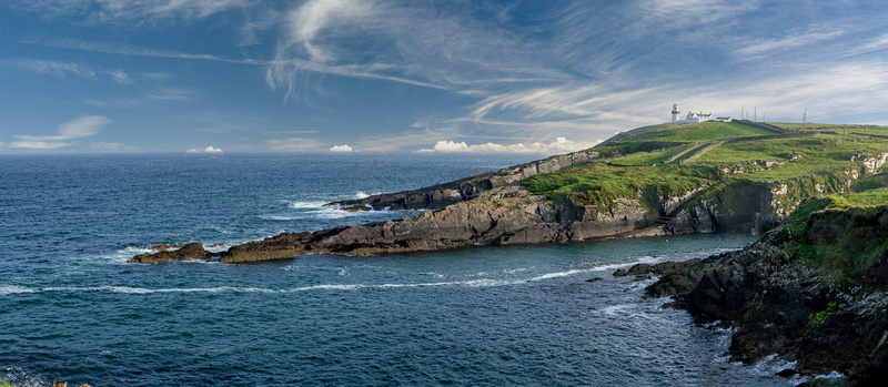
We arrived in plenty of time to find the best locations and while we waited for the golden hour I got a few shots from the cliffs.
As the sun was going down a thin overcast formed on the western horizon which diffused the light and color quite a bit but we did eke out a little bit of warm light. I guess the final result was worthwhile.
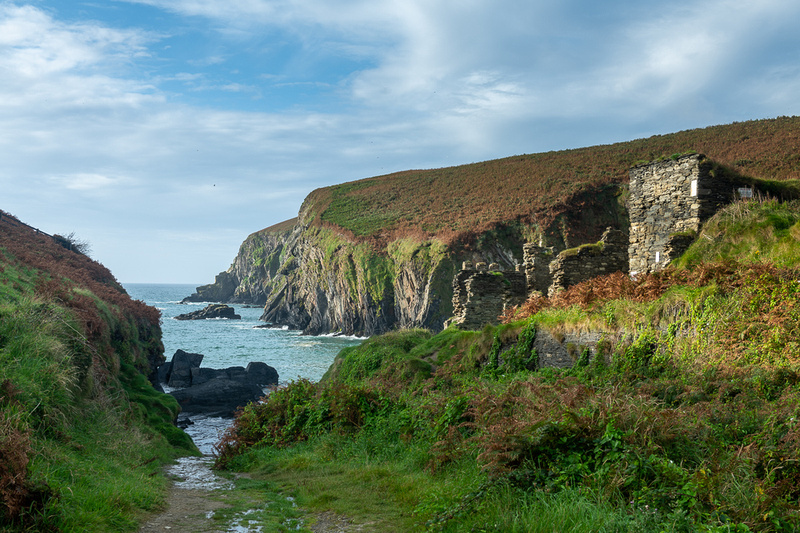
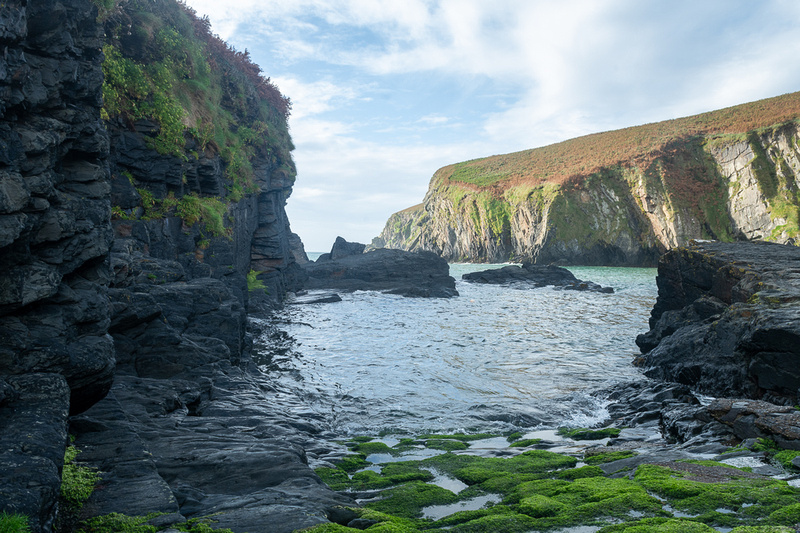
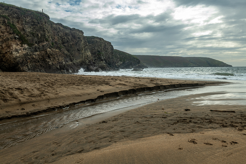
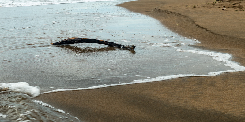
Next day the main plan was to go into Cobh and photograph St. Colman Cathedral but I knew I wanted afternoon light for that so we scouted up a little beach that had some interesting structure on it. We headed out at a civilized hour and let Gladys navigate. That's Gladys P. Smith, AKA GPS. She took us to this little cove which had no beach but was kind of interesting anyway.
We gave her another chance to find Rocky Bay beach and this time she succeeded. It was a nice beach but it was high tide so no unusual structure. I was finally figuring out how close you have to watch the tides on these coastal shots. One more thing to juggle along with the light and the weather. The pictures came out okay. Might make good black & whites.
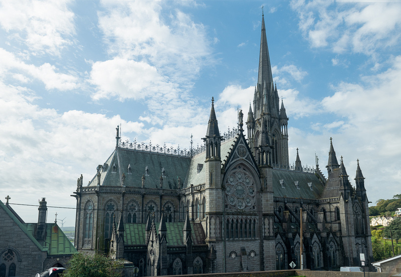
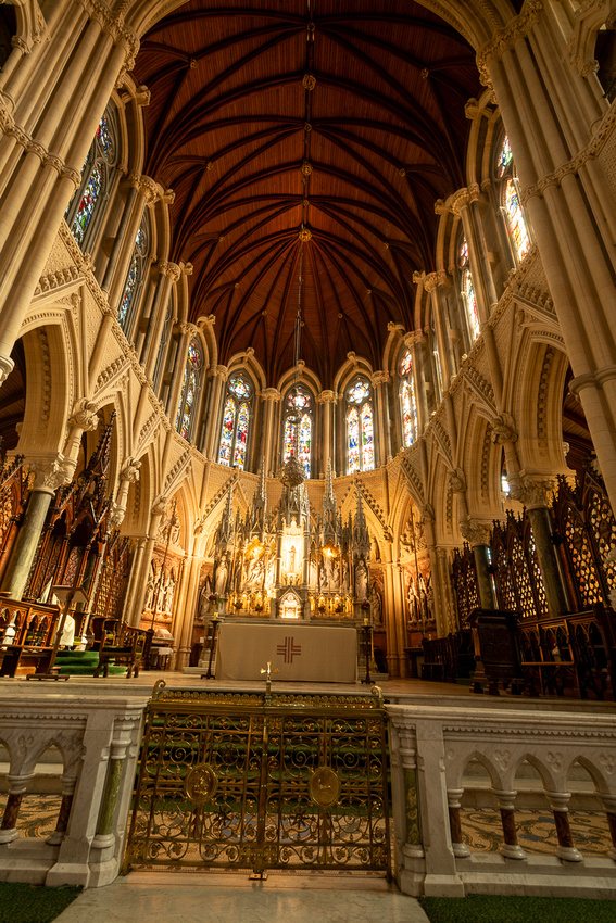
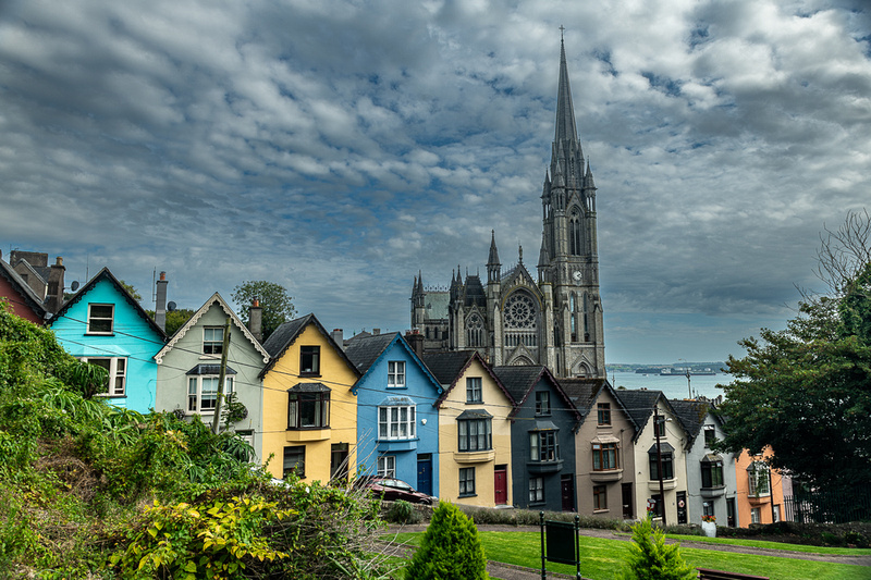
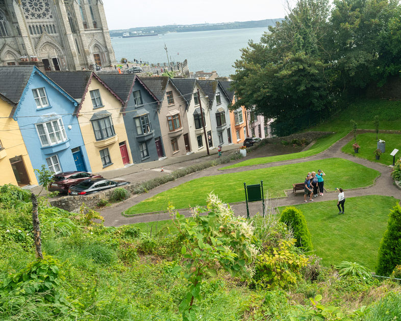
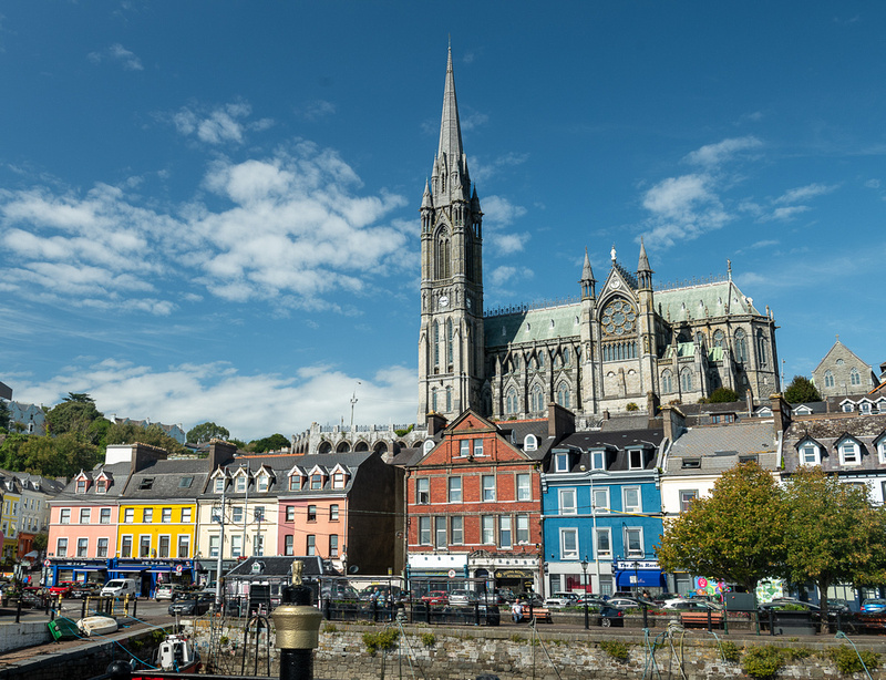
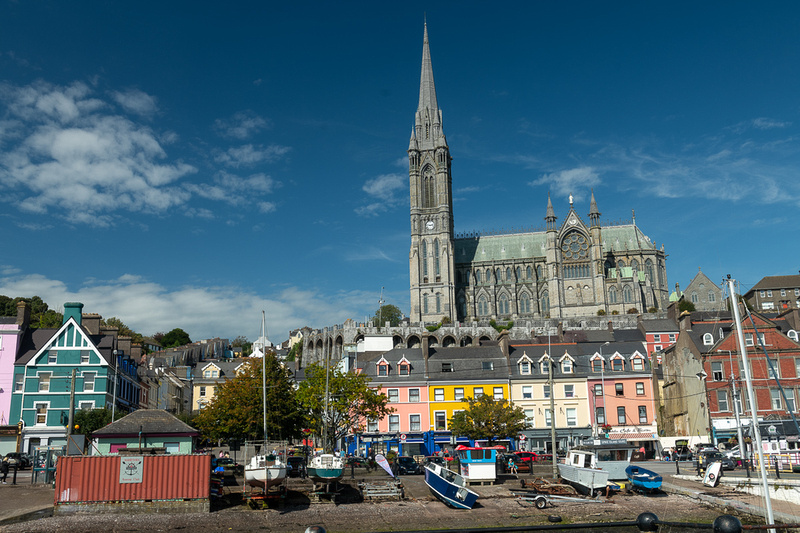
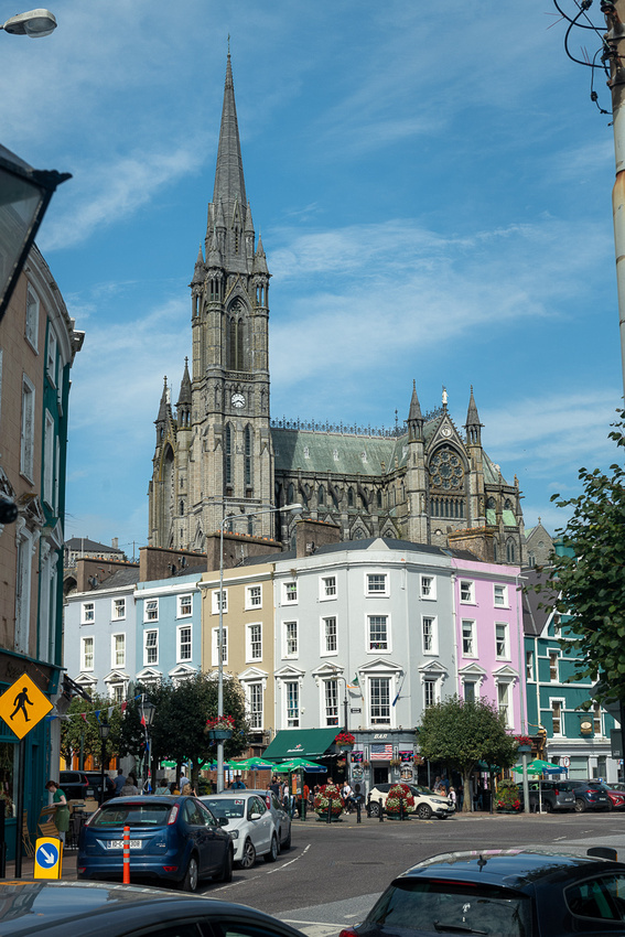
Cobh is the port town for the city of Cork. Many ships made their last European call here before crossing the Atlantic and by the late 19th century it was the primary embarkation point for those emigrating from Ireland. The most famous ship to stop here during this period was the RMS Titanic, just before heading out to her doom. 120 Irish emigrants boarded her at Cobh. Cobh must have been a prosperous town to have built a cathedral this impressive. It commands the entire skyline and the view of the harbor and it has 49 bells in the steeple.
Below is the iconic shot of St. Colmans behind the “Deck of Cards”, the nickname of the row of houses in front.
Ever wonder what Jeanne Marie does while waiting for me to take a picture?
Below is JM's shot of the Deck of Cards.
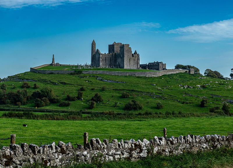
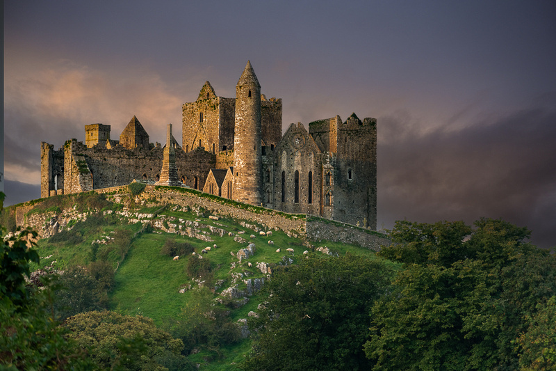
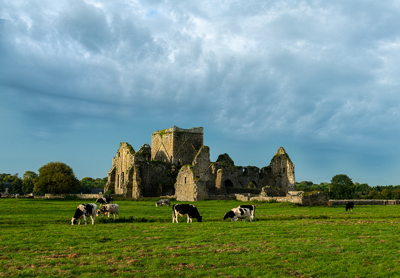
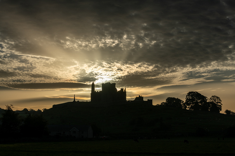
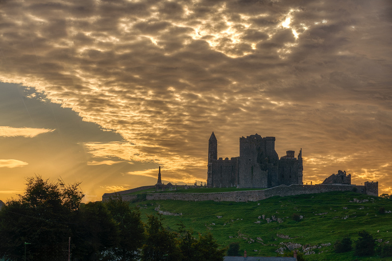
Tomorrow we head for County Kerry where we spend the next seven days. Cashel and CahirThe Rock of Cashel, in County Tipperary, is the ancient seat of the kings of Munster and has been a stronghold since at least the Bronze Age. Supposedly St. Patrick himself baptized the King on these grounds and as the legend has it, while preaching his homily, he became a little animated and kept stabbing his crozier into the ground for emphasis. Except it wasn’t the ground. It was the king’s foot. Thinking this was part of the ritual, the king endured this mishap without complaint. Just down the hill from the castle are the ruins of Hore Abby. They too, are an interesting subject for photography. The sky that evening was nothing to get excited about but we could always hope for better light in the morning.
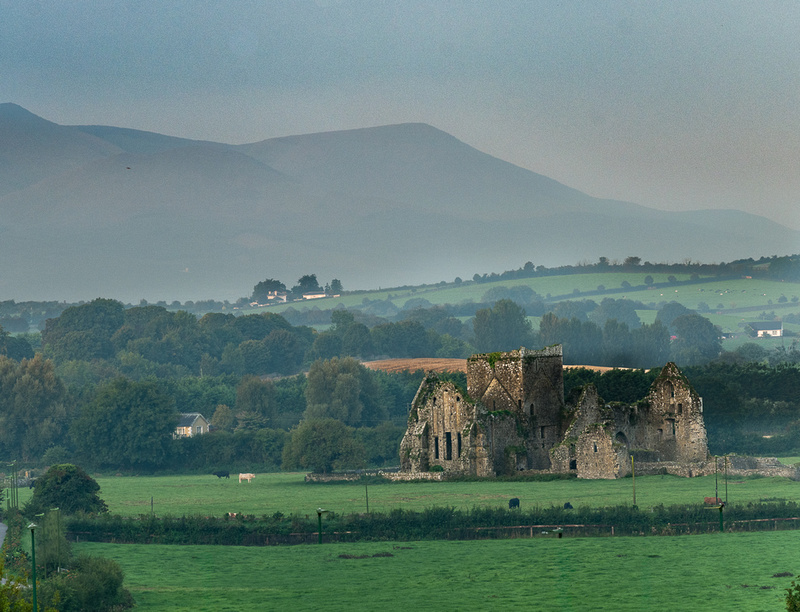
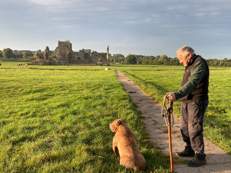
The Above is the view from the Abbey, which appeared to be infested with Little People. They were everywhere you looked Next morning the sunrise was decent enough to get some color and it would prove to be the best we would get on the trip. I’ve noticed on my various photo expeditions to Ireland that epic sunrises are hard to come by. The clouds seem to form up before dawn and obscure the horizon, not burning off until an hour or so after sunrise. The Abbey had pretty good light too. And the cows came home.
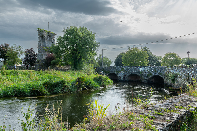
Once the sun was high it was time to head south. Just ouside of Cashel was the village of Golden. It has a cool bridge and the ruins of a guard tower. I’d never seen this place mentioned in my research. A fine example of the kind of thing one stumbles across in Ireland all the time.
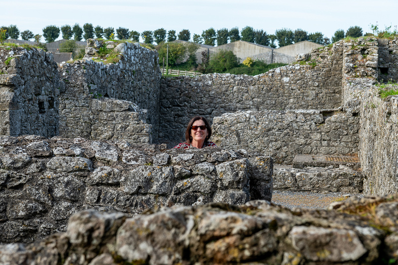
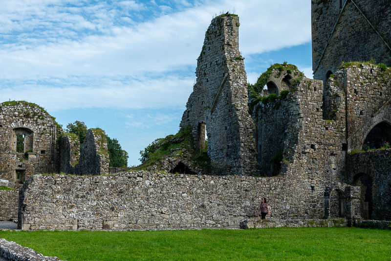
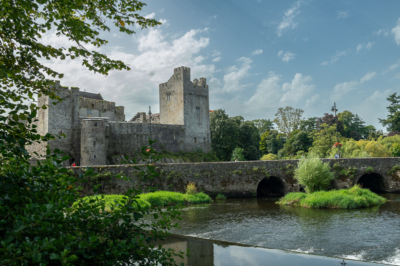
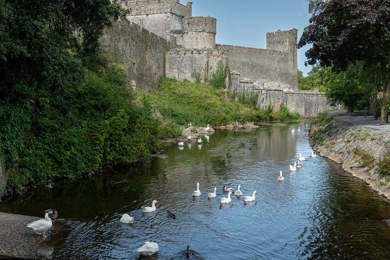
Kinsale, in County Cork, would be our destination for the night but we decided to go by way of Castle Cahir, just before leaving Co Tipperary. It was worth the stop. It is a major Norman castle built on an island in the River Suir and it is right in town. We had lunch in a lovely café just across the road.
Then on to Kinsale and Galley Head Lighthouse.
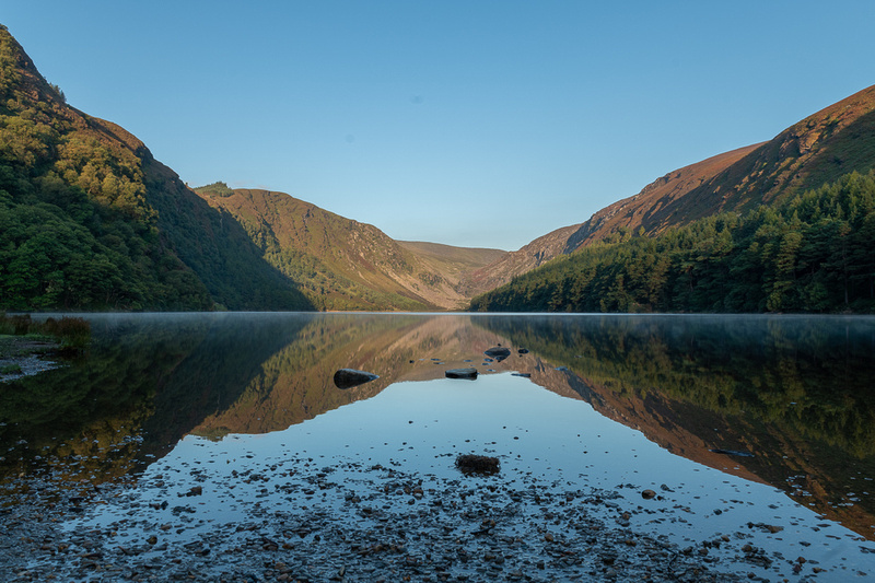
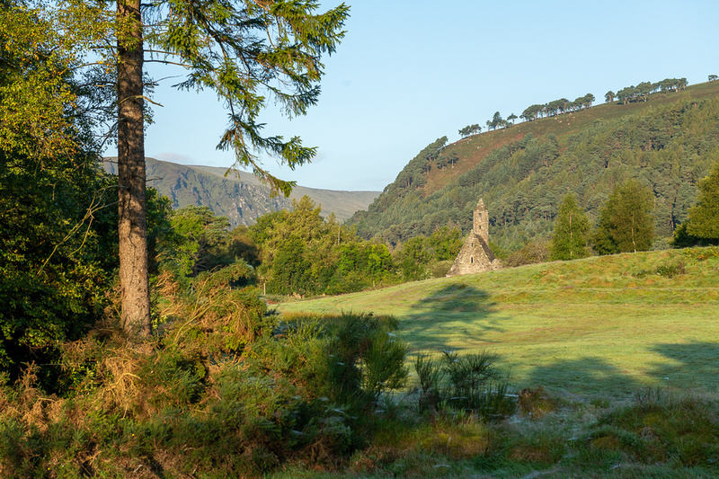
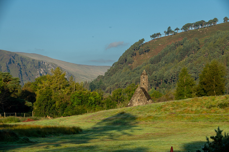
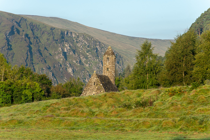
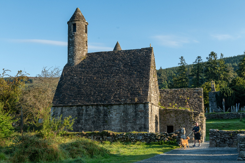
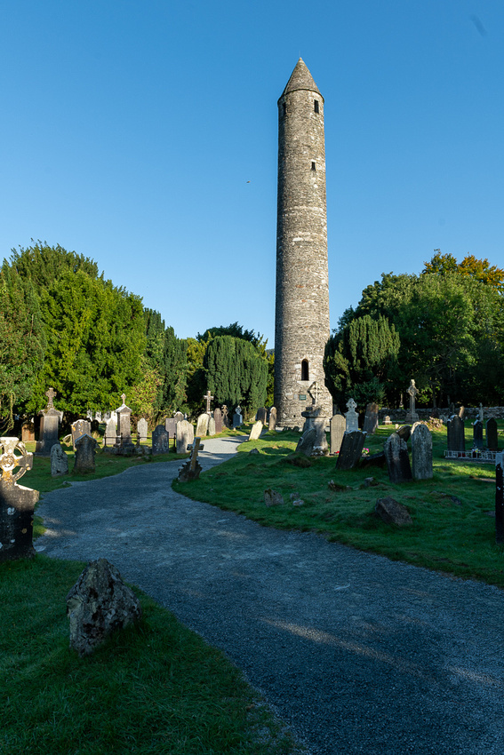
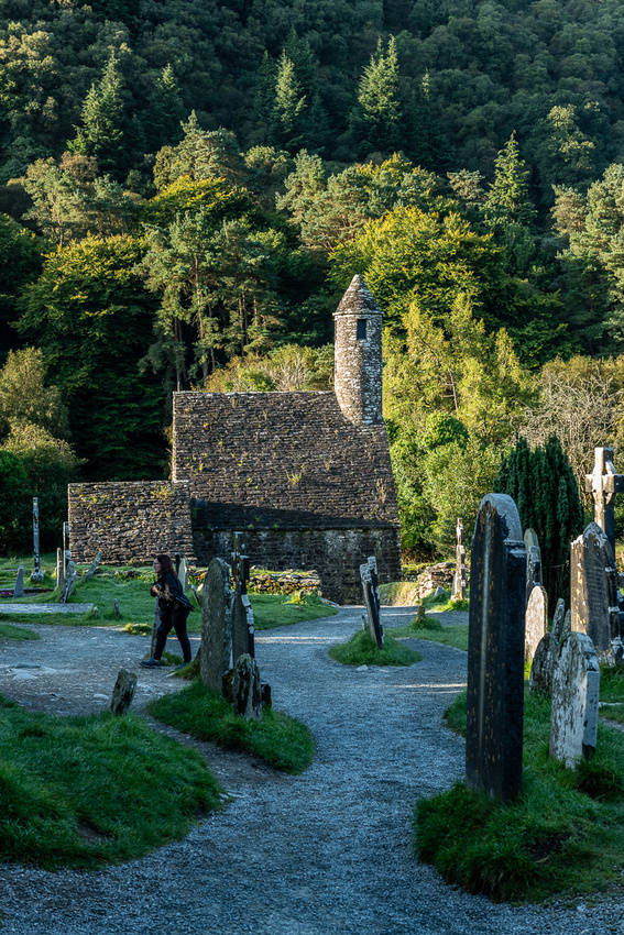
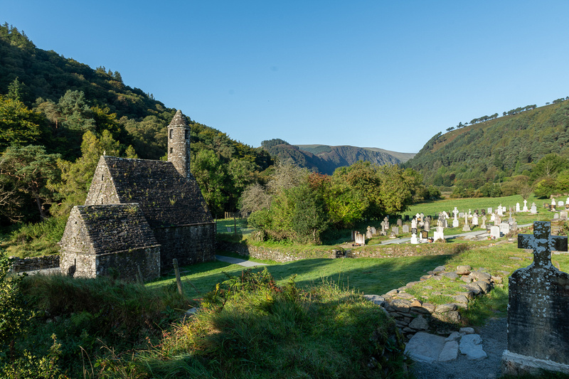
Greetings All From The Emerald IslandGreetings All, from the Emerald Isle. Jeanne Marie and I have not been back to the Olde Sodde since 2017 so we were totally ready for this trip. We connected through Charlotte from St Louis, mainly because the loads looked best, but the flight operated so early. It departed Charlotte to Dublin at 4 PM, arriving at 4:40 AM Dublin time. I was dreading a 3 hour wait for the rental car counter to open but we were delira and excira to see them all fully staffed and we and a cheerful lady named Mary had us on the road to Glendalough by 6. We would only have a few hours there but it was all we needed to sink down into Ireland's magic. The upper lake was a perfect mirror so I did make a few exposures.
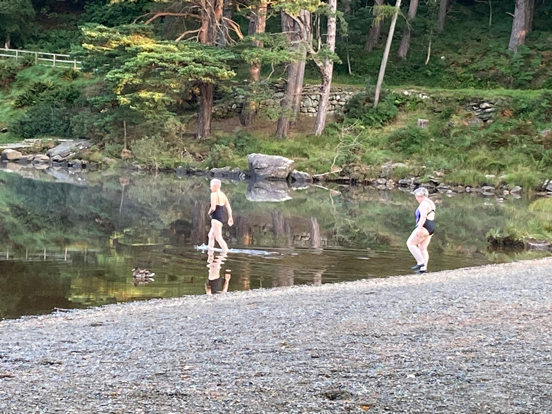
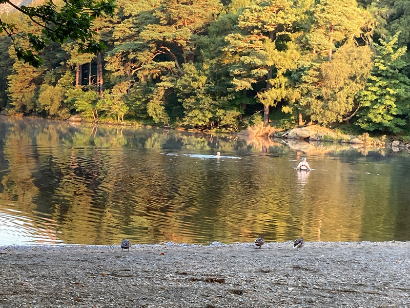
And as if to leave no doubt that we were not in Kansas anymore, just as we were leaving the upper lake to go down to the monastery, two ladies walked out, dropped their robes down to their bathing suits, and waded right in up to their necks. The air temp was 52 degrees.
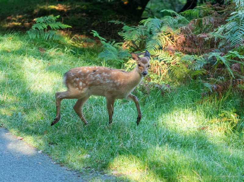
On the way down to the monastery a herd of deer crossed our path.
I know the shots I’m posting look like the ones from the last four trips but I love shooting here. And we didn’t really have time to look for new compositions. There were certainly fewer people to worry about shooting around. By 10 we were on our way through the Wicklow Mountains to Cashel where we would spend our first night.
|